Lincoln County, Georgia
| Lincoln County, Georgia | |
|---|---|
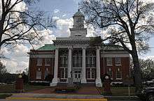 Lincoln County Courthouse in Lincolnton | |
 Location in the U.S. state of Georgia | |
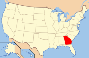 Georgia's location in the U.S. | |
| Founded | February 20, 1796 |
| Named for | Benjamin Lincoln |
| Seat | Lincolnton |
| Largest city | Lincolnton |
| Area | |
| • Total | 257 sq mi (666 km2) |
| • Land | 210 sq mi (544 km2) |
| • Water | 47 sq mi (122 km2), 18.2% |
| Population | |
| • (2010) | 7,996 |
| • Density | 38/sq mi (15/km²) |
| Congressional district | 10th |
| Time zone | Eastern: UTC-5/-4 |
| Website |
www |
Lincoln County is a county located in the U.S. state of Georgia. As of the 2010 census, the population was 7,996.[1] The county seat is Lincolnton.[2] The county was created on February 20, 1796.
Lincoln County is included in the Augusta-Richmond County, GA-SC Metropolitan Statistical Area. The Savannah River forming its northeastern border. Located above the fall line, it is part of the Central Savannah River Area (CSRA) and a member of the CSRA Regional Development Center.
History
On February 20, 1796 Lincoln County was established as the twenty-fourth county in the state of Georgia. Before then, its territory was part of Wilkes County, now on its western side. The new county was named after General Benjamin Lincoln (1733-1810), a Revolutionary War hero notable for receiving Gen. Cornwallis's Sword of Surrender at Yorktown, Virginia. In 1809 he retired from the military.
On January 22, 1852 the legislature changed the location of the line between Wilkes County and Lincoln County. There is no record as to why the legislature made these changes.
From before the American Revolutionary War until the 1950s, Lincoln County was primarily a farming and agricultural area. The development and creation of Clarke Hill Dam created a large reservoir that covered portions of Lincoln and nearby counties. Developers have created many residential neighborhoods and subdivisions in areas near the lake.
Geography
According to the U.S. Census Bureau, the county has a total area of 257 square miles (670 km2), of which 210 square miles (540 km2) is land and 47 square miles (120 km2) (18.2%) is water.[3]
The bulk of Lincoln County, from just south of Lincolnton heading north, is located in the Upper Savannah River sub-basin of the Savannah River basin, with the exception of a tiny sliver of the northernmost section of the county, which is located in the Broad River sub-basin of the larger Savannah River basin. The southern portion of the county is located in the Little River sub-basin of the same Savannah River basin.[4]
Major highways
-
 U.S. Route 378
 -
 State Route 43
 -
 State Route 43 Connector
 -
 State Route 44
 -
 State Route 47
 -
 State Route 79
 -
 State Route 220
Adjacent counties
- Elbert County, Georgia - north
- McCormick County, South Carolina - northeast
- Columbia County, Georgia - south
- McDuffie County, Georgia - southwest
- Wilkes County, Georgia - west
Demographics
| Historical population | |||
|---|---|---|---|
| Census | Pop. | %± | |
| 1800 | 4,766 | — | |
| 1810 | 4,555 | −4.4% | |
| 1820 | 6,458 | 41.8% | |
| 1830 | 6,145 | −4.8% | |
| 1840 | 5,895 | −4.1% | |
| 1850 | 5,998 | 1.7% | |
| 1860 | 5,466 | −8.9% | |
| 1870 | 5,413 | −1.0% | |
| 1880 | 6,412 | 18.5% | |
| 1890 | 6,146 | −4.1% | |
| 1900 | 7,156 | 16.4% | |
| 1910 | 8,714 | 21.8% | |
| 1920 | 9,739 | 11.8% | |
| 1930 | 7,847 | −19.4% | |
| 1940 | 7,042 | −10.3% | |
| 1950 | 6,462 | −8.2% | |
| 1960 | 5,906 | −8.6% | |
| 1970 | 5,895 | −0.2% | |
| 1980 | 6,716 | 13.9% | |
| 1990 | 7,442 | 10.8% | |
| 2000 | 8,348 | 12.2% | |
| 2010 | 7,996 | −4.2% | |
| Est. 2015 | 7,673 | [5] | −4.0% |
| U.S. Decennial Census[6] 1790-1960[7] 1900-1990[8] 1990-2000[9] 2010-2013[1] | |||
2000 census
As of the census[10] of 2000, there were 8,348 people, 3,251 households, and 2,379 families residing in the county. The population density was 40 people per square mile (15/km²). There were 4,514 housing units at an average density of 21 per square mile (8/km²). The racial makeup of the county was 64.25% White, 34.37% Black or African American, 0.37% Native American, 0.16% Asian, 0.05% Pacific Islander, 0.24% from other races, and 0.56% from two or more races. 0.97% of the population were Hispanic or Latino of any race.
There were 3,251 households out of which 30.60% had children under the age of 18 living with them, 53.20% were married couples living together, 15.50% had a female householder with no husband present, and 26.80% were non-families. 23.70% of all households were made up of individuals and 10.40% had someone living alone who was 65 years of age or older. The average household size was 2.55 and the average family size was 3.01.
In the county the population was spread out with 24.40% under the age of 18, 7.20% from 18 to 24, 27.50% from 25 to 44, 26.30% from 45 to 64, and 14.60% who were 65 years of age or older. The median age was 39 years. For every 100 females there were 94.90 males. For every 100 females age 18 and over, there were 91.90 males.
The median income for a household in the county was $31,952, and the median income for a family was $36,657. Males had a median income of $27,165 versus $21,338 for females. The per capita income for the county was $15,351. About 12.40% of families and 15.30% of the population were below the poverty line, including 19.60% of those under age 18 and 15.90% of those age 65 or over.
2010 census
As of the 2010 United States Census, there were 7,996 people, 3,281 households, and 2,252 families residing in the county.[11] The population density was 38.0 inhabitants per square mile (14.7/km2). There were 4,786 housing units at an average density of 22.7 per square mile (8.8/km2).[12] The racial makeup of the county was 65.7% white, 32.1% black or African American, 0.4% Asian, 0.4% American Indian, 0.4% from other races, and 0.9% from two or more races. Those of Hispanic or Latino origin made up 1.2% of the population.[11] In terms of ancestry, 24.8% were American, 8.4% were English, and 6.3% were German.[13]
Of the 3,281 households, 28.5% had children under the age of 18 living with them, 50.3% were married couples living together, 14.2% had a female householder with no husband present, 31.4% were non-families, and 27.6% of all households were made up of individuals. The average household size was 2.42 and the average family size was 2.94. The median age was 45.0 years.[11]
The median income for a household in the county was $36,399 and the median income for a family was $43,872. Males had a median income of $38,200 versus $24,577 for females. The per capita income for the county was $19,627. About 23.2% of families and 26.3% of the population were below the poverty line, including 41.2% of those under age 18 and 28.5% of those age 65 or over.[14]
Recreation and historical sites
Since the creation of Clarks Hill Lake, recreation has contributed to Lincoln County's growth. It is a main destination for tourists, providing fishing, boating, and other water sport opportunities for visitors and nearby residents.
Toward the eastern part of Lincoln County, just before the South Carolina line, is Elijah Clarke State Park. This park is roughly 447 acres (1.81 km2). In May of every year, Elijah Clarke holds a bluegrass festival which has become a major attraction in the last 20 years. Several well-known bluegrass musicians play at this event each year, including Lincoln County natives, The Lewis Family. Also held annually at Elijah Clarke is an Arts and Crafts Festival and a Log Cabin Christmas.
There are many historic places to visit in Lincoln County. They include:
- Lamar-Blanchard House, Lincolnton, which is on the National Register of Historic Places
- The Lincoln County Historical Park
- Graves Mountain
Economy
Economic growth has been associated with development of the J. Strom Thurmond Dam and Clarks Hill Lake. In Lincoln County, logging is a multimillion-dollar industry. More than 20 logging businesses produce most of the jobs for Lincoln County residents. The county has attracted new companies, such as Hero Metal, LLC; Top Grill, LLC; and Charles Owen, Inc.
Communities
Notable people
- Garrison Hearst- Former NFL player, pro bowler, comeback player in 1995 and 2001
- Barney Bussey - Former NFL player, played for the Cincinnati Bengals and then the Tampa Bay Buccaneers
- The Lewis Family - family bluegrass and gospel band, in 1992 they were inducted into Georgia Music Hall of Fame
- Tom Nash - NFL player for the Green Bay Packers and Brooklyn Dodgers
See also
- Central Savannah River Area
- National Register of Historic Places listings in Lincoln County, Georgia
References
- 1 2 "State & County QuickFacts". United States Census Bureau. Retrieved June 23, 2014.
- ↑ "Find a County". National Association of Counties. Retrieved 2011-06-07.
- ↑ "US Gazetteer files: 2010, 2000, and 1990". United States Census Bureau. 2011-02-12. Retrieved 2011-04-23.
- ↑ "Georgia Soil and Water Conservation Commission Interactive Mapping Experience". Georgia Soil and Water Conservation Commission. Retrieved 2015-11-19.
- ↑ "County Totals Dataset: Population, Population Change and Estimated Components of Population Change: April 1, 2010 to July 1, 2015". Retrieved July 2, 2016.
- ↑ "U.S. Decennial Census". United States Census Bureau. Retrieved June 23, 2014.
- ↑ "Historical Census Browser". University of Virginia Library. Retrieved June 23, 2014.
- ↑ "Population of Counties by Decennial Census: 1900 to 1990". United States Census Bureau. Retrieved June 23, 2014.
- ↑ "Census 2000 PHC-T-4. Ranking Tables for Counties: 1990 and 2000" (PDF). United States Census Bureau. Retrieved June 23, 2014.
- ↑ "American FactFinder". United States Census Bureau. Retrieved 2011-05-14.
- 1 2 3 "DP-1 Profile of General Population and Housing Characteristics: 2010 Demographic Profile Data". United States Census Bureau. Retrieved 2015-12-30.
- ↑ "Population, Housing Units, Area, and Density: 2010 - County". United States Census Bureau. Retrieved 2015-12-30.
- ↑ "DP02 SELECTED SOCIAL CHARACTERISTICS IN THE UNITED STATES – 2006-2010 American Community Survey 5-Year Estimates". United States Census Bureau. Retrieved 2015-12-30.
- ↑ "DP03 SELECTED ECONOMIC CHARACTERISTICS – 2006-2010 American Community Survey 5-Year Estimates". United States Census Bureau. Retrieved 2015-12-30.
Further reading
- Perryman, Clinton J. History of Lincoln County, Georgia, Tignall, GA: 1985
External links
- "Lincoln County Red Devils"
- "Biography", The Lewis Family Singers Website
- Jeff & Sheri Easter
External links
 |
Elbert County | McCormick County, South Carolina | | |
| Wilkes County | |
|||
| ||||
| | ||||
| McDuffie County | Columbia County |
Municipalities and communities of Lincoln County, Georgia, United States | ||
|---|---|---|
| Cities | | |
| Unincorporated community | ||
Template:Georgia
Coordinates: 33°47′N 82°27′W / 33.79°N 82.45°W