Martinez, Georgia
| Martinez, Georgia | |
|---|---|
| Census-designated place | |
 Location in Columbia County and the state of Georgia | |
| Coordinates: 33°30′58″N 82°6′0″W / 33.51611°N 82.10000°WCoordinates: 33°30′58″N 82°6′0″W / 33.51611°N 82.10000°W | |
| Country | United States |
| State | Georgia |
| County | Columbia |
| Area | |
| • Total | 14.6 sq mi (37.9 km2) |
| • Land | 14.5 sq mi (37.6 km2) |
| • Water | 0.1 sq mi (0.3 km2) |
| Elevation | 361 ft (110 m) |
| Population (2010) | |
| • Total | 35,795 |
| • Density | 2,467/sq mi (952.4/km2) |
| Time zone | Eastern (EST) (UTC-5) |
| • Summer (DST) | EDT (UTC-4) |
| ZIP code | 30907 |
| Area code(s) | 706 |
| FIPS code | 13-50036[1] |
| GNIS feature ID | 0332326[2] |
Martinez (/mɑːrˈtənɛz/) is a census-designated place (CDP) in Columbia County, Georgia, United States. It is a northwestern suburb of Augusta and is part of the Augusta, Georgia metropolitan area. The population was 35,795 at the 2010 census.[3]
Geography
Martinez is located in eastern Columbia County at 33°30′58″N 82°6′0″W / 33.51611°N 82.10000°W (33.516089, -82.100024).[4] It is bordered to the southeast by the city of Augusta in Richmond County. To the north and northwest is the CDP of Evans. Interstate 20 forms the short southern boundary of Martinez, with access from Exit 194 (Georgia State Route 383/South Belair Road).
According to the United States Census Bureau, the CDP has a total area of 14.6 square miles (37.9 km2), of which 14.5 square miles (37.6 km2) is land and 0.12 square miles (0.3 km2), or 0.76%, is water.[3]
Martinez has an elevation of 361 feet (110 m) above sea level, about 200 feet (61 m) higher than downtown Augusta. The areas of the CDP closest to the Richmond County line tend to be relatively flat, while land further west is hillier. Trees in Martinez are seen mainly in the subdivisions, as the main roads are crowded with businesses. They include pine, oak, sweet gum, hickory, and a variety of other species.
History
Although named for a Latino, this town is pronounced Martin-EZ rather in than in the traditional Spanish way. The founder was José Martínez y Saldivar, a wealthy man from Cuba. He bought a plantation in Columbia County and named it El Cordero Ranch ("The Lamb Ranch"). He wanted to be an American soldier. He ended up having four daughters who married very wealthy men, one being a Dr. Perrin who died around 1940. El Cordero Ranch is now only 20 acres (8.1 ha) in size. His old home (hacienda) and several buildings, barns and a water tower original to the property still stand.[5]
Demographics
| Historical population | |||
|---|---|---|---|
| Census | Pop. | %± | |
| 1980 | 10,104 | — | |
| 1990 | 33,731 | 233.8% | |
| 2000 | 27,749 | −17.7% | |
| 2010 | 35,795 | 29.0% | |
| source:[6] | |||
As of the census[1] of 2000, there were 27,749 people, 9,886 households, and 8,037 families residing in the CDP. The population density was 2,207.1 people per square mile (852.3/km). There were 10,320 housing units at an average density of 820.8 per square mile (317.0/km). The racial makeup of the CDP was 83.98% White, 8.02% African American, 0.23% Native American, 5.60% Asian, 0.07% Pacific Islander, 0.68% from other races, and 1.42% from two or more races. Hispanic or Latino of any race were 2.31% of the population.
There were 9,886 households out of which 44.9% had children under the age of 18 living with them, 67.2% were married couples living together, 11.2% had a female householder with no husband present, and 18.7% were non-families. 15.6% of all households were made up of individuals and 4.4% had someone living alone who was 65 years of age or older. The average household size was 2.80 and the average family size was 3.13.
In the CDP the population was spread out with 29.3% under the age of 18, 7.2% from 18 to 24, 30.9% from 25 to 44, 25.4% from 45 to 64, and 7.1% who were 65 years of age or older. The median age was 35 years. For every 100 females there were 95.4 males. For every 100 females age 18 and over, there were 91.2 males.
The median income for a household in the CDP was $68,300, and the median income for a family was $80,390. Males had a median income of $47,312 versus $30,821 for females. The per capita income for the CDP was $29,345. About 2.5% of families and 3.1% of the population were below the poverty line, including 3.5% of those under age 18 and 5.4% of those age 65 or over.
Highways
Schools
- Augusta Preparatory Day School
- Lakeside High School
- Evans High School
- Greenbrier High School
- Lakeside Middle School
- Riverside Middle School
- Columbia Middle School
- Augusta Christian Schools
- Greenbrier Middle School
- Evans Middle School
- Stallings Island Middle School
- Martinez Elementary School
- Blue Ridge Elementary School
- Westmont Elementary School
- Martinez Elementary School
- South Columbia Elementary School
- Stevens Creek Elementary School[7]
See also
References
- 1 2 "American FactFinder". United States Census Bureau. Retrieved 2008-01-31.
- ↑ "US Board on Geographic Names". United States Geological Survey. 2007-10-25. Retrieved 2008-01-31.
- 1 2 "Geographic Identifiers: 2010 Demographic Profile Data (G001): Martinez CDP, Georgia". U.S. Census Bureau, American Factfinder. Retrieved July 30, 2014.
- ↑ "US Gazetteer files: 2010, 2000, and 1990". United States Census Bureau. 2011-02-12. Retrieved 2011-04-23.
- ↑ Gerald Smith, To Seek a Newer World
- ↑ "CENSUS OF POPULATION AND HOUSING (1790-2000)". U.S. Census Bureau. Retrieved 2010-07-31.
- ↑ "The Columbia County School District". Columbia County School System. Retrieved January 23, 2016.
Municipalities and communities of Columbia County, Georgia, United States | ||
|---|---|---|
| Cities | 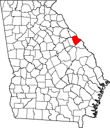 | |
| CDPs | ||
| Unincorporated community | ||