Keysville, Georgia
| Keysville, Georgia | |
|---|---|
| Town | |
 Location in Burke County and the state of Georgia | |
| Coordinates: 33°14′7″N 82°13′54″W / 33.23528°N 82.23167°WCoordinates: 33°14′7″N 82°13′54″W / 33.23528°N 82.23167°W | |
| Country | United States |
| State | Georgia |
| Counties | Burke, Jefferson |
| Area | |
| • Total | 1.1 sq mi (2.8 km2) |
| • Land | 1.0 sq mi (2.7 km2) |
| • Water | 0.04 sq mi (0.1 km2) |
| Elevation | 262 ft (80 m) |
| Population (2010) | |
| • Total | 332 |
| • Density | 315/sq mi (121.6/km2) |
| Time zone | Eastern (EST) (UTC-5) |
| • Summer (DST) | EDT (UTC-4) |
| ZIP codes | 30811, 30816 |
| Area code(s) | 706 |
| FIPS code | 13-43360[1] |
| GNIS feature ID | 0316404[2] |
| Website |
ckeysville |
Keysville is a city in Burke and Jefferson counties in the U.S. state of Georgia. As of the 2010 census, the city's population was 332.[3]
Geography
Keysville is located at 33°14′7″N 82°13′54″W / 33.23528°N 82.23167°W (33.235293, -82.231687),[4] 23 miles (37 km) southwest of downtown Augusta.
According to the United States Census Bureau, the city has a total area of 1.1 square miles (2.8 km2), of which 0.023 square miles (0.06 km2), or 2.08%, is water.[3]
Demographics
| Historical population | |||
|---|---|---|---|
| Census | Pop. | %± | |
| 1930 | 378 | — | |
| 1990 | 284 | — | |
| 2000 | 180 | −36.6% | |
| 2010 | 332 | 84.4% | |
| Est. 2015 | 348 | [5] | 4.8% |
As of the 2010 United States Census, there were 332 people residing in the city. The racial makeup of the city was 55.1% Black, 37.7% White, 1.8% Asian and 1.8% from two or more races. 3.6% were Hispanic or Latino of any race.
As of the census[1] of 2000, there were 180 people, 45 households, and 35 families residing in the city. The population density was 121.0 people per square mile (46.6/km²). There were 52 housing units at an average density of 35.0 per square mile (13.5/km²). The racial makeup of the city was 62.22% African American, 33.89% White, 0.56% from other races, and 3.33% from two or more races. Hispanic or Latino of any race were 1.67% of the population.
There were 45 households out of which 31.1% had children under the age of 18 living with them, 37.8% were married couples living together, 31.1% had a female householder with no husband present, and 22.2% were non-families. 17.8% of all households were made up of individuals and 11.1% had someone living alone who was 65 years of age or older. The average household size was 2.67 and the average family size was 3.00.
In the city the population was spread out with 18.9% under the age of 18, 5.0% from 18 to 24, 18.9% from 25 to 44, 17.8% from 45 to 64, and 39.4% who were 65 years of age or older. The median age was 50 years. For every 100 females there were 52.5 males. For every 100 females age 18 and over, there were 47.5 males.
The median income for a household in the city was $21,167, and the median income for a family was $21,324. Males had a median income of $20,833 versus $14,063 for females. The per capita income for the town was $7,970. About 45.2% of families and 61.1% of the population were below the poverty line, including 65.6% of those under the age of eighteen and 68.9% of those sixty five or over. According to the 2010 Census,the population was 332. Of this, 53.63% were Black or African American, 37.95% were White, 2.11% were two or more races, 1.81% were Asian, and 1.51% were some other race. 3.61% were Hispanic or Latino (of any race)[7]
See also
References
- 1 2 "American FactFinder". United States Census Bureau. Retrieved 2008-01-31.
- ↑ "US Board on Geographic Names". United States Geological Survey. 2007-10-25. Retrieved 2008-01-31.
- 1 2 "Geographic Identifiers: 2010 Demographic Profile Data (G001): Keysville city, Georgia". U.S. Census Bureau, American Factfinder. Retrieved November 8, 2013.
- ↑ "US Gazetteer files: 2010, 2000, and 1990". United States Census Bureau. 2011-02-12. Retrieved 2011-04-23.
- ↑ "Annual Estimates of the Resident Population for Incorporated Places: April 1, 2010 to July 1, 2015". Retrieved July 2, 2016.
- ↑ "Census of Population and Housing". Census.gov. Retrieved June 4, 2015.
- ↑ http://censusviewer.com/city/GA/keysville/2010
External links
Municipalities and communities of Burke County, Georgia, United States | ||
|---|---|---|
| Cities | 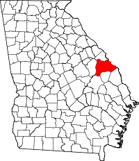 | |
| Town | ||
| Unincorporated community | ||
| Footnotes | ‡This populated place also has portions in an adjacent county or counties | |
Municipalities and communities of Jefferson County, Georgia, United States | ||
|---|---|---|
| Cities | 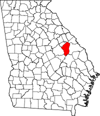 | |
| Town | ||
| CDP | ||
| Footnotes | ‡This populated place also has portions in an adjacent county or counties | |