Macquarie Rivulet
Not to be confused with Macquarie River.
| Macquarie Rivulet | |
| Perennial river | |
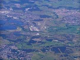 Aerial view showing Macqurie Rivulet entering Lake Illawarra via the curved channel at left. | |
| Name origin: In honour of Lachlan Macquarie | |
| Country | Australia |
|---|---|
| State | New South Wales |
| Regions | Sydney Basin (IBRA), Southern Highlands, Illawarra |
| Local government areas | Wingecarribee, City of Shellharbour |
| Source | Illawarra escarpment |
| - location | near Robertson |
| Mouth | Lake Illawarra |
| - location | east of Yallah |
| Length | 23 km (14 mi) |
| National park | Macquarie Pass NP |
Macquarie Rivulet is a perennial river located in the Southern Highlands and Illawarra regions of New South Wales, Australia.
Location and features
Macquarie Rivulet rises within the Macquarie Pass National Park on the eastern slopes of the Illawarra escarpment and drains the eastern edge of the Southern Highlands plateau. The headwaters of the rivulet gather approximately 4 kilometres (2.5 mi) northeast of the town of Robertson and north of the Macquarie Pass. The rivulet flows generally east by north before reaching its mouth within Lake Illawarra, east of the Shellharbour suburb of Yallah.[1]
The Princes Highway crosses the Macquarie Rivulet at Yallah.
See also
- List of rivers of New South Wales
- List of rivers in New South Wales (L-Z)
- Mount Murray
- Rivers of New South Wales
References
- ↑ "Macquarie Rivulet". Geographical Names Register (GNR) of NSW. Geographical Names Board of New South Wales. Retrieved 18 May 2013.
External links
- "Illawarra catchments" (map). Office of Environment and Heritage. Government of New South Wales.
Rivers of the Southern Rivers catchment, New South Wales, Australia | |||||||
|---|---|---|---|---|---|---|---|
| |||||||
| |||||||
| |||||||
| |||||||
| |||||||
|
Coordinates: 34°33′S 150°48′E / 34.550°S 150.800°E
This article is issued from Wikipedia - version of the 5/3/2016. The text is available under the Creative Commons Attribution/Share Alike but additional terms may apply for the media files.