Karuah River
| Karuah River | |
| Karuah River Left Hand Branch[1], Clyde[2] | |
| Open semi-mature tide dominated drowned valley estuary[3] | |
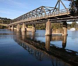 Karuah Bridge over the Karuah River at Karuah. | |
| Name origin: Aboriginal[2] | |
| Country | Australia |
|---|---|
| State | New South Wales |
| Regions | NSW North Coast (IBRA), Mid North Coast, Hunter |
| Local government area | Mid-Coast Council |
| Part of | Mid-Coast Council[4] |
| Tributaries | |
| - left | Martins Creek (New South Wales), Lawlers Creek, Mammy Johnsons River, Mill Creek (New South Wales), Alderley Creek, Booral Creek, Snapes Creek, The Branch River |
| - right | Whispering Gully, Telegherry River, Scotters Creek, Deep Creek (New South Wales), Limeburners Creek |
| Town | Stroud, Karuah |
| Source | Gloucester Tops, Great Dividing Range |
| - location | below The Mountaineer, southwest of Gloucester |
| - elevation | 598 m (1,962 ft) |
| Mouth | Port Stephens |
| - location | Karuah |
| - elevation | 0 m (0 ft) |
| Length | 101 km (63 mi) |
| Depth | 2.2 m (7 ft) |
| Volume | 31,221 m3 (1,102,559 cu ft) |
| Basin | 1,448 km2 (559 sq mi) |
| Area | 17.9 km2 (7 sq mi) |
| Website: NSW Environment & Heritage website | |
| [5] | |
Karuah River, an open semi-mature tide dominated drowned valley estuary[3] of the Mid-Coast Council[4] system, is located in the Mid North Coast and Hunter regions of New South Wales, Australia.
Course and features
Karuah River rises on the southeastern slopes of Gloucester Tops of the Great Dividing Range, below The Mountaineer, southwest of Gloucester, and flows generally southeast and south. joined by eleven tributaries including the Telegherry, Mammy Johnsons, and The Branch rivers, before reaching its mouth within Port Stephens at Karuah, and then flows out to the Tasman Sea of the South Pacific Ocean. The river descends 600 metres (2,000 ft) over its 101 kilometres (63 mi) course.[5]
Etymology
Initially named Clyde by Lachlan Macquarie, the use of the Aboriginal name became prevalent subsequently.[2]
See also
References
- ↑ "Karuah River". Geographical Names Register (GNR) of NSW. Geographical Names Board of New South Wales. Retrieved 18 March 2013.
- 1 2 3 Dow, L; Guyon, D; Irving, R; McPhee, M; Matthews, A; Prineas, P; Rubinich, T; Simpson, J (1995). Reader's Digest Illustrated Guide to Australian Places. Surry Hills, NSW: Reader's Digest. p. 68. ISBN 0-86438-399-1.
- 1 2 Roy, P. S; Williams, R. J; Jones, A. R; Yassini, I; et al. (2001). "Structure and Function of South-east Australian Estuaries". Estuarine, Coastal and Shelf Science. 53: 351–384. doi:10.1006/ecss.2001.0796.
- 1 2 "Lakes". Great Lakes Tourism. Mid-Coast Council. Retrieved 17 March 2013.
- 1 2 "Map of Karuah River, NSW". Bonzle Digital Atlas of Australia. Retrieved 18 March 2013.
External links
- "Karuah River and Great Lakes catchments" (map). Office of Environment and Heritage. Government of New South Wales.
- Department of Environment and Climate Change report
River systems and rivers of Hunter-Central Rivers catchment, New South Wales, Australia | |||||||
|---|---|---|---|---|---|---|---|
| |||||||
| |||||||
| |||||||
|
Coordinates: 32°39′S 151°58′E / 32.650°S 151.967°E