Boorowa River
| Boorowa | |
| River | |
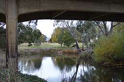 Boorowa River crossed by the Jubilee Bridge at Boorowa | |
| Name origin: Aboriginal: Wiradjuri for kangaroo; fish hawks[1] | |
| Country | Australia |
|---|---|
| State | New South Wales |
| Region | IBRA: South Eastern Highlands |
| Districts | Southern Tablelands, Central West |
| Municipalities | Yass Valley, Boorowa, Upper Lachlan |
| Part of | Murray–Darling basin |
| Tributaries | |
| - left | Breakfast Creek (Boorowa, New South Wales) |
| - right | Pudman Creek |
| Source | |
| - location | north of Yass |
| - elevation | 619 m (2,031 ft) |
| Mouth | Lachlan River |
| - location | south–east of Cowra |
| - elevation | 301 m (988 ft) |
| Length | 134 km (83 mi) |
| Wikimedia Commons: Boorowa River | |
| [2] | |
Boorowa River, a perennial stream that is part of the Lachlan catchment within the Murray–Darling basin, is located in the central–western region of New South Wales, Australia.
Location and features
The river rises about 16 kilometres (9.9 mi) north of Yass and flows generally north, joined by two minor tributaries, before reaching its confluence with the Lachlan River about 18 kilometres (11 mi) south–east of Cowra;[3] dropping 318 metres (1,043 ft) over its course of 134 kilometres (83 mi).[2]
The river flows through the town of Boorowa; from where it draws its name, an Aboriginal Wiradjuri word for kangaroo.[1]
See also
References
- 1 2 "Boorowa". Geographical Names Register (GNR) of NSW. Geographical Names Board of New South Wales. Retrieved 14 January 2013.
- 1 2 "Map of Boorowa River". Bonzle.com. Retrieved 14 January 2013.
- ↑ "Boorowa River". Geographical Names Register (GNR) of NSW. Geographical Names Board of New South Wales. Retrieved 14 January 2013.
External links
- "Lachlan River catchment" (map). Office of Environment and Heritage. Government of New South Wales.
Rivers of the Murrumbidgee River catchment, New South Wales and the Australian Capital Territory, Australia | |||||
|---|---|---|---|---|---|
| |||||
| |||||
Coordinates: 33°57′S 148°50′E / 33.950°S 148.833°E
This article is issued from Wikipedia - version of the 5/3/2016. The text is available under the Creative Commons Attribution/Share Alike but additional terms may apply for the media files.