Canton, Michigan
| Canton, Michigan | |
|---|---|
| Charter township | |
| Charter Township of Canton | |
|
Canton Municipal Building | |
| Motto: Michigan's Community of Vision. | |
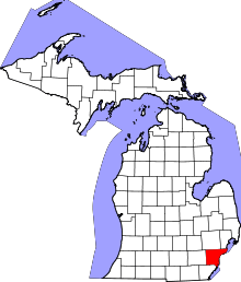
 Location of Canton within Michigan | |
 Canton, Michigan Location in the United States | |
| Coordinates: 42°18′31″N 83°28′56″W / 42.30861°N 83.48222°WCoordinates: 42°18′31″N 83°28′56″W / 42.30861°N 83.48222°W | |
| Country | United States |
| State | Michigan |
| County | Wayne |
| Settled | 1825 |
| Organized | 1834 |
| Government | |
| • Supervisor | Philip LaJoy |
| Area | |
| • Total | 36.0 sq mi (93.2 km2) |
| • Land | 36.0 sq mi (93.2 km2) |
| • Water | 0.0 sq mi (0.0 km2) 0.0% |
| Elevation | 679 ft (207 m) |
| Population (2010) | |
| • Total | 90,173 |
| • Density | 2,500/sq mi (970/km2) |
| Time zone | EST (UTC-5) |
| • Summer (DST) | EDT (UTC-4) |
| ZIP codes | 48187-48188 |
| Area code(s) | 734 |
| FIPS code | 26-13120[1] |
| GNIS feature ID | 1626030[2] |
| Website | www.canton-mi.org |

Canton is a charter township of Wayne County in the U.S. state of Michigan. It is located about 8 miles (13 km) west of the city limits of Detroit and 8 miles (13 km) east of the city limits of Ann Arbor. As of the 2010 census, the township had a population of 90,173,[3] making it Michigan's second largest township and eleventh largest community. Canton is ranked as 96th highest-income place in the United States with a population of 50,000 or more. Canton Township is also consistently ranked as one of the safest cities in the United States, as well as in the state of Michigan. In 2015, the township was ranked as the 29th safest city in America.[4] Canton is one of Michigan's fastest growing communities.
Communities
- Sheldon or Sheldon's Corners is a historic locale in the south of the township on U.S. Highway 12 just west of Interstate 275 at 42°16′29″N 83°28′33″W / 42.27472°N 83.47583°W.[5] It is named after Timothy F. Sheldon who purchased lands there in 1842.
- Cherry Hill is a historic locale in the west of the township at 42°18′22″N 83°32′10″W / 42.30611°N 83.53611°W[6] at the intersection of Cherry Hill Road and Ridge Road. It is the site of a new urbanist neighborhood with architecture that is supposed to be reminiscent of what Canton was like a hundred years ago. It is located on a rise over a branch of the Lower River Rouge. It is now the site of a theatre, the Village Theater.
History
Earlier, on October 20, 1829, the legislature had passed a bill creating the townships of Lima and Richland out of Bucklin Township. Governor Lewis Cass returned the acts unapproved, citing a conflict under the law. The names conflicted with post offices in existence, contrary to a territorial law from April 12, 1827, prohibiting incorporation of a new township bearing the same name as any existing post office. The legislature thus had to substitute the names of Nankin and Pekin after the cities of Nanjing (Nanking) and Beijing (Peking) in China. The name of Pekin was extinguished when it was renamed Redford in 1833.
The Township of Canton was created by act of the Michigan Territorial Legislature on March 7, 1834 out of a southern portion of Plymouth Township. It was named in honor of the port and provincial capital known historically as Canton, Imperial China, which in 1918 was renamed Guangzhou (Chinese: 廣州; pinyin: Guǎngzhōu) — now the capital and largest city of Guangdong province, People's Republic of China.
The first meeting to organize the township was held in April 1834.
In the summer of 2002, the emerald ash borer was discovered in Canton, eventually infesting the Great Lakes region.
The Canton Historical Society and Museum opened in 1982 in a one-roomed schoolhouse.
Geography
According to the United States Census Bureau, the township has a total area of 36.0 square miles (93 km2). No part of the total area is covered by water. The south of the township is drained by the Lower River Rouge and its tributaries, including Pine Creek, which drains from the northwest corner to the southeast. The northeast is drained by Tonquish Creek and Garden Creek, which are tributaries of the Middle River Rouge.
Economy
Top employers
According to the Charter Township's 2010 Comprehensive Annual Financial Report,[7] the top employers in the city are:
| # | Employer | # of Employees |
|---|---|---|
| 1 | Plymouth-Canton Community Schools | 2,500 |
| 2 | Yazaki North America | 1,062 |
| 3 | Walmart | 650 |
| 4 | A. D. Transport Express | 550 |
| 5 | Sysco Detroit | 540 |
| 6 | Charter Township of Canton | 356 |
| 7 | Meijer | 339 |
| 8 | IKEA | 314 |
| 9 | Kroger | 250 |
| 10 | The Home Depot | 555 |
The publisher Visible Ink Press has its headquarters in Canton.[8]
Transportation
Canton-Plymouth-Mettetal Airport is in Canton Township.[9]
Education
Canton Township is served by the Plymouth-Canton Community Schools (which serves the northern 2/3 portion of Canton), Wayne-Westland Community Schools (which serves the south-eastern portion of Canton) and Van Buren Public Schools (which serves the south-western portion of the township). P-CCS includes most of Canton Township, the city of Plymouth, Plymouth Township, and portions of Salem, Superior, and Northville Townships.
Schools
Wayne-Westland Community Schools
A portion is in Wayne-Westland Community Schools[10][11] Most Wayne-Westland-zoned areas are zoned to Walker-Winter Elementary School in Canton.[12] A small portion is zoned to Roosevelt-McGrath Elementary School in Wayne.[13]
Some portions of the Wayne-Westland section of Canton are zoned to Adams Upper Elementary School in Westland,[14] Franklin Middle School in Wayne,[15] and Wayne Memorial High School in Wayne.[16] Other portions are zoned to Marshall Upper Elementary School,[17] Stevenson Middle School in Westland,[18] John Glenn High School, all in Westland.[19]
Plymouth-Canton Community Schools

A portion is in the Plymouth-Canton Community Schools.
- Allen Elementary School
- Bentley Elementary School
- Bird Elementary School
- Canton High School *
- Central Middle School (will be replaced by Liberty M.S.)
- Discovery Middle School
- Dodson Elementary School
- East Middle School
- Eriksson Elementary School
- Farrand Elementary School
- Field Elementary School
- Gallimore Elementary School
- Hoben Elementary School
- Hulsing Elementary School
- Isbister Elementary School
- Liberty Middle School (opens Fall 2015 )
- Miller Elementary School
- Pioneer Middle School
- Plymouth High School *
- Salem High School *
- Smith Elementary School
- Starkweather Center (Alternative education)
- Tanger Center (Alternative education)
- Tonda Elementary School
- West Middle School
- Workman Elementary School
(* Part of the Plymouth-Canton Educational Park)
Public charter schools
- Canton Charter Academy
- Achieve Charter Academy
- South Canton Scholars Charter Academy
- Plymouth Scholars Charter Academy
Private schools
- All Saints Catholic School
- Plymouth Christian Academy
- Plymouth Canton Montessori
- Crescent Academy International
Demographics
| Historical population | |||
|---|---|---|---|
| Census | Pop. | %± | |
| 1960 | 5,313 | — | |
| 1970 | 11,057 | 108.1% | |
| 1980 | 48,616 | 339.7% | |
| 1990 | 57,047 | 17.3% | |
| 2000 | 76,366 | 33.9% | |
| 2010 | 90,173 | 18.1% | |
The U.S. Census Bureau also defined Canton Township as a census-designated place (CDP) at the 2000 Census so that the community would appear on the list of places (like cities and villages) as well on the list of county subdivisions (like other townships). The final statistics for the township and the CDP were identical.
As of the census[1] of 2010, there were 90,173 people, 32,771 households, and 24,231 families residing in the township. The population density was 2,121.5 per square mile (819.0/km²). There were 34,829 housing units at an average density of 789.8 per square mile (304.9/km²). The racial makeup of the township was 72.2% White, 10.2% African American, 0.2% Native American, 14.1% Asian (80.0% Indian, 2.2% Chinese, 0.7% Filipino), 0.0% Pacific Islander, 0.7% from other races, and 1.91% from two or more races. Hispanic or Latino of any race were 3.1% of the population.
There were 27,490 households out of which 42.0% had children under the age of 18 living with them, 63.4% were married couples living together, 8.6% had a female householder with no husband present, and 25.2% were non-families. 20.5% of all households were made up of individuals and 4.8% had someone living alone who was 65 years of age or older. The average household size was 2.77 and the average family size was 3.26. The median household price was $239,900 according to the U.S. Census Bureau's 2006 American Community Survey estimates.[20]
In the township the population was spread out with 29.0% under the age of 18, 8.0% from 18 to 24, 34.9% from 25 to 44, 22.1% from 45 to 64, and 5.9% who were 65 years of age or older. The median age was 33 years. For every 100 females there were 98.0 males. For every 100 females age 18 and over, there were 96.2 males.
According to a 2007 estimate, the median income for a household in the township was $82,669, and the median income for a family was $95,267.[21] Males had a median income of $61,570 versus $35,615 for females. The per capita income for the township was $28,609. About 2.9% of families and 3.7% of the population were below the poverty line, including 4.2% of those under age 18 and 5.5% of those age 65 or over.
Notable people
- Brian Calhoun, back-up running back for the Detroit Lions
- Louis Delmas, safety for the Detroit Lions and Miami Dolphins
- Spencer Haywood, center for five NBA teams
- Lindsey Hunter, point guard and assistant coach for several NBA teams
- Mikel Leshoure, running back for the Detroit Lions
- Robert L. McKenzie, also known as Bobby McKenzie, a domestic and foreign policy analyst, public commentator, and scholar of the Middle East and North Africa. He is a visiting fellow at the Brookings Institution, a former Democratic nominee for Michigan’s 11th congressional district, and a former Senior Advisor at the US Department of State.
- Nathan Perkovich, forward for the Medvescak Zagreb of KHL and Albany Devils of AHL; grew up in Canton
- Nate Robertson, former MLB pitcher for the Detroit Tigers, Florida Marlins, and Philadelphia Phillies[22]
- Allison Schmitt, Olympic gold medalist swimmer in 2012 Summer Olympics and 2016 Summer Olympics; Team USA swim captain
- Jason Stollsteimer, vocalist and guitarist of the band The Von Bondies, attended Plymouth-Canton Educational Park
- Tahir Whitehead, linebacker for the Detroit Lions,played high school football for the West Side High School
- James Wisniewski, defenseman for the Carolina Hurricanes; previously with Anaheim Ducks, Columbus Blue Jackets, Chicago Blackhawks, New York Islanders, and Montreal Canadiens; born in Canton
Gallery
 The Village Theater
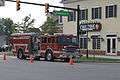 Canton Twp. Fire Rescue Truck
 Cherry Hill United Methodist Church, erected 1882
 Cherry Hill School
 Bronze statue, Cherry Hill School
 Cherry Hill School historical marker
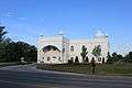 Gurudwara Sahib Sikh Temple, Canton Center Rd.
References
- 1 2 "American FactFinder". United States Census Bureau. Archived from the original on September 11, 2013. Retrieved 2008-01-31.
- ↑ U.S. Geological Survey Geographic Names Information System: Canton, Michigan
- ↑ "Race, Hispanic or Latino, Age, and Housing Occupancy: 2010 Census Redistricting Data (Public Law 94-171) Summary File (QT-PL), Canton charter township, Wayne County, Michigan". U.S. Census Bureau, American FactFinder 2. Archived from the original on September 11, 2013. Retrieved September 8, 2011.
- ↑ http://detroit.cbslocal.com/2015/02/15/troy-ranked-safest-city-in-michigan-23rd-in-united-states/
- ↑ U.S. Geological Survey Geographic Names Information System: Sheldon, Michigan
- ↑ U.S. Geological Survey Geographic Names Information System: Cherry Hill, Michigan
- ↑ "Charter Township of Canton CAFR" (PDF). Retrieved 2014-08-17.
- ↑ "Contact Us." Visible Ink Press. Retrieved on September 24, 2012. "43311 Joy Road #414 Canton, MI 48187-2075"
- ↑ "Canton township, Wayne county, Michigan." U.S. Census Bureau. Retrieved on October 28, 2009.
- ↑ "Home." (Archive) Wayne-Westland Community Schools. Retrieved on November 12, 2012.
- ↑ "Zoning Map" (Archive) City of Canton. Retrieved on April 20, 2014.
- ↑ "Walker-Winter Elementary School" (Archive) Wayne-Westland Community Schools. Retrieved on April 20, 2014.
- ↑ "rooseveltm.pdf." (Archive) Wayne-Westland Community Schools. Retrieved on November 2, 2013.
- ↑ "adams.pdf." (Archive) Wayne-Westland Community Schools. Retrieved on November 2, 2013.
- ↑ "franklin.pdf." (Archive) Wayne-Westland Community Schools. Retrieved on November 2, 2013.
- ↑ "waynemem.pdf." (Archive) Wayne-Westland Community Schools. Retrieved on November 2, 2013.
- ↑ "Marshall Upper Elementary School" (Archive). Wayne-Westland Community Schools. Retrieved on April 20, 2014.
- ↑ "Stevenson Middle School" (Archive) Wayne-Westland Community Schools. Retrieved on April 20, 2014.
- ↑ "johnglenn.pdf." (Archive) Wayne-Westland Community Schools. Retrieved on November 2, 2013.
- ↑ Canton township, Wayne County, Michigan Fact Sheet, 2006 American Community Survey, U.S. Census Bureau
- ↑ "American FactFinder". Factfinder.census.gov. Retrieved 2014-08-17.
- ↑ "Nate Robertson Statistics and History | Baseball-Reference.com". Baseball-Reference.com. Retrieved 2016-09-13.
External links
| Wikimedia Commons has media related to Canton Township, Michigan. |
- Official website
- Canton Public Library
- Canton City Wiki
- Canton Historical Society
- Canton Township in History of Detroit and Wayne County and early Michigan, Farmer, Silas, 1839–1902.
Municipalities and communities of Wayne County, Michigan, United States | ||
|---|---|---|
| Cities |
|  |
| Charter townships | ||
| General law townships | ||
| Unincorporated community | ||
| Footnotes | ‡This populated place also has portions in an adjacent county or counties | |
| Topics |  | |
|---|---|---|
| Detroit | ||
| Municipalities over 80,000 | ||
| Municipalities 40,000 to 80,000 | ||
| Cultural enclaves | ||
| Satellite cities | ||
| Counties in MSA | ||
| Counties in CSA | ||