Lapeer, Michigan
| Lapeer, Michigan | |
|---|---|
| City | |
|
| |
 Location of Lapeer, Michigan | |
| Coordinates: 43°3′7″N 83°18′59″W / 43.05194°N 83.31639°W | |
| Country | United States |
| State | Michigan |
| County | Lapeer |
| Government | |
| • Type | Council–manager |
| • Mayor | William J. Sprague |
| • Mayor Pro tempore | Thomas Robinet |
| Area[1] | |
| • Total | 7.38 sq mi (19.11 km2) |
| • Land | 7.13 sq mi (18.47 km2) |
| • Water | 0.25 sq mi (0.65 km2) |
| Elevation | 856 ft (261 m) |
| Population (2010)[2] | |
| • Total | 8,841 |
| • Estimate (2012[3]) | 8,821 |
| • Density | 1,240.0/sq mi (478.8/km2) |
| Time zone | Eastern (EST) (UTC-5) |
| • Summer (DST) | EDT (UTC-4) |
| ZIP code | 48446 |
| Area code(s) | 810 |
| FIPS code | 26-46040[4] |
| GNIS feature ID | 0630146[5] |
| Website | www.ci.lapeer.mi.us/ |

Lapeer is a city in the U.S. state of Michigan and is the county seat of Lapeer County.[6] As of the 2010 census, the city population was 8,841. Most of the city was incorporated from land that was formerly in Lapeer Township, though portions were also annexed from Mayfield Township and Elba Township. The city government is politically independent of all three townships. Lapeer is in southern Michigan, east of Flint, on the Flint River. The name "Lapeer" is a corruption of the French la pierre, which means "the flint".[7] (See List of Michigan county name etymologies.)
History
By an ordinance of the Congress of the United States passed on July 13, 1787, the area lying northwest of the Ohio River, though still occupied by the British, was organized as the Northwest Territory. Lapeer County was once part of the Northwest Territory. In January 1820, the county of Oakland was formed, which served the area now known as Lapeer, until the County of Lapeer was formed in 1837, when Michigan became a state. The first elections were for county officers, with 520 persons voting in 1837.
Folklore claims Lapeer was derived from the naming of the south branch of the Flint River, which flows northwestward in Lapeer County. French and Indian traders frequently passed over this section of the county and through the river, ultimately naming the city for the stone that lay at the river bottom. In French, stone is called "la pierre"; the English pronunciation of these words gives Lapeer. The river was named Flint, synonymous with stone.
It is also believed that the first settlers who came from New York State may have brought the name Lapeer from a similarly named city in their home state. A third supposition is that French missionaries named the city Le Pere, meaning The Father.
The first settler in Lapeer was Alvin N. Hart, who was born in Cornwall, Connecticut, on February 11, 1804. He came to Lapeer in 1831 and platted the Village of Lapeer, November 8, 1833. The plat was registered in Pontiac on December 14, 1833, in the County of Oakland; four years before Michigan became a state and Lapeer became a county.
Alvin H. Hart became a State Senator in 1843, representing Lapeer, Oakland, Genesee, Shiawassee, Tuscola, Saginaw Counties and the entire Upper Peninsula. He was instrumental in having the State Capitol relocated from Detroit to Lansing. Hart died on August 22, 1874, and is buried in Lapeer. Mrs. Kate Rhead is his great-great granddaughter.
The second settler, Enoch J. White, was born in South Hadley, Massachusetts in 1814. He came to Lapeer in 1833. Of pioneer stock, Alvin N. Hart and Enoch J. White both had the initiative to start new communities. Mr. Hart formed Lapeer and Mr. White formed what was then known as Whitesville, which now consists of the western portion of Lapeer. A tamarack swamp once separated these two settlements.
Other distinguished natives include John T. Rich, former governor of the state; L. S. Cramton, known as the Father of the National Park System; Charles Potter, whose son became a U.S. Senator; William Reed, Big Ten Football Commissioner and Marguerite deAngeli, internationally known writer of children's books.
At one time, there were two courthouses. The White family erected one at the present site of the Old Lapeer High School at Main and Genesee Streets, while the Hart family erected one at Nepessing and Court Streets. The Board of Supervisors purchased the Hart courthouse for $3,000, which is now the oldest continuously running courthouse in the state of Michigan and one of the oldest 10 courthouses in the United States. White's courthouse later became the first school in Lapeer called Lapeer Academy.
Over time, it became evident that the business district would be near the Courthouse, so our founders moved the Opera House piece-by-piece to its present location at the southeast corner of Court and Nepessing Streets in 1879. The building is now known as the White Block.
Lapeer’s first church was the Congregational Church; organized in 1833, the same year Lapeer was platted. The Methodist Episcopal Church opened its doors a year later, followed by the Baptist Church in 1858, the Immaculate Conception Catholic Church in 1866, the Universalist Church in 1873, the Methodist Protestant Church in 1877 and the Grace Episcopal Church in 1882.
Lumbering was the sole industry in the early days of Lapeer. The flourishing lumber business attracted the New York Central Railroad and Grand Trunk Railroad. Lapeer later became the intersection to two state trunk lines: M-21 and M-24. Adequate supplies of water, fuel and electricity, and many various forms of recreational facilities, provided the foundation for our growing community. Our industries today supply our state’s high-tech automotive industry with gray iron casting, molded plastics, plastic fabrics, electrical harnesses and stamping.
On October 26, 2010,[8] Lapeer became a founding member of the Karegnondi Water Authority.[8]
On August 15, 2012, the fourth-largest Powerball jackpot was won from a ticket sold at a Sunoco station in Lapeer. The jackpot had an annuity value of $337 million.
Geography
According to the United States Census Bureau, the city has a total area of 7.38 square miles (19.11 km2), of which 7.13 square miles (18.47 km2) is land and 0.25 square miles (0.65 km2) is water.[1] It is considered to be part of the Thumb of Michigan, which in turn is a subregion of the Flint/Tri-Cities.
Demographics
| Historical population | |||
|---|---|---|---|
| Census | Pop. | %± | |
| 1870 | 1,772 | — | |
| 1880 | 2,911 | 64.3% | |
| 1890 | 2,758 | −5.3% | |
| 1900 | 3,297 | 19.5% | |
| 1910 | 3,946 | 19.7% | |
| 1920 | 4,723 | 19.7% | |
| 1930 | 5,008 | 6.0% | |
| 1940 | 5,365 | 7.1% | |
| 1950 | 6,143 | 14.5% | |
| 1960 | 6,160 | 0.3% | |
| 1970 | 6,314 | 2.5% | |
| 1980 | 6,198 | −1.8% | |
| 1990 | 7,759 | 25.2% | |
| 2000 | 9,072 | 16.9% | |
| 2010 | 8,841 | −2.5% | |
| Est. 2015 | 8,790 | [9] | −0.6% |
Most Common Employment: Manufacturing 26.4% Educational, Health 24.5% Retail 10.3%
Unemployment Rate: 3.3% (2000 Census)
Average Commute Time for City Residents: 26.8 minutes Growth Rate: 16.9% (10th highest in Michigan for comparable cities)
2010 census
As of the census[2] of 2010, there were 8,841 people, 3,446 households, and 1,927 families residing in the city. The population density was 1,240.0 inhabitants per square mile (478.8/km2). There were 3,956 housing units at an average density of 554.8 per square mile (214.2/km2). The racial makeup of the city was 88.6% White, 7.6% African American, 0.6% Native American, 0.8% Asian, 0.5% from other races, and 1.8% from two or more races. Hispanic or Latino of any race were 3.9% of the population.
There were 3,446 households of which 32.6% had children under the age of 18 living with them, 32.1% were married couples living together, 18.3% had a female householder with no husband present, 5.5% had a male householder with no wife present, and 44.1% were non-families. 39.2% of all households were made up of individuals and 15.6% had someone living alone who was 65 years of age or older. The average household size was 2.22 and the average family size was 2.97.
The median age in the city was 36 years. 24.1% of residents were under the age of 18; 11% were between the ages of 18 and 24; 27.2% were from 25 to 44; 24.2% were from 45 to 64; and 13.5% were 65 years of age or older. The gender makeup of the city was 51.5% male and 48.5% female.
2000 census
As of the census[4] of 2000, there were 9,072 people, 3,443 households, and 1,979 families residing in the city. The population density was 1,635.5 per square mile (631.1/km²). There were 3,658 housing units at an average density of 659.5 per square mile (254.5/km²). The racial makeup of the city was 89.91% White, 5.95% African American, 0.47% Native American, 0.57% Asian, 0.03% Pacific Islander, 1.09% from other races, and 1.96% from two or more races. Hispanic or Latino of any race were 3.33% of the population.
There were 3,443 households out of which 33.0% had children under the age of 18 living with them, 38.3% were married couples living together, 15.7% had a female householder with no husband present, and 42.5% were non-families. 36.8% of all households were made up of individuals and 14.2% had someone living alone who was 65 years of age or older. The average household size was 2.29 and the average family size was 3.02.
In the city the population was spread out with 24.6% under the age of 18, 9.9% from 18 to 24, 36.5% from 25 to 44, 17.1% from 45 to 64, and 11.9% who were 65 years of age or older. The median age was 33 years. For every 100 females there were 106.8 males. For every 100 females age 18 and over, there were 110.6 males.
The median income for a household in the city was $35,526, and the median income for a family was $42,872. Males had a median income of $36,731 versus $24,552 for females. The per capita income for the city was $16,608. About 8.5% of families and 10.2% of the population were below the poverty line, including 12.3% of those under age 18 and 12.1% of those age 65 or over.
Government and infrastructure
Lapeer is member of Karegnondi Water Authority[8] and of the Greater Lapeer County Utilities Authority.[11] Lapeer is served by the Lapeer District Library.[12] Public schools in the Lapeer are run by the Lapeer Community Schools. Lapeer formerly utilized two high schools, Lapeer East High School and Lapeer West High School, however in 2014 the schools were merged into Lapeer High School. Lapeer is home to the following private schools:
- St Paul Lutheran School
- Bishop Kelley Catholic School
- Montessori Children's Center
Historic Homes
Lapeer is home to a variety of historic homes that have been restored and maintained to display their original elegance. Adjacent to Lapeer’s Central Business District on Nepessing Street is the Piety Hill Historic District, 29 properties that are largely nineteenth-century dwellings; one-sixth of the buildings are churches.
A significant number of the structures are Greek Revival in style, dating from the 1830s through the 1850s. The district is in an irregularly shaped area of approximately 15.5 acres located just west of Lapeer's downtown business district.
Featuring Gothic, Italianate and Queen Anne architectural designs, many of our historic homes are listed on the National Register of Historic Places.
Notable people
- Marguerite de Angeli - Writer and illustrator of children's books, including the 1950 Newbery Award winning book The Door in the Wall [13]
- Danelle Gay - Winner of Miss Michigan USA 2006.
- Terry Knight - Producer of the groups Grand Funk Railroad and Bloodrock.
- Jake Long - University of Michigan offensive lineman and 2008 first overall NFL draft pick, who currently plays for the St. Louis Rams.
- Terry Nichols - Oklahoma City Bombing conspirator.
- Victor Prather - Set an altitude record for manned balloon flight in 1960 (held until 2012). Helped develop the space suit.
- Rob Rubick - Former Detroit Lions tight end.
- Jim Slater - NHL Professional hockey player Winnipeg Jets
- Kris Tamulis - professional golfer
Transportation
Major highways
 I-69 - runs east and west south of the city
 M-24 - runs north and south through the city
 M-21 - previously ran through Lapeer but its designation was removed east of Flint after the completion of I-69.
Rail and bus
Amtrak, the national passenger rail system, provides service to Lapeer, operating its Blue Water daily in both directions between Chicago and Port Huron.
Greater Lapeer Transportation Authority (GLTA) is the local public bus system serving Lapeer and the surrounding area.
Media
Radio
The thumb area is an unranked radio area. Local radio in Lapeer includes WLCO AM, WQUS FM, and WMPC AM.
Newspaper
- The County Press is a local newspaper, published Sundays and Wednesdays.
- The Lapeer Area View is a free local newspaper, mailed to homes throughout the county every Thursday.
- Daily editions of the Flint Journal, Detroit Free Press and The Detroit News are also available throughout the area.
Television
Lapeer is in the Detroit and Flint television markets; Lapeer also receives most stations from the Flint-Saginaw-Bay City market. Charter Communications in Lapeer carry most Detroit channels and most major Flint/Tri-Cities channels.
Notes
- 1 2 "US Gazetteer files 2010". United States Census Bureau. Retrieved 2012-11-25.
- 1 2 "American FactFinder". United States Census Bureau. Retrieved 2012-11-25.
- ↑ "Population Estimates". United States Census Bureau. Retrieved 2013-06-03.
- 1 2 "American FactFinder". United States Census Bureau. Retrieved 2008-01-31.
- ↑ "US Board on Geographic Names". United States Geological Survey. 2007-10-25. Retrieved 2008-01-31.
- ↑ "Find a County". National Association of Counties. Retrieved 2011-06-07.
- ↑ Gannett, Henry (1905). The Origin of Certain Place Names in the United States. U.S. Government Printing Office. p. 181.
- 1 2 3 Thorne, Blake (October 27, 2010). "Karegnondi Water Authority sets course for cutting ties with Detroit water". Flint Journal. Retrieved 6 December 2011.
- ↑ "Annual Estimates of the Resident Population for Incorporated Places: April 1, 2010 to July 1, 2015". Retrieved July 2, 2016.
- ↑ "Census of Population and Housing". Census.gov. Retrieved June 4, 2015.
- ↑ Hogan, Jeff (June 16, 2010). "Lapeer signs onto water authority". The County Press. Retrieved 7 December 2011.
- ↑ "Library Board". Lapeer District Library website. Lapeer County. Retrieved 9 December 2011.
- ↑ "Newbery Medal and Honor Books, 1922-Present". ala.org.
- ↑ "Sanilac Broadcasting - Home". sanilacbroadcasting.com.
External links
| Topics |  | |
|---|---|---|
| Detroit | ||
| Municipalities over 80,000 | ||
| Municipalities 40,000 to 80,000 | ||
| Cultural enclaves | ||
| Satellite cities | ||
| Counties in MSA | ||
| Counties in CSA | ||
Municipalities and communities of Lapeer County, Michigan, United States | ||
|---|---|---|
| Cities | 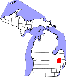 | |
| Villages | ||
| Townships | ||
| CDPs | ||
| Other unincorporated communities | ||
| Footnotes | ‡This populated place also has portions in an adjacent county or counties | |
Coordinates: 43°03′05″N 83°19′08″W / 43.05139°N 83.31889°W