Allegan County, Michigan
| Allegan County, Michigan | |
|---|---|
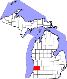 Location in the U.S. state of Michigan | |
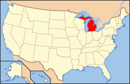 Michigan's location in the U.S. | |
| Founded |
established 1831 organized 1835[1] |
| Seat | Allegan |
| Largest city | Holland |
| Area | |
| • Total | 1,833 sq mi (4,747 km2) |
| • Land | 825 sq mi (2,137 km2) |
| • Water | 1,008 sq mi (2,611 km2), 55% |
| Population | |
| • (2010) | 111,408 |
| • Density | 135/sq mi (52/km²) |
| Congressional districts | 2nd, 6th |
| Time zone | Eastern: UTC-5/-4 |
| Website |
www |
Allegan County is a county in the U.S. state of Michigan. As of 2010 census, the population was 111,408.[2] The county seat is Allegan.[3] The name was coined by Henry Rowe Schoolcraft to sound like a Native American word.[1]
Allegan County comprises the Holland, MI Micropolitan Statistical Area, which is included in the Grand Rapids-Wyoming-Muskegon, MI Combined Statistical Area. It is primarily an agricultural area that is rapidly becoming urbanized as the population centers of Grand Rapids on the northeast and Kalamazoo to the southeast expand into Allegan County.
The county has long been a regional tourist draw, particularly the Tulip Time Festival in Holland and the area along Lake Michigan. The Lake Michigan shoreline has long been a popular place for vacation homes, and that such development continues, especially around Saugatuck and Douglas. Another draw is Allegan State Game Area, a 45,000 acres (180 km2) forest attracting campers, snowmobilers, cross-country skiers and hunters. Allegan County also hosts Saugatuck Dunes State Park with trails through scenic dunes and a swimming beach on Lake Michigan. Lake Allegan is another popular destination.[4]
History
As with other areas of Michigan, this territory was long occupied by bands of the Potowatomi and Ojibwe of the Lake Superior Band of Chippewa Indians. The United States government persuaded the tribes to cede their extensive territories to the federal government, in exchange for annuities and small reservations. The federally recognized Match-E-Be-Nash-She-Wish Band of Pottowatomi has a reservation here.
The boundaries of Allegan County were laid out by the legislature in 1831. The county was organized in 1835. At that time there were only about four European-American families permanently settled in the area. Among the first settlers of Allegan County were Giles Scott and Turner Aldrich.[5]
Geography
According to the U.S. Census Bureau, the county has a total area of 1,833 square miles (4,750 km2), of which 825 square miles (2,140 km2) is land and 1,008 square miles (2,610 km2) (55%) is water.[6]
Adjacent counties
- Ottawa County (north)
- Kent County (northeast)
- Barry County (east)
- Kalamazoo County (southeast)
- Van Buren County (south)
- Lake County, Illinois (southwest)
- Kenosha County, Wisconsin (west)
- Racine County, Wisconsin (northwest)
Highways
Demographics
| Historical population | |||
|---|---|---|---|
| Census | Pop. | %± | |
| 1840 | 1,783 | — | |
| 1850 | 5,125 | 187.4% | |
| 1860 | 16,087 | 213.9% | |
| 1870 | 32,105 | 99.6% | |
| 1880 | 37,815 | 17.8% | |
| 1890 | 38,961 | 3.0% | |
| 1900 | 38,812 | −0.4% | |
| 1910 | 39,819 | 2.6% | |
| 1920 | 37,540 | −5.7% | |
| 1930 | 38,974 | 3.8% | |
| 1940 | 41,839 | 7.4% | |
| 1950 | 47,493 | 13.5% | |
| 1960 | 57,729 | 21.6% | |
| 1970 | 66,575 | 15.3% | |
| 1980 | 81,555 | 22.5% | |
| 1990 | 90,509 | 11.0% | |
| 2000 | 105,665 | 16.7% | |
| 2010 | 111,408 | 5.4% | |
| Est. 2015 | 114,625 | [7] | 2.9% |
| U.S. Decennial Census[8] 1790-1960[9] 1900-1990[10] 1990-2000[11] 2010-2013[2] | |||
As of the 2010 United States Census, there were 111,408 people residing in the county. 92.9% were White, 1.2% Black or African American, 0.6% Asian, 0.6% Native American, 2.8% of some other race and 1.9% of two or more races. 6.7% were Hispanic or Latino (of any race). 23.0% were of Dutch, 17.5% German, 8.3% English, 7.1% Irish and 7.1% American ancestry.[12]
As of the 2000 census,[13] there were 105,665 people, 38,165 households, and 28,394 families residing in the county. The population density was 128 people per square mile (49/km²). There were 43,292 housing units at an average density of 52 per square mile (20/km²). The racial makeup of the county was 93.47% White, 1.31% Black or African American, 0.55% Native American, 0.55% Asian, 0.03% Pacific Islander, 2.77% from other races, and 1.32% from two or more races. 5.72% of the population were Hispanic or Latino of any race. 25.6% were of Dutch, 17.8% German, 9.6% American, 8.4% English and 7.2% Irish ancestry according to Census 2000. 93.6% spoke only English; 5.2% spoke Spanish at home.
There were 38,165 households out of which 37.40% had children under the age of 18 living with them, 61.40% were married couples living together, 9.10% had a female householder with no husband present, and 25.60% were non-families. 20.70% of all households were made up of individuals and 7.80% had someone living alone who was 65 years of age or older. The average household size was 2.72 and the average family size was 3.15.
In the county the population was spread out with 28.90% under the age of 18, 8.00% from 18 to 24, 30.00% from 25 to 44, 22.00% from 45 to 64, and 11.10% who were 65 years of age or older. The median age was 35 years. For every 100 females there were 99.60 males. For every 100 females age 18 and over, there were 97.60 males.
The median income for a household in the county was $45,813, and the median income for a family was $51,908. Males had a median income of $38,681 versus $26,887 for females. The per capita income for the county was $19,918. About 5.00% of families and 7.30% of the population were below the poverty line, including 7.50% of those under age 18 and 7.90% of those age 65 or over.
Religion
The Reformed Church in America was the greatest Protestan denomination with 4,500 members in 11 churches followed by the United Methodists with 3,600 congregants and 20 churches, the thirds is the Christian Reformed Church with 10 churches and 2,600 members. The Catholic Church has 10,000 members as of 2010.[14]
Government
The county government operates the jail, maintains rural roads, operates the major local courts, keeps files of deeds and mortgages, maintains vital records, administers public health regulations, and participates with the state in the provision of welfare and other social services. The county board of commissioners controls the budget but has only limited authority to make laws or ordinances. In Michigan, most local government functions—police and fire, building and zoning, tax assessment, street maintenance, etc.—are the responsibility of individual cities and townships.
Elected officials
- Prosecuting Attorney: Frederick Anderson
- Sheriff: Blaine Koops
- County Clerk/Register of Deeds: Joyce A. Watts
- County Treasurer: Sally L. Brooks
- Drain Commissioner: Denise Medemar
- County Surveyor: Kirk L. VanOrder
(Information as of September 2005)
Communities
Cities
Villages
Unincorporated communities
- Argenta
- Bakersville
- Beachmont
- Bentheim
- Belknap
- Bradley
- Bravo
- Boyd
- Burnips
- Castle Park
- Cedar Bluff
- Cheshire
- Chicora
- Corning
- Diamond Springs
- Dorr
- Dunningville
- East Saugatuck
- East Martin
- Fillmore
- Ganges
- Glenn
- Glenn Haven Shores
- Glenn Shores
- Graafschap
- Grange Corners
- Green Lake
- Hamilton
- Hawkhead
- Hilliards
- Hooper
- Hopkinsburg
- Kibbie
- Lacota
- Lee
- Leisure
- Macatawa
- Macks Landing
- Merson
- Miami Park
- Millgrove
- Moline
- Monteith Station
- Monterey
- Monterey Center
- Mount Pleasant
- Neeley
- New Salem
- New Richmond
- Oakland
- Old Saugatuck
- Old Squaw Skin Landing
- Overisel
- Oxbow
- Pearl
- Pier Cove
- Plummerville
- Pullman
- Sandy Pines
- Shelbyville
- Sherman Park
- Shorecrest
- Shorewood
- South Haven Highlands
- South Monterey
- Spring Grove
- Sulphur Springs
- Watson
Townships
- Allegan Township
- Casco Township
- Cheshire Township
- Clyde Township
- Dorr Township
- Fillmore Township
- Ganges Township
- Gun Plain Charter Township
- Heath Township
- Hopkins Township
- Laketown Township
- Lee Township
- Leighton Township
- Manlius Township
- Martin Township
- Monterey Township
- Otsego Township
- Overisel Township
- Salem Township
- Saugatuck Township
- Trowbridge Township
- Valley Township
- Watson Township
- Wayland Township
See also
- List of Michigan State Historic Sites in Allegan County, Michigan
- National Register of Historic Places listings in Allegan County, Michigan
References
- 1 2 "Bibliography on Allegan County". Clarke Historical Library, Central Michigan University. Retrieved January 18, 2013.
- 1 2 "State & County QuickFacts". United States Census Bureau. Retrieved August 26, 2013.
- ↑ "Find a County". National Association of Counties. Archived from the original on May 31, 2011. Retrieved June 7, 2011.
- ↑ "Exploring Lake Allegan". Retrieved October 23, 2014.
- ↑ Thomas, Henry F. (Ed.) (1907). A Twentieth Century History of Allegan County, Michigan, pp. 4-6. The Lewis Publishing Company.
- ↑ "2010 Census Gazetteer Files". United States Census Bureau. August 22, 2012. Retrieved September 18, 2014.
- ↑ "County Totals Dataset: Population, Population Change and Estimated Components of Population Change: April 1, 2010 to July 1, 2015". Retrieved July 2, 2016.
- ↑ "U.S. Decennial Census". United States Census Bureau. Archived from the original on May 11, 2015. Retrieved September 18, 2014.
- ↑ "Historical Census Browser". University of Virginia Library. Retrieved September 18, 2014.
- ↑ "Population of Counties by Decennial Census: 1900 to 1990". United States Census Bureau. Retrieved September 18, 2014.
- ↑ "Census 2000 PHC-T-4. Ranking Tables for Counties: 1990 and 2000" (PDF). United States Census Bureau. Retrieved September 18, 2014.
- ↑ Data Access and Dissemination Systems (DADS). "American FactFinder". United States Census Bureau. Retrieved October 23, 2014.
- ↑ Statistical profile of Allegan County, Michigan, United States Census Bureau, Census 2000
- ↑ "The Association of Religion Data Archives - Maps & Reports". University Park, PA. 2010. Retrieved October 23, 2014.
External links
- Allegan County
- "Bibliography on Allegan County". Clarke Historical Library, Central Michigan University. Retrieved January 18, 2013.
 |
Racine County, Wisconsin | Ottawa County | Kent County | |
| Kenosha County, Wisconsin | |
Barry County | ||
| ||||
| | ||||
| Lake County, Illinois | Van Buren County | Kalamazoo County |
Municipalities and communities of Allegan County, Michigan, United States | ||
|---|---|---|
| City | | |
| Villages | ||
| Charter township | ||
| General law townships | ||
| Unincorporated communities | ||
| Footnotes | ‡This populated place also has portions in an adjacent county or counties | |
| Central cities | |||
|---|---|---|---|
| Counties |
| ||
| Geography | |||
| Transportation | |||
| Economy | |||
Coordinates: 42°34′N 86°15′W / 42.56°N 86.25°W