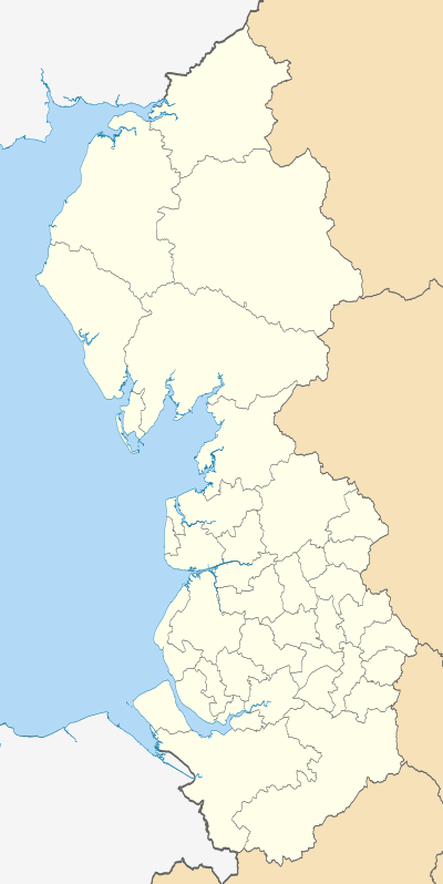
Wyre
Coordinates: 53°54′00″N 2°48′32″W / 53.900°N 2.809°W
| Borough of Wyre | |
|---|---|
| Borough | |
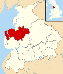 Wyre shown within Lancashire and England | |
| Sovereign state | United Kingdom |
| Constituent country | England |
| Region | North West England |
| Ceremonial county | Lancashire |
| Founded | 1974 |
| Admin. HQ | Poulton-le-Fylde |
| Government | |
| • Type | Wyre Borough Council |
| • Leadership: | Leader & Cabinet |
| • Executive: | Conservative |
| • MPs: | Mark Menzies, Cat Smith, Ben Wallace |
| Area[1] | |
| • Total | 109.1 sq mi (282.6 km2) |
| Area rank | 145th |
| Population (mid-2014 est.)[2] | |
| • Total | 108,742 |
| • Rank | 215th |
| • Density | 1,000/sq mi (380/km2) |
| Time zone | Greenwich Mean Time (UTC+0) |
| • Summer (DST) | British Summer Time (UTC+1) |
| ONS code |
30UQ (ONS) E07000128 (GSS) |
| Ethnicity |
96.6% White 1.9% S.Asian[3] |
| Website | wyre.gov.uk |
Wyre is a local government district with borough status in Lancashire, England. The population of the Non-metropolitan district at the 2011 census was 107,749.[4] Its council is based in Poulton-le-Fylde.
The district is named after the River Wyre, which runs through the district. It was formed on 1 April 1974 by the Local Government Act 1972, and was a merger of the municipal borough of Fleetwood, along with Poulton-le-Fylde, Preesall, Garstang and Thornton-Cleveleys urban districts and various Rural Districts.

Town and Parish Councils
Urban areas
Civil parishes

- Barnacre with Bonds
- Bleasdale
- Cabus
- Catterall
- Claughton
- Fleetwood (town council)
- Forton
- Garstang (town council)
- Great Eccleston
- Hambleton
- Inskip-with-Sowerby
- Kirkland
- Myerscough and Bilsborrow
- Nateby
- Nether Wyresdale
- Out Rawcliffe
- Pilling
- Preesall (town council)
- Stalmine-with-Staynall
- Upper Rawcliffe with Tarnacre
- Winmarleigh
Local elections
Elections to Wyre Borough Council take place every four years on the first Thursday in May. All 55 councillors are elected from 26 wards. Since the formation of the council in 1973 it has been under the control of the Conservative Party with the exception of one term from 1995 to 1999 when the Labour Party held control of the council.
Following the most recent election held on 5 May 2011 the composition of the council is as follows:
| Party | Seats | ± | |
|---|---|---|---|
| Conservative | 40 | –5 | |
| Labour | 15 | +7 | |
| Liberal Democrat | 0 | –1 | |
| Independent | 0 | –1 | |
Parliament
Wyre is split into three Parliamentary Constituencies - Wyre and Preston North, Lancaster and Fleetwood and Blackpool North and Cleveleys. This was recently changed as part of the Boundary changes for the United Kingdom general election, 2010. Before this change it had been split into three Lancaster and Wyre, Blackpool North and Fleetwood and Fylde.
External links
References
- ↑ "Standard Area Measurements - Local Authorities - Dec 2010 (SAM_LAD_DEC_2010_UK)". UK Standard Area Measurements (SAM). Office for National Statistics. 31 December 2010. Retrieved 1 October 2011.
- ↑ "Population estimates for UK mid-2014 analysis tool" (zip). Office for National Statistics. 25 June 2015. Retrieved 27 June 2015.
- ↑ "Resident Population Estimates by Ethnic Group (Percentages)". Office for National Statistics. 30 October 2007. Retrieved 2008-08-26.
- ↑ "Non-Metropolitan District population 2011". Retrieved 23 January 2016.
- ↑ http://www.wyre.gov.uk/councillors