State Scenic Highway System (California)
| State Scenic Highway System | |
|---|---|
|
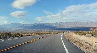
State Scenic Highway System signage | |
| Highway names | |
| Interstates: | Interstate XX (I-XX) |
| US Highways: | U.S. Route XX (US XX) |
| State: | State Route XX (SR XX) |
| System links | |


The State Scenic Highway System is a list of highways, mainly state highways, that have been designated by the California Department of Transportation (Caltrans) as scenic highways. The California State Legislature, primarily through Section 263 of the Streets and Highways Code, makes highways eligible for designation as a scenic highway. For a highway to be declared scenic, the government with jurisdiction over abutting land must adopt a "scenic corridor protection program" that limits development, outdoor advertising, and earthmoving, and Caltrans must agree that it meets the criteria. The desire to create such a designation has at times been in conflict with the property rights of abutters, for example on State Route 174.[1][2] Scenic highways are marked by the state flower, a California poppy, inside a rectangle (for state-maintained highways) or pentagon (for county highways).[3]
List of eligible and designated scenic highways

- I-5 in San Juan Capistrano to SR 19 in Long Beach
- SR 187 near Santa Monica to US 101 near El Rio
- US 101 at Las Cruces to SR 246 in Lompoc
- Designated 1971-12-14 in Santa Barbara County: US 101 at Las Cruces to Lompoc
- SR 227 near Oceano to US 101 in Pismo Beach
- US 101 in San Luis Obispo to SR 35 in Daly City
- Designated 1999-08-13 in San Luis Obispo County: San Luis Obispo to Monterey County
- Designated 1965-06-07 in Monterey County: San Luis Obispo County to Carmel River
- Designated 1970-05-21 in Monterey County: Carmel River to SR 68 in Monterey
- Designated 1976-06-25 in San Mateo County: Santa Cruz County to Half Moon Bay
- SR 35 to US 101 in San Francisco
- US 101 near Marin City to US 101 at Leggett
- I-210 in La Cañada Flintridge to SR 138 near Wrightwood
- Designated 1971-05-12 in Los Angeles County: La Cañada Flintridge to San Bernardino County
- SR 160 in Antioch to SR 84 near Brentwood
- SR 49 in Angels Camp to SR 89 near Markleeville
- Designated 1971-11-09 in Calaveras County: Arnold to Alpine County
- Designated 1970-09-14 in Alpine County: Calaveras County to SR 89 near Markleeville
- Mexico to SR 75 in southern San Diego
- SR 75 near Downtown San Diego to SR 74 in San Juan Capistrano
- I-210 in Sylmar to SR 126 in Santa Clarita
- SR 152 near Los Banos to I-580 near Tracy
- Designated 1968-10-25 in Merced County: SR 152 near Los Banos to Stanislaus County
- Designated 1968-10-25 in Stanislaus County: Merced County to San Joaquin County
- Designated 1974-06-07 in San Joaquin County: Stanislaus County to I-580 near Tracy
- SR 44 in Redding to Shasta Lake
- SR 89 near Mount Shasta to US 97 in Weed
- SR 3 in Yreka to Oregon
- SR 1 in Santa Cruz to SR 17 in Los Gatos
- Designated 1979-10-18 in Santa Clara County: SR 35 at Saratoga Gap to Saratoga Sunnyvale Road in Saratoga
- Designated 1968-05-02 in Santa Clara County: Saratoga Sunnyvale Road in Saratoga to Los Gatos
- SR 38 in Redlands to SR 62 near White Water
- US 101 in Santa Rosa to SR 121 near Sonoma
- Designated 1974-12-17 in Sonoma County: Santa Rosa to Agua Caliente
- SR 58 near Mojave to US 395 near Little Lake
- SR 1 in Santa Cruz to SR 9 in Los Gatos
- SR 138 at Crestline to SR 247 at Lucerne Valley
- SR 1 in Fort Bragg to SR 16 near Rumsey
- SR 49 in Grass Valley to I-80 near Emigrant Gap
- Designated 1971-03-12 in Nevada County: Relief to Bear Valley
- Caldecott Tunnel near Oakland to I-680 in Walnut Creek
- Designated 1982-10-22 in Contra Costa County: Caldecott Tunnel near Oakland to I-680 in Walnut Creek
- SR 1 at Topanga Beach to Mulholland Drive in Los Angeles
- SR 89 in Tahoe City to Nevada
- US 101 in Ventura to SR 166 near Cuyama
- Designated 1972-02-18 in Ventura County: Wheeler Springs to near Sespe Gorge
- Designated 1988-07-11 in Ventura County: near Sespe Gorge to near Pine Mountain Ridge Road
- Designated 1972-02-18 in Ventura County: near Pine Mountain Ridge Road to near Lockwood Valley Road
- Designated 1988-07-11 in Ventura County: near Lockwood Valley Road to Santa Barbara County
- SR 17 near Redwood Estates to SR 1 in San Francisco
- Designated 1968-09-13 in San Mateo County: Santa Cruz County to near Page Mill Road
- Designated 1968-01-22 in San Mateo County: near Page Mill Road to SR 92 near Crystal Springs Reservoir
- I-10 in Redlands to SR 18 at Big Bear Dam
- Designated 1968-03-19 in San Bernardino County: Santa Ana River to State Lane near Sugarloaf
- I-210 in Azusa to SR 2 at Islip Saddle
- SR 1 in Morro Bay to US 101 in Atascadero
- SR 46 near Cholame to SR 33 at Reef Station
- SR 49 at Oakhurst to Yosemite National Park
- I-5 in Redding to SR 89 near Old Station
- SR 41 at Oakhurst to SR 89 at Sattley
- Designated 1971-07-14 in Sierra County: Yuba County to Yuba Pass
- SR 49 in Placerville to Nevada
- Designated 1985-04-02 in El Dorado County: Placerville Drive in Placerville (west of SR 49) to Echo Summit
- Designated 1986-04-01 in El Dorado County: Echo Summit to South Lake Tahoe
- SR 29 at Lower Lake to SR 20 near Clearlake
- I-10 near White Water to Arizona
- Designated 1972-09-14 in Riverside County: I-10 near White Water to San Bernardino County
- Monterey to US 101 in Salinas
- Designated 1968-06-19 in Monterey County: SR 1 in Monterey to Salinas River
- SR 149 at Wicks Corner to SR 89 at Blairsden
- SR 91 near Corona to SR 83 in Chino Hills
- I-5 in San Juan Capistrano to SR 111 in Palm Desert, California
- Designated 1971-10-18 in Riverside County: San Bernardino National Forest west boundary to SR 111 in Palm Desert as the Pines to Palms Highway[4]
- I-5 in southern San Diego to I-5 near Downtown San Diego
- Designated 1974-03-04 in San Diego County: Imperial Beach to Avenida del Sol in Coronado
- Designated 1969-12-17 in San Diego County: San Diego-Coronado Bridge
- I-5 in Oceanside to SR 79 near Lake Henshaw
- SR 79 at Santa Ysabel to SR 86 near Salton City
- Designated 1971-12-14 in San Diego County: Anza-Borrego Desert State Park
- I-280 in San Francisco to SR 61 in Oakland
- SR 20 near Emigrant Gap to Nevada
- SR 238 in Fremont to I-680 near Sunol
- Designated 2007-07-27 in Alameda County: SR 238 in Fremont to I-680 near Sunol
- SR 49 in Jackson to Nevada
- Designated 1986-07-30 in Amador County: Dew Drop Ranger Station to Alpine County
- Designated 1970-09-14 in Alpine County: Amador County to Nevada
- US 395 near Coleville to I-5 near Mount Shasta
- Designated 1971-11-09 in Mono County: Slinkard Valley to Alpine County
- Designated 1970-09-14 in Alpine County: Mono County to El Dorado County
- Designated 1986-04-01 in El Dorado County: Alpine County to Placer County
- SR 55 in Anaheim to I-15 in Corona
- Designated 1971-11-15 in Orange County: SR 55 in Anaheim to Anaheim east limit
- SR 1 in Half Moon Bay to I-280 near Crystal Springs Reservoir
- SR 125 near Spring Valley to I-8 near Jacumba
- SR 299 at Willow Creek to I-5 near Yreka
- SR 27 in Woodland Hills to SR 46 in Paso Robles
- Golden Gate Bridge to SR 1 near Marin City
- SR 1 at Leggett to US 199 near Crescent City
- Designated 1970-02-18 in Del Norte County: Del Norte Coast Redwoods State Park
- SR 197 near Smith River to Oregon
- SR 49 in Sonora to US 395 near Bridgeport
- California Historic Parkway: Figueroa Street/Avenue 26 in Los Angeles to Glenarm Street in Pasadena
- Bombay Beach to SR 195 at Mecca
- SR 74 in Palm Desert to I-10 near White Water
- SR 1 near Jenner to US 101 in Cotati
- Designated 1988-09-20 in Sonoma County: SR 1 near Jenner to Sebastopol east limit
- SR 23 in Moorpark to De Soto Avenue in Los Angeles
- Yosemite National Park to US 395 near Mono Lake
- SR 94 near Spring Valley to I-8 in La Mesa
- Designated 1971-03-01 in San Diego County: SR 94 near Spring Valley to I-8 in La Mesa
- SR 150 in Santa Paula to I-5 in Santa Clarita
- SR 2 near Wrightwood to SR 18 at Crestline
- SR 49 at Mariposa to Yosemite National Park
- Designated 1991-08-30 in Mariposa County: Mariposa to El Portal
- Brea to Peyton Drive in Chino Hills
- Pinnacles National Park to SR 25 near Paicines
- US 101 in Carpinteria to SR 126 in Santa Paula
- Shasta Dam to I-5 in Shasta Lake
- Designated 1981-09-09 in Shasta County: Shasta Dam to Shasta Lake
- SR 1 in Watsonville to Hecker Pass
- SR 156 near San Felipe to I-5 near Los Banos
- Designated 1970-06-19 in Merced County: Santa Clara County to I-5 near Los Banos
- US 101 near Los Olivos to US 101 in Santa Barbara
- Designated 1968-11-22 in Santa Barbara County: US 101 near Los Olivos to US 101 in Santa Barbara
- SR 1 near Castroville to SR 152 near San Felipe
- Designated 1972-09-14 in Monterey County: Castroville to US 101 near Prunedale
- US 395 at June Lake Junction to US 395 at Grant Lake Junction
- SR 4 in Antioch to Sacramento
- Designated 1969-10-03 in Sacramento County: Contra Costa County to Sacramento
- Ash Street in Downtown San Diego to I-8 in San Diego
- Designated 1992-04-24 in San Diego County: Balboa Park
- California Historic Parkway: A Street in Downtown San Diego to Sixth Avenue in San Diego
- US 101 near Santa Maria to SR 33 near Cuyama
- SR 65 near Clovis to Huntington Lake
- Camp Sabrina to SR 266 at Oasis
- Designated 1970-06-19 in Inyo County: Camp Sabrina to Bishop
- SR 138 in Hesperia to SR 18 near Lake Arrowhead
- Death Valley National Park to SR 127 near Shoshone
- SR 65 near Minkler to Kings Canyon

- SR 65 in Porterville to SR 127 at Death Valley Junction
- Designated 1968-05-10 in Inyo County: Death Valley National Park (original boundaries)
- Designated 2002-01-07 in Inyo County: Death Valley National Park (new boundaries)
- US 199 near Hiouchi to US 101 near Smith River

- US 101 near Crescent City to Oregon
- Minaret Summit to US 395 near Mammoth Lakes
- Point Loma to I-5 in San Diego
- SR 9 at Boulder Creek to SR 9 at Waterman Gap
- SR 74 at Mountain Center to I-10 in Banning
- Designated 1972-03-21 in Riverside County: SR 74 at Mountain Center to Banning
- SR 62 in Yucca Valley to I-15 in Barstow
- SR 37 near Nicasio to SR 1 near Point Reyes Station

- US 101 near Phillipsville to US 101 near Stafford

- I-880/SR 17 in San Jose to I-80 in San Francisco
- Designated 1980-04-28 in San Mateo County: Santa Clara County to South San Francisco
- US 101 in Arcata to SR 96 at Willow Creek
- SR 3 at Weaverville to I-5 in Redding
- SR 89 near Burney to SR 139 near Canby
- SR 14 near Little Lake to SR 89 near Coleville
- Designated 1970-06-30 in Inyo County: Independence to Fish Springs
- Designated 2000-06-05 in Mono County: Inyo County to near Crowley Lake
- Designated 1971-11-09 in Mono County: near Crowley Lake to near Mammoth Lakes
- Designated 2000-06-05 in Mono County: near Mammoth Lakes to SR 120 near Mono Lake
- Designated 2000-06-05 in Mono County: Lee Vining to Bridgeport
- Designated 2000-06-05 in Mono County: Bridgeport to Walker
- I-5 near Tracy to I-80 in Oakland
- Designated 1974-06-07 in San Joaquin County: I-5 near Tracy to Alameda County
- Designated 1970-02-18 in Alameda County: San Joaquin County to I-205 near Tracy
- Designated 1976-06-25 in Alameda County: San Leandro to I-980/SR 24 in Oakland
- Milpitas to SR 24 in Walnut Creek
- Designated 1978-06-15 in Alameda County: SR 238 in Fremont to Bernal Avenue in Pleasanton
- Designated 1982-10-22 in Alameda County: Bernal Avenue in Pleasanton to Contra Costa County
- Designated 1982-10-22 in Contra Costa County: Alameda County to SR 24 in Walnut Creek
County highways
- San Luis Obispo County: Chimney Rock Road near Paso Robles to Monterey County
- Monterey County: San Luis Obispo County to CR G18 at Lockwood
- Monterey County: Carmel Valley Road to SR 68 near Monterey
- Los Angeles County: SR 1 in Malibu to Lost Hills Road in Calabasas
- Los Angeles County: SR 1 at Leo Carrillo State Park to CR N9 near Cornell
- Los Angeles County: Malibu Creek State Park
- River Road
- Sacramento County: SR 160 near Isleton to SR 160 near Paintersville
See also
 California Roads portal
References
- California Department of Transportation, Officially Designated State Scenic Highways and Historic Parkways, accessed January 2008
- California Department of Transportation, Officially Designated Scenic Highways, accessed January 2008
- ↑ Sacramento Bee, Scenic Highway Concept Spurs Alarm, March 25, 1999, p. N1
- ↑ Dave Moller, Union of Grass Valley, CABPRO's Urke steps down, August 7, 2004
- ↑ California Department of Transportation District 3, Scenic Highway Program, accessed January 2008
- ↑ Lech, Steve (2012). For Tourism and a Good Night's Sleep: J. Win Wilson, Wilson Howell, and the Beginnings of the Pines-to-Palms Highway. Riverside, CA: Steve Lech. p. 230. ISBN 978-0-9837500-1-7.