Canby, California
| Canby | |
|---|---|
| census-designated place | |
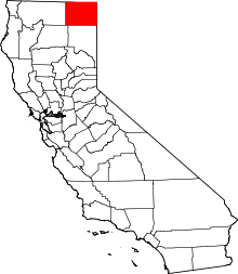
 Canby Location in California | |
| Coordinates: 41°26′38″N 120°52′13″W / 41.44389°N 120.87028°WCoordinates: 41°26′38″N 120°52′13″W / 41.44389°N 120.87028°W | |
| Country |
|
| State |
|
| County | Modoc |
| Area[1] | |
| • Total | 2.309 sq mi (5.982 km2) |
| • Land | 2.268 sq mi (5.875 km2) |
| • Water | 0.041 sq mi (0.107 km2) 1.79% |
| Elevation[2] | 4,314 ft (1,315 m) |
| Population (2010) | |
| • Total | 315 |
| • Density | 140/sq mi (53/km2) |
| Time zone | Pacific (PST) (UTC-8) |
| • Summer (DST) | PDT (UTC-7) |
| ZIP Code | 96015 |
| Area code(s) | 530 |
| GNIS feature ID | 220535; 2582963 |
| U.S. Geological Survey Geographic Names Information System: Canby, California; U.S. Geological Survey Geographic Names Information System: Canby, California | |
Canby is a census-designated place[3] in Modoc County, California.[2] It is located 17 miles (27 km) west of Alturas,[4] at an elevation of 4314 feet (1315 m).[2] It had a population of 315 at the 2010 census. The ZIP Code is 96015. The community is inside area code 530.
Canby is the location of the main branch of the I'SOT religious community,[5] and is known for the I'SOT's nativity scenes prominently displayed along the town's main street, California State Route 299.[6]
History
The first post office opened at Canby in 1874.[4] The town was named in honor of General Edward Canby,[4] who was shot by the Modoc tribal leader Captain Jack at a peacemaking session as part of the Modoc War. This shooting lead to the siege at Captain Jack's Stronghold.[7]
Until the late 1940s, Canby was the site of Big Lakes Box Company and the supply point for Big Lakes Logging Camp in the Adin Mountains about 10 miles to the southeast, where conditions were primitive.[8]
Geography
According to the United States Census Bureau, the CDP covers an area of 2.3 square miles (6.0 km²), 98.21% of it land, and 1.79% of it water.
Climate
This region experiences warm (but not hot) and dry summers, with no average monthly temperatures above 71.6 °F. According to the Köppen Climate Classification system, Canby has a warm-summer Mediterranean climate, abbreviated "Csb" on climate maps.[9]
Demographics
The 2010 United States Census[10] reported that Canby had a population of 315. The population density was 136.4 people per square mile (52.7/km²). The racial makeup of Canby was 292 (92.7%) White, 2 (0.6%) African American, 7 (2.2%) Native American, 1 (0.3%) Asian, 0 (0.0%) Pacific Islander, 9 (2.9%) from other races, and 4 (1.3%) from two or more races. Hispanic or Latino of any race were 24 persons (7.6%).
The Census reported that 154 people (48.9% of the population) lived in households, 133 (42.2%) lived in non-institutionalized group quarters, and 28 (8.9%) were institutionalized.
There were 62 households, out of which 15 (24.2%) had children under the age of 18 living in them, 30 (48.4%) were opposite-sex married couples living together, 7 (11.3%) had a female householder with no husband present, 3 (4.8%) had a male householder with no wife present. There were 5 (8.1%) unmarried opposite-sex partnerships, and 0 (0%) same-sex married couples or partnerships. 15 households (24.2%) were made up of individuals and 8 (12.9%) had someone living alone who was 65 years of age or older. The average household size was 2.48. There were 40 families (64.5% of all households); the average family size was 2.58.
The population was spread out with 87 people (27.6%) under the age of 18, 27 people (8.6%) aged 18 to 24, 71 people (22.5%) aged 25 to 44, 80 people (25.4%) aged 45 to 64, and 50 people (15.9%) who were 65 years of age or older. The median age was 36.2 years. For every 100 females there were 85.3 males. For every 100 females age 18 and over, there were 83.9 males.
There were 76 housing units at an average density of 32.9 per square mile (12.7/km²), of which 34 (54.8%) were owner-occupied, and 28 (45.2%) were occupied by renters. The homeowner vacancy rate was 2.9%; the rental vacancy rate was 12.5%. 73 people (23.2% of the population) lived in owner-occupied housing units and 81 people (25.7%) lived in rental housing units.
Politics
In the state legislature, Canby is in the 1st Senate District, represented by Republican Ted Gaines,[11] and the 1st Assembly District, represented by Republican Brian Dahle.[12]
Federally, Canby is in California's 1st congressional district, represented by Republican Doug LaMalfa.[13]
References
- ↑ U.S. Census Archived 2012-07-14 at WebCite
- 1 2 3 "Canby". Geographic Names Information System. United States Geological Survey.
- ↑ U.S. Geological Survey Geographic Names Information System: Canby, California
- 1 2 3 Durham, David L. (1998). California's Geographic Names: A Gazetteer of Historic and Modern Names of the State. Clovis, Calif.: Word Dancer Press. p. 362. ISBN 1-884995-14-4.
- ↑ "Contact Us". I'SOT Inc. 2004. Retrieved 2010-04-02.
- ↑ "The Christmas Scene in Canby". I'SOT Inc. 2004. Retrieved 2010-04-02.
- ↑ "Modoc Wars, 1873–74". California State Military Museum. 2009. Retrieved 21 July 2009.
- ↑ Pease, Robert W. (1965). Modoc County; University of California Publications in Geography, Volume 17. Berkeley and Los Angeles: University of California Press. p. 115.
- ↑ Climate Summary for Canby, California
- ↑ "2010 Census Interactive Population Search: CA - Canby CDP". U.S. Census Bureau. Retrieved July 12, 2014.
- ↑ "Senators". State of California. Retrieved March 10, 2013.
- ↑ "Members Assembly". State of California. Retrieved March 2, 2013.
- ↑ "California's 1st Congressional District - Representatives & District Map". Civic Impulse, LLC. Retrieved March 3, 2013.