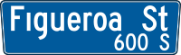
Figueroa Street
 | |
|---|---|
| Length | 25.00 mi (40.23 km) |
| Coordinates | 34°2′59″N 118°15′34″W / 34.04972°N 118.25944°W |
| South end | John S Gibson Blvd in Los Angeles |
| Major junctions |
|
| North end |
|

Figueroa Street is a street in Los Angeles County, California named for General José Figueroa (1792 – 29 September 1835), governor of Alta California from 1833 to 1835, who oversaw the secularization of the missions of California.
Route
One of the longer streets in the city, it runs in a north/south direction for more than 30 miles (48 km) between the neighborhoods of Wilmington and Eagle Rock of Los Angeles. The southern terminus is at Harry Bridges Boulevard in San Pedro, and its northern terminus at its interchange with the Ventura Freeway west of Pasadena, with a break between Alpine Street in Chinatown and San Fernando Road in Cypress Park.
From its south end at Harry Bridges Boulevard to Downtown Los Angeles, Figueroa Street runs north parallel to the Harbor Freeway (Interstate 110) in South Los Angeles. The only portion of this segment of Figueroa Street that lies outside Los Angeles city limits is in the city of Carson. South of the Financial District, Figueroa Street services some popular locations including the University of Southern California, the Los Angeles Convention Center, and Staples Center/L.A. Live.
After passing through downtown Los Angeles near Bunker Hill and South Park, Figueroa Street "ends" near the overcrossing of Sunset Boulevard over the Arroyo Seco Parkway (SR 110) before "resuming" at San Fernando Road in Cypress Park. An early routing of Figueroa Street in this area was originally part of U.S. Route 66, today a part of the Arroyo Seco Parkway. The noted Figueroa Street Tunnels were once a part of that same stretch of roadway.
After resuming at San Fernando Road, Figueroa continues to run roughly parallel to the Arroyo Seco Parkway until it reaches York Boulevard in Highland Park. Afterwards, it heads north to its terminus with the Ventura Freeway.
Some of the southern termini was once part of U.S. Route 6 before its almost total decommissioning through California in 1964; indeed, Figueroa Street at Pacific Coast Highway was the actual western terminus of that highway, although some maps show that US 6 turned east on Pacific Coast Highway as far as Atlantic Avenue in Long Beach.
Early maps produced by the Automobile Club of Southern California measured distances to Los Angeles from the club's headquarters at the intersection of Figueroa Street with Adams Boulevard.[1]
On April 2, 2011, a portion of the street at Jefferson Boulevard was blocked off for the "Orange Carpet" and the grandstand for the broadcasting of the 2011 Kids' Choice Awards.
History

Figueroa was originally called Calle de los Chapules (or Grasshopper Street). Later in the 1880s it became known as "Pearl Street". The section of what is now Figueroa in Highland Park above Avenue 39 was known as "Pasadena Avenue" until Figueroa was extended through Elysian Park. The portion of what is now Figueroa between the Los Angeles River and Avenue 39 was originally known as Dayton Avenue until the Arroyo Parkway went through.[2]
Education
- Luther Burbank Middle School
- Florence Nightingale Middle School
- Optimist High School
- Sycamore Grove School
- University of Southern California
Transportation
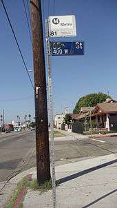
The Metro Green Line operates a station underneath Interstate 105 at Figueroa Street. Metro Local Line 81 operates on Figueroa Street between Colorado Boulevard and Interstate 105 and Torrance Transit Line 1 between Interstate 105 and the Harbor Gateway Transit Center. The Metro Silver Line runs on Figueroa Street between 23rd and 6th Streets: Northbound Silver line trips to El Monte Bus Station continue north on Figueroa Street to serve the 7th Street / Metro Center and finally turn right on 6th street, leaving Figueroa Street. Southbound Silver Line trips to Harbor Gateway Transit Center run south on Flower Street from 5th Street to the Harbor Transitway. There are 5 Silver line street stops served in the northbound direction: Figueroa/23rd, Figueroa/Washington, Figueroa/Pico, Figueroa/Olympic and Figueroa/7th. In addition, there are 5 Metro Silver Line Stations served on the Harbor Transitway close to Figueroa Street: 37th Street/USC, Slauson, Manchester, Harbor Freeway, and Rosecrans. The Harbor Transitway is located on the I-110 freeway, between Figueroa Street and Broadway. The Lincoln/Cypress Station for the Metro Gold Line on Avenue 26 at its intersection with Lacy Street is about a 5-minute walk from Figueroa Street.
"My Figueroa" Development Plan / LA 2024
The Figueroa Corridor Streetscape project is a city led effort to beautify and improve the boulevard by adding pedestrian friendly amenities. The project begins on 7th street in Downtown Los Angeles, by Staples Center and terminates at Exposition Park at USC. The projects aims to improve transit and pedestrian access, protected bike lanes totally protected by physical barriers, a more organized and efficient street by adding better signalization and signage, high-visibility crosswalks, transit platforms, more street trees, and public art to make the pedestrian and transit-rider experience safer and more enjoyable and wider sidewalks. The $20 million Figueroa Corridor Streetscape project is funded by a Proposition 1C grant. After delays, work is expected to commence in the summer of 2016[3] and is expected to be completed by March 2017. When the prop 1C grant expires. [4] Los Angeles 2024 bid organizers plan to use this corridor as a planned "Live Site". A area dedicated as a central pedestrian corridor, linking all of the Downtown LA venues, and creating an unparalleled zone of fan excitement for locals and visitors from around the world. [5]
Notable Landmarks
- Automobile Club of Southern California
- Bob Hope Patriotic Hall
- Bonaventure Hotel
- Eagle Rock Historical Landmark
- Exposition Park
- Galen Center
- The Grammy Museum
- Highland Park Adult Senior Citizen Center
- Jonathan Club
- L.A. Live
- Los Angeles Convention Center
- Los Angeles County Health Department
- Los Angeles Memorial Coliseum
- Los Angeles Memorial Sports Arena
- Original Pantry Cafe
- Staples Center
- Stimson House
- University of Southern California
- Variety Arts Center Building
- Wilshire Grand Tower
Buildings on Figueroa
-
.jpg)
Variety Arts Center Building, 938-940 South Figueroa, 1980, Julius Shulman photo
-
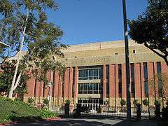
Galen Center on the USC campus at Jefferson Boulevard, 2007
-

HSBC Building at Seventh Street, 2012
References
- ↑ See Route 66: Traveler's Guide and Roadside Companion by Tom Snyder for examples
- ↑ Lucas, Greg (29 September 2011). "The Streets of Los Angeles". California's Capitol. Retrieved 22 Jun 2012.
Grasshopper Street – Calle de los Chapules – is now Figueroa which, in turn, is a tip of the hat to the former Mexican Governor Jose Figueroa.
- ↑ http://la.curbed.com/2016/6/10/11903348/myfigueroa-bikes-pedestrians-2017
- ↑ http://www.myfigueroa.com/about
- ↑ https://la24-prod.s3.amazonaws.com/assets/pdf/LA2024-canditature-part1_english.pdf