Cuyama, California
| Cuyama | |
|---|---|
| census-designated place | |
 Cuyama Position in California. | |
| Coordinates: 34°55′52″N 119°36′54″W / 34.93111°N 119.61500°WCoordinates: 34°55′52″N 119°36′54″W / 34.93111°N 119.61500°W | |
| Country |
|
| State |
|
| County | Santa Barbara |
| Area[1] | |
| • Total | 0.457 sq mi (1.186 km2) |
| • Land | 0.453 sq mi (1.174 km2) |
| • Water | 0.004 sq mi (0.011 km2) 0.96% |
| Elevation[2] | 2,293 ft (699 m) |
| Population (2010) | |
| • Total | 57 |
| • Density | 120/sq mi (48/km2) |
| Time zone | Pacific (PST) (UTC-8) |
| • Summer (DST) | PDT (UTC-7) |
| GNIS feature ID | 2582989 |
| U.S. Geological Survey Geographic Names Information System: Cuyama, California | |
Cuyama /kwiːˈjɑːmə/ (Chumash: Kuyam, "To Rest, To Wait" [3]) is a census-designated place in Santa Barbara County. California. It is located in the Cuyama Valley, near the Carrizo Plain. The Cuyama River runs adjacent to the town, flowing west towards the Pacific Ocean. Cuyama is surrounded by many apricot, peach, and plum orchards. The ZIP Code is 93254, and the community is inside area code 805. The population was 57 at the 2010 census. The name "Cuyama" comes from an Indian village named for the Chumash word kuyam, meaning "clam" or "freshwater mollusk".[4]
Cuyama is located on California State Route 166 2.5 miles (4 km) east of its much larger neighbor New Cuyama.
South of the town is the Sierra Madre mountain range, most of which is included in the Los Padres National Forest. Considerable oil and gas development has taken place at the South Cuyama Oil Field in the foothills of the Sierra Madre, just south of Cuyama and adjacent New Cuyama. In July 2005, 52,000 acres (210 km2) in Los Padres National Forest, mostly in the region immediately south of Cuyama, was opened up to further development by the National Forest Service.
History
Rancho Cuyama, which consisted of 22,200 acres, was granted to Jose Maria Rojo in 1843. In 1943 Richfield Oil Company started oil exploration in the area, followed by the Norris Oil company five years later. In 1952 Atlantic Richfield established New Cuyama four miles East of Cuyama to house its employees.[5]
Geography
According to the United States Census Bureau, the CDP covers an area of 0.5 square miles (1.2 km²), 99.04% of it land, and 0.96% of it water.
Climate
This region experiences warm (but not hot) and dry summers, with no average monthly temperatures above 71.6 °F. According to the Köppen Climate Classification system, Cuyama has a warm-summer Mediterranean climate, abbreviated "Csb" on climate maps.[6]
Demographics
The 2010 United States Census[7] reported that Cuyama had a population of 57. The population density was 124.5 people per square mile (48.1/km²). The racial makeup of Cuyama was 40 (70.2%) White, 0 (0.0%) African American, 2 (3.5%) Native American, 0 (0.0%) Asian, 0 (0.0%) Pacific Islander, 14 (24.6%) from other races, and 1 (1.8%) from two or more races. Hispanic or Latino of any race were 40 persons (70.2%).
The Census reported that 57 people (100% of the population) lived in households, 0 (0%) lived in non-institutionalized group quarters, and 0 (0%) were institutionalized.
There were 20 households, out of which 7 (35.0%) had children under the age of 18 living in them, 9 (45.0%) were opposite-sex married couples living together, 1 (5.0%) had a female householder with no husband present, 2 (10.0%) had a male householder with no wife present. There were 2 (10.0%) unmarried opposite-sex partnerships, and 0 (0%) same-sex married couples or partnerships. 6 households (30.0%) were made up of individuals and 2 (10.0%) had someone living alone who was 65 years of age or older. The average household size was 2.85. There were 12 families (60.0% of all households); the average family size was 3.75.
The population was spread out with 14 people (24.6%) under the age of 18, 8 people (14.0%) aged 18 to 24, 13 people (22.8%) aged 25 to 44, 17 people (29.8%) aged 45 to 64, and 5 people (8.8%) who were 65 years of age or older. The median age was 34.2 years. For every 100 females there were 137.5 males. For every 100 females age 18 and over, there were 152.9 males.
There were 30 housing units at an average density of 65.5 per square mile (25.3/km²), of which 10 (50.0%) were owner-occupied, and 10 (50.0%) were occupied by renters. The homeowner vacancy rate was 0%; the rental vacancy rate was 23.1%. 27 people (47.4% of the population) lived in owner-occupied housing units and 30 people (52.6%) lived in rental housing units.
See also
- USS Cuyama (AO-3) — a fleet oiler built in 1916.
References
- ↑ U.S. Census Archived 2012-01-24 at WebCite
- ↑ U.S. Geological Survey Geographic Names Information System: Cuyama, California
- ↑ McCall, Lynne; Perry, Rosalind (2002). California’s Chumash Indians : a project of the Santa Barbara Museum of Natural History Education Center (Revised ed.). San Luis Obispo, Calif: EZ Nature Books. ISBN 0936784156.
- ↑ Bright, William; Erwin G. Gudde (1998). 1500 California Place Names: Their Origin and Meaning. University of California Press. p. 46. ISBN 0-520-21271-1.
- ↑ David W. Kean, Wide Places in the California Roads: The encyclopedia of California's small towns and the roads that lead to them (Volume 1 of 4: Southern California Counties), p. 51,52
- ↑ Climate Summary for Cuyama, California
- ↑ "2010 Census Interactive Population Search: CA - Cuyama CDP". U.S. Census Bureau. Retrieved July 12, 2014.
Municipalities and communities of Santa Barbara County, California, United States | ||
|---|---|---|
| Cities | 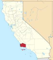 | |
| CDPs | ||
| Unincorporated communities | ||
| Indian reservation | ||
| Ghost towns | ||