Sunnyside–Tahoe City, California
| Sunnyside–Tahoe City | |
|---|---|
| census-designated place | |
|
North Lake Boulevard | |
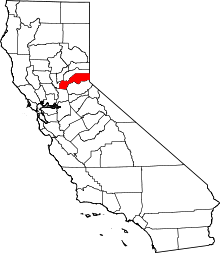
 Location in Placer County and the state of California | |
 Sunnyside–Tahoe City Location in the United States | |
| Coordinates: 39°9′1″N 120°8′59″W / 39.15028°N 120.14972°WCoordinates: 39°9′1″N 120°8′59″W / 39.15028°N 120.14972°W | |
| Country |
|
| State |
|
| County | Placer |
| Government | |
| • State Senate | Dave Cox (R) |
| • State Assembly | Ted Gaines (R) |
| • U. S. Congress | Tom McClintock (R)[1] |
| Area[2] | |
| • Total | 3.380 sq mi (8.755 km2) |
| • Land | 3.380 sq mi (8.755 km2) |
| • Water | 0 sq mi (0 km2) 0% |
| Elevation[3] | 6,804 ft (2,074 m) |
| Population (2010) | |
| • Total | 1,557 |
| • Density | 460/sq mi (180/km2) |
| Time zone | PST (UTC-8) |
| • Summer (DST) | PDT (UTC-7) |
| ZIP code | 96145 |
| Area code(s) | 530 |
| FIPS code | 06-76015 |
| GNIS feature ID | 2410030 |

Sunnyside–Tahoe City is a census-designated place (CDP) in Placer County, California, located on the northwest shore of Lake Tahoe. It is part of the Sacramento–Arden-Arcade–Roseville Metropolitan Statistical Area. The population was 1,557 at the 2010 census, down from 1,761 at the 2000 census, and a total area of 3.4 sq mi (8.8 km2), all of it land.
Demographics
2010
The 2010 United States Census[4] reported that Sunnyside–Tahoe City had a population of 1,557. The population density was 460.6 people per square mile (177.8/km²). The racial makeup of Sunnyside–Tahoe City was 1,480 (95.1%) White, 3 (0.2%) African American, 4 (0.3%) Native American, 15 (1.0%) Asian, 1 (0.1%) Pacific Islander, 32 (2.1%) from other races, and 22 (1.4%) from two or more races. Hispanic or Latino of any race were 84 persons (5.4%).
The Census reported that 1,550 people (99.6% of the population) lived in households, 7 (0.4%) lived in non-institutionalized group quarters, and 0 (0%) were institutionalized.
There were 744 households, out of which 120 (16.1%) had children under the age of 18 living in them, 268 (36.0%) were opposite-sex married couples living together, 29 (3.9%) had a female householder with no husband present, 24 (3.2%) had a male householder with no wife present. There were 84 (11.3%) unmarried opposite-sex partnerships, and 5 (0.7%) same-sex married couples or partnerships. 255 households (34.3%) were made up of individuals and 40 (5.4%) had someone living alone who was 65 years of age or older. The average household size was 2.08. There were 321 families (43.1% of all households); the average family size was 2.64.
The population was spread out with 191 people (12.3%) under the age of 18, 140 people (9.0%) aged 18 to 24, 549 people (35.3%) aged 25 to 44, 513 people (32.9%) aged 45 to 64, and 164 people (10.5%) who were 65 years of age or older. The median age was 40.7 years. For every 100 females there were 120.5 males. For every 100 females age 18 and over, there were 125.8 males.
There were 2,119 housing units at an average density of 626.9 per square mile (242.0/km²), of which 402 (54.0%) were owner-occupied, and 342 (46.0%) were occupied by renters. The homeowner vacancy rate was 4.3%; the rental vacancy rate was 21.2%. 849 people (54.5% of the population) lived in owner-occupied housing units and 701 people (45.0%) lived in rental housing units.
2000
As of the census[5] of 2000, there were 1,761 people, 789 households, and 362 families residing in the CDP. The population density was 515.8 people per square mile (199.4/km²). There were 2,102 housing units at an average density of 615.7 sq mi (1,595 km2). The racial makeup of the CDP was 95.34% White, 0.28% African American, 0.40% Native American, 1.31% Asian, 0.11% Pacific Islander, 0.45% from other races, and 2.10% from two or more races. Hispanic or Latino of any race were 3.63% of the population.

There were 789 households out of which 20.8% had children under the age of 18 living with them, 37.9% were married couples living together, 4.6% had a female householder with no husband present, and 54.1% were non-families. 30.0% of all households were made up of individuals and 3.7% had someone living alone who was 65 years of age or older. The average household size was 2.23 and the average family size was 2.75.
In the CDP the population was spread out with 15.9% under the age of 18, 7.4% from 18 to 24, 45.0% from 25 to 44, 25.7% from 45 to 64, and 6.0% who were 65 years of age or older. The median age was 36 years. For every 100 females there were 128.4 males. For every 100 females age 18 and over, there were 132.5 males.
The median income for a household in the CDP was $56,875, and the median income for a family was $79,412. Males had a median income of $41,136 versus $25,833 for females. The per capita income for the CDP was $33,534. About 1.1% of families and 5.5% of the population were below the poverty line, including none of those under the age of eighteen or sixty-five or over.
Climate
Sunnyside-Lake Tahoe has a warm-summer Mediterranean climate (Csb) according to the Köppen climate classification system.
| Climate data for Tahoe City (1903-2015) | |||||||||||||
|---|---|---|---|---|---|---|---|---|---|---|---|---|---|
| Month | Jan | Feb | Mar | Apr | May | Jun | Jul | Aug | Sep | Oct | Nov | Dec | Year |
| Average high °F (°C) | 38.6 (3.7) |
40.3 (4.6) |
44.0 (6.7) |
50.4 (10.2) |
59.6 (15.3) |
68.7 (20.4) |
77.9 (25.5) |
77.2 (25.1) |
69.8 (21) |
58.8 (14.9) |
46.9 (8.3) |
40.3 (4.6) |
56.0 (13.3) |
| Average low °F (°C) | 19.1 (−7.2) |
19.9 (−6.7) |
22.8 (−5.1) |
26.9 (−2.8) |
32.8 (0.4) |
38.6 (3.7) |
44.4 (6.9) |
43.7 (6.5) |
39.0 (3.9) |
32.3 (0.2) |
25.8 (−3.4) |
20.8 (−6.2) |
30.5 (−0.8) |
| Average precipitation inches (mm) | 5.97 (151.6) |
5.29 (134.4) |
4.12 (104.6) |
2.14 (54.4) |
1.20 (30.5) |
0.65 (16.5) |
0.26 (6.6) |
0.30 (7.6) |
0.59 (15) |
1.82 (46.2) |
3.57 (90.7) |
5.55 (141) |
31.46 (799.1) |
| Average snowfall inches (cm) | 45.9 (116.6) |
36.5 (92.7) |
35.2 (89.4) |
15.9 (40.4) |
3.7 (9.4) |
0.2 (0.5) |
0 (0) |
0 (0) |
0.3 (0.8) |
2.4 (6.1) |
15.5 (39.4) |
35.2 (89.4) |
190.7 (484.4) |
| Source: WRCC[6] | |||||||||||||
See also
Tahoe City, California (unincorporated community)
References
- ↑ "California's 4th Congressional District - Representatives & District Map". Civic Impulse, LLC. Retrieved March 3, 2013.
- ↑ U.S. Census
- ↑ U.S. Geological Survey Geographic Names Information System: Sunnyside–Tahoe City, California
- ↑ "2010 Census Interactive Population Search: CA - Sunnyside-Tahoe City CDP". U.S. Census Bureau. Retrieved July 12, 2014.
- ↑ "American FactFinder". United States Census Bureau. Retrieved 2008-01-31.
- ↑ "TAHOE CITY, CA (048758)". Western Regional Climate Center. Retrieved December 3, 2015.