Shire of Wiluna
| Shire of Wiluna Western Australia | |||||||||||||
|---|---|---|---|---|---|---|---|---|---|---|---|---|---|
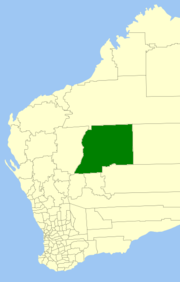 Location in Western Australia | |||||||||||||
| Population | 1,279 (2013 est)[1] | ||||||||||||
| • Density | 0.0070215/km2 (0.018186/sq mi) | ||||||||||||
| Area | 182,155.8 km2 (70,330.7 sq mi) | ||||||||||||
| Mayor | John Kyanga | ||||||||||||
| Council seat | Wiluna | ||||||||||||
| Region | Mid West | ||||||||||||
| State electorate(s) | Kalgoorlie | ||||||||||||
| Federal Division(s) | Durack | ||||||||||||
 | |||||||||||||
| Website | Shire of Wiluna | ||||||||||||
| |||||||||||||
The Shire of Wiluna is a local government area in the Mid West region of Western Australia, about 950 kilometres (590 mi) northeast of the state capital, Perth. The Shire covers an area of 182,155 square kilometres (70,330 sq mi), and its seat of government is the town of Wiluna.
History
The Wiluna Road Board was gazetted in 1909. On 1 July 1961, it became a shire following changes to the Local Government Act. On 1 July 1993, the eastern half of the Shire abutting the State's border with the Northern Territory was incorporated as the Shire of Ngaanyatjarraku.[2]
The shire is predominantly mining and pastoral land. There are 27 pastoral leases within the shire; 15 of which are owned by families or pastoral companies, ten of which are owned by mining companies, two are owned by the Department of Environment and Conservation (DEC). Both of the stations that are owned by the DEC are destocked and run as nature reserved, many of the leases owned by mining companies have also been destocked.[3]
Wards
The Shire is no longer divided into wards and the seven councillors sit at large.
Towns and localities
References
- ↑ "3218.0 Regional Population Growth, Australia. Table 5. Estimated Resident Population, Local Government Areas, Western Australia". 3 April 2014. Retrieved 11 September 2014.
- ↑ WA Electoral Commission, Municipality Boundary Amendments Register (release 2.0), 31 May 2003.
- ↑ Christina Lange (2009). "Incorporating cattle: governance and an Aboriginal pastoral enterprise". Australian National University. Retrieved 17 May 2014.
External links
Coordinates: 26°35′42″S 120°13′30″E / 26.595°S 120.225°E