Shire of Mukinbudin
| Shire of Mukinbudin Western Australia | |||||||||||||
|---|---|---|---|---|---|---|---|---|---|---|---|---|---|
 Mukinbudin Memorial Hall, 2014 | |||||||||||||
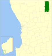 Location in Western Australia | |||||||||||||
| Population | 491 (2013 est)[1] | ||||||||||||
| • Density | 0.17/km2 (0.44/sq mi) | ||||||||||||
| Postcode(s) | 6479 | ||||||||||||
| Area | 3,437.1 km2 (1,327.1 sq mi) | ||||||||||||
| Mayor | Gary Shadbolt | ||||||||||||
| Council seat | Mukinbudin | ||||||||||||
| Region | Wheatbelt | ||||||||||||
| State electorate(s) | Central Wheatbelt | ||||||||||||
| Federal Division(s) | Durack | ||||||||||||
|
| |||||||||||||
| Website | Shire of Mukinbudin | ||||||||||||
| |||||||||||||
The Shire of Mukinbudin is a local government area in the Wheatbelt region of Western Australia, about 80 kilometres (50 mi) north of Merredin and about 300 kilometres (186 mi) east of the state capital, Perth. The Shire covers an area of 3,437 square kilometres (1,327 sq mi), and its seat of government is the town of Mukinbudin.
History
Initially, Mukinbudin was governed by the Merredin Road District. In 1921, the Nungarin Road District was gazetted, and on 1 November 1933 Mukinbudin, which had grown considerably in the intervening years, was gazetted separately.[2] Its first election was held on 18 November 1933, and Thomas Basil Conway was elected its inaugural chairman at its first meeting.
On 1 July 1961, it became a Shire under the Local Government Act 1960.[3]
Towns and localities
- Mukinbudin
- Barbalin
- Bonnie Rock
- Dandanning
- Elachbutting
- Lake Brown
- Wattoning
- Wilgoyne
Population
| Year | Population |
|---|---|
| 1933 | 350 |
| 1947 | 470 |
| 1954 | 589 |
| 1961 | 707 |
| 1966 | 869 |
| 1971 | 872 |
| 1976 | 995 |
| 1981 | 884 |
| 1986 | 855 |
| 1991 | 678 |
| 1996 | 691 |
| 2001 | 648 |
| 2006 | 575 |
| 2011 | 490 |
References
- ↑ "3218.0 Regional Population Growth, Australia. Table 5. Estimated Resident Population, Local Government Areas, Western Australia". 3 April 2014. Retrieved 11 September 2014.
- ↑ "Road Districts Act 1919-32 (per PW 1952/26)". Western Australia Government Gazette. 20 July 1933. p. 1933:1080.
* "Road Districts Act 1919-32. Nungarin Road District. Alteration of boundaries with Mount Marshall Road District and formation of Mukinbudin Road District. Order in Council (per PW 1952/26)". Western Australia Government Gazette. 1 September 1933. p. 1933:1260. Effective 1 November 1933. - ↑ WA Electoral Commission, Municipality Boundary Amendments Register (release 3.0), 31 May 2007.
External links
Coordinates: 30°54′50″S 118°12′25″E / 30.914°S 118.207°E