City of Kalgoorlie-Boulder
| City of Kalgoorlie-Boulder Western Australia | |||||||||||||
|---|---|---|---|---|---|---|---|---|---|---|---|---|---|
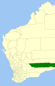 Location in Western Australia | |||||||||||||
| Population | 33,763 (2013 est)[1] | ||||||||||||
| • Density | 0.353261/km2 (0.914943/sq mi) | ||||||||||||
| Established | 1989 | ||||||||||||
| Area | 95,575.1 km2 (36,901.8 sq mi) | ||||||||||||
| Mayor | Ron Yuryevich | ||||||||||||
| Council seat | Kalgoorlie | ||||||||||||
| Region | Goldfields-Esperance | ||||||||||||
| State electorate(s) | Kalgoorlie, Eyre | ||||||||||||
| Federal Division(s) | O'Connor | ||||||||||||
|
| |||||||||||||
| Website | City of Kalgoorlie-Boulder | ||||||||||||
| |||||||||||||
The City of Kalgoorlie-Boulder is a local government area in the Goldfields-Esperance region of Western Australia, about 550 kilometres (342 mi) east of the state capital, Perth. The City covers an area of 95,575 square kilometres (36,902 sq mi), and its seat of government is the town of Kalgoorlie; all but 244 of the city's population live in either Kalgoorlie or Boulder. In terms of area, Kalgoorlie-Boulder is the largest city in Australia, and the third-largest city in the world, with a total area of 95,575 km2.
History
This region has a long history of continuous inhabitation and cultivation by Aboriginal Australians.
In the years immediately after discovery of gold in the region, a variety of local government entities sprang up around the often-temporary settlements on the Kalgoorlie goldfields. Only three persisted beyond the early 20th century:
- Boulder Municipal Council (1897–1961) – later Town of Boulder (1961–1969) and Shire of Boulder (1961-1969)
- Kalgoorlie Roads Board (1896–1961) – later Shire of Kalgoorlie (1961–1969)
- Kalgoorlie Municipal Council (1895–1961) – later Town of Kalgoorlie (1961–1989)
The others were:
- Broad Arrow Municipal Council (1897–1903)
- Broad Arrow Roads Board (1899–1922)
- Broad Arrow-Paddington Municipal Council (1903–1910)
- Bulong Municipal Council (1896–1909)
- Bulong Roads Board (1899–1911)
- East Coolgardie Roads Board (1895–1897)
- Kanowna Municipal Council (1896–1917)
- North East Coolgardie Roads Board (1896–1922)
- Paddington Municipal Council (1901–1903)
Major Roads in the region
- Goldfields Highway
- Boulder Road
- Anzac Drive
- Gatacre Drive
- Picadilly Street
- Hannan Street
- Graeme Street
- Maritana Street
- Federal Road
- Great Eastern Highway
Origins of the City

Key dates
- 1 July 1961 – Boulder and Kalgoorlie municipalities became towns, and Kalgoorlie Roads Board became a shire, following changes to the Local Government Act
- 1 July 1969 – Town of Boulder was amalgamated into the Shire of Kalgoorlie, which was renamed Shire of Boulder.
- 1 February 1989 – The Shire of Boulder and Town of Kalgoorlie amalgamated to form the City of Kalgoorlie-Boulder.[2]
Wards
The City is not divided into wards and the twelve councillors sit at large. The mayor is elected by popular vote.
Suburbs
- Kalgoorlie
- Boulder
- Binduli
- Broadwood
- Brown Hill
- Fimiston
- Hannans
- Karlkurla
- Lamington
- Mullingar
- Parkeston
- Piccadilly
- Somerville
- South Boulder
- South Kalgoorlie
- Trafalgar
- Victory Heights
- West Kalgoorlie
- West Lamington
- Williamstown
- Yilkari
Towns
References
- ↑ "3218.0 Regional Population Growth, Australia. Table 5. Estimated Resident Population, Local Government Areas, Western Australia". 3 April 2014. Retrieved 11 September 2014.
- ↑ WA Electoral Commission, Municipality Boundary Amendments Register (release 2.0), 31 May 2003.
External links
Coordinates: 30°44′56″S 121°27′58″E / 30.749°S 121.466°E