Shire of Bruce Rock
| Shire of Bruce Rock Western Australia | |||||||||||||
|---|---|---|---|---|---|---|---|---|---|---|---|---|---|
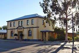 Bruce Rock shire offices, 2014 | |||||||||||||
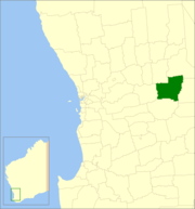 Location in Western Australia | |||||||||||||
| Population | 996 (2013 est)[1] | ||||||||||||
| • Density | 0.36525/km2 (0.9460/sq mi) | ||||||||||||
| Established | 1913 | ||||||||||||
| Area | 2,726.9 km2 (1,052.9 sq mi) | ||||||||||||
| Mayor | Stephen Strange | ||||||||||||
| Council seat | Bruce Rock | ||||||||||||
| Region | Wheatbelt | ||||||||||||
| State electorate(s) | Central Wheatbelt | ||||||||||||
| Federal Division(s) | O'Connor | ||||||||||||
|
| |||||||||||||
| Website | Shire of Bruce Rock | ||||||||||||
| |||||||||||||
The Shire of Bruce Rock is a local government area in the Wheatbelt region of Western Australia, about 50 kilometres (31 mi) south of Merredin and about 250 kilometres (155 mi) east of the state capital, Perth. The Shire covers an area of 2,727 square kilometres (1,053 sq mi), and its seat of government is the town of Bruce Rock.
History
Bruce Rock was initially constituted as the East Avon Road District in 1913. In 1918, it was renamed to Bruce Rock, and on 1 July 1961, it became a shire following the enactment of the Local Government Act 1960. In 1999, the Ardath, Babakin, Kwolyin, Shackleton, Belka and Coordarin wards covering outlying areas of the Shire were replaced by 2-member South, West and East Wards, while the Central and Town wards covered other areas. Wards were abolished for the 2005 elections.[2]
Wards
The Shire is no longer divided into wards and the eleven councillors represent the entire Shire.
Towns and localities
- Bruce Rock
- Ardath
- Babakin
- Belka
- Erikin
- Kwolyin
- Shackleton
- Yarding
Population
| Year | Population |
|---|---|
| 1921 | 2,431 |
| 1933 | 2,498 |
| 1947 | 1,897 |
| 1954 | 2,384 |
| 1961 | 2,291 |
| 1966 | 2,142 |
| 1971 | 1,694 |
| 1976 | 1,470 |
| 1981 | 1,410 |
| 1986 | 1,298 |
| 1991 | 1,164 |
| 1996 | 1,126 |
| 2001 | 1,051 |
| 2006 | 950 |
References
- ↑ "3218.0 Regional Population Growth, Australia. Table 5. Estimated Resident Population, Local Government Areas, Western Australia". 3 April 2014. Retrieved 11 September 2014.
- ↑ WA Electoral Commission, Municipality Boundary Amendments Register (release 3.0), 31 May 2007.
External links
![]() Media related to Shire of Bruce Rock at Wikimedia Commons
Media related to Shire of Bruce Rock at Wikimedia Commons
Coordinates: 31°52′52″S 118°08′53″E / 31.881°S 118.148°E