Shire of Nannup
| Shire of Nannup Western Australia | |||||||||||||
|---|---|---|---|---|---|---|---|---|---|---|---|---|---|
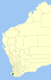 Location in Western Australia | |||||||||||||
| Population | 1,316 (2013 est)[1] | ||||||||||||
| • Density | 0.44844/km2 (1.1615/sq mi) | ||||||||||||
| Established | 1890 | ||||||||||||
| Area | 2,934.6 km2 (1,133.1 sq mi) | ||||||||||||
| Mayor | Barbara Dunnet | ||||||||||||
| Council seat | Nannup | ||||||||||||
| Region | South West | ||||||||||||
| State electorate(s) | Blackwood-Stirling | ||||||||||||
| Federal Division(s) | Forrest | ||||||||||||
|
| |||||||||||||
| Website | Shire of Nannup | ||||||||||||
| |||||||||||||
The Shire of Nannup is a local government area in the South West region of Western Australia, approximately 280 kilometres (174 mi) south of the state capital, Perth and 60 kilometres (37 mi) southeast of the coastal resort town of Busselton. Its seat of government is the town of Nannup, where about half of the Shire's population reside.
The Shire has a land area of 2,935 square kilometres (1,133 sq mi), about 85% of which is covered in hardwood jarrah, karri and marri forests, while the southern coastline is mostly within the D'Entrecasteaux National Park.
History
The Lower Blackwood Road Board (renamed to Nannup Road Board in 1925) was gazetted in 1890. On 1 July 1961, it became the Nannup Shire following changes to the Local Government Act.
Wards
The Shire is divided into three wards.
- Central Ward (three councillors)
- North Ward (three councillors)
- South Ward (two councillors)
Towns
- Nannup
- Carlotta
- Cundinup
- Donnelly River (Wheatley)
- Jalbarragup
- Peerabeelup
Notable councillors
- Edmund Vernon Brockman, Nannup Roads Board member 1909–1935, 1937–1938, chairman 1915–1935; also a state MP
References
- ↑ "3218.0 Regional Population Growth, Australia. Table 5. Estimated Resident Population, Local Government Areas, Western Australia". 3 April 2014. Retrieved 11 September 2014.
External links
Coordinates: 33°58′55″S 115°45′54″E / 33.982°S 115.765°E