Shire of York
| Shire of York Western Australia | |||||||||||||
|---|---|---|---|---|---|---|---|---|---|---|---|---|---|
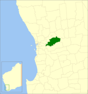 Location in Western Australia | |||||||||||||
| Population | 3,581 (2013 est)[1] | ||||||||||||
| • Density | 1.67909/km2 (4.3488/sq mi) | ||||||||||||
| Established | 1871 | ||||||||||||
| Area | 2,132.7 km2 (823.4 sq mi) | ||||||||||||
| Council seat | York | ||||||||||||
| Region | Wheatbelt | ||||||||||||
| State electorate(s) | Central Wheatbelt | ||||||||||||
| Federal Division(s) | Pearce | ||||||||||||
|
| |||||||||||||
| Website | Shire of York | ||||||||||||
| |||||||||||||
The Shire of York is a local government area in the Wheatbelt region of Western Australia, covering an area of 2,133 square kilometres (824 sq mi) just beyond the eastern fringe of Perth's metropolitan area. The Shire's seat of government is the town of York.
History
In 1871, the York Road District and the Municipality of York were gazetted as two separate entities. On 1 July 1961, they became respectively the Shire of York and the Town of York under the Local Government Act 1960. The two entities merged on 15 March 1965.[2]
Wards
The council was previously split into three wards - Town (4 councillors), West (2 councillors) and East (3 councillors) - but these were abolished and an election for 6 councillors for the entire Shire was held on 6 May 2006.
Towns and localities
- Badgin
- Balladong
- Cold Harbour
- Greenhills
- Gwambygine
- Inkpen
- Mount Hardey
- Mount Observation
- Talbot
- York
Notable councillors
- Frederick Monger, York Municipality councillor 1892; later a state MP
- Garnet Wood, York Road Board member 1932–1951; also a state MP
References
- ↑ "3218.0 Regional Population Growth, Australia. Table 5. Estimated Resident Population, Local Government Areas, Western Australia". 3 April 2014. Retrieved 11 September 2014.
- ↑ WA Electoral Commission, Municipality Boundary Amendments Register (release 3.0), 31 May 2007.
External links
Coordinates: 31°53′S 116°46′E / 31.883°S 116.767°E