Saratoga Township, Grundy County, Illinois
| Saratoga Township | |
|---|---|
| Township | |
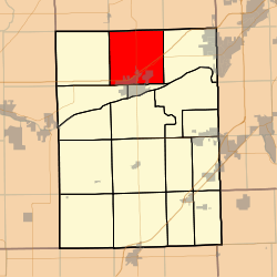 Location in Grundy County | |
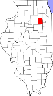 Grundy County's location in Illinois | |
| Coordinates: 41°25′N 88°25′W / 41.417°N 88.417°WCoordinates: 41°25′N 88°25′W / 41.417°N 88.417°W | |
| Country | United States |
| State | Illinois |
| County | Grundy |
| Established | November 6, 1849 |
| Area | |
| • Total | 36.22 sq mi (93.8 km2) |
| • Land | 35.98 sq mi (93.2 km2) |
| • Water | 0.24 sq mi (0.6 km2) 0.66% |
| Elevation | 554 ft (169 m) |
| Population (2010) | |
| • Total | 6,122 |
| • Density | 170.2/sq mi (65.7/km2) |
| Time zone | CST (UTC-6) |
| • Summer (DST) | CDT (UTC-5) |
| ZIP codes | 60447, 60450 |
| GNIS feature ID | 0429714 |
Saratoga Township (T34N R7E) is one of seventeen townships in Grundy County, Illinois, USA. As of the 2010 census, its population was 6,122 and it contained 2,541 housing units.[1]
Geography
According to the 2010 census, the township has a total area of 36.22 square miles (93.8 km2), of which 35.98 square miles (93.2 km2) (or 99.34%) is land and 0.24 square miles (0.62 km2) (or 0.66%) is water.[1]
Cities, towns, villages
Unincorporated towns
- Fields of Saratoga at 41°23′02″N 88°26′24″W / 41.384°N 88.440°W
- Goode Subdivision at 41°22′34″N 88°23′17″W / 41.376°N 88.388°W
- Lisbon North at 41°23′06″N 88°26′10″W / 41.385°N 88.436°W
- Ridgecrest at 41°23′56″N 88°23′53″W / 41.399°N 88.398°W
(This list is based on USGS data and may include former settlements.)
Cemeteries
The township contains these three cemeteries: Catholic North, Cryder and Saratoga.
Major highways
Airports and landing strips
- Morris Municipal Airport
- Nelson Airport
Political districts
- Illinois' 11th congressional district
- State House District 75
- State Senate District 38
References
- "Saratoga Township, Grundy County, Illinois". Geographic Names Information System. United States Geological Survey. Retrieved 2010-01-17.
- United States Census Bureau 2007 TIGER/Line Shapefiles
- United States National Atlas
- 1 2 "Population, Housing Units, Area, and Density: 2010 - County -- County Subdivision and Place -- 2010 Census Summary File 1". United States Census. Retrieved 2013-05-28.
External links
 |
Big Grove Township, Kendall County | Lisbon Township, Kendall County | Seward Township, Kendall County | |
| Nettle Creek Township | |
Aux Sable Township | ||
| ||||
| | ||||
| Erienna Township | Morris Township |
Municipalities and communities of Grundy County, Illinois, United States | ||
|---|---|---|
| Cities | ||
| Villages | ||
| Townships | ||
| Unincorporated communities | ||
| Footnotes | ‡This populated place also has portions in an adjacent county or counties | |
This article is issued from Wikipedia - version of the 12/4/2013. The text is available under the Creative Commons Attribution/Share Alike but additional terms may apply for the media files.