Greenfield Township, Grundy County, Illinois
| Greenfield Township | |
|---|---|
| Township | |
 Location in Grundy County | |
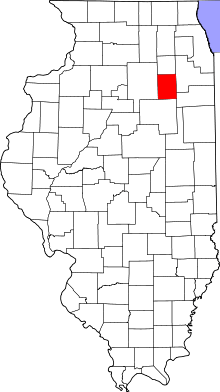 Grundy County's location in Illinois | |
| Coordinates: 41°09′32″N 88°16′26″W / 41.15889°N 88.27389°WCoordinates: 41°09′32″N 88°16′26″W / 41.15889°N 88.27389°W | |
| Country | United States |
| State | Illinois |
| County | Grundy |
| Established | November 6, 1849 |
| Area | |
| • Total | 18.05 sq mi (46.7 km2) |
| • Land | 17.31 sq mi (44.8 km2) |
| • Water | 0.73 sq mi (1.9 km2) 4.04% |
| Elevation | 587 ft (179 m) |
| Population (2010) | |
| • Total | 997 |
| • Density | 57.6/sq mi (22.2/km2) |
| Time zone | CST (UTC-6) |
| • Summer (DST) | CDT (UTC-5) |
| ZIP codes | 60407, 60424, 60474, 60961 |
| GNIS feature ID | 0429078 |
Greenfield Township is one of seventeen townships in Grundy County, Illinois, USA. As of the 2010 census, its population was 997 and it contained 441 housing units.[1]
History
The Township of Greenfield was organized on 6 November 1849, the Village of East Brooklyn was organized in ____, and the Village of South Wilmington was organized in ____. Villages remain part of the township.
On 10 March 1903, Garfield Township was separated from Greenfield Township. The southeastern portion of the village of Gardner, which is located mainly within Garfield Township, is in Greenfield Township. Garfield was begun centered at an intersection in 18__ prior to the township division.
The social and economic factors which led to the division of the township in 1905 have changed. Modern transportation, technological advances and familial relationships have led to increased cohesiveness between the five main communities within the two townships in the twenty-first century. The high schools are focal points of activity for the entire area. The villages are in many respects neighborhoods within the townships.
Geography
According to the 2010 census, the township has a total area of 18.05 square miles (46.7 km2), of which 17.31 square miles (44.8 km2) (or 95.90%) is land and 0.73 square miles (1.9 km2) (or 4.04%) is water.[1]
Cities, towns, villages
- East Brooklyn
- Gardner (southeast edge)
- South Wilmington
Major highways
School districts
Political districts
- Illinois' 11th congressional district
- State House District 75
- State Senate District 38
References
- "Greenfield Township, Grundy County, Illinois". Geographic Names Information System. United States Geological Survey. Retrieved 2010-01-17.
- United States Census Bureau 2007 TIGER/Line Shapefiles
- United States National Atlas
- 1 2 "Population, Housing Units, Area, and Density: 2010 - County -- County Subdivision and Place -- 2010 Census Summary File 1". United States Census. Retrieved 2013-05-28.
External links

Municipalities and communities of Grundy County, Illinois, United States | ||
|---|---|---|
| Cities | ||
| Villages | ||
| Townships | ||
| Unincorporated communities | ||
| Footnotes | ‡This populated place also has portions in an adjacent county or counties | |