Mazon Township, Grundy County, Illinois
| Mazon Township | |
|---|---|
| Township | |
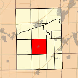 Location in Grundy County | |
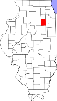 Grundy County's location in Illinois | |
| Coordinates: 41°14′28″N 88°25′04″W / 41.24111°N 88.41778°WCoordinates: 41°14′28″N 88°25′04″W / 41.24111°N 88.41778°W | |
| Country | United States |
| State | Illinois |
| County | Grundy |
| Established | November 6, 1849 |
| Area | |
| • Total | 35.5 sq mi (92 km2) |
| • Land | 35.14 sq mi (91.0 km2) |
| • Water | 0.36 sq mi (0.9 km2) 1.01% |
| Elevation | 584 ft (178 m) |
| Population (2010) | |
| • Total | 1,487 |
| • Density | 42.3/sq mi (16.3/km2) |
| Time zone | CST (UTC-6) |
| • Summer (DST) | CDT (UTC-5) |
| ZIP codes | 60424, 60444, 60450, 60479 |
| GNIS feature ID | 0429346 |
Mazon Township is one of seventeen townships in Grundy County, Illinois, USA. As of the 2010 census, its population was 1,487 and it contained 621 housing units.[1]
Geography
According to the 2010 census, the township has a total area of 35.5 square miles (92 km2), of which 35.14 square miles (91.0 km2) (or 98.99%) is land and 0.36 square miles (0.93 km2) (or 1.01%) is water.[1]
Cities, towns, villages
Cemeteries
The township contains these four cemeteries: Brookside, Old Mazon, Ward and Wheeler.
Major highways
Airports and landing strips
- J B Fillman Airport
School districts
- Coal City Community Unit School District 1
Political districts
- Illinois' 11th congressional district
- State House District 75
- State Senate District 38
References
- "Mazon Township, Grundy County, Illinois". Geographic Names Information System. United States Geological Survey. Retrieved 2010-01-17.
- United States Census Bureau 2007 TIGER/Line Shapefiles
- United States National Atlas
- 1 2 "Population, Housing Units, Area, and Density: 2010 - County -- County Subdivision and Place -- 2010 Census Summary File 1". United States Census. Retrieved 2013-05-28.
External links
 |
Norman Township | Wauponsee Township | Goose Lake Township | |
| Vienna Township | |
Maine Township | ||
| ||||
| | ||||
| Highland Township | Goodfarm Township | Garfield Township |
Municipalities and communities of Grundy County, Illinois, United States | ||
|---|---|---|
| Cities | ||
| Villages | ||
| Townships | ||
| Unincorporated communities | ||
| Footnotes | ‡This populated place also has portions in an adjacent county or counties | |
This article is issued from Wikipedia - version of the 9/10/2016. The text is available under the Creative Commons Attribution/Share Alike but additional terms may apply for the media files.