Minooka, Illinois
| Minooka | |
| Village | |
 CO&P station at Minooka | |
| Motto: "A Nice Place To Call Home." | |
| Country | United States |
|---|---|
| State | Illinois |
| Counties | Grundy, Kendall, Will |
| Elevation | 609 ft (186 m) |
| Coordinates | 41°27′17″N 88°15′36″W / 41.45472°N 88.26000°WCoordinates: 41°27′17″N 88°15′36″W / 41.45472°N 88.26000°W |
| Area | 9.56 sq mi (25 km2) |
| - land | 9.45 sq mi (24 km2) |
| - water | 0.08 sq mi (0 km2) |
| Population | 10,924 (2010) |
| Density | 931.5/sq mi (360/km2) |
| Founded | 1869 |
| Mayor | Pat Brennan |
| Timezone | CST (UTC-6) |
| - summer (DST) | CDT (UTC-5) |
| Postal code | 60447 |
| Area code | 815 & 779 |
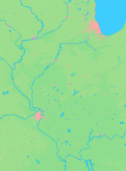
  Location of Minooka within Illinois | |
| Wikimedia Commons: Minooka, Illinois | |
Minooka, a suburb of Chicago, is a village in Grundy, Kendall, and Will counties, Illinois, United States.[1] The population was 10,924 at the 2010 census. Minooka currently has two high schools in its district, a campus for juniors and seniors and a newer campus for freshmen and sophomores. Minooka Community Consolidated School District 201 (elementary district) has a total of seven schools and serves nearly 4000 students.[2] Minooka has continuously been growing and has many new subdivisions. The Rock Island Line served the town at Minooka Station.
Geography
According to the 2010 census, Minooka has a total area of 9.526 square miles (24.67 km2), of which 9.45 square miles (24.48 km2) (or 99.2%) is land and 0.076 square miles (0.20 km2) (or 0.8%) is water.[3]
Demographics
| Historical population | |||
|---|---|---|---|
| Census | Pop. | %± | |
| 1880 | 416 | — | |
| 1890 | 360 | −13.5% | |
| 1900 | 424 | 17.8% | |
| 1910 | 361 | −14.9% | |
| 1920 | 314 | −13.0% | |
| 1930 | 346 | 10.2% | |
| 1940 | 317 | −8.4% | |
| 1950 | 369 | 16.4% | |
| 1960 | 539 | 46.1% | |
| 1970 | 768 | 42.5% | |
| 1980 | 1,565 | 103.8% | |
| 1990 | 2,561 | 63.6% | |
| 2000 | 3,971 | 55.1% | |
| 2010 | 10,924 | 175.1% | |
| Est. 2015 | 11,243 | [4] | 2.9% |

As of the 2000 census,[6] there were 3,971 people, 1,315 households, and 1,088 families residing in the village. The population was 10,924 at the 2010 census. The population density was 931.5 people per square mile (359.9/km²). There were 1,338 housing units at an average density of 313.9 per square mile (121.3/km²). The racial makeup of the village was 98.04% White, 0.25% African American, 0.20% Native American, 0.30% Asian, 0.53% from other races, and 0.68% from two or more races. Hispanic or Latino of any race were 2.85% of the population.
There were 1,315 households out of which 49.3% had children under the age of 18 living with them, 70.3% were married couples living together, 8.1% had a female householder with no husband present, and 17.2% were non-families. 14.2% of all households were made up of individuals and 4.0% had someone living alone who was 65 years of age or older. The average household size was 3.02 and the average family size was 3.34.
In the village the population was spread out with 31.9% under the age of 18, 8.3% from 18 to 24, 30.4% from 25 to 44, 23.9% from 45 to 64, and 5.5% who were 65 years of age or older. The median age was 34 years. For every 100 females there were 98.6 males. For every 100 females age 18 and over, there were 99.8 males.
The median income for a household in the village was $75,249, and the median income for a family was $81,190. Males had a median income of $59,583 versus $33,347 for females. The per capita income for the village was $26,054. About 1.1% of families and 2.2% of the population were below the poverty line, including 0.5% of those under age 18 and 7.5% of those age 65 or over.
Notable people
- Nick Offerman, actor (Ron Swanson on Parks and Recreation)
- Sal Fasano, former Major League Baseball player
- Dale Coyne, Indy Car team owner
- Mike Foltynewicz, Major League Baseball player
References
- ↑ "2009 Zoning Map" (PDF). Village of Minooka. 2009. Retrieved 22 February 2010.
- ↑ "Minooka Community Consolidated School District 201". Minooka CCSD 201. Retrieved 2014-05-11.
- ↑ "G001 - Geographic Identifiers - 2010 Census Summary File 1". United States Census Bureau. Retrieved 2015-12-19.
- ↑ "Annual Estimates of the Resident Population for Incorporated Places: April 1, 2010 to July 1, 2015". Retrieved July 2, 2016.
- ↑ "Census of Population and Housing". Census.gov. Retrieved June 4, 2015.
- ↑ "American FactFinder". United States Census Bureau. Retrieved 2008-01-31.
