Rock Creek, Alabama
| Rock Creek, Alabama | |
|---|---|
| CDP | |
 Location in Jefferson County and the state of Alabama | |
| Coordinates: 33°28′33″N 87°4′44″W / 33.47583°N 87.07889°W | |
| Country | United States |
| State | Alabama |
| County | Jefferson |
| Area | |
| • Total | 3.0 sq mi (7.8 km2) |
| • Land | 3.0 sq mi (7.8 km2) |
| • Water | 0 sq mi (0 km2) |
| Elevation | 587 ft (179 m) |
| Population (2010) | |
| • Total | 1,456 |
| • Density | 490/sq mi (190/km2) |
| Time zone | Central (CST) (UTC-6) |
| • Summer (DST) | CDT (UTC-5) |
| FIPS code | 01-65412 |
| GNIS feature ID | 1852798 |
Rock Creek is a census-designated place in Jefferson County, Alabama, United States. Its location is northwest of Hueytown. At the 2010 census the population was 1,456.[1] This area was damaged by an F5 tornado on April 8, 1998. An EF2 tornado struck northwest from here on January 23, 2012.
Geography
Rock Creek is located at 33°28′33″N 87°4′44″W / 33.47583°N 87.07889°W (33.475884, -87.079003).[2]
According to the U.S. Census Bureau, the CDP has a total area of 3.0 square miles (7.8 km2), all land.
Demographics
| Historical population | |||
|---|---|---|---|
| Census | Pop. | %± | |
| 2000 | 1,495 | — | |
| 2010 | 1,456 | −2.6% | |
| U.S. Decennial Census[3] | |||
As of the census[4] of 2000, there were 1,495 people, 569 households, and 458 families residing in the CDP. The population density was 515.0 people per square mile (199.0/km²). There were 592 housing units at an average density of 203.9 per square mile (78.8/km²). The racial makeup of the CDP was 98.86% White, 0.27% Black or African American, 0.40% Native American, 0.07% Asian, 0.13% from other races, and 0.27% from two or more races. 0.54% of the population were Hispanic or Latino of any race.
There were 569 households out of which 35.7% had children under the age of 18 living with them, 67.8% were married couples living together, 9.5% had a female householder with no husband present, and 19.5% were non-families. 17.9% of all households were made up of individuals and 6.9% had someone living alone who was 65 years of age or older. The average household size was 2.63 and the average family size was 2.98.
In the CDP the population was spread out with 24.7% under the age of 18, 7.7% from 18 to 24, 29.9% from 25 to 44, 26.6% from 45 to 64, and 11.0% who were 65 years of age or older. The median age was 38 years. For every 100 females there were 89.7 males. For every 100 females age 18 and over, there were 92.0 males.
The median income for a household in the CDP was $41,875, and the median income for a family was $49,375. Males had a median income of $35,294 versus $27,250 for females. The per capita income for the CDP was $33,333. About 6.2% of families and 3.8% of the population were below the poverty line, including none of those under age 18 and 7.9% of those age 65 or over.
2010 census
As of the census[5] of 2010, there were 1,456 people, 576 households, and 447 families residing in the CDP. The population density was 490 people per square mile (190/km²). There were 615 housing units at an average density of 205 per square mile (79/km²). The racial makeup of the CDP was 97.5% White, 0.8% Black or African American, 0.7% Native American, 0.1% Asian, 0.0% from other races, and 0.8% from two or more races. 0.0% of the population were Hispanic or Latino of any race.
There were 576 households out of which 27.8% had children under the age of 18 living with them, 63.0% were married couples living together, 9.9% had a female householder with no husband present, and 22.4% were non-families. 19.4% of all households were made up of individuals and 7.7% had someone living alone who was 65 years of age or older. The average household size was 2.53 and the average family size was 2.90.
In the CDP the population was spread out with 20.5% under the age of 18, 7.5% from 18 to 24, 27.2% from 25 to 44, 28.8% from 45 to 64, and 16.0% who were 65 years of age or older. The median age was 41 years. For every 100 females there were 93.6 males. For every 100 females age 18 and over, there were 97.2 males.
The median income for a household in the CDP was $43,370, and the median income for a family was $44,321. Males had a median income of $44,500 versus $38,244 for females. The per capita income for the CDP was $19,878. About 8.4% of families and 8.0% of the population were below the poverty line, including 8.0% of those under age 18 and 0% of those age 65 or over.
References
- ↑ "American FactFinder". United States Census Bureau. Retrieved 2011-05-14.
- ↑ "US Gazetteer files: 2010, 2000, and 1990". United States Census Bureau. 2011-02-12. Retrieved 2011-04-23.
- ↑ "U.S. Decennial Census". Census.gov. Retrieved June 6, 2013.
- ↑ "American FactFinder". United States Census Bureau. Retrieved 2008-01-31.
- ↑ "American FactFinder". United States Census Bureau. Retrieved 2015-07-29.
Coordinates: 33°28′33″N 87°04′44″W / 33.475884°N 87.079003°W
Municipalities and communities of Jefferson County, Alabama, United States | ||
|---|---|---|
| Cities | 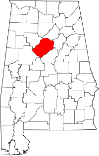 | |
| Towns | ||
| CDPs | ||
| Unincorporated communities | ||
| Former towns | ||
| Footnotes | ‡This populated place also has portions in an adjacent county or counties | |