Gardendale, Alabama
| Gardendale | |
|---|---|
| City | |
 Location in Jefferson County and the state of Alabama | |
| Coordinates: 33°39′38″N 86°48′42″W / 33.66056°N 86.81167°W | |
| Country | United States |
| State | Alabama |
| County | Jefferson |
| Area | |
| • Total | 17.9 sq mi (46.5 km2) |
| • Land | 17.9 sq mi (46.5 km2) |
| • Water | 0 sq mi (0 km2) |
| Elevation | 679 ft (207 m) |
| Population (2013)[1] | |
| • Total | 13,735 |
| • Density | 766.5/sq mi (295/km2) |
| Time zone | Central (CST) (UTC-6) |
| • Summer (DST) | CDT (UTC-5) |
| ZIP code | 35071 |
| Area code(s) | 205 |
| FIPS code | 01-29056 |
| GNIS feature ID | 0118823 |
| Website | http://www.cityofgardendale.com/ |
Gardendale is a city in Jefferson County, Alabama, and a northern suburb of Birmingham. The population was 13,893 at the 2010 census.[2]
History
A large farm settlement near the area today known as Gardendale was settled around 1825. Some years later, other settlers began to move into the community commonly known as Jugtown, a name given to the area based on the presence of a large jug and churn factory that operated in the area. Some years later, Hettie Thomason Cargo, a school teacher, would lead a campaign to change the name of the community. In 1906, the name Gardendale was selected, and in 1955, the City of Gardendale was officially incorporated. Today, with more than 13,000 residents (estimated), the city of Gardendale has grown to include more than 400 businesses, 4 schools, and 24 churches.[3]
In 1996, the Olympic torch run passed through the city during the weeks leading up to the 1996 Summer Olympic Games in Atlanta. Before Interstate 65 was constructed, the main route between Nashville, Tennessee and Birmingham, Alabama was U.S. Route 31. Prior to being built as a four-lane road, U.S. 31 was a twisting two-lane road that is still largely visible today. From the north end of Gardendale, it is now Snow Rogers Road, North Road, Moncrief Road, and then Main Street southward through the city to the Fultondale city limit where it becomes Stouts Road. In the fall of 2008, new signs were placed along the original route of Stouts Road through Gardendale denoting its historical significance as a stagecoach route between Tennessee and Birmingham during the 19th century. The first traffic signals in the city were located along U.S. 31 at Tarrant Road, Fieldstown Road, and Moncrief Road as well as Tarrant Road at Pineywood Road. A new signal at the intersection of Fieldstown Road and Main Street near city hall replaced a blinking signal shortly thereafter. Fieldstown Road was a narrow two lane road from U.S. 31 westward until Interstate 65 was built and then Fieldstown Road was re-routed onto the new road in the mid-1980s. An abundance of traffic signals have been erected in the city since those early days. In approximately 1970, the city installed street lights along U.S. 31 from the Fultondale city limits northward to the Moncrief Road intersection. The technology at that time was for blue vapor lights. Today, nearly 40 years later those same blue vapor lights still exist with some being replaced with the more modern bulbs near major intersections. Since 1980, Gardendale has annexed considerable amounts of land on the north, east, and west sides. Much of the eastern area is uninhabited. The western annexation is centered along Fieldstown Road. Most of the newest residential development has been in this area and along Shady Grove Road south of Fieldstown Road. The northern annexation has centered along US 31 and extends nearly 2 miles (3.2 km) farther north than 1980. The city has a working historical society, established January 23, 2006, that is working to record the history of the Gardendale area. They have a museum that is open to the public on Saturday mornings each week. It contains a variety of photographs, documents, and other historical memorabilia from Gardendale.
Geography
Gardendale is located at 33°39′38″N 86°48′42″W / 33.66056°N 86.81167°W (33.660492, -86.811648).[4]
According to the U.S. Census Bureau, the city has a total area of 18.0 square miles (47 km2), all land. However, with the recent annexation of several thousand acres from the community of Mt. Olive and other unincorporated areas, the city now has an estimated total area of around 25.0 square miles (65 km2). Gardendale is situated along one of the three major transportation corridors from the Midwest to the Gulf Coast (I-75, I-65, I-55). A tremendous volume of freight (via rail and truck) passes through or near Gardendale.
Gardendale is served by two major north-south highways: Interstate 65 and U.S. 31. A new interstate highway, Interstate 22 will run northwestward from I-65 near Gardendale towards Memphis, Tennessee. This freeway is open from Coalburg Road near Fultondale just southwest of Gardendale to Memphis. Another future road project is the Northern Beltline which will run from Interstate 59 near Argo westward across northern Jefferson County, crossing I-65 on the northern edge of Gardendale. This highway is currently designated to become Interstate 422. This route is some 15–20 years away from completion. Major east/west roads in Gardendale include Fieldstown Road (there has been some discussion of requesting a state highway designation for this road between US 31 and I-65 and perhaps westward towards I-22) which runs from U.S. 31 in Gardendale westward, Tarrant Road which runs from the city eastward, and Mt. Olive Road which runs northwestward from the city. Another future road project may be an extension of Fieldstown Road east of U.S. 31 to connect to the Castle Pines development (which is in the city but only accessible via a roundabout route nearly 10 miles (16 km) long) and then across New Castle Road, and then further east to connect to Carson Road. Gardendale is located in an area that once yielded large amounts of coal. Gardendale is located at the southwestern end of one of the Appalachian ridgelines running from eastern Tennessee into northeast Alabama. Several old and closed coal mines exist in the area as well as lands that were once strip mined and then replanted for forests. No major waterways are located in Gardendale but several streams feed into the Locust Fork of the Black Warrior River that passes north and west of the city. Much of the land inside the city limits on the east and northeast sides of Gardendale is rocky and hilly with deep ravines. This portion of the city is sparsely populated and has limited access by road. The only major rail line passing near Gardendale is a north/south track passing on the eastern edge of the city from Boyles Yard near Tarrant paralleling New Castle Road northward towards Blount County. This rail line carries freight and is not a passenger line. The nearest passenger train service is by Amtrak at the Birmingham station 10 miles (16 km) south of Gardendale. Commercial air travel is located at the nearby Birmingham-Shuttlesworth International Airport.
Demographics
| Historical population | |||
|---|---|---|---|
| Census | Pop. | %± | |
| 1960 | 4,712 | — | |
| 1970 | 6,537 | 38.7% | |
| 1980 | 8,005 | 22.5% | |
| 1990 | 9,251 | 15.6% | |
| 2000 | 11,626 | 25.7% | |
| 2010 | 13,893 | 19.5% | |
| Est. 2015 | 13,711 | [5] | −1.3% |
| U.S. Decennial Census[6] 2013 Estimate[7] | |||
2010 census
As of the census of 2010, there were 13,893 people, 5,670 households, and 3,979 families residing in the city. The population density was 746.1 people per square mile (298.8/km²). There were 6,040 housing units at an average density of 337.4 per square mile (129.9/km²). The racial makeup of the city was 88.4% White, 8.6% Black or African American, 0.3% Native American, 1.2% Asian, 0.0% Pacific Islander, 0.6% from other races, and 1.0% from two or more races. 1.5% of the population were Hispanic or Latino of any race.
There were 5,670 households out of which 27.4% had children under the age of 18 living with them, 56.1% were married couples living together, 11.2% had a female householder with no husband present, and 29.8% were non-families. 26.5% of all households were made up of individuals and 12.7% had someone living alone who was 65 years of age or older. The average household size was 2.42 and the average family size was 2.92.
The median income for a household in the city was $60,244, and the median income for a family was $79,044. Males had a median income of $52,782 versus $41,224 for females. The per capita income for the city was $30,748. About 1.9% of families and 3.5% of the population were below the poverty line, including 3.2% of those under age 18 and 6.3% of those age 65 or over.
2000 census
As of the census of 2000, there were 11,626 people, 4,733 households, and 3,474 families residing in the city. The population density was 647.9 people per square mile (250.1/km²). There were 4,959 housing units at an average density of 276.3 per square mile (106.7/km²). The racial makeup of the city was 97.19% White, 1.48% Black or African American, 0.17% Native American, 0.53% Asian, 0.02% Pacific Islander, 0.14% from other races, and 0.47% from two or more races. 0.65% of the population were Hispanic or Latino of any race.
There were 4,733 households out of which 28.8% had children under the age of 18 living with them, 61.3% were married couples living together, 9.6% had a female householder with no husband present, and 26.6% were non-families. 24.6% of all households were made up of individuals and 11.7% had someone living alone who was 65 years of age or older. The average household size was 2.42 and the average family size was 2.88.
The median income for a household in the city was $45,786, and the median income for a family was $56,929. Males had a median income of $36,714 versus $29,039 for females. The per capita income for the city was $22,673. About 3.5% of families and 5.1% of the population were below the poverty line, including 7.0% of those under age 18 and 7.3% of those age 65 or over.
Economic development
Most new business development in the past ten years has been along Fieldstown Road (and Odum Road) on the west side of the city between I-65 and US 31. Additional development, but to a lesser extent, has occurred along Mt. Olive Road near I-65. Several older more mature shopping and dining areas exist along US 31. The new City Center is being developed on Mt. Olive Road just south of Fieldstown Road. The new city hall and offices will be located here. Retail development will occur here as well including the restaurant chain Buffalo Wild Wings which broke ground in August 2012 and is slated to open in December 2012.
New retail developments are slated near Interstate 65 at exit 275. This area is within the Gardendale city limits. The first new business here will be the Dewey Barber Chevrolet dealership which will relocate from Warrior to Gardendale. Exit 275 is one mile from the future exit 274 Interstate 422. The interchange of these two interstates will spur commercial growth at exit 275. The segment of Interstate 422 from Alabama State Route 79 to Interstate 65 is currently slated to be the second segment of Interstate 422 to be constructed. The first segment is a short stretch between Alabama State Route 79 and Alabama State Route 75 near Pinson. Construction began in 2013 as all of the right of way has now been acquired and should be completed in 2016.
Media
Gardendale is located within the Birmingham television and radio market, the 39th largest market in the United States.
Newspapers covering Gardendale include The Birmingham News (daily, based in neighboring Birmingham) and The North Jefferson News (twice weekly, based in Gardendale).
Radio station WZNN (97.3 FM) is licensed and identified on air as a Gardendale radio station. This station is a 24-hour sports station that covers the Birmingham radio market. The broadcast studios and transmitter are not located in Gardendale even though the station is licensed to Gardendale.
Churches and hospitals
The Gardendale community is served by some 20–25 houses of worship. Denominations include, but are not limited to, Messianic, Southern Baptist, Methodist, Church of God, Nazarene, Roman Catholic and others. The largest is Gardendale First Baptist Church, among the 10 largest churches (by membership) in Alabama, located on two separate campuses including its new sanctuary near Interstate 65 between Mount Olive Road and Fieldstown Road. Gardendale is also home to both the Gardendale Ward of The Church of Jesus Christ of Latter-day Saints; and Alabama’s only Latter-day Saint temple, the Birmingham Alabama Temple; both located on the corner of State Road 31 and Mount Olive Boulevard.[8]
Gardendale is served by several small health centers/clinics. Large hospitals offering secondary and tertiary care, including a trauma center, are located nearby in Birmingham, the home of the University of Alabama School of Medicine, the University Hospital, and a dozen other hospitals offering all kinds of care, including major cardiac and brain surgery.
City government
Gardendale uses the mayor/council form of government. Past mayors include J.I. Pesnell, Gilbert Jacks, James Yarbrough, Horace Parker, G. William Noble, Kenny Clemons, and Othell Phillips. Stan Hogeland is the current mayor.
The city council consists of five members. The city is divided into five geographic districts with each one electing a council member to represent it on the city council. The election cycle for the mayor and council members is every four years during the same years as presidential elections. The mayoral position became a full-time paid position following the 2008 elections. The city council chooses a member to become council president, who presides over the council meetings. The current council consists of: Allen Jerkins (District 1), Blake Guinn (District 2), Alvin Currington (District 3, council president), Greg Colvert (District 4), and Will Hardman (District 5).[9]
Gardendale has full-time police and fire departments. The Fire & Rescue Department has two stations with station 1 located on Decatur Highway and station 2 located on Fieldstown Road. Fieldstown Volunteers, which is located in the western portion of the city, is a combination emergency response/disaster relief squad that mainly responds to large emergencies and provides support to other agencies. Regional Paramedic Services also provides residents of Gardendale with Advanced Life Support ambulance Services.
Gardendale has a new City Hall that opened in 2015 on Main Street near the Civic Center. The previous city hall has been demolished and the property was sold to CVS for use as a pharmacy. The new Gardendale Civic Center is located on Main Street across from Gardendale High School. The Gardendale Public Library is located on Mt. Olive Road just south of the intersection of Mt. Olive Road and Fieldstown Road. A new municipal justice complex including court, police department, and jail has been located within the former Food World building facing US 31 just North of the city center area. Gardendale has several parks and athletic facilities. G. William Noble Park (formerly known as Moncrief Park) contains 6 baseball fields, 8 tennis courts, a football field, and 3 playgrounds as well as picnic and party facilities. It is located just off Moncrief Road on the northside of the city. The tennis courts are well maintained, and host many different events as do the baseball fields. G. William Noble Park is well kept and gets new playground equipment periodically. Luman Harris Park is a girls softball facility located just off Pineywood Road in the southeast part of the city. Also located there is the Miracle Park which is used for mentally and physically handicapped children. Mini Park, consisting of a playground for smaller children is located on Keith Circle, just north of Tarrant Road, four tenths of a mile east of US 31. Celebration Park is located on Fieldstown Road on the western edge of the city and contains two soccer fields and a walking track, a "splash pad" water park for children. Memorial Park is located between Main Street and US 31 in the north central part of the city and honors those who have served in the US Armed Forces. Past park facilities included two tennis courts and the old civic center which were located adjacent to city hall in the center of the city, two tennis courts located on Tarrant Road in the eastern edge of the city, a mini park located at the corner of Peterson Drive and Tarrant Road which contained an asphalt basketball court, and a softball field that was located behind the south end of Bragg Middle School.
Civic organizations and events
Included among several organizations are the Gardendale Chamber of Commerce which was established in 1987,the Gardendale Arts Council, and the Gardendale Historical Society.
Annual events include the Magnolia Festival which occurs each spring and is held around and near the Civic Center complex on Main Street.

Education
Gardendale is served by several schools. Gardendale Elementary School which opened in 1969 and replaced the older elementary school located about 300 yards east of the current school. Bragg Middle School was built later to handle the growing student population. Until Bragg was opened, Gardendale High School handled grades 7–12. Both Gardendale High School and Bragg Middle School use the nickname Rockets and share the same colors of maroon, gray, and white. Gardendale High School is rated as a 6A school for athletic competition for the two-year period beginning in the fall of 2010. Tabernacle Christian School is located on the northern side of the city as a school run by Gardendale Baptist Tabernacle. Their athletic teams carry the nickname Torches. Gardendale Christian Academy is also located on the northern side as a school and daycare run by Gardendale Church of the Nazarene. GCA's mascot is King's Knights. It currently has, in addition to kindergarten and below, grades one through six, and very small class sizes. Also located on the north side of Gardendale is Snow Rogers Elementary School. Snow Rogers school is unique in that although it is inside Gardendale city limits, it is a feeder school for both Bragg Middle School in Gardendale as well as North Jefferson Middle School located in nearby Kimberly, Alabama. These schools in turn feed into Gardendale High School and Mortimer Jordan High School located in nearby Kimberly, Alabama. Residential addresses of Snow Rogers students determine which school they go to once leaving Snow Rogers Elementary. Mt. Olive Elementary is located in the nearby unincorporated Mt. Olive community. Gardendale was once home to the Rogers Area Vocational School which has now been demolished to make way for soccer & baseball fields as well as student parking. Gardendale High School used the Rogers campus as well as temporary classroom buildings while a new high school was being constructed on the site of the former high school (which was built in the mid-1960s). The new high school opened in early 2010. Gardendale High School graduated its first student class in 1968. As of November 2013, the city has decided to break off from Jefferson county and form its own school system.
Notable people
- John Salter, mixed martial arts fighter[10]
- Willie Wyatt, former Arena Football League player[11]
Jordan Howard- RB Chicago Bears
References
- ↑ "Population Estimates". United States Census Bureau. Retrieved 2014-06-07.
- ↑ U.S. Census Bureau. 2010 Population Census for Incorporated Places
- ↑ "Gardendale History". City of Gardendale. Retrieved 9 June 2014.
- ↑ "US Gazetteer files: 2010, 2000, and 1990". United States Census Bureau. 2011-02-12. Retrieved 2011-04-23.
- ↑ "Annual Estimates of the Resident Population for Incorporated Places: April 1, 2010 to July 1, 2015". Retrieved July 2, 2016.
- ↑ United States Census Bureau. "Census of Population and Housing". Retrieved August 10, 2013.
- ↑ "Annual Estimates of the Resident Population: April 1, 2010 to July 1, 2013". Retrieved June 7, 2014.
- ↑ "LDS Maps". maps.lds.org. The Church of Jesus Christ of Latter-day Saints. Retrieved 20 May 2015.
- ↑ "Gardendale City Council". City of Gardendale. Retrieved August 22, 2016.
- ↑ Irvine, Steve. "John Salter looking to make a splash in the UFC". al.com. Alabama Media Group. Retrieved 29 April 2015.
- ↑ Sentell, Jeff. "Gardendale dedicates its Game of the Week Homewood playoff victory to recovering coach Willie Wyatt". al.com. Alabama Media Group. Retrieved 29 April 2015.
External links
Coordinates: 33°39′38″N 86°48′42″W / 33.660492°N 86.811648°W
Municipalities and communities of Jefferson County, Alabama, United States | ||
|---|---|---|
| Cities | 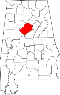 | |
| Towns | ||
| CDPs | ||
| Unincorporated communities | ||
| Former towns | ||
| Footnotes | ‡This populated place also has portions in an adjacent county or counties | |