Fairfield, Alabama
| Fairfield, Alabama | |
|---|---|
| City | |
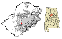 Location in Jefferson County and the state of Alabama | |
| Coordinates: 33°28′36″N 86°55′0″W / 33.47667°N 86.91667°WCoordinates: 33°28′36″N 86°55′0″W / 33.47667°N 86.91667°W | |
| Country | United States |
| State | Alabama |
| County | Jefferson |
| Area | |
| • Total | 3.5 sq mi (9.2 km2) |
| • Land | 3.5 sq mi (9.2 km2) |
| • Water | 0 sq mi (0 km2) |
| Elevation | 561 ft (171 m) |
| Population (2013)[1] | |
| • Total | 10,952 |
| • Density | 3,537.4/sq mi (1,345.8/km2) |
| Time zone | Central (CST) (UTC-6) |
| • Summer (DST) | CDT (UTC-5) |
| ZIP code | 35064 |
| Area code(s) | 205 |
| FIPS code | 01-25120 |
| GNIS feature ID | 0118113 |
Fairfield is a city in western Jefferson County, Alabama, United States. It is part of the Birmingham metropolitan area and is located southeast of Pleasant Grove. The population was 11,117 at the 2010 census.
History
This city was founded in 1910 in which the featured speaker at the dedication ceremony was former President Theodore Roosevelt. It was originally named Corey, after an executive of U. S. Steel Corporation. The name was later changed to the city in which the President of U. S. Steel lived, Fairfield, Connecticut. It was planned as a model city by the Tennessee Coal, Iron and Railroad Company to house workers in their new Fairfield Works plant, now owned by U.S. Steel similar to its northeastern city of Ensley.
It was incorporated on January 1, 1919.[2]
Geography
Fairfield is located at 33°28′37″N 86°55′01″W / 33.476908°N 86.916842°W.[3]
According to the U.S. Census Bureau, the city has a total area of 3.5 square miles (9.1 km2), all land.
Demographics
| Historical population | |||
|---|---|---|---|
| Census | Pop. | %± | |
| 1920 | 5,003 | — | |
| 1930 | 11,059 | 121.0% | |
| 1940 | 11,703 | 5.8% | |
| 1950 | 13,177 | 12.6% | |
| 1960 | 15,816 | 20.0% | |
| 1970 | 14,369 | −9.1% | |
| 1980 | 13,242 | −7.8% | |
| 1990 | 12,200 | −7.9% | |
| 2000 | 12,381 | 1.5% | |
| 2010 | 11,117 | −10.2% | |
| Est. 2015 | 10,907 | [4] | −1.9% |
| U.S. Decennial Census[5] 2013 Estimate[6] | |||
As of the census of 2000, there were 12,381 people, 4,600 households, and 3,141 families residing in the city. The population density was 3,503.8 people per square mile (1,354.2/km²). There were 4,960 housing units at an average density of 1,403.7 per square mile (542.5/km²). The racial makeup of the city was 8.90% White, 90.23% Black or African American, 0.06% Native American, 0.15% Asian, 0.02% Pacific Islander, 0.17% from other races, and 0.48% from two or more races. 0.59% of the population were Hispanic or Latino of any race.
There were 4,600 households out of which 34.0% had children under the age of 18 living with them, 35.6% were married couples living together, 28.4% had a female householder with no husband present, and 31.7% were non-families. 29.2% of all households were made up of individuals and 12.0% had someone living alone who was 65 years of age or older. The average household size was 2.55 and the average family size was 3.17.
In the city the population was spread out with 26.7% under the age of 18, 11.9% from 18 to 24, 25.2% from 25 to 44, 22.3% from 45 to 64, and 13.8% who were 65 years of age or older. The median age was 36 years. For every 100 females there were 79.2 males. For every 100 females age 18 and over, there were 73.4 males.
The median income for a household in the city was $27,845, and the median income for a family was $38,552. Males had a median income of $30,833 versus $25,143 for females. The per capita income for the city was $14,607. About 16.5% of families and 21.5% of the population were below the poverty line, including 27.7% of those under age 18 and 25.3% of those age 65 or over.
2010 census
As of the census of 2010, there were 11,117 people, 4,229 households, and 2,738 families residing in the city. The population density was 3,176.3 people per square mile (1,208.4/km²). There were 4,935 housing units at an average density of 1,410 per square mile (536.4/,/km²). The racial makeup of the city was 94.6% Black or African American, 4.2% White, 0.0% Native American, 0.0% Asian, 0.0% Pacific Islander, 0.7% from other races, and 0.4% from two or more races. 1.1% of the population were Hispanic or Latino of any race.
There were 4,229 households out of which 24.9% had children under the age of 18 living with them, 28.3% were married couples living together, 31.4% had a female householder with no husband present, and 35.3% were non-families. 32.7% of all households were made up of individuals and 12.4% had someone living alone who was 65 years of age or older. The average household size was 2.45 and the average family size was 3.10.
In the city the population was spread out with 23.0% under the age of 18, 14.3% from 18 to 24, 20.7% from 25 to 44, 28.9% from 45 to 64, and 13.0% who were 65 years of age or older. The median age was 36.8 years. For every 100 females there were 79.0 males. For every 100 females age 18 and over, there were 81.1 males.
The median income for a household in the city was $34,242, and the median income for a family was $41,841. Males had a median income of $34,854 versus $29,788 for females. The per capita income for the city was $18,221. About 22.2% of families and 24.2% of the population were below the poverty line, including 40.5% of those under age 18 and 21.7% of those age 65 or over.
Education
Fairfield has its own school system, independent from Jefferson County. The system includes three elementary schools, Forest Hills Middle School, Fairfield High Preparatory School (formerly Fairfield High School), and an alternative all-grades school.
The city is also home to Miles College, a historically black college operated by the CME Church. The school was founded in 1898.
Industry and business

Though the United States steel making industry has gone through a decline through the last half of the 20th Century, U.S. Steel's Fairfield Works continues to be a major employer, though not in the levels seen around the 1950s. Advances in steel-making technology have enabled the works to produce roughly the same amount of product as during that era, but with a much smaller workforce.
Portions of the Works have been closed over the years, but many parts of the complex have been reopened by smaller industries, some of which are steel-related.
Fairfield is traversed by I-20/I-59. Three railroads serve the area: CSX Transportation (former Louisville and Nashville Railroad), Norfolk Southern Railway (former Southern Railway), and short-line Birmingham Southern Railroad, which is headquartered in Fairfield.
The city's downtown area features a number of small businesses, primarily service-related. Other retail businesses are concentrated along Aronov Drive, northwest of Western Hills Mall, though those strip malls have declined due to closures of Kmart, Winn-Dixie, and Sears locations. Walmart shut its doors in early 2016 . All public bus transportation was terminated in July 2016 for failure to pay the bill. The water board has threatened to cut off all water to public buildings because of non payment.
Western Hills Mall
Western Hills Mall is the city's major shopping mall.
Notable people
- Willie Mays attended school in Fairfield, graduating from Fairfield Industrial High School in 1950. As a student, he played baseball, football, and basketball, and even played professionally for the Birmingham Black Barons of the Negro American League while still a student.
- Actor George Lindsey ("The Andy Griffith Show") was born in Fairfield. He is buried in Jasper.
- Jazz musician Cleveland Eaton (Count Basie Orchestra) was born in Fairfield.
- Singer Dennis Edwards, a member of The Temptations, was born in Fairfield.
- Photographer Spider Martin was born in Fairfield.
- Former Fairfield Mayor, Jefferson County Commission President, and Mayor of Birmingham Larry Langford resided in Fairfield.
- Georgia congressman and environmental advocate James MacKay was born in Fairfield.
- Former NFL players Red Cochran and Jim Tolbert were born in Fairfield.
- Federal judge U. W. Clemon was born in Fairfield.
- Major General Oliver W. Dillard, US Army Retired, graduated as the Fairfield Industrial High School valedictorian in 1942. A Tuskegee Institute alumnus, he became the Army's fifth Black general officer on February 1, 1972, and was elected into the Army's Military Intelligence Hall of Fame, Class of 2012.
- Walter Gilbert, member of the College Football Hall of Fame
- Tim Johnson, former professional football linebacker
- Demetrius Newton, civil rights lawyer and member of the Alabama House of Representatives
References
- ↑ "Population Estimates". United States Census Bureau. Retrieved 2014-06-07.
- ↑ http://www.encyclopediaofalabama.org/article/h-3142
- ↑ "US Gazetteer files: 2010, 2000, and 1990". United States Census Bureau. 2011-02-12. Retrieved 2011-04-23.
- ↑ "Annual Estimates of the Resident Population for Incorporated Places: April 1, 2010 to July 1, 2015". Retrieved July 2, 2016.
- ↑ United States Census Bureau. "Census of Population and Housing". Retrieved August 10, 2013.
- ↑ "Annual Estimates of the Resident Population: April 1, 2010 to July 1, 2013". Retrieved June 7, 2014.
External links
- Fairfield Main Street Inc
- Historic American Engineering Record (HAER) No. AL-110, "City of Fairfield, Fairfield, Jefferson County, AL", 4 photos, 8 data pages, 1 photo caption page
Municipalities and communities of Jefferson County, Alabama, United States | ||
|---|---|---|
| Cities | 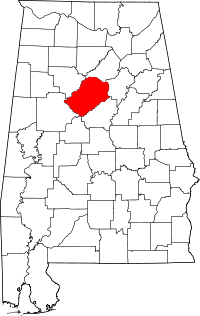 | |
| Towns | ||
| CDPs | ||
| Unincorporated communities | ||
| Former towns | ||
| Footnotes | ‡This populated place also has portions in an adjacent county or counties | |