Kimberly, Alabama
| Kimberly, Alabama | |
|---|---|
| City | |
 Location in Jefferson County and the state of Alabama | |
| Coordinates: 33°46′16″N 86°47′43″W / 33.77111°N 86.79528°W | |
| Country | United States |
| State | Alabama |
| County | Jefferson |
| Area | |
| • Total | 4 sq mi (10.4 km2) |
| • Land | 4 sq mi (10.4 km2) |
| • Water | 0 sq mi (0 km2) |
| Elevation | 459 ft (140 m) |
| Population (2010) | |
| • Total | 2,711 |
| • Density | 677.5/sq mi (260.7/km2) |
| Time zone | Central (CST) (UTC-6) |
| • Summer (DST) | CDT (UTC-5) |
| ZIP code | 35091 |
| Area code(s) | 205 |
| FIPS code | 01-39856 |
| GNIS feature ID | 0151954 |
| Website | kimberlyal.org |
Kimberly is a city in Jefferson County, Alabama, United States. At the 2010 census the population was 2,711.
History
Kimberly officially incorporated in 1952.[1] Beginning June 29, 2011, due to the population increasing from 1,801 persons in 2000 to 2,711 in 2010, the town began operating as a city, per Alabama law.
Geography
Kimberly is located at 33°46′16″N 86°47′43″W / 33.77111°N 86.79528°W (33.771163, -86.795280).[2] According to the U.S. Census Bureau, the city has a total area of 4.0 square miles (10 km2), all land.
Demographics
| Historical population | |||
|---|---|---|---|
| Census | Pop. | %± | |
| 1960 | 763 | — | |
| 1970 | 847 | 11.0% | |
| 1980 | 1,043 | 23.1% | |
| 1990 | 1,096 | 5.1% | |
| 2000 | 1,801 | 64.3% | |
| 2010 | 2,711 | 50.5% | |
| Est. 2015 | 2,892 | [3] | 6.7% |
| U.S. Decennial Census[4] 2013 Estimate[5] | |||
As of the census[6] of 2000, there were 1,801 people, 652 households, and 528 families residing in the town. The population density was 447.8 people per square mile (173.0/km²). There were 699 housing units at an average density of 173.8 per square mile (67.1/km²). The racial makeup of the town was 95.78% White, 1.61% Black or African American, 0.61% Native American, 0.17% Asian, 0.44% from other races, and 1.39% from two or more races. 1.17% of the population were Hispanic or Latino of any race.
There were 652 households out of which 42.2% had children under the age of 18 living with them, 68.3% were married couples living together, 9.5% had a female householder with no husband present, and 18.9% were non-families. 17.0% of all households were made up of individuals and 8.4% had someone living alone who was 65 years of age or older. The average household size was 2.76 and the average family size was 3.11.
In the town the population was spread out with 29.3% under the age of 18, 6.7% from 18 to 24, 33.1% from 25 to 44, 20.5% from 45 to 64, and 10.5% who were 65 years of age or older. The median age was 34 years. For every 100 females there were 99.4 males. For every 100 females age 18 and over, there were 91.6 males.
The median income for a household in the town was $46,343, and the median income for a family was $52,109. Males had a median income of $36,977 versus $29,150 for females. The per capita income for the town was $17,055. About 6.7% of families and 7.7% of the population were below the poverty line, including 9.6% of those under age 18 and 15.8% of those age 65 or over.
2010 census
As of the census[7] of 2010, there were 2,711 people, 932 households, and 752 families residing in the town. The population density was 677.5 people per square mile (260.7/km²). There were 1,002 housing units at an average density of 250.5 per square mile (96.3/km²). The racial makeup of the town was 96.2% White, 1.8% Black or African American, 0.4% Native American, 0.6% Asian, 0.3% from other races, and .7% from two or more races. .8% of the population were Hispanic or Latino of any race.
There were 932 households out of which 41.7% had children under the age of 18 living with them, 67.0% were married couples living together, 10.2% had a female householder with no husband present, and 19.3% were non-families. 16.8% of all households were made up of individuals and 6.8% had someone living alone who was 65 years of age or older. The average household size was 2.91 and the average family size was 3.28.
In the town the population was spread out with 28.7% under the age of 18, 8.0% from 18 to 24, 29.0% from 25 to 44, 25.4% from 45 to 64, and 9.0% who were 65 years of age or older. The median age was 35.4 years. For every 100 females there were 94.9 males. For every 100 females age 18 and over, there were 96.9 males.
Government
- Elected Officials
- Mayor - Bob Ellerbrock
- Council Member - Brad Stark
- Council Member - Brian Pharris
- Council Member - Donna Cude
- Council Member - John Richardson
- Council member - Chris Cassady
Education
- Bryan Elementary School
- North Jefferson Middle School
- Mortimer Jordan High School
All three schools are located in Kimberly, with North Jefferson Middle and Mortimer Jordan serving a feeder pattern consisting of Kimberly, Warrior, Morris, Trafford and several areas of extreme north Gardendale.
References
- ↑ http://www.encyclopediaofalabama.org/article/h-3261
- ↑ "US Gazetteer files: 2010, 2000, and 1990". United States Census Bureau. 2011-02-12. Retrieved 2011-04-23.
- ↑ "Annual Estimates of the Resident Population for Incorporated Places: April 1, 2010 to July 1, 2015". Retrieved July 2, 2016.
- ↑ "U.S. Decennial Census". Census.gov. Retrieved June 6, 2013.
- ↑ "Annual Estimates of the Resident Population: April 1, 2010 to July 1, 2013". Retrieved June 3, 2014.
- ↑ "American FactFinder". United States Census Bureau. Retrieved 2008-01-31.
- ↑ "American FactFinder". United States Census Bureau. Retrieved 2015-07-27.
External links
Coordinates: 33°46′16″N 86°47′43″W / 33.771163°N 86.79528°W
Municipalities and communities of Jefferson County, Alabama, United States | ||
|---|---|---|
| Cities | 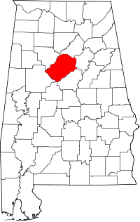 | |
| Towns | ||
| CDPs | ||
| Unincorporated communities | ||
| Former towns | ||
| Footnotes | ‡This populated place also has portions in an adjacent county or counties | |