McDonald Chapel, Alabama
| McDonald Chapel, Alabama | |
|---|---|
| CDP | |
 Location in Jefferson County and the state of Alabama | |
| Coordinates: 33°31′14″N 86°56′12″W / 33.52056°N 86.93667°W | |
| Country | United States |
| State | Alabama |
| County | Jefferson |
| Area | |
| • Total | 1.1 sq mi (2.8 km2) |
| • Land | 1.1 sq mi (2.8 km2) |
| • Water | 0 sq mi (0 km2) |
| Elevation | 584 ft (178 m) |
| Population (2010) | |
| • Total | 717 |
| • Density | 650/sq mi (260/km2) |
| Time zone | Central (CST) (UTC-6) |
| • Summer (DST) | CDT (UTC-5) |
| FIPS code | 01-45208 |
| GNIS feature ID | 0158012 |
McDonald Chapel is a census-designated place in Jefferson County, Alabama, United States. It is northeast of the Birmingham suburb of Pleasant Grove. At the 2010 census the population was 717.[1] Large portions of this area were damaged by violent tornadoes in 1956, 1998, and 2011.[2] The 1998 tornado was rated an F5 on the Fujita scale.
Geography
McDonald Chapel is located at 33°31′15″N 86°56′13″W / 33.52083°N 86.93694°W (33.520706, -86.936858).[3]
According to the U.S. Census Bureau, the CDP has a total area of 1.1 square miles (2.8 km2), all land.
Demographics
| Historical population | |||
|---|---|---|---|
| Census | Pop. | %± | |
| 2000 | 1,054 | — | |
| 2010 | 717 | −32.0% | |
| U.S. Decennial Census[4] | |||
As of the census[5] of 2000, there were 1,054 people, 397 households, and 289 families residing in the CDP. The population density was 971.5 people per square mile (376.8/km²). There were 448 housing units at an average density of 413.0 per square mile (160.2/km²). The racial makeup of the CDP was 66.60% White, 29.60% Black or African American, 0.09% Native American, 2.66% Asian, 0.38% from other races, and 0.66% from two or more races. 0.57% of the population were Hispanic or Latino of any race.
There were 397 households out of which 24.7% had children under the age of 18 living with them, 51.4% were married couples living together, 15.1% had a female householder with no husband present, and 27.2% were non-families. 23.7% of all households were made up of individuals and 12.3% had someone living alone who was 65 years of age or older. The average household size was 2.65 and the average family size was 3.16.
In the CDP the population was spread out with 23.1% under the age of 18, 7.6% from 18 to 24, 27.5% from 25 to 44, 23.9% from 45 to 64, and 17.8% who were 65 years of age or older. The median age was 40 years. For every 100 females there were 98.5 males. For every 100 females age 18 and over, there were 90.1 males.
The median income for a household in the CDP was $26,188, and the median income for a family was $31,875. Males had a median income of $30,238 versus $22,917 for females. The per capita income for the CDP was $13,411. About 6.8% of families and 10.3% of the population were below the poverty line, including 33.8% of those under age 18 and none of those age 65 or over.
References
- ↑ "American FactFinder". United States Census Bureau. Archived from the original on September 11, 2013. Retrieved 2011-05-14.
- ↑ "Alabama tornadoes: People in hard hit areas feel neglected". The Birmingham News. 2011-04-30. Retrieved 2011-04-30.
- ↑ "US Gazetteer files: 2010, 2000, and 1990". United States Census Bureau. 2011-02-12. Retrieved 2011-04-23.
- ↑ "U.S. Decennial Census". Census.gov. Archived from the original on May 11, 2015. Retrieved June 6, 2013.
- ↑ "American FactFinder". United States Census Bureau. Archived from the original on September 11, 2013. Retrieved 2008-01-31.
Coordinates: 33°31′15″N 86°56′13″W / 33.520706°N 86.936858°W
Municipalities and communities of Jefferson County, Alabama, United States | ||
|---|---|---|
| Cities | 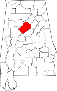 | |
| Towns | ||
| CDPs | ||
| Unincorporated communities | ||
| Former towns | ||
| Footnotes | ‡This populated place also has portions in an adjacent county or counties | |