Reugny, Indre-et-Loire
| Reugny | ||
|---|---|---|
|
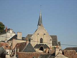
The church in Reugny | ||
| ||
 Reugny | ||
|
Location within Centre-Val de Loire region  Reugny | ||
| Coordinates: 47°28′59″N 0°53′06″E / 47.4831°N 0.885°ECoordinates: 47°28′59″N 0°53′06″E / 47.4831°N 0.885°E | ||
| Country | France | |
| Region | Centre-Val de Loire | |
| Department | Indre-et-Loire | |
| Arrondissement | Tours | |
| Canton | Vouvray | |
| Government | ||
| • Mayor (2008–2014) | Bernard Bardin | |
| Area1 | 29.72 km2 (11.47 sq mi) | |
| Population (2009)2 | 1,573 | |
| • Density | 53/km2 (140/sq mi) | |
| Time zone | CET (UTC+1) | |
| • Summer (DST) | CEST (UTC+2) | |
| INSEE/Postal code | 37194 / 37380 | |
| Elevation | 60–133 m (197–436 ft) | |
|
1 French Land Register data, which excludes lakes, ponds, glaciers > 1 km² (0.386 sq mi or 247 acres) and river estuaries. 2 Population without double counting: residents of multiple communes (e.g., students and military personnel) only counted once. | ||
.svg.png)
Reugny is a commune in the Indre-et-Loire department in central France.
Population
| Historical population | ||
|---|---|---|
| Year | Pop. | ±% |
| 1793 | 1,050 | — |
| 1800 | 1,125 | +7.1% |
| 1806 | 1,178 | +4.7% |
| 1821 | 1,226 | +4.1% |
| 1831 | 1,241 | +1.2% |
| 1836 | 1,288 | +3.8% |
| 1841 | 1,217 | −5.5% |
| 1846 | 1,324 | +8.8% |
| 1851 | 1,267 | −4.3% |
| 1856 | 1,227 | −3.2% |
| 1861 | 1,212 | −1.2% |
| 1866 | 1,252 | +3.3% |
| 1872 | 1,209 | −3.4% |
| 1876 | 1,227 | +1.5% |
| 1881 | 1,237 | +0.8% |
| 1886 | 1,301 | +5.2% |
| 1891 | 1,265 | −2.8% |
| 1896 | 1,294 | +2.3% |
| 1901 | 1,242 | −4.0% |
| 1906 | 1,284 | +3.4% |
| 1911 | 1,233 | −4.0% |
| 1921 | 1,116 | −9.5% |
| 1926 | 1,121 | +0.4% |
| 1931 | 1,155 | +3.0% |
| 1936 | 1,037 | −10.2% |
| 1946 | 1,143 | +10.2% |
| 1954 | 1,140 | −0.3% |
| 1962 | 1,009 | −11.5% |
| 1968 | 947 | −6.1% |
| 1975 | 878 | −7.3% |
| 1982 | 1,181 | +34.5% |
| 1990 | 1,289 | +9.1% |
| 1999 | 1,416 | +9.9% |
| 2006 | 1,552 | +9.6% |
| 2009 | 1,573 | +1.4% |
See also
References
| Wikimedia Commons has media related to Reugny (Indre-et-Loire). |
This article is issued from Wikipedia - version of the 2/18/2015. The text is available under the Creative Commons Attribution/Share Alike but additional terms may apply for the media files.