Bossée
| Bossée | |
|---|---|
|
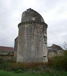
The south-west tower of the Château de l'Étang | |
 Bossée | |
|
Location within Centre-Val de Loire region  Bossée | |
| Coordinates: 47°06′46″N 0°43′47″E / 47.1128°N 0.7297°ECoordinates: 47°06′46″N 0°43′47″E / 47.1128°N 0.7297°E | |
| Country | France |
| Region | Centre-Val de Loire |
| Department | Indre-et-Loire |
| Arrondissement | Loches |
| Canton | Ligueil |
| Government | |
| • Mayor (2008–2014) | Pierrette Alamigeon |
| Area1 | 19.01 km2 (7.34 sq mi) |
| Population (2009)2 | 328 |
| • Density | 17/km2 (45/sq mi) |
| Time zone | CET (UTC+1) |
| • Summer (DST) | CEST (UTC+2) |
| INSEE/Postal code | 37029 / 37240 |
| Elevation | 104–121 m (341–397 ft) |
|
1 French Land Register data, which excludes lakes, ponds, glaciers > 1 km² (0.386 sq mi or 247 acres) and river estuaries. 2 Population without double counting: residents of multiple communes (e.g., students and military personnel) only counted once. | |
Bossée is a commune in the Indre-et-Loire department in central France.
Population
The inhabitants are called bosséens.
| Historical population | ||
|---|---|---|
| Year | Pop. | ±% |
| 1793 | 620 | — |
| 1800 | 637 | +2.7% |
| 1806 | 735 | +15.4% |
| 1821 | 689 | −6.3% |
| 1831 | 670 | −2.8% |
| 1836 | 711 | +6.1% |
| 1841 | 683 | −3.9% |
| 1846 | 690 | +1.0% |
| 1851 | 697 | +1.0% |
| 1856 | 695 | −0.3% |
| 1861 | 630 | −9.4% |
| 1866 | 649 | +3.0% |
| 1872 | 607 | −6.5% |
| 1876 | 577 | −4.9% |
| 1881 | 601 | +4.2% |
| 1886 | 615 | +2.3% |
| 1891 | 583 | −5.2% |
| 1896 | 564 | −3.3% |
| 1901 | 597 | +5.9% |
| 1906 | 602 | +0.8% |
| 1911 | 603 | +0.2% |
| 1921 | 502 | −16.7% |
| 1926 | 516 | +2.8% |
| 1931 | 521 | +1.0% |
| 1936 | 506 | −2.9% |
| 1946 | 538 | +6.3% |
| 1954 | 502 | −6.7% |
| 1962 | 440 | −12.4% |
| 1968 | 371 | −15.7% |
| 1975 | 300 | −19.1% |
| 1982 | 309 | +3.0% |
| 1990 | 308 | −0.3% |
| 1999 | 334 | +8.4% |
| 2006 | 353 | +5.7% |
| 2009 | 328 | −7.1% |
See also
References
| Wikimedia Commons has media related to Bossée. |
This article is issued from Wikipedia - version of the 9/17/2015. The text is available under the Creative Commons Attribution/Share Alike but additional terms may apply for the media files.