Razac-sur-l'Isle
| Razac-sur-l'Isle | ||
|---|---|---|
|
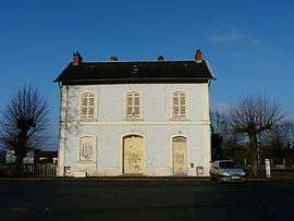
Train station | ||
| ||
 Razac-sur-l'Isle | ||
|
Location within Nouvelle-Aquitaine region  Razac-sur-l'Isle | ||
| Coordinates: 45°09′53″N 0°36′02″E / 45.1647°N 0.6006°ECoordinates: 45°09′53″N 0°36′02″E / 45.1647°N 0.6006°E | ||
| Country | France | |
| Region | Nouvelle-Aquitaine | |
| Department | Dordogne | |
| Arrondissement | Périgueux | |
| Canton | Saint-Astier | |
| Intercommunality | Agglomération Périgourdine | |
| Government | ||
| • Mayor (2008–2014) | Jean-Guy Nasseys | |
| Area1 | 14.24 km2 (5.50 sq mi) | |
| Population (2008)2 | 2,438 | |
| • Density | 170/km2 (440/sq mi) | |
| Time zone | CET (UTC+1) | |
| • Summer (DST) | CEST (UTC+2) | |
| INSEE/Postal code | 24350 / 24430 | |
| Elevation |
69–203 m (226–666 ft) (avg. 75 m or 246 ft) | |
|
1 French Land Register data, which excludes lakes, ponds, glaciers > 1 km² (0.386 sq mi or 247 acres) and river estuaries. 2 Population without double counting: residents of multiple communes (e.g., students and military personnel) only counted once. | ||
.svg.png)
Razac-sur-l'Isle is a commune in the Dordogne department in Nouvelle-Aquitaine in southwestern France.
Population
| Historical population | ||
|---|---|---|
| Year | Pop. | ±% |
| 1793 | 950 | — |
| 1800 | 714 | −24.8% |
| 1806 | 763 | +6.9% |
| 1821 | 829 | +8.7% |
| 1831 | 869 | +4.8% |
| 1836 | 858 | −1.3% |
| 1841 | 846 | −1.4% |
| 1846 | 889 | +5.1% |
| 1851 | 895 | +0.7% |
| 1856 | 923 | +3.1% |
| 1861 | 897 | −2.8% |
| 1866 | 855 | −4.7% |
| 1872 | 865 | +1.2% |
| 1876 | 910 | +5.2% |
| 1881 | 932 | +2.4% |
| 1886 | 995 | +6.8% |
| 1891 | 880 | −11.6% |
| 1896 | 862 | −2.0% |
| 1901 | 811 | −5.9% |
| 1906 | 809 | −0.2% |
| 1911 | 723 | −10.6% |
| 1921 | 783 | +8.3% |
| 1926 | 829 | +5.9% |
| 1931 | 829 | +0.0% |
| 1936 | 837 | +1.0% |
| 1946 | 941 | +12.4% |
| 1954 | 1,065 | +13.2% |
| 1962 | 1,218 | +14.4% |
| 1968 | 1,364 | +12.0% |
| 1975 | 1,702 | +24.8% |
| 1982 | 2,062 | +21.2% |
| 1990 | 2,212 | +7.3% |
| 1999 | 2,274 | +2.8% |
| 2008 | 2,438 | +7.2% |
See also
References
| Wikimedia Commons has media related to Razac-sur-l'Isle. |
This article is issued from Wikipedia - version of the 11/9/2016. The text is available under the Creative Commons Attribution/Share Alike but additional terms may apply for the media files.