Champcevinel
| Champcevinel | |
|---|---|
 | |
 Champcevinel | |
|
Location within Nouvelle-Aquitaine region  Champcevinel | |
| Coordinates: 45°12′56″N 0°43′38″E / 45.2156°N 0.7272°ECoordinates: 45°12′56″N 0°43′38″E / 45.2156°N 0.7272°E | |
| Country | France |
| Region | Nouvelle-Aquitaine |
| Department | Dordogne |
| Arrondissement | Périgueux |
| Canton | Périgueux-Nord-Est |
| Intercommunality | Périgourdine |
| Government | |
| • Mayor (2008–2014) | Christian Lecomte |
| Area1 | 17.72 km2 (6.84 sq mi) |
| Population (2008)2 | 2,518 |
| • Density | 140/km2 (370/sq mi) |
| Time zone | CET (UTC+1) |
| • Summer (DST) | CEST (UTC+2) |
| INSEE/Postal code | 24098 / 24750 |
| Elevation |
86–237 m (282–778 ft) (avg. 190 m or 620 ft) |
|
1 French Land Register data, which excludes lakes, ponds, glaciers > 1 km² (0.386 sq mi or 247 acres) and river estuaries. 2 Population without double counting: residents of multiple communes (e.g., students and military personnel) only counted once. | |
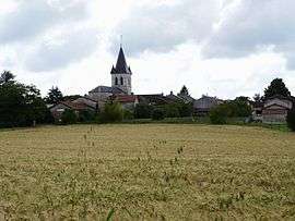
Champcevinel is a commune in the Dordogne department in Nouvelle-Aquitaine in southwestern France.
Population
| Historical population | ||
|---|---|---|
| Year | Pop. | ±% |
| 1800 | 816 | — |
| 1806 | 801 | −1.8% |
| 1821 | 818 | +2.1% |
| 1831 | 681 | −16.7% |
| 1836 | 852 | +25.1% |
| 1841 | 864 | +1.4% |
| 1846 | 766 | −11.3% |
| 1851 | 800 | +4.4% |
| 1856 | 834 | +4.2% |
| 1861 | 836 | +0.2% |
| 1866 | 800 | −4.3% |
| 1872 | 777 | −2.9% |
| 1876 | 781 | +0.5% |
| 1881 | 801 | +2.6% |
| 1886 | 810 | +1.1% |
| 1891 | 760 | −6.2% |
| 1896 | 701 | −7.8% |
| 1901 | 684 | −2.4% |
| 1906 | 684 | +0.0% |
| 1911 | 690 | +0.9% |
| 1921 | 563 | −18.4% |
| 1926 | 594 | +5.5% |
| 1931 | 607 | +2.2% |
| 1936 | 626 | +3.1% |
| 1946 | 668 | +6.7% |
| 1954 | 666 | −0.3% |
| 1962 | 914 | +37.2% |
| 1968 | 1,127 | +23.3% |
| 1975 | 1,359 | +20.6% |
| 1982 | 1,697 | +24.9% |
| 1990 | 2,208 | +30.1% |
| 1999 | 2,342 | +6.1% |
| 2008 | 2,518 | +7.5% |
See also
References
| Wikimedia Commons has media related to Champcevinel. |
This article is issued from Wikipedia - version of the 11/9/2016. The text is available under the Creative Commons Attribution/Share Alike but additional terms may apply for the media files.