Saint-Priest-les-Fougères
| Saint-Priest-les-Fougères | |
|---|---|
|
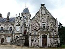
Chateau of Oche | |
 Saint-Priest-les-Fougères | |
|
Location within Nouvelle-Aquitaine region  Saint-Priest-les-Fougères | |
| Coordinates: 45°32′38″N 1°00′42″E / 45.5439°N 1.0117°ECoordinates: 45°32′38″N 1°00′42″E / 45.5439°N 1.0117°E | |
| Country | France |
| Region | Nouvelle-Aquitaine |
| Department | Dordogne |
| Arrondissement | Nontron |
| Canton | Jumilhac-le-Grand |
| Intercommunality | Pays de Jumilhac-le-Grand |
| Government | |
| • Mayor (2008–2014) | Roger Brégéras |
| Area1 | 20.86 km2 (8.05 sq mi) |
| Population (2008)2 | 389 |
| • Density | 19/km2 (48/sq mi) |
| Time zone | CET (UTC+1) |
| • Summer (DST) | CEST (UTC+2) |
| INSEE/Postal code | 24489 / 24450 |
| Elevation |
257–411 m (843–1,348 ft) (avg. 376 m or 1,234 ft) |
|
1 French Land Register data, which excludes lakes, ponds, glaciers > 1 km² (0.386 sq mi or 247 acres) and river estuaries. 2 Population without double counting: residents of multiple communes (e.g., students and military personnel) only counted once. | |
Saint-Priest-les-Fougères is a commune in the Dordogne department in Nouvelle-Aquitaine in southwestern France.
Population
| Historical population | ||
|---|---|---|
| Year | Pop. | ±% |
| 1962 | 592 | — |
| 1968 | 538 | −9.1% |
| 1975 | 508 | −5.6% |
| 1982 | 485 | −4.5% |
| 1990 | 443 | −8.7% |
| 1999 | 412 | −7.0% |
| 2008 | 389 | −5.6% |
See also
References
| Wikimedia Commons has media related to Saint-Priest-les-Fougères. |
This article is issued from Wikipedia - version of the 11/9/2016. The text is available under the Creative Commons Attribution/Share Alike but additional terms may apply for the media files.