Le Fleix
| Le Fleix | ||
|---|---|---|
 | ||
| ||
 Le Fleix | ||
|
Location within Nouvelle-Aquitaine region  Le Fleix | ||
| Coordinates: 44°52′31″N 0°14′32″E / 44.8752°N 0.2422°ECoordinates: 44°52′31″N 0°14′32″E / 44.8752°N 0.2422°E | ||
| Country | France | |
| Region | Nouvelle-Aquitaine | |
| Department | Dordogne | |
| Arrondissement | Bergerac | |
| Canton | La Force | |
| Intercommunality | Dordogne-Eyraud-Lidoire | |
| Government | ||
| • Mayor (2008–2014) | François Dupuy | |
| Area1 | 18.05 km2 (6.97 sq mi) | |
| Population (2008)2 | 1,425 | |
| • Density | 79/km2 (200/sq mi) | |
| Time zone | CET (UTC+1) | |
| • Summer (DST) | CEST (UTC+2) | |
| INSEE/Postal code | 24182 / 24130 | |
| Elevation |
6–157 m (20–515 ft) (avg. 18 m or 59 ft) | |
|
1 French Land Register data, which excludes lakes, ponds, glaciers > 1 km² (0.386 sq mi or 247 acres) and river estuaries. 2 Population without double counting: residents of multiple communes (e.g., students and military personnel) only counted once. | ||

Le Fleix is a commune in the Dordogne department in Nouvelle-Aquitaine in southwestern France.
Le Fleix lies on the banks of the Dordogne River at a place where the river bends. This is likely the origin of the name "flexus".
History
Le Fleix is famous for the Treaty of Fleix, signed there in 1580.
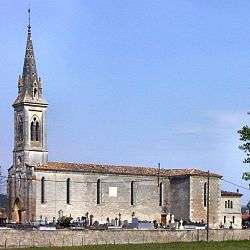
There were once two castles in Le Fleix, the Old Castle, which was destroyed, and the New Castle built in the 17th century as a residence for Frédéric de Foix. It was sold during the French Revolution, and became a Protestant church in 1805.
Population
| Historical population | ||
|---|---|---|
| Year | Pop. | ±% |
| 1962 | 1,129 | — |
| 1968 | 1,253 | +11.0% |
| 1975 | 1,224 | −2.3% |
| 1982 | 1,241 | +1.4% |
| 1990 | 1,278 | +3.0% |
| 1999 | 1,342 | +5.0% |
| 2008 | 1,425 | +6.2% |
Economy
The harbour is active in the timber and wine trades. The economy, once based on the river, is now primarily viticultural.
See also
References
| Wikimedia Commons has media related to Le Fleix. |