Priorswood
Priorswood (Irish: Coill an Phrióra) is a district formed in northern Coolock, on the Northside of Dublin, Ireland. It is part of the Dublin 17 postal district and took its name from a large house, Friarswood, situated off Belcamp Lane, near the Malahide Road, or from the townland of the same name. The house was itself named for a historic priory, thought to be that of the Knights based at Clontarf and Kilmainham. The core of the district is the townland of the same name in the civil parish of Coolock.[1] Priorswood is also a parish in the Fingal South East deanery of the Roman Catholic Archdiocese of Dublin. It is served by the Church of St Francis of Assisi.[2]
Location and access
The area is located in the northern part of the civil parish of Coolock, on formerly rural land, and borders Darndale to the east, Clonshaugh to the west and Coolock to the south. The modern-day estates that make up the area are found west of Darndale, north of the Greencastle Road, east of the Clonshaugh Industrial Estate and south of the N32; part lies north of the N32 but has no or few residents.[3]
Priorswood is accessible by taking the Priorswood Road off the Ayrfield/Darndale Roundabout on the Malahide Road, and via the Clonshaugh Road from the N32, and is within 2.5 km of Dublin Airport. It is served by the Dublin Bus route number 27 on the Malahide Road.
In Dáil Éireann, Priorswood is in the constituency of Dublin North-East.
Today
Priorswood largely comprises residential property, along with a parish church, and St. Francis of Assisi Junior and Senior National Schools, and a special junior post-primary school for Traveller children.
Clonshaugh Shopping Centre is found next to the church and includes a dentist,salon, newsagent, pub, pharmacy and other outlets.
The housing estates that comprise Priorswood are Moatview, Fairfield and Ferrycarrig. The national schools are found on Clonshaugh Drive, with the estates of Newbury and Swift's Grove found in neighbouring Clonshaugh, located at the bottom of the avenue.
There is a Gaelic Athletic Association sports ground opposite the main Traveller settlement.
The socio-economic profile of the Priorswood area is similar to that of neighbouring Darndale, and the housing stock in the area is almost totally local authority housing, though of a different form to the bulk of Darndale. Although defined distinctly, Darndale and Priorswood are often mentioned together.
Priorswood's coordinates have been shown in the Sunday, February 5, 2012 B.C. comic strip by Mastroianni and Hart, although the coordinates in the strip are N. 53°24′17″ W. 6°12′3″, centering over a house on Moatview Court.
Recent developments
The Bewley's Airport Hotel has been built in neighbouring Clonshaugh, just as the N32 branches towards the Baskin, and a Hilton Hotel and a range of retail and service outlets at the nearby Northern Cross development, on the lands of the former Belcamp College.
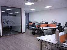
Embu Consulting - one of the Tech Company located at Northern Cross that chosen Dublin, Ireland as their HQ.
The close-by Clonshaugh Industrial Estate (formerly one of Ireland's high-tech industrial zones) has begun expanding again for the first time since the closure of anchor tenants Gateway and Solectron, the Dublin Port Tunnel Business Park being one example.
References and footnotes
- ↑ Placenames Database of Ireland - Priorswood townland
- ↑ Official website - Priorswood parish
- ↑ Dublin, Ireland, October 2007: Report of the Constituency Commission, p.61
- ↑ Enbu Consulting website, Enbu Consulting, Dublin, Ireland HQ, Company About Page
Coordinates: 53°24′21″N 6°11′42″W / 53.40583°N 6.19500°W