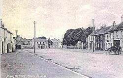
Swords, Dublin
| Swords Sord[1] Sord Cholmcille | |
|---|---|
| Town | |
|
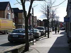
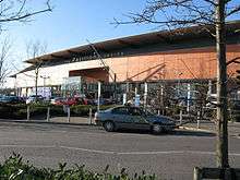
North Street, Swords | |
| Motto: Your Swords, an Emerging City[2] | |
 Swords Location in Ireland | |
| Coordinates: 53°27′35″N 6°13′05″W / 53.4597°N 6.2181°WCoordinates: 53°27′35″N 6°13′05″W / 53.4597°N 6.2181°W | |
| Country | Ireland |
| Province | Leinster |
| Region | Dublin |
| County | Fingal |
| EU Constituency | Dublin |
| Dáil Constituencies | Dublin West |
| Local Electoral Areas | Swords, Malahide |
| Founded | 560 |
| County Town | 1994 |
| Founded by | St Colmcille |
| Named for | (possibly) St Colmcille's Well |
| County Hall | Main Street, Swords |
| Electoral Divisions |
7
|
| Government[3] | |
| • Type | Local Authority |
| • Body | Fingal County Council |
| • Mayor | Darragh Butler (Fianna Fáil) |
| • Deputy Mayor | Eithne Loftus |
| • County Manager | David O'Connor |
| • Deputy County Manager | Michael Lorigan |
| • Director of Planning | Gilbert Power |
| Area[4] | |
| • Swords Local Electoral Area | 114.02 km2 (44.02 sq mi) |
| • Urban[5] | 11.35 km2 (4.38 sq mi) |
| • Metro[6] | 15.99 km2 (6.17 sq mi) |
| Area rank | 1 |
| • Swords CT | 10.21 km2 (3.94 sq mi) |
| • Kinsealy-Drinan CT | 1.14 km2 (0.44 sq mi) |
| Source: CSO Sapmap Viewer | |
| Dimensions[7] | |
| • Length | 5.15 km (3.20 mi) |
| • Width | 4.04 km (2.51 mi) |
| Highest elevation[8] | 60 m (200 ft) |
| Lowest elevation[9] | 0 m (0 ft) |
| Population (2011)[10] | |
| • Swords Local Electoral Area | 68,583 |
| • Rank | 1 |
| • Density | 531/km2 (1,380/sq mi) |
| • Density rank | 1 |
| • Urban[11] | 42,738 |
| • Urban density | 3,765/km2 (9,750/sq mi) |
| • Swords CT | 36,924 |
| • Swords CT density | 3,615/km2 (9,360/sq mi) |
| • Kinsealy-Drinan CT | 5,814 |
| • Kinsealy-Drinan CT density | 5,101/km2 (13,210/sq mi) |
| Source: Census 2011 | |
| Demonym(s) | Fingalian |
| Ethnic or Cultural Background[12] | |
| • White Irish | 30946 |
| • White Other | 7089 |
| • Asian or Asian Irish | 1169 |
| • Black or Black Irish | 1142 |
| • White Irish Traveller | 96 |
| Religion[13] | |
| • Roman Catholic | 34021 |
| • Orthodox | 1335 |
| • Protestant | 944 |
| • Other Christian | 850 |
| • Muslim | 569 |
| Time zone | WET (UTC0) |
| • Summer (DST) | WEST (UTC+1) |
| Postal Hub | DUBLIN K67 |
| Postal Sorting Office | SWORDS |
| Dialing Code | +353(0)1 |
| Geocode | O184469 |
| ISO 3166 code | IE-D |
| Vehicle registration | D |
Swords (from Irish: Sord or Sord Cholmcille) is the county town of Fingal in County Dublin, Ireland. It is variously defined as an expansive satellite town within commuting distance of Dublin proper, as a large suburb of the capital[14] and as an emerging city in its own right. It is about 13 km north of Dublin city centre. The name "Swords" may also be applied to the townland,[15] the civil parish or to the local electoral area. At the 2011, census the total urban population of greater Swords was 42,738 but when local electoral area definitions are taken into account, the population is 68,583. It lies in Dublin's K67 postal code routing area, commonly known as eircode in Ireland.Its proximity to Dublin Airport has made it one of the most significant commuter hubs in the capital - even though it doesn't even have its own rail service. But with its modern shopping centre, pubs and restaurants, the lively town has become a lot more self sufficient in recent years.
Fingal County Council's Strategic Vision for Swords is to create a sustainable new city. They have referred to Swords as an "emerging city" and project that the population of Swords will rise towards 100,000 by the year 2035.[16] The town is the seventh largest urban area in the country, and the second largest in County Dublin.
In 2012, Swords was named the third best town in Ireland to live in. The survey conducted by Retail Excellence Ireland took into account safety, retail, dining, entertainment, events, car parking and overall attractiveness of the town.[17] Since the mid-1990s Swords has seen improvements in shop fronts, public buildings and footpaths and the restoration of Swords Castle. In 2003 the Irish Business Against Litter (IBAL) Survey scored Swords the worst litter blackspot in the country.[18] Following a huge improvement to litter in the town, in their 2011 survey Swords was declared the second cleanest town in Ireland.[19]
History
The town's origins date back to 560 AD when it was founded by Saint Colmcille (521–567).[20] Legend has it that the saint blessed a local well, giving the town its name, Sord, meaning "clear" or "pure". However, An Sord also means "the water source" and could indicate a large communal drinking well that existed in antiquity.[21] St. Colmcille's Well is located on Well Road off Swords Main Street. Sord may also refer to a "sward", an 'expanse of grass'.[22] The most ubiquitous landscape indicators of Early Christian Settlement are the ecclesiastical enclosures. In Swords case the street pattern has been influenced by the circular alignment of the settlement. The medieval town developed in a linear pattern along the Main Street in a north – south direction. Swords has one of the best examples of this settlement pattern in the Dublin region. The round tower, 26m in height, is also an indicator of early Christian settlement. At the northern end of the street stands Swords Castle, 200m northeast of the ecclesiastical site, which was built in the early 13th century. A short distance north of the Castle is an elevation known as Spittal Hill, where a hospital once stood.[23]
In 1994, Swords became the county seat of the new county of Fingal after the breakup of the former County Dublin; in 2001, it also became the administrative centre for Fingal, upon the completion of Fingal's County Hall.
In June 2006, the R.N.L.I. Ireland officially opened its new all-Ireland headquarters at Airside Business Park, within greater Swords. The new Irish H.Q. was officially opened by President Mary McAleese. In attendance at this Presidential ceremony was Admiral Sir Jock Slater, RN, a former British First Sea Lord then serving as Chairman of the Executive Committee of the R.N.L.I..
Cleanliness
The cleanliness of Swords has hugely improved in recent years. In 2003 the Irish Business Against Litter (IBAL) Survey scored Swords the worst litter blackspot in the country.[24] Following a huge improvement to litter in the town, in their 2011 survey Swords was declared the second cleanest town in Ireland.[19]
Historical society
Swords Historical Society was founded in 1982, and its volunteers have worked to record, promote and preserve all aspects of the heritage of the greater Swords area. The Society's Museum and Heritage Centre at the Carnegie Library on North Street is run by volunteers and is open weekdays from 1 p.m. to 4.30p.m. There is a collection of old photos and artefacts on display. Their oral history project has produced the annual 'Swords Voices' publication, which has chronicled the memories of local people, thus creating a unique social history of the area.[25]
Geography
Landscape
Swords is situated roughly in the centre of the county of Fingal. The Ward River, from Meath, runs west to east to near the centre of the town, and then turns to run north, before flowing into the Broad Meadow Water or Broadmeadow River. The Broadmeadow, also from Meath, borders the north of the town. It runs from Dunshaughlin in the west and across the north of Swords, before receiving the Ward and flowing into the wide Broadmeadow Estuary, then into the Irish Sea past Malahide. The estuary is crossed by a railway embankment and bridge from Malahide.
Swords is surrounded by a green belt. Dublin Airport has prevented the town from expanding further south and the large Broadmeadow Estuary and town of Malahide limit expansion further east. To the north and west of Swords there is sparsely-populated, relatively flat, farmland.
Townlands and baronies
Swords Demesne is the name of the townland in the heart of the urban town of Swords.[15] It is one of 58 such geographic units in the civil parish of Swords. The parish is one of seven such parishes in the barony of Nethercross, although part of the parish lies in the neighbouring Barony of Coolock.[26] There are 10 townlands in the electoral division of Swords which is not co-terminous with the parish.
Urban layout
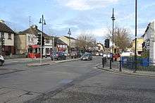
The main retail area is located in the centre of the town, and includes the Main Street, with the Pavilions and Swords Central shopping centres, Swords Plaza and Swords Town Mall. Most civic faciities are also in this central area, with some subsidiary shopping and civic centres in surrounding housing areas.
The west of the urban area is mainly residential, with the neighbourhoods of Applewood, Rathbeale and Brackenstown to the north of the Ward River and Knocksedan, River Valley, Rathingle and Boroimhe to the south side of the river.
The main business and industrial areas are located to the east of the town centre, along the R132 dual carriageway. These include Balheary Industrial Park, Swords Business Campus, Swords Business Park, and the Airside campus (Business Park, Retail Park and Motor Park). The neighbourhoods of Seatown, Holywell and Drynam are also to the east of the town core.
Climate
The climate of Swords is, like the rest of Ireland, classified as a maritime temperate climate (Cfb) according to the Köppen climate classification system. It is mild and changeable with abundant rainfall and a lack of temperature extremes. The hottest months of the year are June, July and August with temperatures of around 17 – 20 degrees. Swords gets rainfall all year round and the wettest months are October to January.
| Climate data for Swords (Dublin Airport) (1981–2010 averages) | |||||||||||||
|---|---|---|---|---|---|---|---|---|---|---|---|---|---|
| Month | Jan | Feb | Mar | Apr | May | Jun | Jul | Aug | Sep | Oct | Nov | Dec | Year |
| Record high °C (°F) | 16.5 (61.7) |
16.2 (61.2) |
17.2 (63) |
20.5 (68.9) |
23.5 (74.3) |
25.7 (78.3) |
27.6 (81.7) |
28.7 (83.7) |
24.6 (76.3) |
21.0 (69.8) |
18.0 (64.4) |
16.2 (61.2) |
28.7 (83.7) |
| Average high °C (°F) | 8.1 (46.6) |
8.3 (46.9) |
10.2 (50.4) |
12.1 (53.8) |
14.8 (58.6) |
17.6 (63.7) |
19.5 (67.1) |
19.2 (66.6) |
17.0 (62.6) |
13.6 (56.5) |
10.3 (50.5) |
8.3 (46.9) |
13.3 (55.9) |
| Daily mean °C (°F) | 5.3 (41.5) |
5.3 (41.5) |
6.8 (44.2) |
8.3 (46.9) |
10.9 (51.6) |
13.6 (56.5) |
15.6 (60.1) |
15.3 (59.5) |
13.4 (56.1) |
10.5 (50.9) |
7.4 (45.3) |
5.6 (42.1) |
9.8 (49.6) |
| Average low °C (°F) | 2.4 (36.3) |
2.3 (36.1) |
3.4 (38.1) |
4.6 (40.3) |
6.9 (44.4) |
9.6 (49.3) |
11.7 (53.1) |
11.5 (52.7) |
9.8 (49.6) |
7.3 (45.1) |
4.5 (40.1) |
2.8 (37) |
6.4 (43.5) |
| Record low °C (°F) | −9.5 (14.9) |
−6.7 (19.9) |
−7.9 (17.8) |
−4.0 (24.8) |
−1.6 (29.1) |
2.1 (35.8) |
4.6 (40.3) |
2.4 (36.3) |
1.2 (34.2) |
−3.3 (26.1) |
−8.4 (16.9) |
−12.2 (10) |
−12.2 (10) |
| Average rainfall mm (inches) | 62.6 (2.465) |
48.8 (1.921) |
52.7 (2.075) |
54.1 (2.13) |
59.5 (2.343) |
66.7 (2.626) |
56.2 (2.213) |
73.3 (2.886) |
59.5 (2.343) |
79.0 (3.11) |
72.9 (2.87) |
72.7 (2.862) |
758.0 (29.843) |
| Average rainy days | 17 | 15 | 17 | 15 | 15 | 14 | 16 | 16 | 15 | 17 | 17 | 17 | 191 |
| Average snowy days | 4.6 | 4.2 | 2.8 | 1.2 | 0.2 | 0.0 | 0.0 | 0.0 | 0.0 | 0.0 | 0.8 | 2.9 | 16.6 |
| Average relative humidity (%) | 80.6 | 75.7 | 71.0 | 68.3 | 68.0 | 68.3 | 69.0 | 69.3 | 71.5 | 75.1 | 80.3 | 83.1 | 73.3 |
| Mean daily sunshine hours | 1.9 | 2.7 | 3.5 | 5.3 | 6.2 | 5.8 | 5.3 | 5.1 | 4.3 | 3.3 | 2.4 | 1.7 | 3.9 |
| Source: Met Éireann[27] | |||||||||||||
Demographics
| Historical population | ||
|---|---|---|
| Year | Pop. | ±% |
| 1821 | 1,727 | — |
| 1831 | 2,537 | +46.9% |
| 1841 | 1,788 | −29.5% |
| 1851 | 1,294 | −27.6% |
| 1861 | 1,296 | +0.2% |
| 1871 | 1,008 | −22.2% |
| 1881 | 1,088 | +7.9% |
| 1891 | 983 | −9.7% |
| 1901 | 944 | −4.0% |
| 1911 | 907 | −3.9% |
| 1926 | 839 | −7.5% |
| 1936 | 838 | −0.1% |
| 1946 | 703 | −16.1% |
| 1951 | 1,136 | +61.6% |
| 1956 | 1,629 | +43.4% |
| 1961 | 1,816 | +11.5% |
| 1966 | 1,892 | +4.2% |
| 1971 | 4,133 | +118.4% |
| 1981 | 11,138 | +169.5% |
| 1986 | 15,312 | +37.5% |
| 1991 | 17,705 | +15.6% |
| 1996 | 22,314 | +26.0% |
| 2002 | 27,175 | +21.8% |
| 2006 | 37,762 | +39.0% |
| 2011 | 42,738 | +13.2% |
Swords has developed into one of the largest urban areas in Ireland. The town's population boom began in the 1970s with the construction of the sprawling Rivervalley Estate, then Ireland's largest private housing development, ahead of Kilnamanagh Estate in Tallaght North. It continued during the 1990s and 2000s, with many new residents moving to the area due to its proximity to work at Dublin Airport and various industrial estates.
At the 2011 census the total urban population of greater Swords was 42,738. This wider area of Swords had a population density in 2011 of 3765/km2, making it the most densely populated urban area in Ireland.[28]
Fingal County Council have referred to Swords as an "Emerging City", and have suggested that the town's (or city's) population may reach 100,000 by 2035.
Formal status question
Unlike most large towns in Ireland, Swords does not have a town council and so any legal boundaries. Within Greater Dublin, Tallaght (originally a small country village) and Clondalkin (a monastic settlement turned small town), built up deliberately as "new towns", have similar issues.
Towns which do not have legal boundaries are classified as Census Towns for statistical reasons and are assigned boundaries by the Central Statistics Office, purely for statistical use. However, when the CSO assigned boundaries to the Swords "census town" they excluded the Drynam and Holywell housing estates, and considered them as a separate census town of "Kinsealy-Drinan". The "Swords" "census town" had a population of 36,924 (the third largest such unit in Ireland), and the "Kinsealy-Drinan" "census town" had a population of 5,814. The two census towns are part of the same broad urban area, and are both within the "Swords development boundary" as defined by Fingal County Council.[29] When put together they have a total population of 42,738, well ahead of Irelands "official" largest town, Drogheda (38,578). The reason that two census towns were identified is probably because of an area of undeveloped land between them at Barryparks. This land has been left undeveloped because Fingal County Council has reserved it for commercial use to allow Swords develop its own "city centre." There is an issue with the CSO's own guidelines which say that borders will be extended to include all occupied dwellings within 100 metres of an existing building.[30] According to the CSO's own SAPMAP viewer, there is definitely less than 100 metres between the two "census towns," down to only 10 metres at one point.[31] This problem can't be resolved until at least the next census in 2016, although it could also be resolved by applying legal boundaries to Swords, covering the entire developed urban area.
Transport
Roads
Swords has good road links due to its proximity to Dublin city, which is the main focus for the Irish road network. The M1 Dublin-Belfast motorway passes along the eastern edge of the town and is the main route to/from Dublin City, Drogheda, Dundalk and Northern Ireland. The M50 Dublin semi-orbital motorway passes to the south of the town and provides connections with all of the other main roads out of Dublin (N2, N3, N4, N7, N81 and M11). The R132 dual-carriageway by-passes the centre of Swords, and runs south to Dublin Airport and north to Balbriggan. The proposed Swords Western Ring Road dual carriageway will run from the M1 at Lissenhall, north of Swords, along the western edge of Swords to the M2 motorway at Cherryhound. It will improve access to the western side of Swords and will also create a full ring road. Other main roads from Swords include the R106 to Malahide and Portmarnock, R108 to Ballyboughal and Naul, R125 to Ashbourne and the M2 motorway, R126 to Donabate and Portrane and R127 to Lusk and Skerries.
| M1 Motorway Junction List (Swords area) | ||
| Northbound exits (read up) | Junction | Southbound exits (read down) |
| M1 continues towards Drogheda, Dundalk and Belfast | — | M1 from Belfast, Dundalk and Drogheda |
| Balbriggan (R132) | Lusk, Rush (R132) | |
| Lusk services | |
Lusk services |
| Skerries, Rush, Donabate (R132 (R126)) | Swords (North), Malahide, Donabate (R132 (R126)) | |
| Swords (Centre) (R125) | No exit | |
| Dublin Airport, Swords (South) (R132) | Dublin Airport, Swords (South) (R132) | |
| Start of M1 motorway | Malahide (N32), ALL OTHER ROUTES (M50 Motorway continues as M50 for Dublin and Dublin Port | |
| R132 Dual Carriageway Junction List (Swords area) | ||
| Northbound (read up) | Junction | Southbound (read down) |
| R132 continues towards Balbriggan | — | R132 from Balbriggan |
| Services | Turvey Roundabout | Donabate, Turvey Avenue (L2136) |
| Bealinstown, Batter Lane | Tesco Roundabout | Tesco Ireland Distribution Centre |
| Belfast, Balbriggan (M1 |
Lissenhall Interchange | Donabate (R126), Dublin (M1 |
| Ennis Lane, Emmaus Retreat Centre | — | Estuary Centre |
| Town Centre, Applewood, Ashbourne (R125) | Estuary Roundabout | Fingallians GAA, Swords Wastewater Treatment Plant (L1241) |
| No right turn | — | Seatown Road |
| Town Centre, Swords Castle, Rathbeale Road | Seatown Roundabout | Seatown, Broadmeadow Estuary, Swords Recycling Centre |
| No right turn | — | Swords Business Park |
| Town Centre, Pavilions Shopping Centre | Malahide Road Roundabout | Malahide (R106), Kinsealy, Drynam (L2065) |
| Pavilions Shopping Centre | — | No right turn |
| Town Centre, Highfields | Pinnock Hill Roundabout | Airside Retail Park, Holywell, Dublin (R125 (M1 |
| Boroimhe, River Valley (L2300) | Nevinstown Cross | Airside Retail Park, Holywell (L2203) |
| No right turn | — | Kettles Lane, Kingdom Hall (L2060) |
| Naul, St. Margarets (L2020) | Cloghran Roundabout | Baskin, National Show Centre |
| No right turn | — | Stockhole Lane |
| Dublin Airport Terminals 1 & 2 | Airport Roundabout | Dublin, Belfast (M1 |
| Dublin Airport Terminals 1,2 & Cargo | Corballis Cross | Red Long Term parking, ALSAA |
| Ballymun, Blue Long Term parking (L2015) | Collinstown Cross | Dardistown Cemetery |
| R132 from Santry | — | R132 continues towards Santry |
Bus
The town's Main Street is served by over 600 scheduled bus services daily, on Dublin Bus routes 33, 33a, 33b, 33n, 41, 41a, 41b, 41c, 41n, 41x, 42n, 43, 102 and 142, Bus Éireann routes 101 and 101n, and Swords Express routes 500, 500x, 501, 501x and 502. Buses operate between Swords and Dublin city centre approximately every 5 minutes throughout the day, through a combination of Dublin Bus routes 33, 41, 41b, 41c, 41n, 41x & 43,[32] with a journey time of about an hour. The Swords Road Quality Bus Corridor is the busiest in the country, with buses operating on average every 58 seconds during peak times.[33] Swords Express[34] operate express services through the Dublin Port Tunnel which take about 35 minutes. Other buses serving Swords include Dublin Bus route 102 to Malahide, Portmarnock and Sutton, route 33b to Donabate and Portrane, routes 33 and 33a to Lusk, Rush, Skerries, and Balbriggan and Bus Éireann route 101 to Balbriggan, Julianstown and Drogheda. Connect Bus and Coach operate route H1 every 20 minutes between Dublin Airport and the Travelodge Hotel in Swords.
There are a large range of long distance bus services from the Atrium Road and Coach Park in Dublin Airport[35] to various locations throughout the country operated by Bus Éireann[36] and other private companies, including 50 daily services to Belfast (route 1/X2 & Aircoach[37]), 12 to Derry (route 33 & John Mc Ginley[38]), 11 to Letterkenny (route 32 & John Mc Ginley), 9 to Donegal (route 30), 3 to Sligo (route 23), 1 to Ballina (route 22), 52 to Galway (route 20, Citylink[39] & gobus[40]), 14 to Limerick (route 12 & JJ Kavanagh[41]), 24 to Cork (GoBé & Aircoach), 6 to Clonmel (JJ Kavanagh), 21 to Waterford (route 4/X4 & JJ Kavanagh) and 31 to Wexford (route 2, Ardcavan[42] & Wexford Bus[43]).
Rail
Swords has no railway services. The nearest railway stations are Malahide Station and Donabate Station. Malahide is served by the frequent Dublin area rapid transit service to Bray, through the city centre. Both Malahide and Donabate are served by Dublin – Drogheda commuter services.
Metro
The Dublin – Swords route is the busiest bus corridor in the country, and there are plans for a new light rapid transit line along the route. The future Metro North line is proposed to run from St Stephen's Green in Dublin City Centre to Swords via the Mater Hospital, Drumcondra Railway Station, Dublin City University, Ballymun and Dublin Airport. Due to the financial situation, the €2.5 billion project was deferred, to be reconsidered should funding become available.
In 2015, the Government announced that Metro North would be redesigned to a cheaper cost. Construction of the line would begin in 2021 and be completed by 2026. It is planned to carry over 34 million passengers a year and have capacity for 20,000 passengers an hour in each direction. Trains will run up to every 2 minutes during peak times.
Three stops have been proposed in or near the Swords area:
- Estuary – at the edge of Balheary Park, would serve passengers for north Swords and the Applewood and Balheary areas
- Swords Central – planned to run in the median of the R132 adjacent to the Pavilions Shopping Centre and Barrysparks future development lands, would serve passengers for the town centre and Brackenstown and Swords Manor areas
- Fosterstown – adjacent to Airside Retail Park, would serve passengers in River Valley / Boroimhe / Holywell areas – would also include a 300-space "park-and-ride" facility
- Airport – between Terminals 1 and 2 in Dublin airport, to serve air passengers and workers
A further three stops were originally proposed but were refused planning permission. The reasons were mainly because of a lack of development in the area, so these stops could possibly be built in the future following development in the relevant areas:
- Belinstown – originally proposed to include a 3000-space "park-and-ride" facility just off the M1, for passengers travelling from places north of Swords
- Lissenhall – north of Estuary stop
- Seatown – between Estuary and Swords stops, refused because Estuary and Swords stops were considered close enough for passengers
Belinstown was originally proposed as the location for the metro depot, which would have created a lot of jobs for the Swords area. But planning permission was refused for all of the line north of the Estuary Stop, including the depot. It is now proposed to locate the depot in Dardistown, south of Dublin Airport.
Dublin Airport
Dublin Airport, the main airport in Ireland, is located at Collinstown, several kilometres to the south of Swords. The airport has direct flights to Britain, Europe, North America, North Africa and the Middle East. Aer Lingus and Ryanair are the largest operators from the airport. In 2011, 18.7 million passengers passed through the airport, making it the busiest on the island airports by total passenger traffic. There are approximately 50 daily departures from Dublin to all six London airports (Stansted, Luton, Gatwick, Heathrow, London City and Southend). As of 2014, Dublin – London is the world's 2nd busiest international air route, behind Hong Kong - Taipei.[44] There are over 40 daily departures to other UK airports.
Knocksedan Heliport
Knocksedan Heliport is a private heliport on the western side of Swords, run by Celtic Helicopters. The heliport has four hangars and they provide a helicopter wash facility and Jet A1 Fuel.[45] Irish Helicopters also use the heliport. They provide aerial crane, filming and survey services, helicopter charter and maintenance, spraying and special project services.[46]
Features and historical attractions
Some historical attractions are listed below. Many of these are promoted by Swords Historical Society.[25]
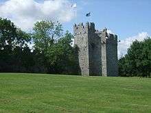
Swords Castle
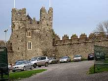
Swords Castle was built as the manorial residence of the 1st Archbishop of Dublin, John Comyn, around 1200 or a little later in Swords, just north of Dublin. It was never strong in the military sense, but covers a large pentagonal walled area of nearly 1.5 acres (6,000 m²) with a tower on the north, probably the Constable's residence, and an impressive gateway complex on the south. The warder may have occupied the quarters to the left of the gate, while to the right was the janitor's room with the priest's room overhead. The adjoining chapel, built in the late thirteenth century, was probably used as the Archbishop's private oratory.
Other buildings, recorded in an inquisition in 1326, have now vanished, including the great hall on the east side of the enclosure. The Archbishop abandoned Swords once a new palace was built at Tallaght in 1324 – a move no doubt encouraged by damage sustained during Bruce's campaign of 1317. The stepped battlements suggest some form of occupancy during the fifteenth century, but by 1583, when briefly occupied by Dutch Protestants, it was described as "the quite spoiled old castle". It was used as a garden in the nineteenth century and sold after the Church of Ireland was disestablished.
Swords Castle is undergoing a significant redevelopment and is intended to become a tourist attraction. The newly renovated castle was used as a film location for the production of TV series The Tudors in spring 2010.[47] Swords Castle and Courtyard is open to the public from Monday to Friday by appointment only by calling 01 890 5600.[48]
St. Colmcille's Well
On Well Road, and also known as St. Columb's Well. In a locked chamber. Reputed to be where Swords got its name when St. Colmcille blessed the well of clear water, 'Sord' being the Irish for 'clear or pure'.
St. Columba's Church, Belfry & Round Tower
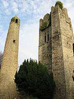
The round tower is the surviving remnant of St. Colmcille's monastic settlement. The only remaining relic of the medieval church is its belfry, from c. 1300, which is open to the public in summertime, when fine days afford the visitor a view of four counties from the tower's height. The original church is said to have fallen into ruin sometime in the seventeenth century. The new church of early Gothic style was built in 1811 on the foundations of the old.[49] The Sexton's Lodge is also of architectural interest and was built in 1870. The body of Brian Boru was said to have been brought there in 1014 to be waked after the Battle of Clontarf, while on the way to be buried in Armagh.[50]
Old Vicarage
Dating from around 1730, the Old Vicarage is now an apartment complex with part of original building retained.
Old Borough School
Located on Main Street, the building was designed by noted architect of the time, Francis Johnston. The story of the school is well documented.
In 2015, Wetherspoon bought the premises, and now operate The Old Borough as a public house.
St. Colmcille’s RC Church
On Chapel Lane, a pre-Catholic Emancipation church built in 1827 on a site donated by James Taylor of Swords House. The graveyard contains many interesting headstones, including one for nationalist politician Andrew Kettle, who was known as "Parnell’s Righthand Man."
The Courthouse
Designed by Alexander Tate, Swords Courthouse is located on North Street, and was built in 1845 in Classical style.
Teachers' residences
North Street – built in 1890. Now part of Fingal Community College.
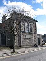
Carnegie Library
North Street, built in 1909. Redbrick building typical early 20th century. Now houses Swords Museum/Fingal Genealogy Centre.
Fingal County Hall
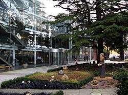
The award-winning modern Fingal County Hall by Bucholz McEvoy architects dominates the northern end of Main Street. It is built on the site of Swords House, the home of the Norman family, the Taylors of Swords. Records show the family arrived there in the 13th century and built a 'Mansion House' in 1403.
Leisure facilities
Ward River Valley Park
The Ward River Valley Park is a linear park on the banks of the Ward River approaching town. It covers an area of 89 ha. (220 acres) between Swords town centre and Knocksedan Bridge. Features of interest include some 12th-century fortifications, woodland habitats, wetlands and rolling grassland. There are viewing points, picnic sites, sports pitches and tennis courts.[51]
Swords Town Park (with Swords Castle)
Swords Town Park is a small park situated in the centre of the town of Swords, along the Ward River.[52] It has tennis courts and a playground. Swords Castle lies within the park. It is the former residence of the Archbishop of Dublin and it is the only fortified residence of the Archbishop to survive in a reasonable state today (see above).
Balheary Park
Balheary Park is north of the town centre near the confluence of the Broadmeadow River and the Ward River, which flow to the northern and southern edges of the park. It meets Swords Business Campus / Balheary Business Park on three sides, and has some playing pitches which are used by St. Colmcille's GAA club. In mid-2006, Fingal County Council built a skatepark and adjoining basketball courts/football court in Balheary Park. The park contains a bowl, a vertwall, a spine, some quarterpipes, and a section of boxes in the middle of the park.
Broadmeadow River Linear Park
The Broadmeadow Linear Park is a small park north of Applewood along the Broadmeadow River. Fingal County Council plan to extend the park eastwards to Balheary Park and westwards into the proposed Swords Regional Park.[53]
Proposed Swords Regional Park
A 65 ha. new regional park for Swords is to be formed north-east of Swords, stretching from the Rathbeale Road to the Broadmeadow River. The park will be immediately west of Oldtown and adjoining and ultimately extending into the Broadmeadow River Valley Linear Park. The Park will serve Swords and its hinterland, and will comprise active recreational and passive activities, commensurate with the Council's vision for the emerging city of Swords.[54]
National Show Centre
A little south of Swords, the National Show Centre is a modern exhibition and conference venue near to Dublin Airport.[55] It is owned by the Irish Kennel Club, who use it as their main venue for dog shows in Ireland.
The National Show Centre is used as the count centre during elections for the Dublin Fingal constituency.
Sports
Badminton
- Forest Badminton Club
- River Valley Badminton Club
Basketball
- Swords Basketball Club
BMX
In September 2013 a local campaign group approached Fingal County Council about the construction of a BMX track in the town. Fingal County Council said it has identified an area of the Ward River Valley that would be suitable for a BMX track, which could be developed quite quickly into a basic facility and improved over time. Prior to any works happening, the first stop is the formation of a club which would be fully insured and act to manage the facility.[56]
Boxing
Swords Boxing Club is located in the former Carnegie Library on North Street. The club was established over 50 years ago and hosts many tournaments.
Fingal Boxing Academy is affiliated with the Irish Amateur Boxing Association, was the first boxing club in Ireland to train female boxers and has trained several national champions. The club is located in Rivervalley, Swords.
GAA
There are three GAA clubs located in Swords:
- Fingallians, Lawless Memorial Park
- St Colmcille's, Holybanks, Glen Ellan Road
- St. Finians, River Valley
Golf
There are several golf courses close to the town, namely Swords Open Golf Course, Forrest Little Golf Club, Roganstown Golf and Country Club and Balheary "Par 3" Golf Course. There are also several driving ranges in the area with the Drynam Golf Centre being the first Driving Range in the country with automated tees.
Hockey
- Swords Hockey Club, Ladies club based in ALSAA Sports Grounds
Martial Arts
- Castle Taekwondo Club, Balheary Scout Hall[57]
- Ilyo Tae Kwon Do and Kick Boxing Club, St. Colmcille's GAA Hall, Glen Ellen[58]
- Hokubu Dojo Shotokan Karate Club, Seatown Business Park[59]
- Swords Judo Club, Loreto College, Rivervalley[60]
- River Valley TaeKwon-Do Club, River Valley Community Centre, River Valley[61]
- Shika-do Karate, Holywell Community Centre, Holywell[62]
Orienteering
Fingal Orienteers have mapped the Ward River Valley park, and the surrounding estates of Swords Manor, Brackenstown, River Valley and Knocksedan, and regularly hold orienteering events in the area.[63] They are also working on a new International Sprint Standard Orienteering map of the Applewood and Glen Ellan areas.
Soccer
- Swords Celtic FC, established in 1962, this club is the most successful in the town. The club has four Senior teams playing in the Leinster Senior League and over 30 schoolboy/girl teams playing in the NDSL Leagues. The main pitch and clubhouse are located at Balheary, Swords, the club also has two floodlight seven a side pitches.
- Swords Manor FC, Brackenstown Road[64]
- Swords Rovers FC, Balheary[65]
- Rivervalley Rangers, established in 1981 and home to legendary local players such as Liam Walshe, Paddy Blake and Gerry Dunne.
Tennis
- Swords Tennis Club, Swords Town Park
Events
Fingal Film Festival
Is an annual festival for independent filmmakers Website
Fingal Horticultural Show
The Fingal Horticultural Society holds their annual flower show in Swords every August.[66] It includes competition classes in Cut Flowers, Hanging Baskets, Pot Plants, Flower Arranging, Fruit, Vegetables, Cookery, Wine Making, Photography, Painting and Handcrafts, as well as special classes for children. The Fingal Horticultural Society also hold an annual Garden Competition, Allotment Competition and Pub Frontage Competition in Swords.
Flavours of Fingal Agricultural Show
The first Flavours of Fingal Show took place on the 21 and 22 July 2012 in Newbridge House near Donabate. The Flavours of Fingal Show combined the sights and sounds of an agricultural show. The farm section of the two-day show featured a program of livestock and sheep competitions, equestrian contests and other agricultural displays. Meanwhile, the historic walled garden of Newbridge House hosted the food producers section of the show and features an array of favourite local delights, cooking demos and all things food in Fingal. Also on offer over the course of the weekend were family and musical entertainment and a programme of walks, talks and festival antics.[67]
Dog shows
In 2012 over 80 dog shows were held in the National Show Centre.[68] The Celtic Winners Dog Show, held on St. Patrick's Day, is the most prestigious dog show in the country.
Fingal 10k Road Race
The first ever Fingal 10k Road Race took place on 22 July 2012 around the streets of Swords. It was part of the Dublin Race Series and over 4200 people entered. Michael MacDiarmada was the winner in a time of 00:31:31 and Siobhan O' Doherty was the first woman over the line in a time of 00:35:30. The event went well and since it has been run ever year.[69]
Economy
Retail
Swords is the home to a large retail and business park called Airside Retail and Business Park, on the southern fringe of the town, hosting many employers, including the European Headquarters of Kellogg's. Ingersoll Rand also has its corporate headquarters in the Airside Business Park.[70] East of the town, running parallel to Swords bypass, lies the large Swords Business Park, where The Hertz Corporation have a Shared Services Centre.
Swords also has a wide range of shops, banks, pubs and other businesses. These include one very large modern shopping centre, the The Pavilions Swords, off the R132, the recent extension of which has a multi-screen cinema; it also has branches of Penneys, SuperValu and Dunnes Stores. Several smaller shopping centres also exist.
Aviation
Swords is the closest town to Dublin Airport and the airport has provided a lot of employment to the area. In 2011 the airport handled over 18.7 million passengers and served over 171 routes with 62 airlines.[71] The airport serves as an operating base for Aer Lingus, Aer Lingus Regional, Air Contractors, CityJet, Orbest Orizonia Airlines, Ryanair and Thomson Airways, and as a maintenance base for Aer Lingus, CityJet, Dublin Aerospace,[72] Eirtech Aviation,[73] Etihad Airways[74] and Ryanair.
The Irish Aviation Authority[75] operate the Dublin Air Traffic Control Centre on the airport.
The headquarters of the Dublin Airport Authority and Ireland's four largest airlines are located in or near Swords. The Dublin Airport Authority, who manage Dublin, Cork and Shannon Airports, employ over 3,000 people and have their headquarters on the airport campus.[76] Aer Lingus,[77] Ireland's flag carrier, have their headquarters on the Dublin Airport campus. CityJet, part of the Air France-KLM group, has its headquarters in Swords Business Campus[78] and Air Contractors, part of the ASL Aviation group, has its head office on the Malahide Road in Swords.[79]
On Monday 27 January 2014 Ryanair,[80] Europe's largest low-cost airline, officially moved into their new €20m, 100,000 sq ft Dublin Head Office in Airside Business Park, having outgrown their previous office based within Dublin Airport.[81] The building was officially opened on Thursday 3 April 2014 by Taoiseach Enda Kenny,[82] Minister for Finance Michael Noonan[83] and the Lord Mayor of Dublin[84] Oisin Quinn.[85]
Logistics
In 2007 Tesco Ireland opened their new €70 million distribution centre in Lanestown, between Swords and Donabate. With a building footprint of over 68,000 m2 and a total volume of 1.55 million m2 the Tesco Ireland distribution centre is the largest building on the island of Ireland and the 8th largest building in the world. The building is over half a kilometre long and could fit 16 jumbo jets. It employs over 600 people and can process 1.5 million cases a week. It has 106 loading bays and supplies 106 stores up to 6 times a day.[86]
Pharmaceutical
Swords is the home to several international chemical producers and pharmaceutical giants, including Opec. Merck Sharp & Dohme (formally Organnon) employ over 500 people in their facility in Drynam, which manufactures women's health, anaesthesiology and mental health products.[87] Bristol Myers Squibb employ over 400 people in their Swords Laboratories bulk pharmaceutical plant on Watery Lane.[88] The Lonza Group employ 45 people in their European manufacturing facility for personal care and industrial biocides, also on Watery Lane.[89]
Food and Horticulture
Swords is located in the heart of Fingal, sometimes promoted as "the Food County," and is surrounded by farms growing various crops, including potatoes, wheat and barley. However unlike the rest of Fingal, a lot of the food distributed from Swords has been imported from abroad.
FoodCentral, marketed as "Ireland's national food park," is being developed south-west of Swords.[90] When complete it will cover an area of 113 hectares.
The Keeling's Group, who employ over 1700 people, have their headquarters in FoodCentral and use a lot of land around Swords.[91] The Keeling's Farms division annually grow 2,500 tonnes of soft fruits/berries from 5 hectares of glasshouse, tunnel and field crops in Swords. They grow Bramley apples in 139 acres of orchards and lettuce in 8 acres of glasshouses. Inside FoodCentral they have the only pepper growing facility in Ireland. Their 5 hectare high technology glasshouse produces 1,500 tonnes of red, orange, yellow and green peppers annually.[92] The Keeling's Multiples Division have a 12,500 square metre refrigerated facility in FoodCentral. They operate a large banana ripening facility for Chiquita which ripens over 3 million bananas each week. They also have separate ripening rooms for "Ready to eat" lines, such as peaches, pears, plums and avocados.[93][94]
Total Produce,[95] Ireland's largest Agribusiness[96] have two large facilities in Swords. Their facility in Swords Business Park includes a distribution and ripening centre for Fyffes[97] Cape, Outspan, Green Ace and TOP Fruit products. Their "Uniplumo" facility on the Rathbeale Road,[98] has 46,000 square metres of glasshouses for growing plants, flowers and tomatoes.
Education
Primary
The town is served by twelve primary schools:
- Gaelscoil Bhrian Boroimhe, Glen Ellan Road[99]
- Educate Together National School, Glen Ellan Road[100]
- Thornleigh Educate Together National School, Applewood[101]
- St. Cronan's Junior National School, Brackenstown Road[102]
- St. Cronan's Senior National School, Brackenstown Road[103]
- Church of Ireland Old Borough National School, Church Road
- St. Colmcille's Boys' National School, Chapel Lane[104]
- St. Colmcille's Girls' National School, Chapel Lane[105]
- Holy Family Junior National School, River Valley[106]
- Holy Family Senior National School, River Valley[107]
- Holywell Educate Together National School, Holywell Road[108]
- Scoil an Duinnigh, Drynam[109]
- Mooretown Primary School (under construction)[110]
- Fosterstown Primary School (in planning)[111]
- Second Mooretown Primary School (in planning)[110]
Secondary
There are four secondary schools serving the town:
- Loreto College (all-girls school), River Valley[112]
- Coláiste Choilm C.B.S. (all-boys school), Dublin Road[113]
- Fingal Community College, Seatown Road[114]
- St. Finian's Community College, Castlefarm[115]
- Mooretown Secondary School (under construction)[116]
Third level
- Swords Institute of Business and Technology (IBAT College), Forster Way[117]
- Accounting Technicians Ireland[118]
- Portobello Institute[119]
- Land has been reserved for a future university campus at Lissenhall in north Swords[120]
Further education
- National Learning Network, Balheary Industrial Estate[121]
- Fingal Adult Education Service, 7 The Plaza, Forster Way[122]
- Swords Youthreach, New Boro' School, North Street[123]
Other
- Pitman Training, Chamber Buildings, North Street[124]
- Irish College of English, 27 Town Centre Mall[125]
- Chris Mee Safety Engineering[126]
There is also a FÁS training centre, the Fingal Adult Literacy and Education Centre, and a beauty college registered with ITEC & CIBTAC called Lenagh's College.
Religion
| Population by religion (Census 2011)[127] | Persons |
|---|---|
| Roman Catholic | 34021 |
| Orthodox (Greek, Coptic, Russian) | 1335 |
| Church of Ireland, England, Anglican, Episcopalian | 944 |
| Apostolic or Pentecostal | 201 |
| Presbyterian | 195 |
| Other Christian religion | 454 |
| Total Christian religions | 37150 |
| Muslim (Islamic) | 579 |
| Other stated religions | 1003 |
| No religion | 3006 |
| Not stated | 1000 |
| Total Population | 42738 |
Christianity
Roman Catholicism is the predominant religion in Swords. The town has six Roman Catholic churches. St. Colmcille's, the Church of the Visitation and Our Lady Queen of Heaven are all within Swords parish. St. Cronan's and St. Finian's each belong to distinct parishes, while the Church of the Immacuate Conception lies within Donabate parish. There are also a further eight Christian churches and a retreat centre.
- St. Columba's Church of Ireland, Church Road[134]
- Other Protestant and evangelical
- The Syriac Orthodox Church – meets as the St. Ignatius Jacobite Congregation in St Columba's Church (Church of Ireland), Church Road, Swords[139]
- Jehovah's Witnesses, Kingdom Hall, Kettles Lane[140]
- Retreat centre
- Emmaus Retreat and Conference Centre, Lissenhall (includes private chapel and 2 prayer rooms)[141]
Islam
- The Dublin Welfare Society manage a makeshift mosque in a Swords industrial estate[142]
Notable residents
- Saint Colmcille, founder of Swords.
- Eleanor Ambrose, Catholic heiress, is from Swords.
- Eddie McLoughlin, Irish international Judoka, won two All-Ireland senior titles (2013 & 2014),[143] is from Swords.
- Conan Byrne, Irish footballer, is from Swords.
- Ed Byrne, comedian, is from Swords.
- Jason Byrne, comedian, lives in Swords.
- Bill Cullen, businessman, presenter of TV show, "The Apprentice", owns and works in Europa Academy in Swords.
- Duncan Campbell, video artist, won 2014 Turner Prize, grew up in Swords.
- Paul Flynn, Dublin and Fingallians GAA player, lives in Swords.
- Ronan Keating, singer-songwriter, lived in the Highfields residential development on the town's southern side. He now lives in Malahide, east of Swords.
- Aidan McGrath, Irish Youth Activist, born in Swords.
- Richard Montgomery, hero of the American revolution, born in Swords.
- Blessed Francis Taylor, former Mayor of Dublin, martyr, born in Swords.
- Kodaline, a popular band, come from Swords
Local Politicians
- Alan Farrell, TD, Fine Gael
- Clare Daly, TD, United Left Alliance/Socialist Party
- Louise O'Reilly TD, Sinn Féin
- Darragh O'Brien, TD, Fianna Fáil
- Brendan Ryan, TD, Labour Party
See also
- Applewood, a neighbourhood in northwestern Swords.
- Brackenstown, a neighbourhood in western Swords.
- Holywell, a neighbourhood in southeastern Swords.
- Knocksedan, a neighbourhood in western Swords.
- Rathbeale, a neighbourhood in western Swords.
- List of abbeys and priories in County Dublin
- List of towns and villages in Ireland
References
- ↑ logainm.ie Official Placenames Database of Ireland
- ↑ Fingal County Council Swords Strategic Vision 2035
- ↑ Fingal County Council
- ↑ Swords Total Area – Swords Local Electoral Area Central Statistics Office
- ↑ Swords Urban Area – Swords and Kinsealy-Drinan Census Towns Central Statistics Office
- ↑ Swords Metro Area – Swords Development Boundary Fingal County Council
- ↑ Swords Dimensions Ordnance Survey Ireland
- ↑ Swords Max Elevation Ordnance Survey Ireland
- ↑ Swords Min Elevation Ordnance Survey Ireland
- ↑ Swords Total Population – Swords Local Electoral Area Census 2011
- ↑ Swords Urban Population – Swords and Kinsealy Drinan Census Towns Census 2011
- ↑ Swords Ethnic or Cultural Background Census 2011
- ↑ Swords Religion Census 2011
- ↑ http://www.independent.ie/life/home-garden/homes/loyal-residents-of-dublin-suburb-keep-demand-and-hype-high-31500623.html
- 1 2 Placenames Database of Ireland Swords Demesne
- ↑ Your Swords, an Emerging City, Strategic Vision 2035 Fingal County Council
- ↑ Retail Excellence Ireland Survey 2012
- ↑ Irish Business Against Litter Survey, 2003
- 1 2 Irish Business Against Litter Survey 2011
- ↑ Sidwell, Keith (1995), Reading Medieval Latin, Cambridge: Cambridge University Press, p. 70, ISBN 0-521-44747-X
- ↑ http://swordsdublin.net/_dublin_history.html
- ↑ Hickey, Raymond, 2005: Dublin English: evolution and change
- ↑ Barrysparks Local Area Plan – Environmental Report Fingal County Council
- ↑ Irish Business Against Litter Survey 2003
- 1 2 Swords Historical Society
- ↑ Placenames Database of Ireland Nethercross
- ↑ Met Eireann
- ↑ Census 2011 Population Density
- ↑ Dashed red line
- ↑ Appendix 2
- ↑ Boundary layer: settlements
- ↑ Dublin Bus timetables
- ↑ Canal Cordon Traffic Count Dublin City Council (page 20)
- ↑ Swords Express timetables
- ↑ Buses from Dublin Airport
- ↑ Bus Eireann timetables
- ↑ Aircoach timetables
- ↑ John McGinley timetables
- ↑ Citylink timetables
- ↑ gobus timetables
- ↑ JJ Kavanagh timetables
- ↑ Ardcavan timetables
- ↑ Wexford Bus timetables
- ↑
- ↑ Celtic Helicopters Knocksedan Heliport
- ↑ Irish Helicopters Knocksedan Heliport
- ↑ Swords Castle – The Tudors Evening Herald
- ↑ Swords Castle – Visiting Information Fingal Tourism
- ↑ St. Columba's Round Tower Fingal Tourism
- ↑ http://homepage.eircom.net/~aroundswords/swordshistory.htm
- ↑ Ward River Valley Park
- ↑ Swords Castle and Town Park
- ↑ Broadmeadow Linear Park (Section 3.1.2)
- ↑ Swords Regional Park (Section 3.1.3)
- ↑ National Show Centre
- ↑ Swords BMX Track
- ↑ Castle Taekwondo Club
- ↑ Ilyo Tae Kwon Do and Kick Boxing Club
- ↑ Red Dragon Shotokan Karate Club
- ↑ Swords Judo Club
- ↑
- ↑
- ↑ Fingal Orienteers
- ↑ Swords Manor FC
- ↑ Swords Rovers FC
- ↑ Fingal Horticultural Society
- ↑ Flavours of Fingal
- ↑ Irish Kennel Club Show Dates search Cloghran
- ↑ Fingal 10k
- ↑ "Contact Us." Ingersoll Rand. Retrieved on 18 January 2011. "Global Headquarters 170/175 Lakeview Drive Airside Business Park Swords, Co. Dublin Ireland."
- ↑ Dublin Airport – Airlines and Destinations
- ↑ Dublin Aerospace
- ↑ Eirtech Aviation
- ↑ Etihad Airways
- ↑ Irish Aviation Authority
- ↑ Dublin Airport Authority
- ↑ Aer Lingus
- ↑ CityJet
- ↑ Air Contractors
- ↑ Ryanair
- ↑ Ryanair Official website News Article
- ↑ Enda Kenny
- ↑ Michael Noonan
- ↑ Lord Mayor Of Dublin
- ↑ Oisin Quinn
- ↑ Tesco Ireland Distribution Centre
- ↑ MSD Ireland
- ↑ Bristol-Myers Squibb Ireland
- ↑ Lonza Swords
- ↑ FoodCentral
- ↑ Keeling's Group
- ↑ Keeling's Farms
- ↑ Keeling's Multiples
- ↑ Chiquita Bananas
- ↑ Total Produce
- ↑ Total Produce – Top Irish Agribusiness Companies
- ↑ Fyffes Swords
- ↑ Uniplumo (Ireland)
- ↑ Gaelscoil Bhrian Boroimhe
- ↑ Swords Educate Together National School
- ↑ Thornleigh Educate Together National School
- ↑ St. Cronan's Junior National School
- ↑ St. Cronan's Senior National School
- ↑ St. Colmcille's Boys' National School
- ↑ St. Colmcille's Girls' National School
- ↑ Holy Family Junior National School
- ↑ Holy Family Senior National School
- ↑ Holywell Educate Together National School
- ↑ Scoil an Duinnigh
- 1 2 Proposed Mooretown Primary Schools Page 2
- ↑ Fosterstown Primary School Page 39
- ↑ Loreto College Swords
- ↑ Coláiste Choilm C.B.S. Swords
- ↑ Fingal Community College
- ↑ St. Finian's Community College
- ↑ Proposed Mooretown Secondary School Page 2
- ↑ Swords Institute of Business and Technology (IBAT College)
- ↑ Accounting Technicians Ireland
- ↑ Portobello Institute
- ↑ Potential Lissenhall University Campus page 89
- ↑ National Learning Network – Swords
- ↑ Fingal Adult Education Service – Swords
- ↑ Swords Youthreach
- ↑ Pitman Training – Swords
- ↑ Irish College of English – Swords
- ↑ Chris Mee Safety Engineering
- ↑ Census 2011 Central Statistics Office
- ↑ St. Colmcille's Church
- ↑ St. Cronan's Church
- ↑ St. Finian's Church
- ↑ Church of the Visitation
- ↑ Church of the Immacuate Conception
- ↑ Our Lady Queen of Heaven Chapel
- ↑ St. Columba's Church of Ireland
- ↑ Swords Baptist Church
- ↑ Lighthouse Baptist Church
- ↑ Apostolic Faith Church
- ↑ Churchtown Trust Churchtown Trust Prayer Room
- ↑ St. Ignatius Jacobite Syriac Orthodox Congregation
- ↑ Kingdom Hall, Kettles Lane
- ↑ Emmaus Retreat and Conference Centre
- ↑ Swords Mosque
- ↑ "Eddie McLoughlin, Judoka, JudoInside". www.judoinside.com. Retrieved 2016-04-16.
External links
| Wikimedia Commons has media related to Swords, Dublin. |
| Wikivoyage has a travel guide for Swords. |