Grigna
| Grigna | |
|---|---|
 Grignone (right) with the Grignetta | |
| Highest point | |
| Elevation | 2,410 m (7,910 ft) [1] |
| Prominence | 1,687 m (5,535 ft) [1] |
| Listing | Ultra |
| Coordinates | 45°57′12″N 09°23′15″E / 45.95333°N 9.38750°ECoordinates: 45°57′12″N 09°23′15″E / 45.95333°N 9.38750°E [1] |
| Geography | |
 Grigna Location in the Alps | |
| Location | Lombardy, Italy |
| Parent range | Bergamo Alps |
The Grigna is a mountain massif in the province of Lecco, Lombardy, northern Italy, with an elevation of 2,410 metres (7,907 ft). It is part of the Bergamo Alps, and it has two peaks, Grignone or Grigna settentrionale, the higher, and the lower Grignetta or Grigna meridionale (2,177 m).
Geography and climbing routes
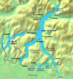
To the southwest, the Grigna massif descends precipitously towards an arm of Lake Como known as Lake Lecco. To the east, the mountain runs more gently through fields and forested land into Valsassina. The northern side of the mountain, which is known for its many caves and crevices, arrives at Passo del Cainallo and the town of Esino Lario.
The easiest route to the Grignone peak is from the southeast starting at the town of Ballabio in Valsassina. Further up the valley is Pasturo, another traditional starting point for the ascent. The mountain's relative isolation affords it panoramic views of Alps towards the north and on a clear day the Milan cathedral can be seen to the southwest.
The Rifugio Brioschi (a mountain hut with food and has accommodations) sits on the Grignone peak and is open most of the year. There are other rifugios lower down on the massif including Rifugio Bietti, Rifugio Arnaldo Bogani, Rifugio Pialeral and Rifugio Rosalba.
Every year in September Grigna hosts a Skyrunning event known as the "Trofeo Scaccabarozzi" which starts and finishes in Pasturo. The route passes over Grigna Meridionale and Grigna Settrionale and covers a distance of 43 km.
References
- 1 2 3 European high-prominence peaks". Peaklist.org. Retrieved 2014-05-19.
External links
- Official website of the Grigna Regional Park (English) (Italian)
| Settlements |
|  |
|---|---|---|
| Islands | ||
| Rivers | ||
| Valleys | ||
| Mountains | ||
| Landmarks | ||
| Films | ||
| People | ||