Fourth Crossing, California
Coordinates: 38°07′53″N 120°38′05″W / 38.13139°N 120.63472°W
| Fourth Crossing | |
|---|---|
| Unincorporated community | |
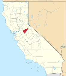
 Fourth Crossing  Fourth Crossing Location in California | |
| Coordinates: 38°07′53″N 120°38′05″W / 38.13139°N 120.63472°W | |
| Country | United States |
| State | California |
| County | Calaveras County |
| Elevation[1] | 922 ft (281 m) |
| Reference no. | 258 |
Fourth Crossing (formerly, Foremans) is an unincorporated community in Calaveras County, California. It lies at an elevation of 922 feet (281 m) and is located on State Route 49 at 38°07′53″N 120°38′05″W / 38.13139°N 120.63472°W. The community is in ZIP code 95248 and area code 209.
Located on San Antonio Creek, the town was originally named Foremans, after its founder David Foreman, but became known as Fourth Crossing, as it was located at the fourth river crossing on the Stockton–Murphys Road. Foreman had established a ferry to cross the river, which they replaced with a toll bridge. The bridge is still standing to the west of the bridge that Hwy. 49 runs on.
The town was famous in the 1850s for its rich placer ores, which were replaced by lode mining. After the gold ran out, the town continued to operate as an important stagecoach and freighting depot, serving the southern mines until after the turn of the 20th century. The county's first Justice Court was established here, complete with a Justice of the Peace.
Today the town is little more than a few buildings and it is registered as California Historical Landmark #258.[2]
A post office was opened in 1855 and discontinued in 1888; re-established in 1892 and closed for good in 1925.[3]
Politics
In the state legislature, Fourth Crossing is in the 8th Senate District, represented by Republican Tom Berryhill,[4] and the 5th Assembly District, represented by Republican Frank Bigelow.[5] Federally, Fourth Crossing is in California's 4th congressional district, represented by Republican Tom McClintock.[6]
References
- ↑ U.S. Geological Survey Geographic Names Information System: Fourth Crossing, California
- ↑ "Fourth Crossing". Office of Historic Preservation, California State Parks. Retrieved 2012-10-06.
- ↑ Durham, David L. (1998). California's Geographic Names: A Gazetteer of Historic and Modern Names of the State. Clovis, Calif.: Word Dancer Press. p. 774. ISBN 1-884995-14-4.
- ↑ "Senators". State of California. Retrieved March 21, 2013.
- ↑ "Members Assembly". State of California. Retrieved March 21, 2013.
- ↑ "California's 4th Congressional District - Representatives & District Map". Civic Impulse, LLC. Retrieved March 1, 2013.