Valley Springs, California
| Valley Springs | |
|---|---|
| Census designated place | |
|
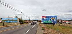
Entering Valley Springs from the west on highway 12. | |
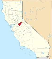
 Location in Calaveras County and the state of California | |
 Valley Springs Location in the United States | |
| Coordinates: 38°11′30″N 120°49′45″W / 38.19167°N 120.82917°WCoordinates: 38°11′30″N 120°49′45″W / 38.19167°N 120.82917°W | |
| Country |
|
| State |
|
| County | Calaveras |
| Area[1] | |
| • Total | 9.875 sq mi (25.579 km2) |
| • Land | 9.872 sq mi (25.570 km2) |
| • Water | 0.003 sq mi (0.009 km2) 0.04% |
| Elevation | 669 ft (204 m) |
| Population (April 1, 2010) | |
| • Total | 3,553 |
| • Density | 360/sq mi (140/km2) |
| Time zone | Pacific (UTC-8) |
| • Summer (DST) | PDT (UTC-7) |
| ZIP codes | 95226, 95252 |
| Area code | 209 |
| FIPS code | 06-81890 |
| GNIS feature IDs | 1660090, 2409398 |
| Reference no. | 251 |
Valley Springs (formerly, Spring Valley and Valley Spring) is a census-designated place (CDP) in Calaveras County, California, United States. The population was 3,553 at the 2010 census, up from 2,560 at the 2000 census. The town is located at the intersection of State Route 12 and Route 26. It is registered as California Historical Landmark #251.[2]
History
In 1885 the San Joaquin and Sierra Nevada Railroad completed a narrow-gauge railroad from Brack's Landing to Valley Springs. There was an old train station known "Kokines station". The line eventually became the property of Southern Pacific Railroad, and a standard-gauge line into Valley Springs was substituted.
A post office was opened here in 1872, closed in 1879, and re-established in 1882.[3]
Geography
According to the United States Census Bureau, the CDP has a total area of 9.9 square miles (26 km2), 99.96% of it land.
Climate
According to the Köppen Climate Classification system, Valley Springs has a warm-summer Mediterranean climate, abbreviated "Csa" on climate maps.[4]
Demographics
2010
The 2010 United States Census[5] reported that Valley Springs had a population of 3,553. The population density was 359.8 people per square mile (138.9/km²). The racial makeup of Valley Springs was 3,047 (85.8%) White, 35 (1.0%) African American, 39 (1.1%) Native American, 70 (2.0%) Asian, 6 (0.2%) Pacific Islander, 179 (5.0%) from other races, and 177 (5.0%) from two or more races. Hispanic or Latino of any race were 454 persons (12.8%).
The Census reported that 3,553 people (100% of the population) lived in households, 0 (0%) lived in non-institutionalized group quarters, and 0 (0%) were institutionalized.
There were 1,343 households, out of which 455 (33.9%) had children under the age of 18 living in them, 793 (59.0%) were opposite-sex married couples living together, 169 (12.6%) had a female householder with no husband present, 55 (4.1%) had a male householder with no wife present. There were 91 (6.8%) unmarried opposite-sex partnerships, and 12 (0.9%) same-sex married couples or partnerships. 249 households (18.5%) were made up of individuals and 101 (7.5%) had someone living alone who was 65 years of age or older. The average household size was 2.65. There were 1,017 families (75.7% of all households); the average family size was 2.97.
The population was spread out with 886 people (24.9%) under the age of 18, 254 people (7.1%) aged 18 to 24, 734 people (20.7%) aged 25 to 44, 1,060 people (29.8%) aged 45 to 64, and 619 people (17.4%) who were 65 years of age or older. The median age was 42.7 years. For every 100 females there were 98.0 males. For every 100 females age 18 and over, there were 95.0 males.
There were 1,530 housing units at an average density of 154.9 per square mile (59.8/km²), of which 1,007 (75.0%) were owner-occupied, and 336 (25.0%) were occupied by renters. The homeowner vacancy rate was 4.0%; the rental vacancy rate was 9.8%. 2,552 people (71.8% of the population) lived in owner-occupied housing units and 1,001 people (28.2%) lived in rental housing units.
2000
As of the census[6] of 2000, there were 2,560 people, 960 households, and 740 families residing in the CDP. The population density was 260.7 people per square mile (100.7/km²). There were 1,021 housing units at an average density of 104.0 per square mile (40.1/km²). The racial makeup of the CDP was 87.54% White, 0.66% Black or African American, 1.80% Native American, 1.37% Asian, 0.12% Pacific Islander, 4.84% from other races, and 3.67% from two or more races. 10.74% of the population were Hispanic or Latino of any race.
There were 960 households out of which 34.6% had children under the age of 18 living with them, 61.6% were married couples living together, 11.5% had a female householder with no husband present, and 22.9% were non-families. 19.2% of all households were made up of individuals and 8.0% had someone living alone who was 65 years of age or older. The average household size was 2.67 and the average family size was 3.02.
In the CDP the population was spread out with 27.2% under the age of 18, 7.4% from 18 to 24, 24.5% from 25 to 44, 25.4% from 45 to 64, and 15.5% who were 65 years of age or older. The median age was 39 years. For every 100 females there were 96.5 males. For every 100 females age 18 and over, there were 93.1 males.
The median income for a household in the CDP was $43,125, and the median income for a family was $45,327. Males had a median income of $36,524 versus $29,861 for females. The per capita income for the CDP was $19,670. About 9.7% of families and 9.9% of the population were below the poverty line, including 14.5% of those under age 18 and 8.7% of those age 65 or over.
Politics
In the state legislature, Valley Springs is in the 8th Senate District, represented by Republican Tom Berryhill,[7] and the 5th Assembly District, represented by Republican Frank Bigelow.[8] Federally, Valley Springs is in California's 4th congressional district, represented by Republican Tom McClintock.[9]
References
- ↑ "2010 Census U.S. Gazetteer Files – Places – California". United States Census Bureau.
- ↑ "Valley Springs". Office of Historic Preservation, California State Parks. Retrieved 2012-10-06.
- ↑ Durham, David L. (1998). California's Geographic Names: A Gazetteer of Historic and Modern Names of the State. Clovis, Calif.: Word Dancer Press. p. 841. ISBN 1-884995-14-4.
- ↑ Climate Summary for Valley Springs, California
- ↑ "2010 Census Interactive Population Search: CA - Valley Springs CDP". U.S. Census Bureau. Retrieved July 12, 2014.
- ↑ "American FactFinder". United States Census Bureau. Retrieved 2008-01-31.
- ↑ "Senators". State of California. Retrieved March 21, 2013.
- ↑ "Members Assembly". State of California. Retrieved March 21, 2013.
- ↑ "California's 4th Congressional District - Representatives & District Map". Civic Impulse, LLC. Retrieved March 2, 2013.