Wilseyville, California
Coordinates: 38°22′45″N 120°30′53″W / 38.37917°N 120.51472°W
| Wilseyville | |
|---|---|
| Unincorporated community | |
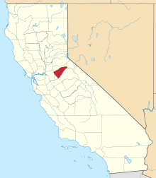
 Wilseyville  Wilseyville Location in California | |
| Coordinates: 38°22′45″N 120°30′53″W / 38.37917°N 120.51472°W | |
| Country | United States |
| State | California |
| County | Calaveras County |
| Elevation[1] | 2,769 ft (844 m) |
Wilseyville is an unincorporated community in Calaveras County, California. It lies at an elevation of 2769 feet (844 m). Wilseyville's post office was established in 1947;[2] it has the zip code 95257. Wilseyville was named after Lawrence A. Wilsey, an executive at the American Forest Products Company.[2]
Wilseyville is notorious for being the location of the ranch where serial killers Leonard Lake and Charles Ng killed and disposed of some of their victims. Their spree ended in June 1985, when Ng was spotted loading stolen merchandise into a car driven by Lake in South San Francisco. Ng fled, but Lake was arrested at the scene for illegally outfitting a .22 caliber pistol with a silencer. He swallowed a cyanide pill while in police custody and died four days later. Police found human remains and other evidence at the Wilseyville ranch and began a manhunt for Ng. He was arrested in Canada while shoplifting and was extradited to the United States after serving a sentence in Canada. Ng was sentenced to death after being found guilty of 11 of 12 counts of murder. It was later ruled that Lake and Ng were responsible for the 12th victim, though they are thought to have killed as many as 25 people.
Climate
Area has a Köppen Climate Classification of Csb, which is a dry-summer subtropical climate often referred to as "Mediterranean".[3]
| Climate data for Wilseyville, California | |||||||||||||
|---|---|---|---|---|---|---|---|---|---|---|---|---|---|
| Month | Jan | Feb | Mar | Apr | May | Jun | Jul | Aug | Sep | Oct | Nov | Dec | Year |
| Average high °C (°F) | 11 (51) |
14 (58) |
16 (60) |
19 (67) |
24 (75) |
28 (83) |
33 (91) |
33 (91) |
30 (86) |
24 (76) |
16 (61) |
10 (50) |
10 (50) |
| Average low °C (°F) | 1 (33) |
1 (34) |
2 (36) |
4 (39) |
7 (45) |
10 (50) |
13 (56) |
13 (55) |
11 (52) |
7 (45) |
3 (37) |
1 (33) |
6 (43) |
| Average precipitation cm (inches) | 23 (9) |
18 (7) |
18.3 (7.2) |
10 (4) |
4.6 (1.8) |
1.5 (0.6) |
0.5 (0.2) |
0.5 (0.2) |
1.8 (0.7) |
6.1 (2.4) |
15 (6) |
19.6 (7.7) |
118.6 (46.7) |
| Source: Weatherbase [4] | |||||||||||||
References
- ↑ U.S. Geological Survey Geographic Names Information System: Wilseyville, California
- 1 2 Durham, David L. (1998). California's Geographic Names: A Gazetteer of Historic and Modern Names of the State. Clovis, Calif.: Word Dancer Press. p. 847. ISBN 1-884995-14-4.
- ↑ Climate Summary for Wilseyville, CA
- ↑ "Weatherbase.com". Weatherbase. 2013. Retrieved on August 20, 2013.