Poverty Bar, California
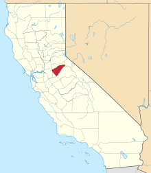
Poverty Bar[1] is a former settlement in Calaveras County, California now covered by the waters of Camanche Reservoir. Poverty Bar is located at latitude - longitude coordinates (also known as lat-long or GPS coordinates) of N 38.22547 and W -120.90938. Poverty Bar is shown in the center of the topographic (topo) map, which is sourced from the United States Geographical Survey map USGS WALLACE quad. The nearest major town is Campo Seco, California.[2]
Poverty Bar was founded south of the Mokelumne River from Lancha Plana in Amador County as a gold mining town during the California Gold Rush, nearby Camanche, California, Cat Camp, and Sand Hill.
A post office was opened in Poverty Bar in 1858 and closed in 1864.[1]
Poverty Bar had a major fire on the night of September 7, 1859. The fire originated in the grocery store of Lorengo & Co., near the center of the town, and spread so rapidly in different directions that in a few minutes the entire town was in flames. It appeared to have been arson, the second such incident there during that summer.[3]
During the American Civil War the town raised the Union Guard a California Militia Company in 1861 and maintained it until its declining population forced it to be moved. "On July 23, 1866, the company was reorganized and their headquarters moved to Campo Seco."[4]
In 1964, before the Comanche Reservoir was filled, the graves in the cemetery of Poverty Bar were transferred to the old Pioneer Cemetery and the People's Cemetery in San Andreas.[5]
Its location is at 38°13′30″N 120°54′30″W / 38.22500°N 120.90833°WCoordinates: 38°13′30″N 120°54′30″W / 38.22500°N 120.90833°W.[1]
References
- 1 2 3 Durham, David L. (1998). California's Geographic Names: A Gazetteer of Historic and Modern Names of the State. Clovis, Calif.: Word Dancer Press. p. 817. ISBN 1-884995-14-4.
- ↑ Poverty Bar, USGS WALLACE Quad, California, Topographic Map
- ↑ Weekly Stockton Democrat, Stockton, San Joaquin Co., CA, Sunday, 11 Sept 1859; from Ancestry.co.uk.
- ↑ Outline History of Calif. National Guard, Vol. 2, #107.
- ↑ Mildred Brooke Hoover, Douglas E. Kyle Historic spots in California, Stanford University Press, 2002, pg. 46.