Altaville, California
| Altaville | |
|---|---|
| Unincorporated community | |
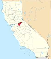
 Altaville  Altaville Location in California | |
| Coordinates: 38°05′02″N 120°33′43″W / 38.08389°N 120.56194°WCoordinates: 38°05′02″N 120°33′43″W / 38.08389°N 120.56194°W | |
| Country | United States |
| State | California |
| County | Calaveras County |
| Elevation[1] | 1,542 ft (470 m) |
| Reference no. | 288[2] |
Altaville (formerly, Cherokee Flat, Forks-of-the Road, Low Divide, and Winterton[3]) is a former unincorporated community in Calaveras County, California, now located in the northwest portion of the city of Angels Camp. It sits at an elevation of 1,542 feet (470 m) above sea level and is located at 38°05′02″N 120°33′43″W / 38.08389°N 120.56194°W, at the intersections of SR 49 and SR 4. The community is in ZIP code 95221 and area code 209.
The town was established in 1852 on Cherokee Creek. Notorious bandit Joaquin Murrieta supposedly spent so much time here that a mountain northwest of the creek was named Joaquin Mountain. Although gold was discovered here in 1854, it didn't last long, but the town survived due to its position as an important point for supplies and machinery. D.D. Demerest established a foundry here in 1854, and others soon followed. Most of the stamp mills and a large part of the mining machinery erected in Calaveras and Tuolumne Counties were built at the Altaville Foundry. A brick schoolhouse was built at Altaville in 1858 and the townsite was established in 1873.
A post office was established in 1904, closed in 1943, and re-established in 1944.[3]
Altaville was also the site of an archaeological hoax, the Calaveras Skull.
The town today is registered as California Historical Landmark #288.[2]
Politics
In the state legislature, Altaville is in the 8th Senate District, represented by Republican Tom Berryhill,[4] and the 5th Assembly District, represented by Republican Frank Bigelow.[5] Federally, Altaville is in California's 4th congressional district, represented by Republican Tom McClintock.[6]
References
- ↑ U.S. Geological Survey Geographic Names Information System: Altaville, California
- 1 2 "Altaville". Office of Historic Preservation, California State Parks. Retrieved 2012-10-06.
- 1 2 Durham, David L. (1998). California's Geographic Names: A Gazetteer of Historic and Modern Names of the State. Clovis, Calif.: Word Dancer Press. p. 740. ISBN 1-884995-14-4.
- ↑ "Senators". State of California. Retrieved March 21, 2013.
- ↑ "Members Assembly". State of California. Retrieved March 21, 2013.
- ↑ "California's 4th Congressional District - Representatives & District Map". Civic Impulse, LLC. Retrieved March 1, 2013.