Denver
| Denver, Colorado | |||
|---|---|---|---|
| Consolidated city-county | |||
| City and County of Denver | |||
|
Top to Bottom, Left to Right: Denver Skyline, Colorado State Capitol, Red Rocks Amphitheatre, Sports Authority Field at Mile High, RTD Light Rail train Downtown. | |||
| |||
|
Nickname(s): The Mile-High City[1] Queen City of the West Queen City of the Plains,[2] Wall Street of the West[3] | |||
 Location of Denver within Colorado | |||
| Coordinates: 39°45′43″N 104°52′52″W / 39.761850°N 104.881105°WCoordinates: 39°45′43″N 104°52′52″W / 39.761850°N 104.881105°W[4] | |||
| Country |
| ||
| State |
| ||
| City and County | Denver[5] | ||
| Founded | November 17, 1858, as Denver City, K.T.[6] | ||
| Incorporated | November 7, 1861, as Denver City, C.T.[7] | ||
| Consolidated | November 15, 1902, as the City and County of Denver | ||
| Named for | James W. Denver | ||
| Government | |||
| • Type | Consolidated City and County[5] | ||
| • Body | Denver City Council | ||
| • Mayor | Michael Hancock (D)[8] | ||
| Area[9] | |||
| • Consolidated city-county | 155 sq mi (400 km2) | ||
| • Land | 153 sq mi (400 km2) | ||
| • Water | 1.6 sq mi (4 km2) 1.1% | ||
| • Metro | 8,414.4 sq mi (21,793 km2) | ||
| Elevation[10] | 5,130–5,690 ft (1,564–1,731 m) | ||
| Population (2010)[11] | |||
| • Consolidated city-county | 600,158 | ||
| • Estimate (2015)[12] | 682,545 | ||
| • Rank | US: 19th | ||
| • Density | 4,044/sq mi (1,561/km2) | ||
| • Urban | 2,374,203 (US: 18th) | ||
| • Metro | 2,814,330 (US: 19th) | ||
| • CSA | 3,418,876 (US: 16th) | ||
| Demonym(s) | Denverite | ||
| Time zone | MST (UTC–07:00) | ||
| • Summer (DST) | MDT (UTC–06:00) | ||
| ZIP codes | 80201–80212, 80214–80239, 80241, 80243–80244, 80246–80252, 80256–80266, 80271, 80273–80274, 80279–80281, 80290–80291, 80293–80295, 80299, 80012, 80014, 80022, 80033, 80123, 80127[13] | ||
| Area code(s) | 303 and 720 | ||
| INCITS place code | 0820000 | ||
| GNIS feature ID | 0201738 | ||
| Highways | I-25, I-70, I-76, I-225, I-270, US 285, US 287, SH 2, SH 26, SH 30, SH 35, SH 83, SH 88, SH 95, SH 121, SH 177, SH 265, SH 470, E-470 | ||
| Website | denvergov.org | ||
|
| |||


Denver (/ˈdɛnvər/), officially the City and County of Denver, is the capital and most populous municipality of the U.S. state of Colorado. Denver is located in the South Platte River Valley on the western edge of the High Plains just east of the Front Range of the Rocky Mountains. The Denver downtown district is located immediately east of the confluence of Cherry Creek with the South Platte River, approximately 12 mi (19 km) east of the foothills of the Rocky Mountains. Denver is nicknamed the Mile-High City because its official elevation is exactly one mile (5,280 ft or 1,610 m) above sea level, making it one of the highest major cities in the United States.[9] The 105th meridian west of Greenwich, the longitudinal reference for the Mountain Time Zone, passes directly through Denver Union Station.
Denver is ranked as a Beta- world city by the Globalization and World Cities Research Network. With a 2015 estimated population of 682,545, Denver ranks as the 19th-most populous U.S. city, and with a 2.8% increase in 2015, the city is also the fastest growing major city in the United States.[14] The 10-county Denver-Aurora-Lakewood, CO Metropolitan Statistical Area had an estimated 2015 population of 2,814,330 and ranked as the 19th most populous U.S. metropolitan statistical area.[15] The 12-city Denver-Aurora, CO Combined Statistical Area had an estimated 2015 population of 3,418,876, which ranks as the 16th most populous U.S. metropolitan area.[16] Denver is the most populous city of the 18-county Front Range Urban Corridor, an oblong urban region stretching across two states with an estimated 2015 population of 4,757,713.[17] Denver is the most populous city within a 500-mile (800 km) radius in the Mountain West and the second-most populous city in the Southwestern United States after Phoenix, Arizona. In 2016, Denver was named the best place to live in the USA by U.S. News & World Report.[18]
History
In the summer of 1858, during the Pike's Peak Gold Rush, a group of gold prospectors from Lawrence, Kansas established Montana City as a mining town on the banks of the South Platte River in what was then western Kansas Territory. This was the first settlement in what was later to become the city of Denver. The site faded quickly, however, and by the summer of 1859 it was abandoned in favor of Auraria (named after the gold mining town of Auraria, Georgia), and St. Charles City.[19]
On November 22, 1858, General William Larimer, a land speculator from eastern Kansas Territory, placed cottonwood logs to stake a claim on the bluff overlooking the confluence of the South Platte River and Cherry Creek, across the creek from the existing mining settlement of Auraria, and on the site of the existing townsite of St. Charles. Larimer named the town site Denver City to curry favor with Kansas Territorial Governor James W. Denver.[20] Larimer hoped that the town's name would help make it the county seat of Arapaho County, but unknown to him Governor Denver had already resigned from office. The location was accessible to existing trails and was across the South Platte River from the site of seasonal encampments of the Cheyenne and Arapaho. The site of these first towns is now the site of Confluence Park near downtown Denver. Larimer, along with associates in the St. Charles City Land Company, sold parcels in the town to merchants and miners, with the intention of creating a major city that would cater to new emigrants. Denver City was a frontier town, with an economy based on servicing local miners with gambling, saloons, livestock and goods trading. In the early years, land parcels were often traded for grubstakes or gambled away by miners in Auraria.[20] In May 1859, Denver City residents donated 53 lots to the Leavenworth & Pike's Peak Express in order to secure the region's first overland wagon route. Offering daily service for "passengers, mail, freight, and gold," the Express reached Denver on a trail that trimmed westward travel time from twelve days to six. In 1863, Western Union furthered Denver's dominance of the region by choosing the city for its regional terminus.
The Colorado Territory was created on February 28, 1861,[21] Arapahoe County was formed on November 1, 1861,[21] and Denver City was incorporated on November 7, 1861.[22] Denver City served as the Arapahoe County Seat from 1861 until consolidation in 1902.[23] In 1867, Denver City became the Territorial Capital. With its new-found importance, Denver City shortened its name to Denver.[23] On August 1, 1876, Colorado was admitted to the Union.

Although by the close of the 1860s, Denver residents could look with pride at their success establishing a vibrant supply and service center, the decision to route the nation's first transcontinental railroad through Cheyenne, rather than Denver, threatened the prosperity of the young town. A daunting 100 miles away, citizens mobilized to build a railroad to connect Denver to the transcontinental railroad. Spearheaded by visionary leaders including Territorial Governor John Evans, David Moffat, and Walter Cheesman, fundraising began. Within three days, $300,000 had been raised, and citizens were optimistic. Fundraising stalled before enough was raised, forcing these visionary leaders to take control of the debt-ridden railroad. Despite challenges, on June 24, 1870, citizens cheered as the Denver Pacific completed the link to the transcontinental railroad, ushering in a new age of prosperity for Denver.[24]
Finally linked to the rest of the nation by rail, Denver prospered as a service and supply center. The young city grew during these years, attracting millionaires with their mansions, as well as the poverty and crime of a rapidly growing city. Denver citizens were proud when the rich chose Denver and were thrilled that Horace Tabor, the Leadville mining millionaire, built an impressive business block at 16th and Larimer as well as the elegant Tabor Grand Opera House. Luxurious hotels, including the much-loved Brown Palace Hotel, soon followed, as well as splendid homes for millionaires like the Croke, Patterson, Campbell Mansion at 11th and Pennsylvania and the now-demolished Moffat Mansion at 8th and Grant.[25] Intent on transforming Denver into one of the world's great cities, leaders wooed industry and enticed laborers to work in these factories. Soon, in addition to the elite and a large middle class, Denver had a growing population of German, Italian, and Chinese laborers, soon followed by African-Americans and Spanish-surname workers. Unprepared for this influx, the Silver Crash of 1893 unsettled political, social, and economic balances, laying the foundation for ethnic bigotry, such as the Red Scare and the rise of the Ku Klux Klan, as well as corruption and crime.[26]

Between 1880 and 1895 the city experienced a huge rise in corruption, as crime bosses, such as Soapy Smith, worked side by side with elected officials and the police to control elections, gambling, and bunco gangs.[27] The city also experienced a depression in 1893 after the crash of silver prices. In 1887, the precursor to the international charity United Way was formed in Denver by local religious leaders who raised funds and coordinated various charities to help Denver's poor.[28] By 1890, Denver had grown to be the second-largest city west of Omaha, Nebraska.[29] In 1900, whites represented 96.8% of Denver's population.[30]
Between the 1880s and 1930s, Denver's floriculture industry developed and thrived.[31][32] This period became known locally as the Carnation Gold Rush.[33]
In 1901, the Colorado General Assembly voted to split Arapahoe County into three parts: a new consolidated City and County of Denver, a new Adams County, and the remainder of the Arapahoe County to be renamed South Arapahoe County. A ruling by the Colorado Supreme Court, subsequent legislation, and a referendum delayed the creation of the City and County of Denver until November 15, 1902.[34]
Denver has hosted the Democratic National Convention twice, during the years of 1908, and again in 2008, taking the opportunity to promote the city's status on the national, political, and socioeconomic stage.[35]
Early in the 20th century, Denver, like many other cities, was home to a pioneering Brass Era car company. The Colburn Automobile Company made cars copied from the contemporary Renault.[36]
From 1953 to 1989, the Rocky Flats Plant, a DOE nuclear weapon facility formerly located about 15 miles from Denver, produced fissile plutonium "pits" for nuclear warheads. A major fire at the facility in 1957, as well as leakage from nuclear waste stored at the site between 1958 and 1968, resulted in the contamination of some parts of Denver, to varying degrees, with plutonium-239, a harmful radioactive substance with a half-life of 24,200 years.[37] A study by the Jefferson County health director, Dr. Carl Johnson, in 1981 linked the contamination to an increase in birth defects and cancer incidence in central Denver and nearer Rocky Flats. Later studies confirmed many of his findings.[38][39][40] Plutonium contamination was still present outside the former plant site as of August 2010,[41] and presents risks to building the envisioned Jefferson Parkway,[42] which would complete Denver's automotive beltway.

Denver was selected in 1970 to host the 1976 Winter Olympics to coincide with Colorado's centennial celebration, but in November 1972 Colorado voters struck down ballot initiatives allocating public funds to pay for the high costs of the games, which were subsequently moved to Innsbruck, Austria.[43] The notoriety of becoming the only city ever to decline to host an Olympiad after being selected has made subsequent bids difficult. The movement against hosting the games was based largely on environmental issues and was led by State Representative Richard Lamm, who was subsequently elected to three terms (1975–87) as Colorado governor.[44] Denver explored a potential bid for the 2022 Winter Olympics,[45] but no bid will be submitted.[46] In 2010, Denver adopted a comprehensive update of its zoning code.[47] The new zoning was developed to guide development as envisioned in adopted plans such as Blueprint Denver,[48] Transit Oriented Development Strategic Plan, Greenprint Denver, and the Strategic Transportation Plan.
Denver has also been known historically as the Queen City of the Plains and the Queen City of the West, because of its important role in the agricultural industry of the high-plains region in eastern Colorado and along the foothills of the Colorado Front Range. Several US Navy ships have been named USS Denver in honor of the city.
Geography


Denver is located in the center of the Front Range Urban Corridor, between the Rocky Mountains to the west and the High Plains to the east. Denver's topography consists of plains in the city center with hilly areas to the north, west and south. According to the United States Census Bureau the city has a total area of 155 square miles (401 km2), of which 153 square miles (396 km2) is land and 1.6 square miles (4.1 km2) (1.1%) is water.[49] The City and County of Denver is surrounded by only three other counties: Adams County to the north and east, Arapahoe County to the south and east, and Jefferson County to the west.
Although Denver's nickname is the "Mile-High City" because its official elevation is one mile above sea level, defined by the elevation of the spot of a benchmark on the steps of the State Capitol building, the elevation of the entire city ranges from 5,130 to 5,690 feet (1,560 to 1,730 m). According to Geographic Names Information System (GNIS) and the National Elevation Dataset, the city's elevation is 5,278 feet (1,609 m), which is reflected on various websites such as that of the National Weather Service.[50]
Neighborhoods


As of January 2013, the City and County of Denver has defined 78 official neighborhoods that the city and community groups use for planning and administration.[51] Although the city's delineation of the neighborhood boundaries is somewhat arbitrary, it corresponds roughly to the definitions used by residents. These "neighborhoods" should not be confused with cities or suburbs, which may be separate entities within the metro area.
The character of the neighborhoods varies significantly from one to another and includes everything from large skyscrapers to houses from the late 19th century to modern, suburban style developments. Generally, the neighborhoods closest to the city center are denser, older and contain more brick building material. Many neighborhoods away from the city center were developed after World War II, and are built with more modern materials and style. Some of the neighborhoods even farther from the city center, or recently redeveloped parcels anywhere in the city have either very suburban characteristics or are new urbanist developments that attempt to recreate the feel of older neighborhoods. Most neighborhoods contain parks or other features that are the focal point for the neighborhood.
Denver does not have larger area designations, unlike the City of Chicago, which has larger areas that house the neighborhoods (IE: Northwest Side). Denver residents use the terms "north" "south" "east" and "west".[52]

Denver also has a number of neighborhoods not reflected in the administrative boundaries. These neighborhoods may reflect the way people in an area identify themselves or they might reflect how others, such as real estate developers, have defined those areas. Well-known non-administrative neighborhoods include the historic and trendy LoDo (short for "Lower Downtown"), part of the city's Union Station neighborhood; Uptown, straddling North Capitol Hill and City Park West; Curtis Park, part of the Five Points neighborhood; Alamo Placita, the northern part of the Speer neighborhood; Park Hill, a successful example of intentional racial integration;[53] and Golden Triangle, in the Civic Center.
Adjacent counties, municipalities and CDPs
| North: Adams County, Berkley, Northglenn, Commerce City | ||
| West: Jefferson County, Wheat Ridge, Lakeside, Mountain View, Edgewater, Lakewood, Dakota Ridge | Denver Enclave: Arapahoe County, Glendale, Holly Hills |
Adams County East: Aurora Arapahoe County |
| South: Arapahoe County, Bow Mar, Littleton, Sheridan, Englewood, Cherry Hills Village, Greenwood Village, Aurora |
Climate

Denver lies within the semi-arid, continental climate zone (Köppen climate classification BSk).[54] It has four distinct seasons and receives a modest amount of precipitation spread throughout the year. Due to its inland location on the High Plains, at the foot of the Rocky Mountains, Denver, like all cities along the eastern edge of the Rocky Mountains, is subject to sudden changes in weather.[55] Contrary to the popular belief that Denver receives 300 days of sunshine a year, the city can actually expect to receive an average of 115 clear days, 130 partly cloudy days, and 120 cloudy days each year.[56][57][58]
July is the warmest month, with a daily average temperature of 74.2 °F (23.4 °C). Summers range from mild to hot with occasional, sometimes severe, afternoon thunderstorms and high temperatures reaching 90 °F (32 °C) on 38 days annually, and occasionally 100 °F (38 °C). December, the coldest month of the year, has a daily average temperature of 29.9 °F (−1.2 °C). Winters consist of periods of snow and very low temperatures alternating with periods of milder weather due to the warming effect of Chinook winds. In winter, daytime highs can exceed 60 °F (16 °C) but can also often fail to reach 32 °F (0 °C) during periods of cold weather and can even fail to rise above 0 °F (−18 °C) on occasion.[59] On the coldest nights of the year, lows can easily fall to −10 °F (−23 °C) or below. Snowfall is common throughout the late fall, winter and early spring, averaging 53.5 inches (136 cm) for 1981–2010.[60] The average window for measurable (≥0.1 in or 0.25 cm) snow is October 17 through April 27; although, measurable snowfall has fallen in Denver as early as September 4 and as late as June 3. Extremes in temperature range from −29 °F (−34 °C) on January 9, 1875 up to 105 °F (41 °C) as recently as June 25 and 26, 2012.[61] Due to the city's high elevation and aridity, diurnal temperature variation is large throughout the year.
Tornadoes are rare west of the I-25 corridor; however, one notable exception was an F3 tornado that struck 4.4 miles south of downtown on June 15, 1988. On the other hand, the suburbs east of Denver and the city's east-northeastern extension (Denver International Airport) can see a few tornadoes, often weak landspout tornadoes, each spring and summer—especially during June with the enhancement of the Denver Convergence Vorticity Zone (DCVZ). The DCVZ, also known as the Denver Cyclone, is a variable vortex of storm-forming air flow usually found north and east of downtown, and which often includes the airport.[62][63] Heavy weather from the DCVZ can disrupt airport operations.[64][65] In a study looking at hail events in areas with a population of at least 50,000, Denver was found to be ranked 10th most prone to hail storms in the continental United States.[66] In fact, Denver has received two of the top 10 costliest hailstorms in United States history which occurred on July 11, 1990 and July 20, 2009, respectively.
Based on 30-year averages obtained from NOAA's National Climatic Data Center for the months of December, January and February, Weather Channel ranked Denver the 18th coldest major U.S. city as of 2014.[67]
| Climate data for Denver (DIA), 1981−2010 normals,[lower-alpha 1] extremes 1872−present[lower-alpha 2] | |||||||||||||
|---|---|---|---|---|---|---|---|---|---|---|---|---|---|
| Month | Jan | Feb | Mar | Apr | May | Jun | Jul | Aug | Sep | Oct | Nov | Dec | Year |
| Record high °F (°C) | 76 (24) |
77 (25) |
84 (29) |
90 (32) |
95 (35) |
105 (41) |
105 (41) |
105 (41) |
97 (36) |
90 (32) |
80 (27) |
79 (26) |
105 (41) |
| Mean maximum °F (°C) | 64.7 (18.2) |
66.5 (19.2) |
73.9 (23.3) |
80.8 (27.1) |
87.8 (31) |
95.9 (35.5) |
99.2 (37.3) |
96.4 (35.8) |
91.5 (33.1) |
82.7 (28.2) |
73.6 (23.1) |
64.9 (18.3) |
99.9 (37.7) |
| Average high °F (°C) | 44.0 (6.7) |
46.2 (7.9) |
54.4 (12.4) |
61.5 (16.4) |
71.5 (21.9) |
82.4 (28) |
89.4 (31.9) |
87.2 (30.7) |
78.5 (25.8) |
65.3 (18.5) |
52.1 (11.2) |
42.8 (6) |
64.6 (18.1) |
| Average low °F (°C) | 17.4 (−8.1) |
18.9 (−7.3) |
26.4 (−3.1) |
33.3 (0.7) |
42.7 (5.9) |
52.3 (11.3) |
58.9 (14.9) |
57.9 (14.4) |
48.3 (9.1) |
36.6 (2.6) |
24.5 (−4.2) |
17.1 (−8.3) |
36.2 (2.3) |
| Mean minimum °F (°C) | −3 (−19) |
−1.3 (−18.5) |
10.4 (−12) |
19.7 (−6.8) |
31.0 (−0.6) |
41.6 (5.3) |
50.9 (10.5) |
49.9 (9.9) |
34.4 (1.3) |
21.5 (−5.8) |
5.5 (−14.7) |
−4.5 (−20.3) |
−12.7 (−24.8) |
| Record low °F (°C) | −29 (−34) |
−25 (−32) |
−11 (−24) |
−2 (−19) |
19 (−7) |
30 (−1) |
42 (6) |
40 (4) |
17 (−8) |
−2 (−19) |
−18 (−28) |
−25 (−32) |
−29 (−34) |
| Average precipitation inches (mm) | 0.41 (10.4) |
0.37 (9.4) |
0.92 (23.4) |
1.71 (43.4) |
2.12 (53.8) |
1.98 (50.3) |
2.16 (54.9) |
1.69 (42.9) |
0.96 (24.4) |
1.02 (25.9) |
0.61 (15.5) |
0.35 (8.9) |
14.30 (363.2) |
| Average snowfall inches (cm) | 7.0 (17.8) |
5.7 (14.5) |
10.7 (27.2) |
6.8 (17.3) |
1.1 (2.8) |
0 (0) |
0 (0) |
0 (0) |
1.3 (3.3) |
4.0 (10.2) |
8.7 (22.1) |
8.5 (21.6) |
53.8 (136.7) |
| Average precipitation days (≥ 0.01 in) | 4.1 | 5.3 | 5.9 | 9.1 | 9.4 | 8.4 | 8.3 | 8.6 | 6.5 | 5.3 | 4.7 | 4.1 | 79.7 |
| Average snowy days (≥ 0.1 in) | 5.0 | 5.3 | 5.8 | 4.1 | 0.6 | 0 | 0 | 0 | 0.5 | 1.8 | 4.9 | 5.3 | 33.3 |
| Average relative humidity (%) | 55.2 | 55.8 | 53.7 | 49.6 | 51.7 | 49.3 | 47.8 | 49.3 | 50.1 | 49.2 | 56.3 | 56.6 | 52.0 |
| Mean monthly sunshine hours | 215.3 | 211.1 | 255.6 | 276.2 | 290.0 | 315.3 | 325.0 | 306.4 | 272.3 | 249.2 | 194.3 | 195.9 | 3,106.6 |
| Percent possible sunshine | 72 | 70 | 69 | 69 | 65 | 70 | 71 | 72 | 73 | 72 | 65 | 67 | 70 |
| Source: NOAA (sun 1961−1990)[60][68][69][70] | |||||||||||||
Demographics
| Historical population | |||
|---|---|---|---|
| Census | Pop. | %± | |
| 1860 | 4,749 | — | |
| 1870 | 4,759 | 0.2% | |
| 1880 | 35,629 | 648.7% | |
| 1890 | 106,713 | 199.5% | |
| 1900 | 133,859 | 25.4% | |
| 1910 | 213,381 | 59.4% | |
| 1920 | 256,491 | 20.2% | |
| 1930 | 287,861 | 12.2% | |
| 1940 | 322,412 | 12.0% | |
| 1950 | 415,765 | 29.0% | |
| 1960 | 493,887 | 18.8% | |
| 1970 | 514,678 | 4.2% | |
| 1980 | 492,686 | −4.3% | |
| 1990 | 467,610 | −5.1% | |
| 2000 | 554,636 | 18.6% | |
| 2010 | 600,158 | 8.2% | |
| Est. 2015 | 682,545 | [71] | 13.7% |
| Racial composition | 2010[73] | 1990[74] | 1970[74] | 1940[74] |
|---|---|---|---|---|
| White | 68.9% | 72.1% | 89.0% | 97.3% |
| —Non-Hispanic | 52.2% | 61.4% | 74.5%[75] | n/a |
| Black or African American | 10.2% | 12.8% | 9.1% | 2.4% |
| Asian or Asian American | 3.4% | 2.4% | 1.4% | 0.2% |
| Hispanic or Latino (of any race) | 31.8% | 23.0% | 15.2%[75] | n/a |
As of the 2010 census, the population of the City and County of Denver was 600,158, making it the 24th most populous U.S. city.[76] The Denver-Aurora-Lakewood, CO Metropolitan Statistical Area had an estimated 2013 population of 2,697,476 and ranked as the 21st most populous U.S. metropolitan statistical area,[15] and the larger Denver-Aurora-Boulder Combined Statistical Area had an estimated 2013 population of 3,277,309 and ranked as the 16th most populous U.S. metropolitan area.[15] Denver is the most populous city within a radius centered in the city and of 550 miles (885 km) magnitude.[15] Denverites is a term used for residents of Denver.
According to the 2010 census, the City and County of Denver contains 600,158 people and 285,797 households. The population density is 3,698 inhabitants per square mile (1,428/km²) including the airport. There are 285,797 housing units at an average density of 1,751 per square mile (676/km²).[14] However, the average density throughout most Denver neighborhoods tends to be higher. Without the 80249 zip code (47.3 sq mi, 8,407 residents) near the airport, the average density increases to around 5,470 per square mile.[77]
According to the 2010 United States Census, the racial composition of Denver was as follows:
- White: 68.9% (Non-Hispanic Whites: 52.2%)
- Hispanic or Latino (of any race): 31.8%; Mexican Americans made up 24.9% of the city's population.
- Black or African American: 10.2%
- Asian: 3.4% (0.8% Vietnamese, 0.6% Chinese, 0.5% Indian, 0.3% Korean, 0.3% Japanese, 0.3% Filipino, 0.2% Burmese, 0.1% Cambodian)
- Native American: 1.4%
- Native Hawaiian and Other Pacific Islander: 0.1%
- Some other race: 9.2%
- Two or more races: 4.1%
Approximately 70.3% of the population (over five years old) spoke only English at home. An additional 23.5% of the population spoke Spanish at home. In terms of ancestry, 31.2% were Mexican, 14.6% of the population were of German ancestry, 9.7% were of Irish ancestry, 8.9% were of English ancestry, and 4.0% were of Italian ancestry.
There are 250,906 households, of which 23.2% have children under the age of 18 living with them, 34.7% are married couples living together, 10.8% have a female householder with no husband present, and 50.1% are non-families. 39.3% of all households are made up of individuals and 9.4% have someone living alone who is 65 years of age or older. The average household size is 2.27 and the average family size is 3.14.
Age distribution is 22.0% under the age of 18, 10.7% from 18 to 24, 36.1% from 25 to 44, 20.0% from 45 to 64, and 11.3% who are 65 years of age or older. The median age is 33 years. For every 100 females there are 102.1 males.
The median household income is $45,438, and the median family income is $48,195. Males have a median income of $36,232 versus $33,768 for females. The per capita income for the city is $24,101. 19.1% of the population and 14.6% of families are below the poverty line. Out of the total population, 25.3% of those under the age of 18 and 13.7% of those 65 and older are living below the poverty line.[78]
Languages
As of 2010, 72.28% (386,815) of Denver residents aged five and older spoke only English at home, while 21.42% (114,635) spoke Spanish, 0.85% (4,550) Vietnamese, 0.57% (3,073) African languages, 0.53% (2,845) Russian, 0.50% (2,681) Chinese, 0.47% (2,527) French, and 0.46% (2,465) German. In total, 27.72% (148,335) of Denver's population age five and older spoke a language other than English.[79]

Economy

.jpg)
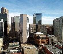

The Denver MSA has a gross metropolitan product of $157.6 billion in 2010, making it the 18th largest metro economy in the United States.[81] Denver's economy is based partially on its geographic position and its connection to some of the major transportation systems of the country. Because Denver is the largest city within 500 miles (800 km), it has become a natural location for storage and distribution of goods and services to the Mountain States, Southwest states, as well as all western states. Another benefit for distribution is that Denver is nearly equidistant from large cities of the Midwest, such as Chicago and St. Louis and some large cities of the West Coast, such as Los Angeles and San Francisco.
Over the years, the city has been home to other large corporations in the central United States, making Denver a key trade point for the country. Several well-known companies originated in or have relocated to Denver. William Ainsworth opened the Denver Instrument Company in 1895 to make analytical balances for gold assayers. Its factory is now in Arvada. AIMCO (NYSE: AIV)—the largest owner and operator of apartment communities in the United States, with approximately 870 communities comprising nearly 136,000 units in 44 states—is headquartered in Denver, employing approximately 3,500 people. Also Samsonite Corp., the world's largest luggage manufacturer, began in Denver in 1910 as Shwayder Trunk Manufacturing Company, but Samsonite closed its NE Denver factory in 2001, and moved its headquarters to Massachusetts after a change of ownership in 2006. The Mountain States Telephone & Telegraph Company, founded in Denver in 1911, is now a part of telecommunications giant CenturyLink.
MediaNews Group purchased the Denver Post in 1987; the company is based in Denver. The Gates Corporation, the world's largest producer of automotive belts and hoses, was established in S. Denver in 1919. Russell Stover Candies Inc. made its first chocolate candy in Denver in 1923, but moved to Kansas City in 1969. The Wright & McGill Company has been making its Eagle Claw brand of fishing gear in NE Denver since 1925. The original Frontier Airlines began operations at Denver's old Stapleton International Airport in 1950. Frontier was reincarnated at DIA in 1994. Scott's Liquid Gold, Inc., has been making furniture polish in Denver since 1954. Village Inn restaurants began as a single pancake house in Denver in 1958. Big O Tires, LLC, of Centennial opened its first franchise in 1962 in Denver. The Shane Company sold its first diamond jewelry in 1971 in Denver. Johns Manville Corp., a manufacturer of insulation and roofing products, relocated its headquarters to Denver from New York in 1972. CH2M HILL Inc., an engineering and construction firm, relocated from Oregon to the Denver Technological Center in 1980. The Ball Corporation sold its glass business in Indiana in the 1990s and moved to suburban Broomfield. Ball has several operations in greater Denver.
Molson Coors Brewing Company established its U.S. headquarters in Denver in 2005. Its subsidiary and regional wholesale distributor, Coors Distributing Company, is in NW Denver. The Newmont Mining Corporation, the 2nd largest gold producer in North America and one of the largest in the world, is headquartered in Denver.
Large Denver-area employers that have headquarters elsewhere include Lockheed Martin Corp., United Airlines, Kroger Co. and Xcel Energy, Inc. MapQuest, an online site for maps, directions and business listings, is headquartered in Denver's LoDo district.

Geography also allows Denver to have a considerable government presence, with many federal agencies based or having offices in the Denver area. Along with federal agencies come many companies based on US defense and space projects, and more jobs are brought to the city by virtue of its being the capital of the state of Colorado. The Denver area is home to the former nuclear weapons plant Rocky Flats, the Denver Federal Center, Byron G. Rogers Federal Building and United States Courthouse, the Denver Mint, and the National Renewable Energy Laboratory.
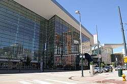
In 2005, a $310.7 million expansion for the Colorado Convention Center was completed, doubling its size. The hope was that the center's expansion would elevate the city to one of the top 10 cities in the nation for holding a convention.[82]
Denver's position near the mineral-rich Rocky Mountains encouraged mining and energy companies to spring up in the area. In the early days of the city, gold and silver booms and busts played a large role in the economic success of the city. In the 1970s and early 1980s, the energy crisis in America and resulting high oil prices created an energy boom in Denver captured in the soap opera Dynasty. Denver was built up considerably during this time with the construction of many new downtown skyscrapers. When the price of oil dropped from $34 a barrel in 1981 to $9 a barrel in 1986, the Denver economy dropped with it, leaving almost 15,000 oil industry workers in the area unemployed (including former mayor and current governor John Hickenlooper, a former geologist), and the highest office vacancy rate in the nation (30%).[83] Since then, the industry has recovered and there remain 700 employed petroleum engineers in the region.[84] Advances in hydraulic fracturing have made the DJ Basin of Colorado into an accessible and lucrative oil play. Energy and mining are still important in Denver's economy today, with companies such as EnCana, Halliburton, Smith International, Rio Tinto Group, Newmont Mining, Noble Energy, and Anadarko headquartered or having significant operations in the area.

Denver's west-central geographic location in the Mountain Time Zone (UTC−7) also benefits the telecommunications industry by allowing communication with both North American coasts, South America, Europe, and Asia in the same business day. Denver's location on the 105th meridian at over one mile (1.6 km) in elevation also enables it to be the largest city in the U.S. to offer a "one-bounce" real-time satellite uplink to six continents in the same business day. Qwest Communications, Dish Network Corporation, Starz-Encore, DIRECTV, and Comcast are a few of the many telecommunications companies with operations in the Denver area. These and other high-tech companies had a boom in Denver in the mid to late 1990s. Denver had one of the lowest unemployment rates in the nation at 3.8% in October 2007.[85] As of April 2015, the unemployment rate for the Denver-Aurora-Broomfield MSA is 4.2%.[86] The Downtown region has seen increased real estate investment with the construction of several new skyscrapers set to be completed in 2010–2013.
Denver has also enjoyed success as a pioneer in the fast casual restaurant industry, with many popular national chain restaurants founded and based in Denver. Chipotle Mexican Grill, Quizno's, and Smashburger were founded and headquartered in Denver. Qdoba Mexican Grill, Noodles & Company, and Good Times Burgers & Frozen Custard originated in Denver, but have moved their headquarters to the nearby suburbs of Wheat Ridge, Broomfield, and Golden.
In 2015, Denver ranked No. 1 on Forbes' list of the Best Places for Business and Careers.[87]
Culture and contemporary life

Apollo Hall opened quickly after the city's founding in 1859 and staged many plays for eager settlers.[23] In the 1880s Horace Tabor built Denver's first Opera House. After the start of the 20th century, city leaders embarked on a city beautification program that created many of the city's parks, parkways, museums, and the Municipal Auditorium, which was home to the 1908 Democratic National Convention and is now known as the Ellie Caulkins Opera House. Denver and the metropolitan areas around it continued to support culture. In 1988, voters in the Denver Metropolitan Area approved the Scientific and Cultural Facilities Tax (commonly known as SCFD), a 1 cent sales tax that contributes money to various cultural and scientific facilities and organizations throughout the Metro area.[88] The tax was renewed by voters in 1994 and 2004 and allows the SCFD to operate until 2018.[89]
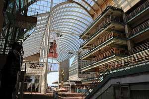
Denver is home to many nationally recognized museums, including a new wing for the Denver Art Museum by world-renowned architect Daniel Libeskind, the second largest Performing Arts Center in the nation after Lincoln Center in New York City and bustling neighborhoods such as LoDo, filled with art galleries, restaurants, bars and clubs. That is part of the reason why Denver was recently recognized for the third year in a row as the best city for singles.[90] Denver's neighborhoods also continue their influx of diverse people and businesses while the city's cultural institutions grow and prosper. The city acquired the estate of abstract expressionist painter Clyfford Still in 2004 and built a museum to exhibit his works near the Denver Art Museum.[91] The Denver Museum of Nature and Science currently holds an aquamarine specimen valued at over one million dollars, as well as specimens of the state mineral, rhodochrosite. Every September the Denver Mart, located at 451 E. 58th Avenue hosts a gem and mineral show.[92] The state history museum, History Colorado Center, opened in April 2012. It features hands-on and interactive exhibits, artifacts and programs about Colorado history.[93] It was named in 2013 by True West Magazine as one of the top-ten "must see" history museums in the country.[94] History Colorado's Byers-Evans House Museum and the Molly Brown House are nearby.
Denver has numerous art districts around the city, including Denver's Art District on Santa Fe and the River North Art District (RiNo).[95]
.jpg)

While Denver may not be as recognized for historical musical prominence as some other American cities, it still manages to have a very active pop, jazz, jam, folk, and classical music scene, which has nurtured several artists and genres to regional, national, and even international attention. Of particular note is Denver's importance in the folk scene of the 1960s and 1970s. Well-known folk artists such as Bob Dylan, Judy Collins and John Denver lived in Denver at various points during this time, and performed at local clubs.[96] Also, three members of the widely popular group Earth, Wind, and Fire are from Denver. More recent Denver-based artists include The Lumineers, Air Dubai, The Fray, Flobots, Cephalic Carnage, Axe Murder Boyz, Deuce Mob, and Five Iron Frenzy.
Because of its proximity to the mountains and generally sunny weather, Denver has gained a reputation as being a very active, outdoor-oriented city. Many Denver residents spend the weekends in the mountains; skiing in the winter and hiking, climbing, kayaking, and camping in the summer.
Denver and surrounding cities are home to a large number of local and national breweries. Many restaurants in the region have on-site breweries, and some of the larger brewers offer tours, including Coors and New Belgium Brewing Company. The city also welcomes visitors from around the world when it hosts the annual Great American Beer Festival each fall.
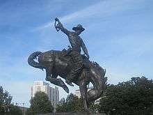
Denver used to be a major trading center for beef and livestock when ranchers would drive (or later transport) cattle to the Denver Union Stockyards for sale. As a celebration of that history, for more than a century Denver has hosted the annual National Western Stock Show, attracting as many as 10,000 animals and 700,000 attendees. The show is held every January at the National Western Complex northeast of downtown.
Denver has one of the country's largest populations of Mexican Americans and hosts four large Mexican American celebrations: Cinco de Mayo (with over 500,000 attendees),[97] in May, El Grito de la Independencia, in September, the annual Lowrider show, and the Dia De Los Muertos art shows/events in North Denver's Highland neighborhood, and the Lincoln Park neighborhood in the original section of West Denver.
Denver is also famous for its dedication to New Mexican cuisine and the chile. It's best known for its green and red chile sauce, Colorado burrito, Southwest (Denver) omelette, breakfast burrito, chiles rellenos, and tamales. Denver is also well known for other types of food such as Rocky Mountain oysters, rainbow trout, and the Denver sandwich.
The Dragon Boat Festival in July, Moon Festival in September and Chinese New Year are annual events in Denver for the Chinese and Asian residents. Chinese hot pot (huo guo) and Korean BBQ restaurants have been growing in popularity. The Denver area has 2 Chinese newspapers, the Chinese American Post and the Colorado Chinese News.[98]
Denver is the setting for The Bill Engvall Show, and the 18th season of MTV's The Real World. It was also the setting for the prime time drama Dynasty from 1981 to 1989 (although the show was mostly filmed in Los Angeles). From 1998 to 2002 the city's Alameda East Veterinary Hospital was home to the Animal Planet series Emergency Vets, which spun off three one-off documentary specials and the current Animal Planet series E-Vet Interns. The city is also the setting for the Disney Channel Original TV Show, Good Luck Charlie.
Sports


Denver is home to a variety of sports teams and is one of the U.S. cities with teams from four major sports (the Denver metro area is the smallest metropolitan area to have a team in all four major sports). The Denver Broncos of the National Football League have drawn crowds of over 70,000 since their origins in the early 1960s, and continue to draw fans today to their current home Sports Authority Field at Mile High. The Broncos have sold out every home game (except for strike-replacement games) since 1970.[99] The Broncos have advanced to eight Super Bowls and won back-to-back titles in 1997 and 1998, and won again in 2015.
The Colorado Rockies were created as an expansion franchise in 1993 and Coors Field opened in 1995. The Rockies advanced to the playoffs that year, but were eliminated in the first round. In 2007, they advanced to the playoffs as a wild-card entrant, won the NL Championship Series, and brought the World Series to Denver for the first time but were swept in four games by the Boston Red Sox.
Denver has been home to two National Hockey League teams. The Colorado Rockies played from 1976 to 1982, but became the New Jersey Devils. The Colorado Avalanche joined in 1995, after relocating from Quebec City. While in Denver, they have won two Stanley Cups in 1996 and in 2001. The Denver Nuggets joined the American Basketball Association in 1967 and the National Basketball Association in 1976. The Avalanche and Nuggets play at Pepsi Center since 1999. The Major League Soccer team Colorado Rapids play in Dick's Sporting Goods Park, an 18,000 seat soccer-specific stadium opened for the 2007 MLS season, located in the Denver suburb of Commerce City.[100] The Rapids won the MLS Cup in 2010.
| Club | League | Venue | Attendance | Titles | Since |
|---|---|---|---|---|---|
| Denver Broncos | NFL | Mile High | 76,939 [101] | 3 (1997, 1998, 2015) | 1960 |
| Colorado Rockies | MLB | Coors Field | 33,090 [102] | 0 | 1993 |
| Denver Nuggets | NBA | Pepsi Center | 16,899 [103] | 0 | 1967 |
| Colorado Avalanche | NHL | Pepsi Center | 16,176 [104] | 2 (1996, 2001) | 1995 |
| Colorado Rapids | MLS | Dick's Sporting Goods Park | 15,819 [105] | 1 (2010) | 1996 |
| Denver Stampede | PRO Rugby | CIBER Field | 1,915 | N/A | 2016 |
Denver has several additional professional teams. In 2006 Denver established a Major League Lacrosse team, the Denver Outlaws. They play in Sports Authority Field at Mile High. In 2006, the Denver Outlaws won the Western Conference Championship. The Colorado Mammoth of the National Lacrosse League play at the Pepsi Center. The Denver Stampede plays at Infinity Park.
Denver submitted the winning bid to host the 1976 Winter Olympics, but subsequently withdrew, giving it the dubious distinction of being the only city to back out after winning a bid to host the Olympics.[43] Denver and Colorado Springs hosted the 1962 World Ice Hockey Championships.
Parks and recreation
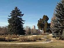
As of 2006, Denver had over 200 parks, from small mini-parks all over the city to the giant 314 acres (1.27 km2) City Park.[106] Denver also has 29 recreation centers providing places and programming for resident's recreation and relaxation.[107]

Many of Denver's parks were acquired from state lands in the late 19th and early 20th centuries. This coincided with the City Beautiful movement, and Denver mayor Robert Speer (1904–12 and 1916–18) set out to expand and beautify the city's parks. Reinhard Schuetze was the city's first landscape architect, and he brought his German-educated landscaping genius to Washington Park, Cheesman Park, and City Park among others. Speer used Schuetze as well as other landscape architects such as Frederick Law Olmsted, Jr. and Saco Rienk DeBoer to design not only parks such as Civic Center Park, but many city parkways and tree-lawns. All of this greenery was fed with South Platte River water diverted through the city ditch.[108]

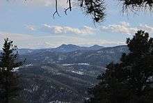
In addition to the parks within Denver itself, the city acquired land for mountain parks starting in the 1911s.[109] Over the years, Denver has acquired, built and maintained approximately 14,000 acres (57 km2) of mountain parks, including Red Rocks Park, which is known for its scenery and musical history revolving around the unique Red Rocks Amphitheatre.[110][111] Denver also owns the mountain on which the Winter Park Resort ski area is operated in Grand County, 67 miles (110 km) west of Denver.[112] City parks are important places for both Denverites and visitors, inciting controversy with every change. Denver continues to grow its park system with the development of many new parks along the Platte River through the city, and with Central Park and Bluff Lake Nature Center in the Stapleton neighborhood redevelopment. All of these parks are important gathering places for residents and allow what was once a dry plain to be lush, active, and green. Denver is also home to a large network of public community gardens, most of which are managed by Denver Urban Gardens, a non-profit organization.
Since 1974, Denver and the surrounding jurisdictions have rehabilitated the urban South Platte River and its tributaries for recreational use by hikers and cyclists. The main stem of the South Platte River Greenway runs along the South Platte from Chatfield Reservoir 35 miles (56 km) into Adams County in the north. The Greenway project is recognized as one of the best urban reclamation projects in the U.S., winning, for example, the Silver Medal Rudy Bruner Award for Urban Excellence in 2001.[113]
In its 2013 ParkScore ranking, The Trust for Public Land, a national land conservation organization, reported that Denver had the 17th best park system among the 50 most populous U.S. cities.[114]
Government


Denver is a consolidated city-county with a mayor elected on a nonpartisan ballot, a 13-member city council and an auditor. The Denver City Council is elected from 11 districts with two at-large council-members and is responsible for passing and changing all laws, resolutions, and ordinances, usually after a public hearing, and can also call for misconduct investigations of Denver's departmental officials. All elected officials have four-year terms, with a maximum of three terms. The current mayor is Michael Hancock.
Denver has a strong mayor/weak city council government. The mayor can approve or veto any ordinances or resolutions approved by the council, makes sure all contracts with the city are kept and performed, signs all bonds and contracts, is responsible for the city budget, and can appoint people to various city departments, organizations, and commissions. However, the council can override the mayor's veto with a nine out of thirteen member vote, and the city budget must be approved and can be changed by a simple majority vote of the council. The auditor checks all expenditures and may refuse to allow specific ones, usually based on financial reasons.[115]
The Denver Department of Safety oversees three branches: the Denver Police Department, Denver Fire Department, and Denver Sheriff Department. The Denver County Court is an integrated Colorado County Court and Municipal Court and is managed by Denver instead of the state.
Politics
While Denver elections are non-partisan, Democrats have long held the majority sway on Denver politics with most officials elected citywide having Democratic Party affiliation. In federal elections, Denverites also tend to vote for Democratic candidates, voting for the Democratic Presidential nominee in every election since 1960, excluding 1972 and 1980. The office of Denver's Mayor has been occupied by a Democrat since the municipal general election of 1963. Denver is represented at the federal level by congresswoman Diana DeGette, a Democrat representing Colorado's 1st congressional district, which includes all of Denver and parts of Arapahoe County.
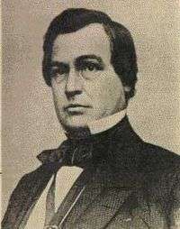
Benjamin F. Stapleton was the mayor of Denver, Colorado, for two periods, the first from 1923 to 1931 and the second from 1935 to 1947. Stapleton was responsible for many civic improvements during his term, notably during his second stint as mayor when he had access to funds and manpower from the New Deal. During this time, the park system was considerably expanded and the Civic Center completed. His signature project was the construction of Denver Municipal Airport, which began in 1929 amidst heavy criticism. It was later renamed Stapleton International Airport in his honor. Today, the airport no longer stands, but has been replaced by a neighborhood also named Stapleton. Stapleton Street continues to bear his name.
During the 1960s and 1970s, Denver was one of the epicenters of the Chicano Movement. The boxer-turned-activist Rodolfo "Corky" Gonzales formed an organization called the Crusade for Justice, which battled police brutality, fought for bilingual education, and, most notably, hosted the First National Chicano Youth Liberation Conference in March 1969.[116]
In recent years, Denver has taken a stance on helping people who are or become homeless, particularly under the administrations of mayors John Hickenlooper and Wellington Webb. At a rate of 19 homeless per 10,000 residents in 2011 as compared to 50 or more per 10,000 residents for the four metro areas with the highest rate of homelessness,[117] Denver's homeless population and rate of homeless are both considerably lower than many other major cities. However, residents of the city streets suffer Denver winters - which, although mild and dry much of the time, can have brief periods of extremely cold temperatures and snow.
In 2005, Denver became the first major city in the U.S. to vote to make the private possession of less than an ounce of marijuana legal for adults 21 and older.[118] The city voted 53.5 percent in favor of the marijuana legalization measure, which, as then-mayor John Hickenlooper pointed out, was without effect, because the city cannot usurp state law, which at that time treated marijuana possession in much the same way as a speeding ticket, with fines of up to $100 and no jail time.[118] Denver passed an initiative in the fourth quarter of 2007 requiring the mayor to appoint an 11-member review panel to monitor the city's compliance with the 2005 ordinance.[119] In 2012, Colorado Amendment 64 was signed into law by Governor John Hickenlooper and at the beginning of 2014 Colorado became the first state to allow the sale of marijuana for recreational use.[120]
Former Denver mayor John Hickenlooper was a member of the Mayors Against Illegal Guns Coalition,[121] an organization formed in 2006 and co-chaired by New York City mayor Michael Bloomberg and Boston mayor Thomas Menino.
Denver hosted the 2008 Democratic National Convention, which was the centennial of the city's first hosting of the landmark 1908 convention. It also hosted the G7 (now G8) summit between June 20 and 22 in 1997 and the 2000 National Convention of the Green Party.[122][123]
On October 31, 2011 it was announced that The University of Denver in Denver was selected as the host of the first of three 2012 presidential debates to be held on October 3, 2012.
Taxes
The City and County of Denver levies an Occupational Privilege Tax (OPT or Head Tax) on employers and employees.
- If any employee performs work in the city limits and is paid over $500 for that work in a single month, the employee and employer are both liable for the OPT regardless of where the main business office is located or headquartered.
- The employer is liable for $4 per employee per month and the employee is liable for $5.75 per month.
- It is the employer's responsibility to withhold, remit, and file the OPT returns. If an employer does not comply, the employer can be held liable for both portions of the OPT as well as penalties and interest.
Education
Denver Public Schools (DPS) is the public school system in Denver. It currently educates about 73,000 students in 73 elementary schools, 15 K-8 schools, 17 middle schools, 14 high schools, and 19 charter schools.[124] The first school of what is now DPS was a log cabin that opened in 1859 on the corner of 12th Street between Market and Larimer Streets. The district boundaries are coextensive with the city limits.[125] The Cherry Creek School District serves some areas with Denver postal addresses that are outside the city limits.[125][126]
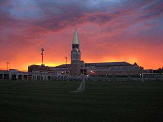
Denver's many colleges and universities range in age and study programs. Three major public schools constitute the Auraria Campus, University of Colorado Denver, Metropolitan State University of Denver, and Community College of Denver. The private University of Denver was the first institution of higher learning in the city and was founded in 1864. Other prominent Denver higher education institutions include Johnson & Wales University, Catholic (Jesuit) Regis University and the city has Roman Catholic and Jewish institutions, as well as a health sciences school. In addition to those schools within the city, there are a number of schools located throughout the surrounding metro area.
Media
The Denver Metropolitan Area is served by a variety of media outlets in print, radio, television, and the Internet.
Television stations
Denver is the 16th-largest market in the country for television, according to the 2009–2010 rankings from Nielsen Media Research.
- KWGN-TV, channel 2, is a CW affiliate owned by Tribune Broadcasting. Tribune also owns KDVR, the Fox affiliate on channel 31, and KWGN is controlled by KDVR management. KWGN is Colorado's first television station, signing on the air in July 1952.
- KCNC-TV, channel 4, is a CBS owned and operated station.
- KRMA-TV, channel 6, is the flagship outlet of Rocky Mountain PBS, a statewide network of Public Broadcasting Service stations. Programming on KRMA is rebroadcast to four other stations throughout Colorado.
- KMGH-TV, channel 7, is an ABC affiliate owned by the E.W. Scripps Company, previously owned by the McGraw-Hill company from 1972 to January 2012.
- KUSA-TV, channel 9, is an NBC affiliate, owned by Tegna, Inc.. TEGNA also owns KTVD, the My Network TV affiliate on channel 20.
- KBDI-TV, channel 12, is Denver's secondary PBS affiliate.
- KDEN-TV, channel 25, is a Telemundo-owned station.
- KPJR-TV, channel 38, is a Trinity Broadcasting Network-owned station.
- KCEC, channel 50, is the Univision affiliate.
- KETD, channel 53, is a Christian station owned by the LeSea Broadcasting group.
Radio stations
Denver is also served by over 40 AM and FM radio stations, covering a wide variety of formats and styles. Denver-Boulder radio is the No. 19 market in the United States, according to the Spring 2011 Arbitron ranking (up from No. 20 in Fall 2009). For a list of radio stations, see Radio Stations in Colorado
After a continued rivalry between Denver's two main newspapers, the Denver Post and Rocky Mountain News, the papers merged operations in 2001 under a Joint Operating Agreement which formed the Denver Newspaper Agency[127] until February 2009 when E. W. Scripps Company, the owner of the Rocky Mountain News closed the paper. There are also several alternative or localized newspapers published in Denver, including the Westword and Out Front Colorado. Denver is home to multiple regional magazines such as 5280, which takes its name from the city's mile-high (5,280 feet or 1,609 meters) elevation.
Transportation

City streets
Most of Denver has a straightforward street grid oriented to the four cardinal directions. Blocks are usually identified in hundreds from the median streets, identified as "00", which are Broadway (the east–west median, running north–south) and Ellsworth Avenue (the north–south median, running east–west). Colfax Avenue, a major east–west artery through Denver, is 15 blocks (1500) north of the median. Avenues north of Ellsworth are numbered (with the exception of Colfax Avenue and several others, such as Martin Luther King, Jr. Blvd and Montview Blvd.), while avenues south of Ellsworth are named.
There is also an older downtown grid system that was designed to be parallel to the confluence of the South Platte River and Cherry Creek. Most of the streets downtown and in LoDo run northeast–southwest and northwest–southeast. This system has an unplanned benefit for snow removal; if the streets were in a normal N–S/E–W grid, only the N–S streets would receive sunlight. With the grid oriented to the diagonal directions, the NW–SE streets receive sunlight to melt snow in the morning and the NE–SW streets receive it in the afternoon. This idea was from Henry Brown the founder of the Brown Palace Hotel. There is now a plaque across the street from the Brown Palace Hotel which honors this idea. The NW–SE streets are numbered, while the NE–SW streets are named. The named streets start at the intersection of Colfax Avenue and Broadway with the block-long Cheyenne Place. The numbered streets start underneath the Colfax and I-25 viaducts. There are 27 named and 44 numbered streets on this grid. There are also a few vestiges of the old grid system in the normal grid, such as Park Avenue, Morrison Road, and Speer Boulevard. Larimer Street, named after William Larimer, Jr., the founder of Denver, which is located in the heart of LoDo, is the oldest street in Denver.
All roads in the downtown grid system are streets (e.g. 16th Street, Stout Street). Roads outside that system that travel east/west are given the suffix "avenue" and those that head north and south are given the "street" suffix (e.g. Colfax Avenue, Lincoln Street). Boulevards are higher capacity streets and travel any direction (more commonly north and south). Smaller roads are sometimes referred to as places, drives (though not all drives are smaller capacity roads, some are major thoroughfares) or courts. Most streets outside the area between Broadway and Colorado Boulevard are organized alphabetically from the city's center.
Many Denver streets have bicycle lanes, and there are over 850 miles[128] of paved, off-road, bike paths in Denver parks and along bodies of water, like Cherry Creek and the South Platte. This allows for a significant portion of Denver's population to be bicycle commuters and has led to Denver being known as a bicycle friendly city.[129] In addition to the many bike paths, Denver launched B-Cycle – a citywide bicycle sharing program – in late April 2010. The B-Cycle network was the largest in the United States at the time of its launch, boasting 400 bicycles.[130]
The Denver Boot, a car-disabling device was first used in Denver.[131]
Cycling
The League of American Bicyclists has rated Colorado as the sixth most bicycle-friendly state in the nation for the year 2014. This is due in large part to Front Range cities like Boulder, Fort Collins and Denver placing an emphasis on legislation, programs and infrastructure developments that promote cycling as a mode of transportation.[132] Walk score has rated Denver as the third most bicycle-friendly large city in the United States.[133] Many Denver streets have bicycle lanes, and there are over 850 miles[128] of paved, off-road, bike paths in Denver parks and along bodies of water, like Cherry Creek and the South Platte. This allows for a significant portion of Denver's population to be bicycle commuters and has led to Denver being known as a bicycle friendly city.[129] According to data from the 2011 American Community Survey, Denver ranks 6th among US cities with populations over 400,000 in terms of the percentage of workers who commute by bicycle at 2.2% of commuters.[134] In addition to the many bike paths, Denver launched B-Cycle – a citywide bicycle sharing program – in late April 2010. The B-Cycle network was the largest in the United States at the time of its launch, boasting 400 bicycles.[130] Through the acquisition of new grants, the program has continued to expand each year, adding dozens of new stations, hundreds of bikes, and by beginning service during the winter months.[135][136]
Walkability
A 2011 study by Walk Score ranked Denver sixteenth most walkable of fifty largest U.S. cities.[137]
Freeways and highways
Denver is primarily served by the interstate freeways I-25 and I-70. The intersection of the two interstates is referred to locally as "the mousetrap", because when viewed from the air, the junction (and subsequent vehicles) resemble mice in a large trap.
-
.svg.png) Interstate 25 runs north–south from New Mexico through Denver to Wyoming
Interstate 25 runs north–south from New Mexico through Denver to Wyoming -
.svg.png) Interstate 225 traverses neighboring Aurora. I-225 was designed to link Aurora with I-25 in the southeastern corner of Denver, and I-70 to the north of Aurora, with construction starting May 1964 and ending May 21, 1976.
Interstate 225 traverses neighboring Aurora. I-225 was designed to link Aurora with I-25 in the southeastern corner of Denver, and I-70 to the north of Aurora, with construction starting May 1964 and ending May 21, 1976. -
.svg.png) Interstate 70 runs east–west from Utah to Maryland.
Interstate 70 runs east–west from Utah to Maryland. -
.svg.png) Interstate 270 runs concurrently with US 36 from an interchange with Interstate 70 in northeast Denver to an interchange with Interstate 25 north of Denver. The freeway continues as US 36 from the interchange with Interstate 25.
Interstate 270 runs concurrently with US 36 from an interchange with Interstate 70 in northeast Denver to an interchange with Interstate 25 north of Denver. The freeway continues as US 36 from the interchange with Interstate 25. -
.svg.png) Interstate 76 begins from I-70 just west of the city in Arvada. It intersects I-25 north of the city and runs northeast to Nebraska where it ends at I-80.
Interstate 76 begins from I-70 just west of the city in Arvada. It intersects I-25 north of the city and runs northeast to Nebraska where it ends at I-80. -
 US 6 follows the alignment of 6th Avenue west of I-25, and connects downtown Denver to the west-central suburbs of Golden and Lakewood. It continues west through Utah and Nevada to Bishop, California. To the east, it continues as far as Provincetown, on Cape Cod in Massachusetts.
 -
 US 36 connects Denver to Boulder and Rocky Mountain National Park near Estes Park. It runs east into Ohio, after crossing four other states.
 -
 State Highway 470 (C-470, SH 470) is the southwestern portion of the Denver metro area's beltway. Originally planned as Interstate 470 in the 1960s, the beltway project was attacked on environmental impact grounds and the interstate beltway was never built. The portion of "Interstate 470" that was built as a state highway is the present-day SH 470, which is a freeway for its entire length.
Denver also has a nearly complete beltway known as "the 470's". These are SH 470 (also known as C-470), a freeway in the southwest Metro area, and two toll highways, E-470 (from southeast to northeast) and Northwest Parkway (from terminus of E-470 to US 36). SH 470 was originally intended to be I-470 and built with federal highway funds, but the funding was redirected to complete conversion of downtown Denver's 16th Street to a pedestrian mall. As a result, construction was delayed until 1980 after state and local legislation was passed.[138] I-470 was also once called "The Silver Stake Highway", from Gov. Lamm's declared intention to drive a silver stake through it and kill it.
A highway expansion and transit project for the southern I-25 corridor, dubbed T-REX (Transportation Expansion Project), was completed on November 17, 2006.[139] The project installed wider and additional highway lanes, and improved highway access and drainage. The project also includes a light rail line that traverses from downtown to the south end of the metro area at Lincoln Avenue.[140] The project spanned almost 19 miles (31 km) along the highway with an additional line traveling parallel to part of I-225, stopping just short of Parker Road.
Metro Denver highway conditions can be accessed on the Colorado Department of Transportation website Traffic Conditions.[141]
Mass transportation


Mass transportation throughout the Denver metropolitan area is managed and coordinated by the Regional Transportation District (RTD). RTD currently operates more than 1,000 buses serving over 10,000 bus stops in 38 municipal jurisdictions in eight counties around the Denver and Boulder metropolitan areas. Additionally, RTD operates seven rail lines, the A, C, D, E, F, W, and H with a total of 57.9 miles (93.2 km) of track, serving 44 stations. All lines are light rail except the A, a commuter rail line.[142] FasTracks is a light rail/bus/rail expansion project approved by voters in 2004 which will serve neighboring suburbs and communities. The W line, or West line, opened in April 2013 serving Golden/Federal Center.
CDOT runs a bus system named Bustang that offers weekday service between Union Station in Denver, Glenwood Springs, Colorado Springs, and Fort Collins.[143]

Greyhound Lines, the intercity bus operator, has a major hub in Denver, with routes to New York City, Portland, Reno, Las Vegas, and their headquarters, Dallas. Subsidiary Autobuses Americanos provides service to El Paso. Allied bus operators Black Hills Trailways, and Burlington Trailways provide service to Billings, Omaha, Indianapolis, and Alamosa.
Amtrak, the national passenger rail system, provides service to Denver, operating its California Zephyr daily in both directions between Chicago and Emeryville, California, across the bay from San Francisco. Amtrak Thruway service operated by private bus companies links the Denver station with Rocky Mountain points.
At Albuquerque, New Mexico, Denver Thruway connections are made daily with the Amtrak Southwest Chief. Additionally, the Ski Train operated on the former Denver & Rio Grande Western Railroad, which took passengers between Denver and the Winter Park Ski Resort, but it is no longer in service. The Ski Train made its final run to Winter Park on March 29, 2009.
Denver's early years as a major train hub of the west are still very visible today. Trains stop in Denver at historic Union Station, where travelers can access RTD's 16th Street Free MallRide or use light rail to tour the city. Union Station will also serve as the main juncture for rail travel in the metro area, at the completion of FasTracks.
Airports


Denver International Airport (IATA: DEN, ICAO: KDEN), commonly known as DIA, serves as the primary airport for a large region surrounding Denver. DIA is located 18.6 miles (30 km) east-northeast of the Colorado State Capitol. DIA is the tenth busiest airport in the world and ranks fourth in the United States, with 51,245,334 passengers passing through it in 2008.[144] It covers more than 53 square miles (137.3 km2), making it the largest airport by land area in the United States and larger than the island of Manhattan.[145][146] Denver serves as a major hub for United Airlines, is the headquarters for Frontier Airlines, and is the fastest-growing focus city for Southwest Airlines.
Three general aviation airports serve the Denver area. Rocky Mountain Metropolitan Airport (KBJC) is 13.7 miles (22 km) north-northwest, Centennial Airport (KAPA) is 13.7 miles (22 km) south-southeast, and Front Range Airport (KFTG) is located 23.7 miles (38 km) east of the state capitol.
In the past, Denver has been home to several other airports that are no longer operational. Stapleton International Airport was closed in 1995 when it was replaced by DIA. Lowry Air Force Base was a military flight training facility that ceased flight operations in 1966, with the base finally being closed in 1994. It is currently being used for residential purposes. Buckley Air Force Base, a former Air National Guard base, is currently the only military facility in the Denver-Metro area.
Notable people

Sister cities
Denver's relationship with Brest, France, began in 1948, making it the second-oldest sister city in the United States.[147] Since then, Denver has established relationships with additional sister cities, and currently has a total of ten partnerships:[148]
- Brest, France, (1948)
- Takayama, Japan (1960)
- Nairobi, Kenya (1975)
- Karmiel, Israel (1977)
- Cuernavaca, Mexico (1983)
- Potenza, Italy (1983)
- Chennai, India (1984)
- Kunming, China (1985)
- Axum, Ethiopia (1995)
- Ulaanbaatar, Mongolia (2001)
In addition to these, the Denver Regional Council of Governments (consisting of the city and 51 other local governments) has established a "sister city" relationship with the Baghdad Governorate, one of Iraq's eighteen provinces.[149]
See also
| Wikivoyage has a travel guide for Denver. |
- Arapahoe County, Colorado
- Arapahoe County, Colorado Territory
- Arapahoe County, Kansas Territory
- Arrappahoe County, Jefferson Territory
- Colorado metropolitan areas
- Front Range Urban Corridor
- Gang activity in Denver
- Historic Colorado counties
- List of cities and towns in Colorado
- List of counties in Colorado
- List of mayors of Denver
- List of neighborhoods in Denver
- List of people from Denver
- National Register of Historic Places listings in Denver, Colorado
- New Denver, British Columbia
- North Central Colorado Urban Area
- Radioactive contamination from the Rocky Flats Plant
- State of Colorado
Notes
- ↑ Mean monthly maxima and minima (i.e. the highest and lowest temperature readings during an entire month or year) calculated based on data at said thread from 1981 to 2010, i.e. Stapleton from January 1981 to February 1995, and DIA from March 1995 to December 2010.
- ↑ Official records for Denver kept at downtown from January 1872 to December 1949, Stapleton Airport from January 1950 to February 1995, and DIA since March 1995. Temperature and precipitation normals are at DIA; snowfall normals at Stapleton are provided since they are unavailable for DIA
References
- ↑ Claims to Fame – Geography, Epodunk, accessed April 16, 2007
- ↑ Queen City, Time (magazine), January 30, 1928, accessed April 13, 2007.
- ↑ "The Big Apple: Wall Street of the West (17th Street in Denver)". 2012.
- ↑ "2014 U.S. Gazetteer Files: Places". United States Census Bureau. July 1, 2014. Retrieved January 5, 2015.
- 1 2 "Active Colorado Municipalities". State of Colorado, Department of Local Affairs. Archived from the original on November 22, 2010. Retrieved November 16, 2007.
- ↑ "Denver City Town Company Record Book, Mss.01813 (accession 99.225), History Colorado." (PDF). Retrieved March 8, 2015.
- ↑ "Colorado Municipal Incorporations". State of Colorado, Department of Personnel & Administration, Colorado State Archives. December 1, 2004. Retrieved December 5, 2007.
- ↑ "Interim Mayor Vidal to be sworn in Jan. 12". Denver Post. Retrieved January 17, 2011.
- 1 2 "Community Report, City and County of Denver, Colorado" (PDF). The City and County of Denver. Retrieved February 4, 2016.
- ↑ "Elevations and Distances in the United States". United States Geological Survey. April 29, 2005. Archived from the original on October 15, 2011. Retrieved November 22, 2010.
- ↑ "American FactFinder". United States Census Bureau. Retrieved June 20, 2014.
- ↑ "Annual Estimates of the Resident Population for Incorporated Places: April 1, 2010 to July 1, 2015". United States Census Bureau. Retrieved May 20, 2016.
- ↑ "ZIP Code Lookup" (JavaScript/HTML). United States Postal Service. August 18, 2007. Retrieved October 16, 2007.
- 1 2 "Annual Estimates of the Resident Population for Incorporated Places of 50,000 or More, Ranked by July 1, 2015 Population: April 1, 2010 to July 1, 2015". United States Census Bureau. Retrieved May 20, 2016.
- 1 2 3 4 "Estimates of Resident Population Change and Rankings: July 1, 2014 to July 1, 2015 - United States -- Metropolitan Statistical Area; and for Puerto Rico 2015 Population Estimates". United States Census Bureau. July 1, 2015. Retrieved April 17, 2016.
- ↑ "Estimates of Resident Population Change and Rankings: July 1, 2014 to July 1, 2015 - United States -- Combined Statistical Area; and for Puerto Rico 2015 Population Estimates". United States Census Bureau. July 1, 2015. Retrieved April 17, 2016.
- ↑ "Annual Resident Population Estimates, Estimated Components of Resident Population Change, and Rates of the Components of Resident Population Change for States and Counties: April 1, 2010 to July 1, 2015" (CSV). 2015 Population Estimates. United States Census Bureau, Population Division. July 1, 2015. Retrieved April 17, 2016.
- ↑ "Best Places to Live in the USA". U.S. News & World Report. Retrieved March 3, 2016.
- ↑ "Denver: The Rocky Mountain metropolis time line". The City and County of Denver. January 1, 2006. Archived from the original on August 13, 2006. Retrieved August 30, 2006.
- 1 2 Thomas J. Noel. "Denver History: The Arapaho Camp". City and County of Denver. Archived from the original on October 13, 2007. Retrieved September 26, 2007.
- 1 2 "State Government History". State of Colorado, Department of Personnel & Administration, Colorado State Archives. April 18, 2001. Retrieved November 28, 2006.
- ↑ "Colorado Municipal Incorporations". State of Colorado, Department of Personnel & Administration, Colorado State Archives. December 1, 2004. Retrieved November 28, 2006.
- 1 2 3 Thomas J. Noel. "Denver History: The Golden Gamble". City and County of Denver. Archived from the original on April 5, 2007. Retrieved April 3, 2007.
- ↑ Baker, Gayle, Denver, HarborTown Histories. Santa Barbara, CA, p. 31-33, ISBN 9780971098442 (print), 9780987903860 (on-line)
- ↑ Baker, p. 39-48
- ↑ Baker, p. 51-55
- ↑ "Information from The Soapy Smith Preservation Trust website". Retrieved October 29, 2006.
- ↑ United Way History Archived January 17, 2010, at the Wayback Machine.. The United Way. Retrieved: September 26, 2006.
- ↑ US Population History from 1850. Demographia. Retrieved: July 20, 2006
- ↑ "Historical Census Statistics On Population Totals By Race, 1790 to 1990, and By Hispanic Origin, 1970 to 1990, For Large Cities And Other Urban Places In The United States". U.S. Census Bureau. Retrieved December 18, 2011.
- ↑ Kingman, Dick (1986). A History - Colorado Flower Growers and its People (PDF). Colorado Greenhouse Association, Inc.
- ↑ Shu Liu and Linda M. Meyer, "Carnations and the Floriculture Industry: Documenting the Cultivation and Marketing of Flowers in Colorado", 2007
- ↑ Rebchuck, John (October 15, 2015). "Neighbors want historic designation for NW Denver home". Denver Real Estate Watch.
- ↑ "American Educational Research Association". Aera.net. Retrieved September 15, 2013.
- ↑ "Think you know your Democratic convention trivia?". CNN. August 26, 2008.
- ↑ Clymer, Floyd. Treasury of Early American Automobiles, 1877–1925 (New York: Bonanza Books, 1950), p.87.
- ↑ Moore, LeRoy (2007). "Democracy and Public Health at Rocky Flats: The Examples of Edward Martell and Carl J. Johnson". In Quigley, Dianne; Lowman, Amy; Wing, Steve. Ethics of Research on Health Impacts of Nuclear Weapons Activities in the United States (PDF). Collaborative Initiative for Research Ethics and Environmental Health (CIREEH) at Syracuse University. pp. 55–97. Retrieved September 17, 2011.
- ↑ Iversen, Kristen (March 10, 2012). "Fallout at a Former Nuclear Weapon Plant". The New York Times.
- ↑ Johnson, Carl J. (October 1981). "Cancer Incidence in an Area Contaminated with Radionuclides Near a Nuclear Installation". AMBIO. 10 (4): 176–182. JSTOR 4312671., cited in Moore 2007, pp. 103–109.
- ↑ "Archived copy" (PDF). Archived from the original (PDF) on July 24, 2013. Retrieved June 5, 2013.
- ↑ "Rocky Flats Nuclear Site Too Hot for Public Access, Citizens Warn". Environment News Service. August 5, 2010. Retrieved September 17, 2011.
- ↑ Salazar, Quibian (July 21, 2011). "Plutonium parkway". Boulderweekly.com. Retrieved February 11, 2012.
- 1 2 "When Denver rejected the Olympics in favour of the environment and economics". The Guardian. April 7, 2015. Retrieved December 31, 2015.
- ↑ "Archives |". Colorado.gov. Retrieved April 7, 2016.
- ↑
- ↑ "USOC: No Winter Olympics for Denver in 2022". Kdvr.com. July 3, 2012. Retrieved September 15, 2013.
- ↑ "Denver Zoning Code". City and County of Denver. 2016. Retrieved February 3, 2016.
- ↑ "Blueprint Denver". Denvergov.org. December 18, 2009. Retrieved September 3, 2011.
- ↑ "US Gazetteer files: 2010, 2000, and 1990". United States Census Bureau. February 12, 2011. Retrieved April 23, 2011.
- ↑ "NWS Point Forecast (with elevation data map)". Forecast.weather.gov. Retrieved July 13, 2012.
- ↑ City and County of Denver, Community Planning and Development. "Denver Open Data Catalog: Statistical Neighborhoods". DenverGov.org.
- ↑ "Find A City To Love – Where to Live in Denver". MetroSeeker.com. Retrieved September 15, 2013.
- ↑ Woods, Katherine (1998). "Park Hill, Denver". Cityscape: A Journal of Policy Development and Research. U.S. Department of Housing and Urban Development. 4 (2): 89–103. Archived from the original on September 4, 2006. Retrieved January 11, 2006.
- ↑ "Climate Classification and Climatic Regions of the World". PhysicalGeography.net. Retrieved March 15, 2010.
- ↑ "Colorado Climate Center – Climate of Colorado". Climate.colostate.edu. Retrieved July 13, 2012.
- ↑ CBS Is 300 Days Of Sunshine In Colorado A Fact Or Just Good Marketing? May 22, 2015
- ↑ KELSEY WHIPPLE, Colorado's 300 days of sunshine claim: It's a myth, and state's climatologist tells us why September 16, 2011
- ↑ "Colorado Climate Figures From NOAA". BULL Forms, Colorado. Retrieved June 6, 2016.
- ↑ http://www.thedenverchannel.com/weather/denver-s-10-longest-below-zero-streaks
- 1 2 "NowData - NOAA Online Weather Data". National Oceanic and Atmospheric Administration. Retrieved 2012-04-01.
- ↑ "Archived copy". Archived from the original on June 27, 2012. Retrieved June 27, 2012.
- ↑ "Adams County, Colorado". Tornado History Project. Retrieved April 7, 2016.
- ↑ Church, Christopher R. (1993). The Tornado: Its Structure, Dynamics, Prediction, and Hazards. American Geophysical Union. p. 353. ISBN 9780875900384.
- ↑ Meyer, Thomas A.; Bobb, William R.; Dulong, Thomas W. "Denver Air Route Traffic Control Thunderstorm Patterns" (PDF). Denver Center Weather Service Unit, Longmont, Colorado. National Weather Service. National Oceanic and Atmospheric Administration. Retrieved May 22, 2014.
- ↑ "Five Worst Weather Airports: Denver International Airport". Chicago Tribune. November 23, 2011.
- ↑ "Report: Colorado and Oklahoma Cities Dominate Top 10 Hail Prone Metro Areas". Retrieved September 18, 2015.
- ↑ John Erdman (January 27, 2014). "America's 20 Coldest Major Cities". The Weather Channel. Retrieved January 9, 2015.
- ↑ "Station Name: CO DENVER-STAPLETON". National Oceanic and Atmospheric Administration. Retrieved 2014-03-13.
- ↑ "Threaded Climate Extremes for Denver Area, CO". National Weather Service. Retrieved 2012-02-10.
- ↑ "WMO Climate Normals for DENVER/STAPLETON INT'L AP CO 1961–1990". National Oceanic and Atmospheric Administration. Retrieved 2014-03-11.
- ↑ "Annual Estimates of the Resident Population for Incorporated Places: April 1, 2010 to July 1, 2015". Retrieved July 2, 2016.
- ↑ "Census of Population and Housing". Census.gov. Archived from the original on April 22, 2013. Retrieved June 4, 2015.
- ↑ "Denver (city), Colorado". State & County QuickFacts. U.S. Census Bureau.
- 1 2 3 "Race and Hispanic Origin for Selected Cities and Other Places: Earliest Census to 1990". U.S. Census Bureau.
- 1 2 From 15% sample
- ↑ "Annual Estimates of the Resident Population for Counties: April 1, 2010 to July 1, 2013". 2013 Population Estimates. United States Census Bureau, Population Division. June 20, 2014. Retrieved June 20, 2014.
- ↑ "80249 Zip Code (Denver, Colorado)". City-Data. Retrieved December 3, 2008.
- ↑ "Denver, Colorado (CO) profile: population, maps, real estate, averages, homes, statistics, relocation, travel, jobs, hospitals, schools, crime, moving, houses, news". City-data.com. Retrieved September 15, 2013.
- ↑ "Denver County, Colorado". Modern Language Association. Archived from the original on August 15, 2013. Retrieved August 6, 2013.
- ↑ "Denver: A Mile High And Climbing". Parks & Recreation. September 2001. Retrieved September 26, 2007.
- ↑ "Gross Metropolitan Product". Greyhill Advisors. Retrieved September 29, 2011.
- ↑ Kris Hudson (December 3, 2004). "Finally, it's built. Now for the test". The Denver Post. Retrieved September 26, 2007.
- ↑ "Denver: The Rocky Mountain Metropolis History". The City and County of Denver. 2002. Archived from the original on June 8, 2006. Retrieved February 27, 2016.
- ↑ "Welcome collegedegreereport.com - BlueHost.com". Collegedegreereport.com. Retrieved April 7, 2016.
- ↑ Metro Denver Economic Development Corporation (October 2, 2007). "Monthly Economic Summary". Metro Denver Economic Development Corporation. Retrieved November 26, 2007.
- ↑ The Bureau of Labor Statistics. "Denver-Aurora-Broomfield, CO Economy at a Glance". The Bureau of Labor Statistics. Retrieved June 4, 2015.
- ↑ "Denver Leads Forbes' 2015 List Of The Best Places For Business And Careers". Retrieved July 30, 2015.
- ↑ "SCFD: Making It Possible". Scientific & Cultural Facilities District. Archived from the original on December 19, 2007. Retrieved September 27, 2007.
- ↑ "SCFD: Crafted for and by the People". Scientific & Cultural Facilities District. Retrieved April 3, 2007.
- ↑ Denver-Boulder No.1 again with singles. The Denver Business Journal. July 25, 2006. Retrieved on July 29, 2006.
- ↑ "Clyfford Still Museum in Denver, Colorado". Clyfford Still Museum in Denver, Colorado. Retrieved October 11, 2007.
- ↑ "The 43rd Annual Denver Gem and Mineral Show". denvermineralshow. Denver Gem and Mineral Show. Retrieved June 26, 2010.
- ↑ Lieff, Laura (2014). "History Colorado Center Ignites Imaginations Of All Ages". Glendale Cherry Creek Chronicle. Archived from the original on February 11, 2015. Retrieved February 3, 2016.
- ↑ "The TOP 10 Must-See Museums". Truewestmagazine.com. August 6, 2013. Archived from the original on April 14, 2014. Retrieved March 30, 2014.
- ↑ "DENVER ART DISTRICTS". artsandvenuesdenver.com. Denver Arts & Venues. Retrieved January 23, 2015.
- ↑ "Landmarks and Local Laughs". Colorado Arts Net. Retrieved September 26, 2007.
- ↑ "Hispanic Denver". Denver.org. February 20, 2007. Retrieved September 15, 2013.
- ↑ "Cocnews.com". Cocnews.com. Retrieved September 3, 2011.
- ↑ "Team History". Pro Football Hall of Fame. Retrieved December 31, 2015.
- ↑ "Dick's Sporting Goods Park". Dickssportinggoodspark.com. Archived from the original on September 10, 2011. Retrieved September 3, 2011.
- ↑ NFL attendance. ESPN Statistics
- ↑ MLB attendance. ESPN Statistics
- ↑ NBA attendance. ESPN Statistics
- ↑ NHL attendance. ESPN Statistics
- ↑ MLS attendance. www.soccerstadiumdigest.com
- ↑ "Denver Parks & Recreation: Parks Division". City and County of Denver. Retrieved August 18, 2006.
- ↑ "Recreation Centers and Programs". City and County of Denver. Archived from the original on September 9, 2007. Retrieved February 3, 2016.
- ↑ Etter, Carolyn and Don. City of Parks: The Preservation of Denver's Park and Parkway System. The Denver Public Library 2005.
- ↑ "Denver Mountain Parks History: Park Descriptions". Denver Mountain Parks Foundation. Retrieved September 26, 2007.
- ↑ "Denver Mountain Parks". City and County of Denver. Archived from the original on December 5, 2006. Retrieved September 26, 2007.
- ↑ "Denver Mountain Parks: Red Rocks Park". City and County of Denver. Archived from the original on December 5, 2006. Retrieved September 26, 2007.
- ↑ Lora J. Finnegan (January 2000). "Winter's tale – Winter Park Resort in Colorado". Sunset. Retrieved September 26, 2007.
- ↑ "Rudy Bruner Award for Urban Excellence". Bruner Foundation. Retrieved September 3, 2013.
- ↑ "City Profiles: Denver". "The Trust for Public Land". Retrieved on July 10, 2013.
- ↑ "How Our City Government Works". City and County of Denver. 2016. Retrieved February 5, 2016.
- ↑ "History Timeline". Chicanomoratorium.org. Retrieved September 15, 2013.
- ↑ "Homelessness in Large Metro Areas" (PDF). Endhomelessness.org. Retrieved December 31, 2015.
- 1 2 O'Driscoll, Patrick.Denver votes to legalize marijuana possession. USATODAY.com. November 3, 2005. Retrieved on July 21, 2006.
- ↑ "Denver setting up panel to review marijuana cases". Daily Camera. Archived from the original on December 15, 2007. Retrieved December 16, 2007.
- ↑ "Which States Will Legalize Marijuana This Year And Next?". Forbes.com. April 9, 2015. Retrieved December 31, 2015.
- ↑ "Mayors Against Illegal Guns: Coalition Members". Archived from the original on November 17, 2007. Retrieved June 11, 2007.
- ↑ "List of Summit Meetings". MOFA. Retrieved September 15, 2013.
- ↑ "Democratic National Convention". Pepsi Center. 2008. Retrieved February 3, 2016.
- ↑ "Denver Public Schools". Dpsk12.org. Retrieved September 3, 2011.
- 1 2 "SCHOOL DISTRICT REFERENCE MAP (2010 CENSUS): Denver County, CO." (Archive) U.S. Census Bureau. Retrieved on May 16, 2013.
- ↑ "About Us." Cherry Creek School District. Retrieved on May 14, 2013.
- ↑ "Denver Newspaper Agency". Retrieved December 15, 2006.
- 1 2 "Denver's 850 Miles of Off-Road Bike Trails". Denver Metro Convention & Visitors Bureau. Archived from the original on August 21, 2008. Retrieved February 3, 2016.
- 1 2 "Bicycle Friendly Communities: Denver" (PDF). League of American Bicyclists. 2006. Archived from the original (PDF) on August 22, 2007. Retrieved February 3, 2016.
- 1 2 "B-cycle bike sharing to be the largest in U.S.". Cnet. Retrieved April 21, 2010.
- ↑ Acton, Johnny; Adams, Tania; Packer, Matt (2006). Origin of Everyday Things. Sterling Publishing. p. 309. ISBN 978-1-4027-4302-3. Retrieved March 21, 2011.
- ↑ "Bicycle Friendly State : 2014 Ranking" (PDF). Bikeleague.org. Retrieved April 7, 2016.
- ↑ "Most Walkable Cities in the United States, Canada, and Australia on Walk Score". Walkscore.com. Retrieved September 15, 2013.
- ↑ "Denver Hits 2.2% Bicycle Commuter Mode Share for 2010 " DenverUrbanism Blog". Denverurbanism.com. October 17, 2011. Retrieved September 15, 2013.
- ↑ "Denver City Council passes Denver B-Cycle expansion". The Denver Post. Retrieved February 13, 2014.
- ↑ "Denver B-cycle goes to year-round schedule". The Denver Post. Retrieved February 13, 2014.
- ↑ "2011 City and Neighborhood Rankings". Walk Score. 2011. Retrieved August 28, 2011.
- ↑ Matthew E. Salek. "C-470? E-470? I-470? W-470? I give up!". Mesalek.com. Retrieved September 3, 2011.
- ↑ "T-REX Announces Opening Day for Southeast Light Rail Line". City and County of Denver. 2007. Archived from the original on October 13, 2007. Retrieved February 3, 2016.
- ↑ "New light rail heads on down the tracks". Rocky Mountain News. Archived from the original on October 13, 2007. Retrieved September 26, 2007.
- ↑ "Road Conditions, Speeds, Travel Times, Traffic Cameras, Live Streaming Traffic Cameras, Road Closures and Road Work Information provided by Intelligent Transportation Systems (ITS) a branch of Colorado Department of Transportation". Cotrip.org. Retrieved September 3, 2011.
- ↑ "Light Rail". RTD Denver. Retrieved September 26, 2007.
- ↑ "Bustang Start". Denver Post. Retrieved July 12, 2015.
- ↑ Yamanouchi, Kelly (October 15, 2007). "DIA ranks fourth-busiest". Denver Post. Retrieved October 15, 2007.
- ↑ "Which Airport Is The World's Biggest? And The Busiest?". flightmapping.com. Retrieved February 24, 2012.
- ↑ "How New York Works". How Stuff Works. Retrieved September 26, 2007.
- ↑ "Brest France". Denver Sister Cities International. Retrieved March 30, 2010.
- ↑ "Denver Sister Cities International". Denver Sister Cities International. Retrieved May 18, 2012.
- ↑ "Baghdad-Denver Region Partnership". Denver Regional Council of Governments. Archived from the original on June 18, 2012. Retrieved May 18, 2012.
External links
- Official website
- History Colorado website
- Regional Transportation District website
-
 Geographic data related to Denver at OpenStreetMap
