Adams County, Colorado
| Adams County, Colorado | |
|---|---|
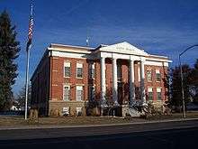 Brighton Historic City Hall | |
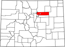 Location in the U.S. state of Colorado | |
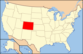 Colorado's location in the U.S. | |
| Founded | April 15, 1901 |
| Named for | Alva Adams[1] |
| Seat | Brighton |
| Largest city | Thornton |
| Area | |
| • Total | 1,184 sq mi (3,067 km2) |
| • Land | 1,168 sq mi (3,025 km2) |
| • Water | 16 sq mi (41 km2), 1.4% |
| Population (est.) | |
| • (2015) | 491,337 |
| • Density | 378/sq mi (146/km²) |
| Congressional districts | 4th, 6th, 7th |
| Time zone | Mountain: UTC-7/-6 |
| Website |
www |
|
Footnotes: | |
Adams County is the fifth-most populous of the 64 counties of the U.S. state of Colorado. As of the 2010 census, the population was 441,603.[2] The county seat is Brighton.[3] The county is named for Alva Adams, Governor of the State of Colorado.[1]
Adams County is part of the Denver-Aurora-Lakewood, CO Metropolitan Statistical Area.
History
On May 30, 1854, the Kansas-Nebraska Act created the Territory of Nebraska and Territory of Kansas, divided by the Parallel 40° North (168th Avenue in present-day Adams County). The future Adams County, Colorado, occupied a strip of northern Arapahoe County, Kansas Territory, immediately south of the Nebraska Territory.
In 1859, John D. "Colonel Jack" Henderson built a ranch, trading post, and hotel on Henderson Island in the South Platte River in Arapahoe County, Kansas Territory. Jack Henderson was the former editor and proprietor of the Leavenworth (Kansas Territory) Journal and an outspoken pro-slavery politician who had been accused of vote fraud in eastern Kansas. Henderson sold meat and provisions to gold seekers on their way up the South Platte River Trail to the gold fields during the Pike's Peak Gold Rush. Henderson Island was the first permanent settlement in the South Platte River Valley between Fort Saint Vrain in the Nebraska Territory and the Cherry Creek Diggings in the Kansas Territory. Jack Henderson eventually returned to eastern Kansas and (ironically) fought for the Union in the American Civil War. Henderson Island is today the site of the Adams County Regional Park and Fairgrounds.
The eastern portion of the Kansas Territory was admitted to the Union as the State of Kansas on January 29, 1861, and on February 28, 1861, the remaining western portion of the territory was made part of the new Colorado Territory.[4] The Colorado Territory created Arapahoe County, on November 1, 1861, and Colorado was admitted to the Union on August 1, 1876.[4]
In 1901, the Colorado General Assembly voted to split Arapahoe County into three parts: a new Adams County, a new consolidated City and County of Denver, and the remainder of the Arapahoe County to be renamed South Arapahoe County. A ruling by the Colorado Supreme Court, subsequent legislation, and a referendum delayed the creation of Adams County until November 15, 1902. Governor James Bradley Orman designated Brighton as the temporary Adams County Seat. Adams County originally stretched 160 miles (258 kilometers) from present-day Sheridan Boulevard to the Kansas state border. On May 12, 1903, the eastern 88 miles (142 kilometers) of Adams County was transferred to the new Washington County and the new Yuma County, reducing the length of Adams County to the present 72 miles (116 kilometers). On November 8, 1904, Adams County voters chose Brighton as the permanent county seat.
A 1989 vote transferred 53 square miles (137 square kilometers) of Adams County to the City and County of Denver for the proposed Denver International Airport, leaving the densely populated western portion of the county as two oddly-shaped peninsulas. Adams County lost the tip of its northwest corner when the consolidated City and County of Broomfield was created on November 15, 2001.
Geography
According to the U.S. Census Bureau, the county has a total area of 1,184 square miles (3,070 km2), of which 1,168 square miles (3,030 km2) is land and 16 square miles (41 km2) (1.4%) is water.[5]
Adams County surrounds (and surrendered the land for) most of Denver International Airport which is in the City and County of Denver.
Adjacent counties
- Weld County – north
- Morgan County – northeast
- Washington County – east
- Arapahoe County – south
- City & County of Denver – south
- Jefferson County – west
- City & County of Broomfield – northwest
National protected area
State park
Historic trail
Recreational trails
- American Discovery Trail
- Big Dry Creek National Recreation Trail
- Highline Canal National Recreation Trail
- Platte River Greenway National Recreation Trail
- Rocky Mountain Arsenal National Recreation Trail
Demographics
| Historical population | |||
|---|---|---|---|
| Census | Pop. | %± | |
| 1910 | 8,892 | — | |
| 1920 | 14,430 | 62.3% | |
| 1930 | 20,245 | 40.3% | |
| 1940 | 22,481 | 11.0% | |
| 1950 | 40,234 | 79.0% | |
| 1960 | 120,296 | 199.0% | |
| 1970 | 185,789 | 54.4% | |
| 1980 | 245,944 | 32.4% | |
| 1990 | 265,038 | 7.8% | |
| 2000 | 363,857 | 37.3% | |
| 2010 | 441,603 | 21.4% | |
| Est. 2015 | 491,337 | [6] | 11.3% |
| U.S. Decennial Census[7] 1790-1960[8] 1900-1990[9] 1990-2000[10] 2010-2015[2] | |||
As of the census[11] of 2000, there were 363,857 people, 128,156 households, and 92,144 families residing in the county. The population density was 305 people per square mile (118/km²). There were 132,594 housing units at an average density of 111 per square mile (43/km²). The racial makeup of the county was 77.29% White, 2.97% Black or African American, 1.19% Native American, 3.21% Asian, 0.12% Pacific Islander, 11.73% from other races, and 3.49% from two or more races. 28.19% of the population were Hispanic or Latino of any race.
There were 128,156 households out of which 37.80% had children under the age of 18 living with them, 53.80% were married couples living together, 12.10% had a female householder with no husband present, and 28.10% were non-families. 21.20% of all households were made up of individuals and 5.50% had someone living alone who was 65 years of age or older. The average household size was 2.81 and the average family size was 3.27.
In the county the population was spread out with 28.60% under the age of 18, 10.30% from 18 to 24, 34.00% from 25 to 44, 19.40% from 45 to 64, and 7.80% who were 65 years of age or older. The median age was 31 years. For every 100 females there were 102.80 males. For every 100 females age 18 and over, there were 102.10 males.
The median income for a household in the county was $47,323, and the median income for a family was $52,517. Males had a median income of $36,499 versus $28,053 for females. The per capita income for the county was $19,944. About 6.50% of families and 8.90% of the population were below the poverty line, including 10.90% of those under age 18 and 7.30% of those age 65 or over.
In 2000, the largest denominational groups were Catholics (with 60,429 members) and Evangelical Protestants (with 25,552 members).[12] The largest religious bodies were the Catholic Church (with 60,429 adherents) and The Church of Jesus Christ of Latter-day Saints (with 6,808 adherents).[13]
Politics
| Year | Republican | Democrat |
|---|---|---|
| 2012 | 40.12% 70,972 | 56.90% 100,649 |
| 2008 | 39.86% 63,976 | 58.22% 93,445 |
| 2004 | 48.22% 65,912 | 50.57% 69,122 |
| 2000 | 44.10% 47,561 | 50.19% 54,132 |
| 1996 | 38.91% 36,666 | 51.28% 48,314 |
| 1992 | 29.93% 30,856 | 44.00% 45,357 |
| 1988 | 45.87% 43,163 | 52.56% 49,464 |
| 1984 | 60.20% 55,092 | 38.55% 35,285 |
| 1980 | 50.50% 42,916 | 36.90% 31,357 |
| 1976 | 45.30% 35,392 | 51.90% 40,551 |
| 1972 | 60.79% 40,372 | 36.39% 24,170 |
| 1968 | 43.86% 24,343 | 45.25% 25,111 |
| 1964 | 30.41% 15,652 | 68.98% 35,498 |
| 1960 | 46.36% 18,452 | 53.18% 21,168 |
Education
The school districts serving Adams County are:[15]
- Adams 12 Five Star Schools
- Adams County 14
- Bennett 29J
- Brighton 27J
- Mapleton 1
- Strasburg 31J
- Westminster 50.
Communities
Cities
- Arvada (part)
- Aurora (part)
- Brighton (part)
- Commerce City
- Federal Heights
- Northglenn
- Strasburg (part)
- Thornton
- Westminster (part)
Town
- Bennett (part)
Census-designated places
Unincorporated communities
License plate code
Up until 1999 when Colorado ceased coding license plates by county, Adams County used the following codes on license plates issued to passenger vehicles: TE-UF, GA-GG, SAA-SEW, and SEY-TZZ. [16]
In popular culture
Adams County was featured as the fictional rival of South Park's peewee hockey team in the South Park episode "Stanley's Cup".
See also
- Outline of Colorado
- Index of Colorado-related articles
- Colorado census statistical areas
- Colorado counties
- Denver-Aurora-Boulder Combined Statistical Area
- Front Range Urban Corridor
- Arapahoe County, Kansas Territory
- Arrappahoe County, Jefferson Territory
- Arapahoe County, Colorado Territory
- National Register of Historic Places listings in Adams County, Colorado
References
- 1 2 Gannett, Henry (1905). The Origin of Certain Place Names in the United States. p. 23.
- 1 2 "State & County QuickFacts". United States Census Bureau. Retrieved June 7, 2014.
- ↑ "Find a County". National Association of Counties. Archived from the original on May 31, 2011. Retrieved 2011-06-07.
- 1 2 "State Government History". State of Colorado, Department of Personnel & Administration, Colorado State Archives. April 18, 2001. Archived from the original on November 30, 2006. Retrieved November 28, 2006.
- ↑ "US Gazetteer files: 2010, 2000, and 1990". United States Census Bureau. 2011-02-12. Retrieved 2011-04-23.
- ↑ "County Totals Dataset: Population, Population Change and Estimated Components of Population Change: April 1, 2010 to July 1, 2015". Retrieved July 2, 2016.
- ↑ "U.S. Decennial Census". United States Census Bureau. Archived from the original on May 11, 2015. Retrieved June 7, 2014.
- ↑ "Historical Census Browser". University of Virginia Library. Retrieved June 7, 2014.
- ↑ "Population of Counties by Decennial Census: 1900 to 1990". United States Census Bureau. Retrieved June 7, 2014.
- ↑ "Census 2000 PHC-T-4. Ranking Tables for Counties: 1990 and 2000" (PDF). United States Census Bureau. Retrieved June 7, 2014.
- ↑ "American FactFinder". United States Census Bureau. Archived from the original on September 11, 2013. Retrieved 2011-05-14.
- ↑ "County Membership Reports". thearda.com. Archived from the original on July 12, 2011. Retrieved August 22, 2011.
- ↑ "County Membership Reports". thearda.com. Retrieved August 22, 2010.
- ↑ "Dave Leip's Atlas of U.S. Presidential Elections". Retrieved 2011-06-11.
- ↑ Education, Colorado Department of. "Index of Counties and School Districts" (PDF). Colorado Department of Education. Archived (PDF) from the original on December 29, 2009. Retrieved December 20, 2009.
- ↑
External links
- Adams County Government website
- Biography of John D. Henderson
- Colorado County Evolution by Don Stanwyck
- Colorado Historical Society
- Adams County Community Development
- Adams County Education Consortium
- Adams County Economic Development
Coordinates: 39°52′N 104°21′W / 39.87°N 104.35°W
 |
City and County of Broomfield | Weld County | Morgan County | |
| Jefferson County | |
Washington County | ||
| ||||
| | ||||
| Arapahoe County and City and County of Denver |
Municipalities and communities of Adams County, Colorado, United States | ||
|---|---|---|
| Cities | | |
| Towns | ||
| CDPs | ||
| Unincorporated communities | ||
| Footnotes | ‡This populated place also has portions in an adjacent county or counties | |
