Clayton County, Georgia
| Clayton County, Georgia | |
|---|---|
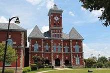 Clayton County Courthouse in Jonesboro | |
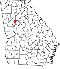 Location in the U.S. state of Georgia | |
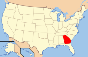 Georgia's location in the U.S. | |
| Founded | November 30, 1858 |
| Named for | Augustin Smith Clayton |
| Seat | Jonesboro |
| Largest city | Forest Park |
| Area | |
| • Total | 144 sq mi (373 km2) |
| • Land | 142 sq mi (368 km2) |
| • Water | 2.8 sq mi (7 km2), 1.9% |
| Population (est.) | |
| • (2015) | 273,955 |
| • Density | 1,832/sq mi (707/km²) |
| Congressional districts | 5th, 13th |
| Time zone | Eastern: UTC-5/-4 |
| Website |
www |
Clayton County is a county located in the north central portion of the U.S. state of Georgia. As of the 2010 census, the population was 259,424.[1] The county seat is Jonesboro.[2]
Clayton County is included in the Atlanta-Sandy Springs-Roswell, GA Metropolitan Statistical Area. It is the home of Hartsfield-Jackson Atlanta International Airport.
History
The county was established in 1858 and named in honor of Augustin Smith Clayton[3] (1783–1839), who served in the United States House of Representatives from 1832 until 1835.
Geography
According to the U.S. Census Bureau, the county has a total area of 144 square miles (370 km2), of which 142 square miles (370 km2) is land and 2.8 square miles (7.3 km2) (1.9%) is water.[4] It is the third-smallest county by area in Georgia.
The eastern portion of Clayton County, between Forest Park and Lovejoy, is located in the Upper Ocmulgee River sub-basin of the Altamaha River basin. The western portion of the county is located in the Upper Flint River sub-basin of the ACF River Basin (Apalachicola-Chattahoochee-Flint River Basin).[5]
Adjacent counties
- DeKalb County (northeast)
- Henry County (east)
- Spalding County (south)
- Fayette County (southwest)
- Fulton County (northwest)
Demographics
| Historical population | |||
|---|---|---|---|
| Census | Pop. | %± | |
| 1860 | 4,466 | — | |
| 1870 | 5,477 | 22.6% | |
| 1880 | 8,027 | 46.6% | |
| 1890 | 8,295 | 3.3% | |
| 1900 | 9,598 | 15.7% | |
| 1910 | 10,453 | 8.9% | |
| 1920 | 11,159 | 6.8% | |
| 1930 | 10,260 | −8.1% | |
| 1940 | 11,655 | 13.6% | |
| 1950 | 22,872 | 96.2% | |
| 1960 | 46,365 | 102.7% | |
| 1970 | 98,043 | 111.5% | |
| 1980 | 150,357 | 53.4% | |
| 1990 | 182,052 | 21.1% | |
| 2000 | 236,517 | 29.9% | |
| 2010 | 259,467 | 9.7% | |
| Est. 2015 | 273,955 | [6] | 5.6% |
| U.S. Decennial Census[7] 1790-1960[8] 1900-1990[9] 1990-2000[10] 2010-2013[1] | |||
2000 census
As of the 2010 United States Census, there were 259,424 people residing in the county. 66.1% were Black or African American, 18.9% White, 5.0% Asian, 0.4% Native American, 0.1% Pacific Islander, 7.1% from some other race and 2.5% from two or more races. 13.7% were Hispanic or Latino (of any race).
As of the 2000 census,[11] there were 236,517 people, 82,243 households, and 59,214 families residing in the county. The population density was 1,658 people per square mile (640/km²). There were 86,461 housing units at an average density of 606 per square mile (234/km²). The racial makeup of the county was 37.94% White, 51.55% Black or African American, 0.32% Native American, 4.49% Asian, 0.07% Pacific Islander, 3.55% from other races, and 2.08% from two or more races. 7.50% of the population were Hispanic or Latino of any race.
Estimated 2006 population is 271,240, with a racial make-up of 20.4% white non-Hispanic, 62.9% African American, 5% Asian, 11.3% Hispanic or Latino, 0.4% American Indian or Alaska Native, and 0.1% Pacific Islander. 1.5% were reported as multi-racial.
There were 82,243 households out of which 40.70% had children under the age of 18 living with them, 45.70% were married couples living together, 20.30% had a female householder with no husband present, and 28.00% were non-families. 21.80% of all households were made up of individuals and 3.60% had someone living alone who was 65 years of age or older. The average household size was 2.84 and the average family size was 3.30.
In the county the population was spread out with 30.00% under the age of 18, 10.40% from 18 to 24, 35.40% from 25 to 44, 18.40% from 45 to 64, and 5.90% who were 65 years of age or older. The median age was 30 years. For every 100 females there were 94.50 males. For every 100 females age 18 and over, there were 90.90 males.
The median income for a household in the county was $42,697, and the median income for a family was $46,782. Males had a median income of $32,118 versus $26,926 for females. The per capita income for the county was $18,079. About 8.20% of families and 10.10% of the population were below the poverty line, including 13.20% of those under age 18 and 8.90% of those age 65 or over.
The last quarter-century has seen significant change in the racial composition of the county's population. In 1980, Clayton county's population was 150,357 — 91% white and 9% minority,[12] while in 2006 the population was approximately 271,240 — 20% white and 80% minority.[13]
2010 census
As of the 2010 United States Census, there were 259,424 people, 90,633 households, and 62,389 families residing in the county.[14] The population density was 1,832.5 inhabitants per square mile (707.5/km2). There were 104,705 housing units at an average density of 739.6 per square mile (285.6/km2).[15] The racial makeup of the county was 66.1% black or African American, 18.9% white, 5.0% Asian, 0.4% American Indian, 0.1% Pacific islander, 7.1% from other races, and 2.5% from two or more races. Those of Hispanic or Latino origin made up 13.7% of the population.[14] In terms of ancestry, and 4.9% were American.[16]
Of the 90,633 households, 42.1% had children under the age of 18 living with them, 36.4% were married couples living together, 25.3% had a female householder with no husband present, 31.2% were non-families, and 25.4% of all households were made up of individuals. The average household size was 2.82 and the average family size was 3.37. The median age was 31.6 years.[14]
The median income for a household in the county was $43,311 and the median income for a family was $48,064. Males had a median income of $36,177 versus $32,460 for females. The per capita income for the county was $18,958. About 13.6% of families and 16.7% of the population were below the poverty line, including 24.5% of those under age 18 and 8.8% of those age 65 or over.[17]
Crime and policing
The Clayton County Police Department has an authorized strength of 525 personnel. It is headed by Chief Michael Register.[18] Other law enforcement services (courts, jail, warrants) are provided by the Clayton County Sheriff's Office.[19]
Economy
The unemployment rate in Clayton County, GA, is 11.50%, with job growth of 0.70%. Future job growth over the next ten years is predicted to be at 29.90%. Clayton County's sales tax rate is 7.00%. The income tax is 6.00%. Clayton County's income and salaries per capita is $18,735, which includes all adults and children. The median household income is $44,454.ValuJet Airlines was headquartered in northern, unincorporated Clayton County, near William B. Hartsfield International Airport, in the 1990s.[20]
Transportation
Airports
Major highways
-
 Interstate 75
 -
 Interstate 85
 -
 Interstate 285
 -
 Interstate 675
 -
 U.S. Route 19
 -
 U.S. Route 23
 -
 U.S. Route 29
 -
 U.S. Route 41
 -
 State Route 3
 -
 State Route 3 Connector
 -
 State Route 14
 -
 State Route 33
 -
 State Route 42
 -
 State Route 54
 -
 State Route 65
 -
 State Route 85
 -
 State Route 138
 -
 State Route 138 Spur
 -
 State Route 139
 -
 State Route 314
 -
 State Route 331
 -
 State Route 401 (unsigned designation for I-75)
 -
 State Route 403 (unsigned designation for I-85)
 -
 State Route 407 (unsigned designation for I-285)
 -
 State Route 413 (unsigned designation for I-675)
Mass transit
Bus
MARTA and Xpress GA / RTA commuter buses serve the County.
Rail
There is commuter rail service in the planning stages along the Norfolk Southern line, with proposed stations in Forest Park, Morrow, Jonesboro, and initially ending at Lovejoy. This line is projected to run to Macon eventually. However, it has been repeatedly stalled by the Georgia General Assembly, despite having federal funding already available for it.
The Metropolitan Atlanta Rapid Transit Authority's Airport station is located in Clayton.
Education
Clayton County Public Schools is the fifth largest school system in Georgia.[21] On August 28, 2008, the district lost its accreditation, citing a 'dysfunctional' school board.
The district currently has 51,237 students enrolled in its 63 schools. Under the current Superintendent Dr. Edmond T. Heatley, the district has a strategic plan that includes the vision and mission statements. Clayton County has twenty-two elementary and five middle schools that have been deemed by the Georgia Department of Education as Distinguished Schools. This is based on the number of consecutive years of making AYP. Clayton County is fully accredited, April 2013
Special schools and programs
Lovejoy High School hosts the district International Baccalaureate Program (IB). The IB Diploma Program is designed as an academically challenging and balanced program of education with final exams that prepare students for success at the university level and life beyond.
CCPS has two charter schools. Unidos Dual Language, Georgia's first public dual language school is a model of excellence in language education. Unidos serves students in Pre-kindergarten through sixth grades. The second charter school is the Elite Scholars Academy; the school serves grades 6-10 and will be expanding to the twelfth grade by 2014. The school operates on a year-round calendar. Any student in the district may apply to enroll. Selection is based on a random lottery.
Clayton County also has a Math and Science Magnet and two fine arts magnet programs at Jackson Elementary and Mount Zion High Schools. Enrollment is based on application and/or audition.
2008 de-accreditation
The 50,000-student school system was the first in the nation to lose accreditation since 1969. The Southern Association of Colleges and Schools (SACS) revoked the school district's accreditation on August 28, 2008.[22] This makes only the second system in the nation to do so since 1960. A grand jury investigated and considered possible criminal indictments against the Clayton County School Board. At issue was whether the school board committed malfeasance in ignoring the shortcomings of the school system and violating its own rules concerning the awarding of bids of contracts.
School Board Chairwoman Ericka Davis announced her resignation on April 2, 2008, amidst the allegations. Clayton County Commission Chairman Eldrin Bell has called for the resignations of all Clayton County School Board Members.[23] Amid controversy and orders for the police to quiet citizens, the Clayton County School Board hired a new temporary superintendent on April 26, 2008. This was despite the fact that the new superintendent did not meet the qualifications set forth by SACS.[24]
The Clayton County Public School System was re-accredited by SACS on May 1, 2009.[25]
Higher education
Clayton State University is located in Morrow.
Communities
Cities
Census-designated places
Unincorporated communities
- Arrowhead District
- Botany Woods
- Clayton Panhandle
- Ellenwood
- Flint River District
- Flintwoods
- Lake Harbin
- Lake Spivey
- Mountain View
- North Jonesboro
- Old Dixie
- Old South
- Rex
- Valley Hill
In popular culture
Parts of Margaret Mitchell's epic 1936 novel Gone with the Wind and the famous 1939 motion picture Gone with the Wind were set in Clayton County, including the location of the fictional plantation, Tara. Tara Boulevard was named for the plantation, and is the main north/south road through the county, carrying U.S. 41 and lesser-known State Route 3. Parts of the novels Rhett Butler's People and Scarlett and the Scarlett TV Mini-Series also took place in Clayton County. Rhett Butler's People is a prequel, sequel, and companion to Gone with the Wind. Scarlett is a sequel to Gone with the Wind, also and also takes place briefly in Clayton County. In the above-mentioned novels, the fictional Twelve Oaks Plantation and others mentioned in the novels above, are located in and around Clayton County.
The 2012 film Flight features Clayton County throughout the film, with Hall's Flying Ranch in Hampton, Georgia, doubling as Denzel Washington's character's childhood home.
Parts of the film Smokey and the Bandit were also shot in and around Clayton County, namely in Jonesboro, as evidenced by a sign in the background of one of the scenes. Even though this particular scene was supposed to be set in Arkansas, a "Willow Bend" sign advertising brick homes in Clayton County can be spotted behind Sheriff George Branford. Many back roads and the movie town of Texarkana are actually the roads and the town of Jonesboro.
Trinidad James filmed his music video for the song "All Gold Everything" in Clayton County
Rap artist Waka Flocka Flame is also from Clayton County as he resides in Riverdale, Georgia.
See also
References
- 1 2 "State & County QuickFacts". United States Census Bureau. Retrieved June 20, 2014.
- ↑ "Find a County". National Association of Counties. Archived from the original on 31 May 2011. Retrieved 2011-06-07.
- ↑ Gannett, Henry (1905). The Origin of Certain Place Names in the United States. Govt. Print. Off. p. 84.
- ↑ "US Gazetteer files: 2010, 2000, and 1990". United States Census Bureau. 2011-02-12. Retrieved 2011-04-23.
- ↑ "Georgia Soil and Water Conservation Commission Interactive Mapping Experience". Georgia Soil and Water Conservation Commission. Retrieved 2015-11-19.
- ↑ "County Totals Dataset: Population, Population Change and Estimated Components of Population Change: April 1, 2010 to July 1, 2015". Retrieved July 2, 2016.
- ↑ "U.S. Decennial Census". United States Census Bureau. Archived from the original on 11 May 2015. Retrieved June 20, 2014.
- ↑ "Historical Census Browser". University of Virginia Library. Retrieved June 20, 2014.
- ↑ "Population of Counties by Decennial Census: 1900 to 1990". United States Census Bureau. Retrieved June 20, 2014.
- ↑ "Census 2000 PHC-T-4. Ranking Tables for Counties: 1990 and 2000" (PDF). United States Census Bureau. Retrieved June 20, 2014.
- ↑ "American FactFinder". United States Census Bureau. Archived from the original on 11 September 2013. Retrieved 2011-05-14.
- ↑ "Archived copy". Archived from the original on 23 March 2009. Retrieved 2008-03-27. Archived copy at the Library of Congress (26 November 2001).
- ↑ "Clayton County, Georgia". American Factfinder. United States Census Bureau. 2008.
- 1 2 3 "DP-1 Profile of General Population and Housing Characteristics: 2010 Demographic Profile Data". United States Census Bureau. Retrieved 2015-12-27.
- ↑ "Population, Housing Units, Area, and Density: 2010 - County". United States Census Bureau. Retrieved 2015-12-27.
- ↑ "DP02 SELECTED SOCIAL CHARACTERISTICS IN THE UNITED STATES – 2006-2010 American Community Survey 5-Year Estimates". United States Census Bureau. Retrieved 2015-12-27.
- ↑ "DP03 SELECTED ECONOMIC CHARACTERISTICS – 2006-2010 American Community Survey 5-Year Estimates". United States Census Bureau. Retrieved 2015-12-27.
- ↑ http://www.claytonpolice.com/
- ↑ http://www.claytonsheriff.com/
- ↑ "Civil Action No. 1-96-CV-1355-JTC." Stanford University Law School. Retrieved on May 19, 2009.
- ↑ "District Statistics". Clayton County Public Schools. Retrieved 5 April 2008.
- ↑ Matteucci, Megan (2008-08-28). "Clayton schools lose accreditation; board members ousted". Atlanta Journal Constitution. Retrieved 28 August 2008.
- ↑ Matteucci, Megan (2008-04-02). "Clayton school board chairwoman steps down". Atlanta Journal Constitution. Retrieved 5 April 2008.
- ↑ Matteucci, Megan (2008-05-01). "Clayton signs school chief's contract amid police presence". Atlanta Journal Constitution.
- ↑ Front, Georgia. (2009-05-01) Georgia Education: Clayton County Public Schools Receive Re-accreditation. Gaeducation.blogspot.com. Retrieved on 2013-08-16.
External links
- Clayton County Government
- Clayton County Visitors Bureau – For information on history, attractions, and events
- Clayton County historical marker
 |
Fulton County | DeKalb County | | |
| |
Henry County | |||
| ||||
| | ||||
| Fayette County | Spalding County |
Municipalities and communities of Clayton County, Georgia, United States | ||
|---|---|---|
| Cities | | |
| CDPs | ||
| Unincorporated communities | ||
| Footnotes | ‡This populated place also has portions in an adjacent county or counties | |
|  | |||||||
|
| ||||||||
| ||||||||

Coordinates: 33°32′N 84°22′W / 33.54°N 84.36°W