Quitman County, Georgia
| Quitman County, Georgia | |
|---|---|
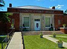 County courthouse in Georgetown | |
 Location in the U.S. state of Georgia | |
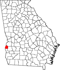
 Georgia's location in the U.S. | |
| Founded | December 10, 1858 |
| Named for | John A. Quitman |
| Seat | Georgetown |
| Largest city | Georgetown |
| Area | |
| • Total | 161 sq mi (417 km2) |
| • Land | 151 sq mi (391 km2) |
| • Water | 9.3 sq mi (24 km2), 5.8% |
| Population (est.) | |
| • (2015) | 2,302 |
| • Density | 17/sq mi (7/km²) |
| Congressional district | 2nd |
| Time zone | Eastern: UTC-5/-4 |
Quitman County is a county located in the U.S. state of Georgia. As of the 2010 census, the population was 2,513,[1] making it the second-least populous county in Georgia. The county seat is Georgetown.[2] The county was created on December 10, 1858 and named after General John A. Quitman, leader in the Mexican-American War, and once Governor of Mississippi.
Geography
According to the U.S. Census Bureau, the county has a total area of 161 square miles (420 km2), of which 151 square miles (390 km2) is land and 9.3 square miles (24 km2) (5.8%) is water.[3] The entirety of Quitman County is located in the Middle Chattahoochee River-Walter F. George Lake sub-basin of the ACF River Basin (Apalachicola-Chattahoochee-Flint River Basin).[4]
Major highways
Adjacent counties
- Stewart County (north)
- Randolph County (east)
- Clay County (south)
- Barbour County, Alabama (west/CST Border)
National protected area
Demographics
| Historical population | |||
|---|---|---|---|
| Census | Pop. | %± | |
| 1860 | 3,499 | — | |
| 1870 | 4,150 | 18.6% | |
| 1880 | 4,392 | 5.8% | |
| 1890 | 4,471 | 1.8% | |
| 1900 | 4,701 | 5.1% | |
| 1910 | 4,594 | −2.3% | |
| 1920 | 3,417 | −25.6% | |
| 1930 | 3,820 | 11.8% | |
| 1940 | 3,435 | −10.1% | |
| 1950 | 3,015 | −12.2% | |
| 1960 | 2,432 | −19.3% | |
| 1970 | 2,180 | −10.4% | |
| 1980 | 2,357 | 8.1% | |
| 1990 | 2,209 | −6.3% | |
| 2000 | 2,598 | 17.6% | |
| 2010 | 2,513 | −3.3% | |
| Est. 2015 | 2,302 | [5] | −8.4% |
| U.S. Decennial Census[6] 1790-1960[7] 1900-1990[8] 1990-2000[9] 2010-2013[1] | |||
2000 census
As of the census[10] of 2000, there were 2,598 people, 1,047 households, and 755 families residing in the county. The population density was 7/km² (17/mi²). There were 1,773 housing units at an average density of 5/km² (12/mi²). The racial makeup of the county was 52.12% White, 46.88% Black or African American, 0.23% Native American, 0.04% Asian, 0.19% from other races, and 0.54% from two or more races. 0.50% of the population were Hispanic or Latino of any race.
There were 1,047 households out of which 26.00% had children under the age of 18 living with them, 50.20% were married couples living together, 18.70% had a female householder with no husband present, and 27.80% were non-families. 24.90% of all households were made up of individuals and 12.30% had someone living alone who was 65 years of age or older. The average household size was 2.48 and the average family size was 2.95.
In the county the population was spread out with 24.00% under the age of 18, 7.20% from 18 to 24, 23.60% from 25 to 44, 25.40% from 45 to 64, and 19.90% who were 65 years of age or older. The median age was 42 years. For every 100 females there were 88.90 males. For every 100 females age 18 and over, there were 85.10 males.
The median income for a household in the county was $25,875, and the median income for a family was $30,691. Males had a median income of $23,365 versus $19,069 for females. The per capita income for the county was $14,301. About 16.10% of families and 21.90% of the population were below the poverty line, including 26.60% of those under age 18 and 24.50% of those age 65 or over.
2010 census
As of the 2010 United States Census, there were 2,513 people, 1,053 households, and 689 families residing in the county.[11] The population density was 16.6 inhabitants per square mile (6.4/km2). There were 2,047 housing units at an average density of 13.5 per square mile (5.2/km2).[12] The racial makeup of the county was 51.3% white, 47.9% black or African American, 0.2% American Indian, 0.1% Asian, 0.1% from other races, and 0.4% from two or more races. Those of Hispanic or Latino origin made up 1.4% of the population.[11] In terms of ancestry, 12.8% were Irish, 10.0% were English, 6.1% were German, and 5.5% were American.[13]
Of the 1,053 households, 24.7% had children under the age of 18 living with them, 44.6% were married couples living together, 15.8% had a female householder with no husband present, 34.6% were non-families, and 30.6% of all households were made up of individuals. The average household size was 2.39 and the average family size was 2.98. The median age was 46.4 years.[11]
The median income for a household in the county was $28,912 and the median income for a family was $34,342. Males had a median income of $27,096 versus $22,331 for females. The per capita income for the county was $13,642. About 21.2% of families and 31.6% of the population were below the poverty line, including 47.4% of those under age 18 and 24.5% of those age 65 or over.[14]
Education
Communities
See also
References
- 1 2 "State & County QuickFacts". United States Census Bureau. Retrieved June 25, 2014.
- ↑ "Find a County". National Association of Counties. Archived from the original on May 31, 2011. Retrieved 2011-06-07.
- ↑ "US Gazetteer files: 2010, 2000, and 1990". United States Census Bureau. 2011-02-12. Retrieved 2011-04-23.
- ↑ "Georgia Soil and Water Conservation Commission Interactive Mapping Experience". Georgia Soil and Water Conservation Commission. Retrieved 2015-11-24.
- ↑ "County Totals Dataset: Population, Population Change and Estimated Components of Population Change: April 1, 2010 to July 1, 2015". Retrieved July 2, 2016.
- ↑ "U.S. Decennial Census". United States Census Bureau. Archived from the original on May 11, 2015. Retrieved June 25, 2014.
- ↑ "Historical Census Browser". University of Virginia Library. Retrieved June 25, 2014.
- ↑ "Population of Counties by Decennial Census: 1900 to 1990". United States Census Bureau. Retrieved June 25, 2014.
- ↑ "Census 2000 PHC-T-4. Ranking Tables for Counties: 1990 and 2000" (PDF). United States Census Bureau. Retrieved June 25, 2014.
- ↑ "American FactFinder". United States Census Bureau. Archived from the original on September 11, 2013. Retrieved 2008-01-31.
- 1 2 3 "DP-1 Profile of General Population and Housing Characteristics: 2010 Demographic Profile Data". United States Census Bureau. Retrieved 2015-12-30.
- ↑ "Population, Housing Units, Area, and Density: 2010 - County". United States Census Bureau. Retrieved 2015-12-30.
- ↑ "DP02 SELECTED SOCIAL CHARACTERISTICS IN THE UNITED STATES – 2006-2010 American Community Survey 5-Year Estimates". United States Census Bureau. Retrieved 2015-12-30.
- ↑ "DP03 SELECTED ECONOMIC CHARACTERISTICS – 2006-2010 American Community Survey 5-Year Estimates". United States Census Bureau. Retrieved 2015-12-30.
External links
 |
Stewart County | | ||
| Barbour County, Alabama | |
Randolph County | ||
| ||||
| | ||||
| Clay County |
Municipalities and communities of Quitman County, Georgia, United States | ||
|---|---|---|
| City | | |
| Community | ||
Template:Georgia
Coordinates: 31°52′N 85°01′W / 31.86°N 85.01°W