Greene County, Georgia
| Greene County, Georgia | |
|---|---|
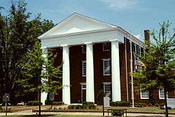 Greene County courthouse in Greensboro | |
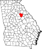 Location in the U.S. state of Georgia | |
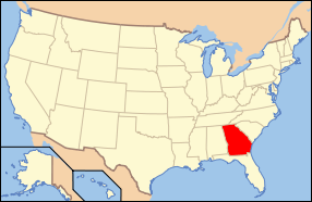 Georgia's location in the U.S. | |
| Founded | 1786 |
| Named for | Nathanael Greene |
| Seat | Greensboro |
| Largest city | Greensboro |
| Area | |
| • Total | 406 sq mi (1,052 km2) |
| • Land | 387 sq mi (1,002 km2) |
| • Water | 19 sq mi (49 km2), 4.6% |
| Population | |
| • (2010) | 15,994 |
| • Density | 41/sq mi (16/km²) |
| Congressional district | 10th |
| Time zone | Eastern: UTC-5/-4 |
| Website |
www |

Greene County is a county located in the U.S. state of Georgia. As of the 2010 census, the population was 15,994.[1] The county seat is Greensboro.[2] The county was created on February 3, 1786 and is named for Nathanael Greene, an American Revolutionary War major general.
History
Greene County was formed on February 3, 1786, from land given by Washington County. It was named in honor of General Nathanael Greene, a hero of the American Revolutionary War.[3]
Geography
According to the U.S. Census Bureau, the county has a total area of 406 square miles (1,050 km2), of which 387 square miles (1,000 km2) is land and 19 square miles (49 km2) (4.6%) is water.[4]
The majority of Greene County, west of a line between Woodville, Union Point, and White Plains, is located in the Upper Oconee River sub-basin of the Altamaha River basin. The northern half of the remainder of the county is located in the Little River sub-basin of the Savannah River basin, while the southern half is located in the Upper Ogeechee River sub-basin of the Ogeechee River basin.[5]
Major highways
-
 Interstate 20
 -
 U.S. Route 278
 -
 State Route 12
 -
 State Route 15
 -
 State Route 44
 -
 State Route 77
 - State Route 402 (unsigned designation for I-20)
Adjacent counties
- Oglethorpe County (north)
- Taliaferro County (east)
- Hancock County (southeast)
- Putnam County (southwest)
- Morgan County (west)
- Oconee County (northwest)
National protected area
- Oconee National Forest (part)
Demographics
| Historical population | |||
|---|---|---|---|
| Census | Pop. | %± | |
| 1790 | 5,405 | — | |
| 1800 | 10,761 | 99.1% | |
| 1810 | 11,679 | 8.5% | |
| 1820 | 13,589 | 16.4% | |
| 1830 | 12,549 | −7.7% | |
| 1840 | 11,690 | −6.8% | |
| 1850 | 13,068 | 11.8% | |
| 1860 | 12,652 | −3.2% | |
| 1870 | 12,454 | −1.6% | |
| 1880 | 17,547 | 40.9% | |
| 1890 | 17,051 | −2.8% | |
| 1900 | 16,542 | −3.0% | |
| 1910 | 18,512 | 11.9% | |
| 1920 | 18,972 | 2.5% | |
| 1930 | 12,616 | −33.5% | |
| 1940 | 13,709 | 8.7% | |
| 1950 | 12,843 | −6.3% | |
| 1960 | 11,193 | −12.8% | |
| 1970 | 10,212 | −8.8% | |
| 1980 | 11,391 | 11.5% | |
| 1990 | 11,793 | 3.5% | |
| 2000 | 14,406 | 22.2% | |
| 2010 | 15,994 | 11.0% | |
| Est. 2015 | 16,710 | [6] | 4.5% |
| U.S. Decennial Census[7] 1790-1960[8] 1900-1990[9] 1990-2000[10] 2010-2013[1] | |||
2000 census
At the 2000 census,[11] there were 14,406 people, 5,477 households and 4,042 families residing in the county. The population density was 37 per square mile (14/km²). There were 6,653 housing units at an average density of 17 per square mile (7/km²). The racial makeup of the county was 52.95% White, 44.45% Black or African American, 0.25% Native American, 0.25% Asian, 0.06% Pacific Islander, 1.49% from other races, and 0.56% from two or more races. 2.92% of the population were Hispanic or Latino of any race.
There were 5,477 households of which 29.20% had children under the age of 18 living with them, 51.00% were married couples living together, 18.30% had a female householder with no husband present, and 26.20% were non-families. 23.00% of all households were made up of individuals and 10.10% had someone living alone who was 65 years of age or older. The average household size was 2.59 and the average family size was 3.02.
25.10% of the population were under the age of 18, 8.70% from 18 to 24, 24.30% from 25 to 44, 27.50% from 45 to 64, and 14.40% who were 65 years of age or older. The median age was 39 years. For every 100 females there were 91.90 males. For every 100 females age 18 and over, there were 88.50 males.
The median household income was $33,479 and the median family incomewas $39,794. Males had a median income of $31,295 versus $20,232 for females. The per capita income for the county was $23,389. About 16.00% of families and 22.30% of the population were below the poverty line, including 33.80% of those under age 18 and 20.20% of those age 65 or over.
2010 census
As of the 2010 United States Census, there were 15,994 people, 6,519 households, and 4,677 families residing in the county.[12] The population density was 41.3 inhabitants per square mile (15.9/km2). There were 8,688 housing units at an average density of 22.4 per square mile (8.6/km2).[13] The racial makeup of the county was 56.6% white, 38.2% black or African American, 0.3% Asian, 0.3% American Indian, 0.1% Pacific islander, 3.4% from other races, and 1.1% from two or more races. Those of Hispanic or Latino origin made up 5.6% of the population.[12] In terms of ancestry, 21.1% were American, 7.6% were English, and 6.1% were German.[14]
Of the 6,519 households, 26.7% had children under the age of 18 living with them, 51.4% were married couples living together, 15.8% had a female householder with no husband present, 28.3% were non-families, and 25.0% of all households were made up of individuals. The average household size was 2.43 and the average family size was 2.85. The median age was 46.4 years.[12]
The median income for a household in the county was $38,513 and the median income for a family was $42,307. Males had a median income of $32,245 versus $24,622 for females. The per capita income for the county was $24,943. About 17.8% of families and 23.6% of the population were below the poverty line, including 39.0% of those under age 18 and 15.6% of those age 65 or over.[15]
Role in passage of Georgia Indigent Defense Act
In 2001, Georgia Supreme Court Chief Justice Robert Benham convened a committee to investigate indigent defense in the state of Georgia. An avalanche of complaints about the state of public defense in Greene County, along with a number of lawsuits filed by Stephen Bright and the Southern Center for Human Rights, contributed to the formation of this commission. The commission discovered during its investigation that indigent defendants in Greene County were routinely pleaded guilty by judges without the presence of counsel and sometimes without even being present in court to make their pleas, violations of the Sixth Amendment. Excessive bail, e.g. $50,000 for loitering, was often set as well, a violation of the Eight Amendment. After two years of investigation, the committee's recommendations led to the passage of the Georgia Indigent Defense Act.[16][17]
Communities
See also
References
- 1 2 "State & County QuickFacts". United States Census Bureau. Retrieved June 22, 2014.
- ↑ "Find a County". National Association of Counties. Retrieved 2011-06-07.
- ↑ Gannett, Henry (1905). The Origin of Certain Place Names in the United States. Govt. Print. Off. p. 143.
- ↑ "US Gazetteer files: 2010, 2000, and 1990". United States Census Bureau. 2011-02-12. Retrieved 2011-04-23.
- ↑ "Georgia Soil and Water Conservation Commission Interactive Mapping Experience". Georgia Soil and Water Conservation Commission. Retrieved 2015-11-19.
- ↑ "County Totals Dataset: Population, Population Change and Estimated Components of Population Change: April 1, 2010 to July 1, 2015". Retrieved July 2, 2016.
- ↑ "U.S. Decennial Census". United States Census Bureau. Retrieved June 22, 2014.
- ↑ "Historical Census Browser". University of Virginia Library. Retrieved June 22, 2014.
- ↑ "Population of Counties by Decennial Census: 1900 to 1990". United States Census Bureau. Retrieved June 22, 2014.
- ↑ "Census 2000 PHC-T-4. Ranking Tables for Counties: 1990 and 2000" (PDF). United States Census Bureau. Retrieved June 22, 2014.
- ↑ "American FactFinder". United States Census Bureau. Retrieved 2011-05-14.
- 1 2 3 "DP-1 Profile of General Population and Housing Characteristics: 2010 Demographic Profile Data". United States Census Bureau. Retrieved 2015-12-29.
- ↑ "Population, Housing Units, Area, and Density: 2010 - County". United States Census Bureau. Retrieved 2015-12-29.
- ↑ "DP02 SELECTED SOCIAL CHARACTERISTICS IN THE UNITED STATES – 2006-2010 American Community Survey 5-Year Estimates". United States Census Bureau. Retrieved 2015-12-29.
- ↑ "DP03 SELECTED ECONOMIC CHARACTERISTICS – 2006-2010 American Community Survey 5-Year Estimates". United States Census Bureau. Retrieved 2015-12-29.
- ↑ Amy Bach (2009). Ordinary Injustice: How America Holds Court. New York: Metropolitan Books. ISBN 978-0-8050-7447-5.
- ↑ "Georgia Indigent Defense Act HB 770". Retrieved 5 August 2011.
External links
- Greene County historical marker
- Old Greene County "Gaol" historical marker
 |
Oconee County | Oglethorpe County | | |
| Morgan County | |
Taliaferro County | ||
| ||||
| | ||||
| Putnam County | Hancock County |
Municipalities and communities of Greene County, Georgia, United States | ||
|---|---|---|
| Cities | | |
| Town | ||
| Unincorporated community | ||
| Ghost town | ||
Template:Georgia
Coordinates: 33°35′N 83°10′W / 33.58°N 83.17°W