Cetatea Albă County
| Județul Cetatea-Albă | ||
|---|---|---|
| County (Județ) | ||
| ||
 | ||
| Country |
| |
| Historic region | Bessarabia | |
| Capital city (Reședință de județ) | Cetatea-Albă | |
| Established | 1925 | |
| Ceased to exist | Administrative and Constitutional Reform in 1938 | |
| Government | ||
| • Type | Prefect | |
| Area | ||
| • Land | 7,595 km2 (2,932 sq mi) | |
| Population | ||
| • Total | 340,459 (1,930 Census) | |
| Time zone | EET (UTC+2) | |
| • Summer (DST) | EEST (UTC+3) | |

Cetatea-Albă was a county (județ) of Romania, in Bessarabia, with the capital city at Cetatea-Albă.
Neighbours
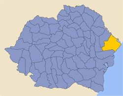
The county neighboured Odessa Oblast of USSR to the east, the Black Sea to the south-east, the counties of Tighina to the north, Ismail to the south and Cahul to the west.
Administration
The county consisted of six districts (plăṣi) : Cazaci, Tarutina, Taslâc (with the seat at Arciz), Tatar-Bunar, Tuzla (with the seat at Cetatea-Albă) and Volințiri. Between 1918 and 1930 it comprised eight districts:
- Arciz
- Cazaci
- Ivăneștii Noi
- Liman (with the seat at Cetatea-Albă)
- Sărata (with the seat at Bairamcea)
- Tarutina
- Tuzla
- Volințiri
Coat of arms
The Coat of Arms featured a tree on the sinister and the fortress of Cetatea-Albă on the dexter.
Population
According to the Romanian census of 1930 the population of Cetatea Albă County was 340,459, of which 20.9% were ethnic Bulgarians, 20.5% ethnic Ukrainians, 18.5% Romanians, 17.3% Russians 16.3% ethnic Germans, 3.3% Jews, 3.3% Gagauz and 0.1% Armenians. Classified by religion: 79.0% were Orthodox Christian, 16.3% Lutheran, 4.7% Jews.
After 1938
After the 1938 Administrative and Constitutional Reform, this county merged with the counties of Lăpușna, Orhei and Tighina to form Ținutul Nistru.
External links
| Wikimedia Commons has media related to Interwar Cetatea Albă County. |
- (Romanian) Județul Cetatea Alba (Romanian)
